- Chesterland, Ohio
-
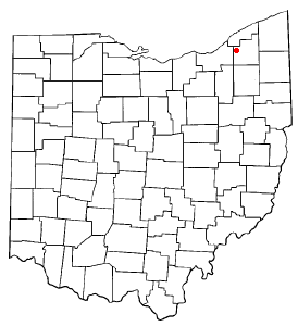
Chesterland, Ohio — CDP — Location of Chesterland, Ohio
Coordinates: 41°31′22″N 81°20′14″W / 41.52278°N 81.33722°WCoordinates: 41°31′22″N 81°20′14″W / 41.52278°N 81.33722°W Country United States State Ohio County Geauga Area – Total 4.4 sq mi (11.4 km2) – Land 4.4 sq mi (11.4 km2) – Water 0.0 sq mi (0.0 km2) Elevation[1] 1,214 ft (370 m) Population (2000) – Total 2,646 – Density 601.7/sq mi (232.3/km2) Time zone Eastern (EST) (UTC-5) – Summer (DST) EDT (UTC-4) ZIP code 44026 Area code(s) 440 FIPS code 39-14100[2] GNIS feature ID 1060956[1] Chesterland is a census-designated place (CDP) in Geauga County, Ohio, United States. The population was 2,646 at the 2000 census. "Chesterland" is also the name by which most of unincorporated Chester Township is known. It was adopted in the early 20th century when the Post Office insisted that one of the two communities in Ohio known as Chester change its name[citation needed].
Contents
Geography
Chesterland is located at 41°31′22″N 81°20′14″W / 41.52278°N 81.33722°W (41.522901, -81.337157)[3].
According to the United States Census Bureau, the CDP has a total area of 4.4 square miles (11 km2), of which, 4.4 square miles (11 km2) of it is land and 0.23% is water.
The town center of Chesterland is located at the intersection of U.S. Route 322 and State Route 306. The commercial district of Chesterland spans out from this intersection in all directions.
Chesterland is considered part of the Chagrin Valley area, which is defined by the cities and villages along the Chagrin River.
Demographics
As of the census[2] of 2000, there were 2,646 people, 1,015 households, and 760 families residing in the CDP. The population density was 601.7 people per square mile (232.2/km²). There were 1,045 housing units at an average density of 237.6/sq mi (91.7/km²). The racial makeup of the CDP was 98.75% White, 0.49% African American, 0.53% Asian, and 0.23% from two or more races. Hispanic or Latino of any race were 0.68% of the population.
There were 1,015 households out of which 28.9% had children under the age of 18 living with them, 62.2% were married couples living together, 9.5% had a female householder with no husband present, and 25.1% were non-families. 22.2% of all households were made up of individuals and 9.7% had someone living alone who was 65 years of age or older. The average household size was 2.57 and the average family size was 3.01.
In the CDP the population was spread out with 22.8% under the age of 18, 4.1% from 18 to 24, 27.1% from 25 to 44, 27.8% from 45 to 64, and 18.2% who were 65 years of age or older. The median age was 43 years. For every 100 females there were 96.0 males. For every 100 females age 18 and over, there were 92.6 males.
The median income for a household in the CDP was $55,781, and the median income for a family was $62,917. Males had a median income of $46,490 versus $33,079 for females. The per capita income for the CDP was $26,168. About 3.2% of families and 3.2% of the population were below the poverty line, including 1.8% of those under age 18 and 2.5% of those age 65 or over.
Schools
Chesterland lies entirely in the West Geauga school district, and shares this district with neighboring Russell Township. There are two elementary schools, one middle school, and one high school, West Geauga High School. Hawken Upper School also lies in Chesterland, although it has a Gates Mills address because its mailbox lies on the opposite side of County Line Road. A third elementary school, Chester Elementary, served the community for many years but closed in the 1980s.
References
- ^ a b "US Board on Geographic Names". United States Geological Survey. 2007-10-25. http://geonames.usgs.gov. Retrieved 2008-01-31.
- ^ a b "American FactFinder". United States Census Bureau. http://factfinder.census.gov. Retrieved 2008-01-31.
- ^ "US Gazetteer files: 2010, 2000, and 1990". United States Census Bureau. 2011-02-12. http://www.census.gov/geo/www/gazetteer/gazette.html. Retrieved 2011-04-23.
Municipalities and communities of Geauga County, Ohio City 
Villages Aquilla | Burton | Hunting Valley‡ | Middlefield | South Russell
Townships CDPs Bainbridge | Chesterland
Unincorporated
communitiesFootnotes ‡This populated place also has portions in an adjacent county or counties
Categories:- Populated places in Geauga County, Ohio
- Census-designated places in Ohio

Wikimedia Foundation. 2010.