- Forestville Mystery Cave State Park
-
Forestville Mystery Cave State Park Minnesota State Park 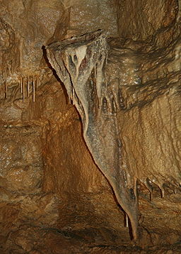 Mystery Cave formation known as the "bird's nest"
Country  United States
State  Minnesota
County Fillmore Location Preston - elevation 1,266 ft (386 m) [1] - coordinates 43°38′23″N 92°12′43″W / 43.63972°N 92.21194°W Area 3,170 acres (1,282.9 ha) Founded 1941 Management Minnesota Department of Natural Resources 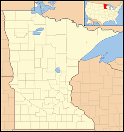
 Location of Forestville/Mystery Cave State Park in MinnesotaForestville Townsite--Meighan Store
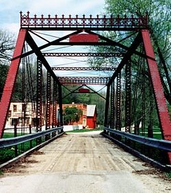 Historic bridge to Forestville
Architect: Robert Foster; Felix Meighen NRHP Reference#: 73000976 Added to NRHP: April 13, 1973 Forestville Mystery Cave State Park is a state park of Minnesota, USA. It contains the village of Forestville which has been restored to a nineteenth century appearance. The Minnesota Historical Society operates it as a historic site. Below ground the park contains Mystery Cave, the longest cave in the state which is open to the public. The park is between Spring Valley and Preston, Minnesota.
Contents
Mystery Cave
The park is in the Driftless Area, noted for its karst topography, which includes sinkholes and caves. The park itself is about 5 miles (8.0 km) away from Mystery Cave and is approximately 3,170 acres (12.8 km2), with camping, interpretive programs, and hiking, horseback, and cross-country skiing trails. The park is also noted for its cold water streams and excellent trout fishing. The cave includes stalactites, stalagmites, and underground pools, and is a constant 48 °F (9 °C) underground. There are over 13 miles (21 km) of passages in 2 rock layers; the cave is currently being re-surveyed and mapped by volunteers.
History
About 450 million years ago sedimentary rocks were deposited as the land was covered intermittently by shallow seas that ingressed and regressed. Over the eons the alternating deposits of mud and oceanic debris were compressed to form limestone, shale and sandstone layers. Today, these layers are 1,300 feet (400 m) above sea level. Within the last 500,000-one million years, flood waters dissolved along fractures in the limestone bedrock to create most of the cave. Acidic rainwater also sculpted the land above and around the cave, creating thousands of sinkholes and other karst features in the county where the cave is located.
Wildlife
The park contains a range of wildlife, from relatively rare species such as glacial snails, and timber rattlesnakes to common species such as deer, raccoon, beaver, mink, opossum, woodchuck, four species of squirrels, and red and grey fox. There have also been at least 175 species of birds recorded in the park. The South Branch of the Root River contains brown trout, brook trout, and rainbow trout.
Historic Forestville
The Minnesota Historical Society operates Historic Forestville as a living museum set in 1899. Costumed interpreters portray residents of Forestville and go about daily activities in the general store, house, kitchen, farm, and barn.
The village of Forestville was a rural trade center in the 1800s that declined after the railroad was built elsewhere in 1868.[2] Thomas Meighen, son of one of the town's founders, owned the entire village by 1890, including the general store, and the local residents worked on his property for housing and credit in the store.
Admission to Historic Forestville is separate from the caves. Historic Forestville is open from May through October.
References
- ^ "Forestville State Park". Geographic Names Information System. United States Geological Survey. 2004-10-04. http://geonames.usgs.gov/pls/gnispublic/f?p=gnispq:3:::NO::P3_FID:2050840. Retrieved 2011-02-24.
- ^ http://www.mnhs.org/places/sites/hf/visitforestville.html Visit Forestville
External links
Categories:- Historic districts in Minnesota
- Caves of Minnesota
- Driftless Area
- Ghost towns in Minnesota
- Living museums in Minnesota
- Minnesota state parks
- Minnesota state historic sites
- Museums in Fillmore County, Minnesota
- Protected areas established in 1963
- Show caves in the United States
- Protected areas of Fillmore County, Minnesota


Wikimedia Foundation. 2010.