- Oroville, Washington
-
Oroville, Washington USA — Town —  Location of Oroville, Washington
Coordinates: 48°56′19″N 119°26′6″W / 48.93861°N 119.435°WCoordinates: 48°56′19″N 119°26′6″W / 48.93861°N 119.435°W Country United States State Washington County Okanogan Area – Total 1.3 sq mi (3.2 km2) – Land 1.2 sq mi (3.2 km2) – Water 0.0 sq mi (0.0 km2) Elevation 938 ft (286 m) Population (2010) – Total 1,686 – Density 1,405/sq mi (526.9/km2) Time zone Pacific (PST) (UTC-8) – Summer (DST) PDT (UTC-7) ZIP code 98844 Area code(s) 509 FIPS code 53-51970[1] GNIS feature ID 1524077[2] Oroville is a town in Okanogan County, Washington, United States. The population was 1,686 at the 2010 census.
Contents
Geography
Oroville is located at 48°56′19″N 119°26′6″W / 48.93861°N 119.435°W (48.938508, -119.434903).[3]
According to the United States Census Bureau, the city has a total area of 1.2 square miles (3.2 km²), of which, 1.2 square miles (3.2 km²) of it is land and 0.80% is water.
Oroville is located 4 miles south of the Canadian border, and features an official crossing into Osoyoos, British Columbia.
Demographics
As of the census[1] of 2000, there were 1,653 people, 691 households, and 433 families residing in the city. The population density was 1,336.5 people per square mile (514.7/km²). There were 794 housing units at an average density of 642.0 per square mile (247.2/km²). The racial makeup of the city was 82.34% White, 0.12% African American, 4.23% Native American, 0.30% Asian, 0.30% Pacific Islander, 9.32% from other races, and 3.39% from two or more races. Hispanic or Latino of any race were 17.06% of the population.
There were 691 households out of which 32.1% had children under the age of 18 living with them, 45.6% were married couples living together, 13.3% had a female householder with no husband present, and 37.2% were non-families. 32.0% of all households were made up of individuals and 14.5% had someone living alone who was 65 years of age or older. The average household size was 2.37 and the average family size was 2.99.
In the city the population was spread out with 28.9% under the age of 18, 5.1% from 18 to 24, 25.6% from 25 to 44, 23.7% from 45 to 64, and 16.7% who were 65 years of age or older. The median age was 38 years. For every 100 females there were 94.0 males. For every 100 females age 18 and over, there were 88.3 males.
The median income for a household in the city was $22,301, and the median income for a family was $30,114. Males had a median income of $25,833 versus $21,750 for females. The per capita income for the city was $12,220. About 22.6% of families and 28.9% of the population were below the poverty line, including 37.0% of those under age 18 and 19.5% of those age 65 or over.
Economy
Most of the economy of Oroville and the surrounding areas is based on agriculture. There are numerous orchards within the city limits and a few grape vineyards. During Oroville's heyday as a mining town, its population was over 10,000 with numerous saloons, restaurants, shops and a drive in movie theater.[4] Today the town's economy is depressed with a nearly 30% poverty rate and a median household income of only $22,000. Recently, three vacation cottage developments have been built, two east of Lake Osoyoos, Sandalia and the Veranda Beach Resort, and one just north of downtown, Sonora Shores.
History
Oroville was first settled by caucasian settlers in the late 1850s and known as 'rag town'. The settlement was named Oro, after the Spanish word for gold, in 1892 after the surrounding gold mines, and in an attempt to attract prospectors and merchants. The Post Office objected to the name "Oro," because there was already a town named "Oso" in Washington, so the name was changed to Oroville,[5] in 1909. Oroville started to become a tourist location in the mid 2000's with large condo developments being placed, the town had an economy peak in 2005-2007 but is now suffering due to the recession.
References
- ^ a b "American FactFinder". United States Census Bureau. http://factfinder.census.gov. Retrieved 2008-01-31.
- ^ "US Board on Geographic Names". United States Geological Survey. 2007-10-25. http://geonames.usgs.gov. Retrieved 2008-01-31.
- ^ "US Gazetteer files: 2010, 2000, and 1990". United States Census Bureau. 2011-02-12. http://www.census.gov/geo/www/gazetteer/gazette.html. Retrieved 2011-04-23.
- ^ http://www.drive-ins.com/theater/watorov
- ^ Gulick, Bill. A Traveler's History of Washington. Caxton Press, 1996. ISBN 0-8700-4371-4. p. 340
External links
Municipalities and communities of Okanogan County, Washington Cities 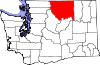
Towns Conconully | Coulee Dam ‡ | Elmer City | Nespelem | Riverside | Twisp | Winthrop
CDPs Unincorporated
communitiesIndian reservation Ghost towns Footnotes ‡This populated place also has portions in an adjacent county or counties
Categories:- Cities in Washington (state)
- Populated places in Okanogan County, Washington


Wikimedia Foundation. 2010.