- Creach Bheinn
-
Note: There are other mountains in Scotland with the same name. This article is about the most prominent.
Creach Bheinn 
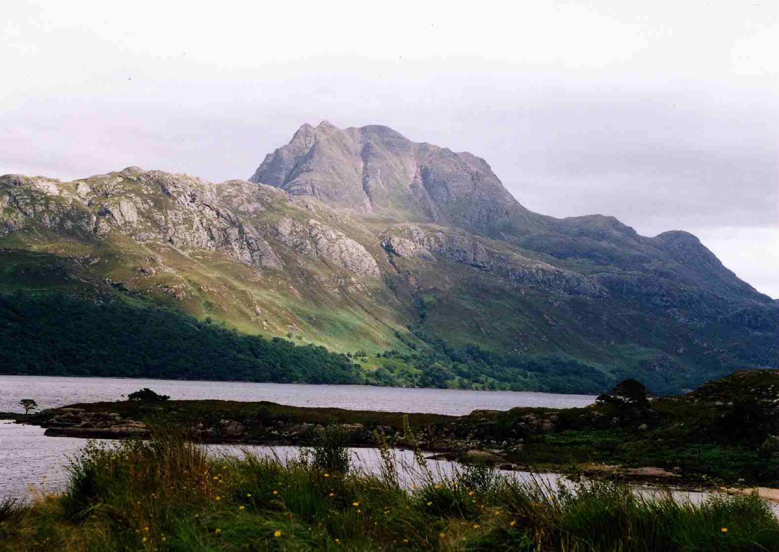
Glen Galmadale and the summit of Creach Bheinn seen from the southElevation 853 m (2,799 ft) Prominence 755 m (2,477 ft)
Ranked 48th in British IslesParent peak Sgurr Dhomhnuill Listing Corbett, Marilyn Translation Hill of spoil (Scottish Gaelic) Location Location Ardgour, Highland,  Scotland
Range Northwest Highlands Topo map OS Landranger 49 OS grid NM870576 Creach Bheinn is a prominent mountain in the Ardgour area in the west of Scotland. It is less steep and even less frequently climbed than its northern neighbour, Garbh Bheinn, but the views to the south and west to the islands are open and extensive.
Ascents
Compared with other hills in the Ardgour area, the slopes of Creach Bheinn are smooth. The best starting point is on the west side of the bridge at Glengalmadale. Parking is limited but sufficient for current demand. From there, a wet track followed by a boggy path lead up Glen Galmadale to the foot of the mountain, which is easily ascended. Alternatively, some or all of a horseshoe ridge can be included. The entire ridge, which includes two additional Marilyns, involves about 1500 metres of uphill climbing.
Summit Camp
Near the summit there are ruins of a camp, which is thought to have been used by early surveyors.[1]
References
- ^ http://www.geograph.org.uk/photo/440570 Geograph
- The Corbetts and Other Scottish Hills, (SMC Guide) ISBN 0-907521-29-0.
- Caledonia Hilltreks
Coordinates: 56°39′42″N 5°28′38″W / 56.66154°N 5.47716°W
Categories:- Corbetts
- Marilyns of Scotland
- Mountains and hills of the Northwest Highlands


Wikimedia Foundation. 2010.