- Maryland Route 425
-
Maryland Route 425

Map of Southern Maryland with MD 425 highlighted in redRoute information Maintained by MDSHA Length: 11.77 mi[1] (18.94 km) Major junctions South end:  MD 6 near Nanjemoy MD 6 in Ironsides
North end:  MD 224 in Mason Springs
Location Counties: Charles Highway system Maryland highway system
Interstate • US • State • Minor • Former • Turnpikes←  MD 424
MD 435  →
→Maryland Route 425 (MD 425) is a state highway in the U.S. state of Maryland. The state highway runs 11.77 miles (18.94 km) from MD 6 near Nanjemoy north to MD 224 in Mason Springs. MD 425 connects Nanjemoy and Ironsides with Pisgah and Mason Springs in western Charles County. The state highway was built as two different routes in the early 1930s: MD 425 from Mason Springs to south of Pisgah, and MD 491 near Nanjemoy. MD 425 and MD 491 were extended to MD 6 in Ironsides in 1950, with MD 425 assuming MD 491 in 1956.
Contents
Route description
MD 425 begins at an intersection with MD 6 (Port Tobacco Road) south of the community of Nanjemoy and north of the hamlet of Grayton. The state highway heads northeast as two-lane Ironsides Road through a forested area, passing Baptist Church Road and crosses a branch of Hill Top Fork of Nanjemoy Creek. At Durham Church Road, MD 425 makes a 90-degree turn to the north and intersects MD 6 again in the village of Ironsides. The state highway continues north as Mason Springs Road, crossing Jane Berrys Run. MD 425 intersects Bicknell Road and Poorhouse Road in the hamlet of Pisgah and passes the historic home Araby before reaching the highway's northern terminus at MD 224 (Chicamuxen Road) in Mason Springs.[1][2]
History
The first section of MD 425 was constructed as a gravel road south 2 miles (3.2 km) from Mason Springs in 1930.[3][4] The highway was extended south another 2 miles (3.2 km) through Pisgah in 1933. Also in 1933, 1 mile (1.6 km) of gravel road was constructed from the Nanjemoy end.[5][6] This segment was originally designated MD 491.[7] MD 425 was extended with another 2-mile (3.2 km) section in 1934.[5][8] The courses of MD 425 and MD 491 remained the same until 1950 when MD 425 was extended south to Ironsides and MD 491 was extended north to Ironsides.[9] MD 425 was extended south to Nanjemoy, assuming MD 491's entire course, in 1956.[10]
Junction list
The entire route is in Charles County.
Location Mile
[1]Destinations Notes Nanjemoy 0.00 MD 6 (Port Tobacco Road) – RiversideSouthern terminus Ironsides 4.81 MD 6 (Port Tobacco Road) – Port Tobacco, La PlataPisgah 8.66 Bicknell Road west / Poorhouse Road east – Marbury, Port Tobacco Former MD 484 Mason Springs 11.77 MD 224 (Chicamuxen Road) – Marbury, Indian HeadNorthern terminus 1.000 mi = 1.609 km; 1.000 km = 0.621 mi References
- ^ a b c "Highway Location Reference: Charles County" (PDF). Maryland State Highway Administration. 2009. http://www.marylandroads.com/Location/2009_CHARLES.pdf. Retrieved 2011-01-12.
- ^ Google, Inc. Google Maps – Maryland Route 425 (Map). Cartography by Google, Inc. http://maps.google.com/maps?f=d&source=s_d&saddr=MD-425+N%2FIronsides+Rd&daddr=Mason+Springs+Rd&hl=en&geocode=FaiNSgIdIglm-w%3BFem7TAId6jhn-w&gl=us&mra=ls&sll=38.583499,-77.120676&sspn=0.015398,0.038581&ie=UTF8&t=h&z=11. Retrieved 2011-01-12.
- ^ Report of the State Roads Commission of Maryland. 1927-1930. Baltimore: Maryland State Roads Commission. 1930-10-01. pp. 206–207. http://www.archive.org/details/reportofstateroa1927mary. Retrieved 2011-01-12.
- ^ Maryland Geological Survey. Map of Maryland Showing State Road System: State Aid Roads and Improved County Road Connections (Map) (1930 ed.).
- ^ a b Report of the State Roads Commission of Maryland. 1931-1934. Baltimore: Maryland State Roads Commission. 1934-12-28. pp. 330–331. http://www.archive.org/details/reportofstateroa1931mary. Retrieved 2011-01-12.
- ^ Maryland Geological Survey. Map of Maryland Showing State Road System: State Aid Roads and Improved County Road Connections (Map) (1933 ed.).
- ^ Maryland State Roads Commission. General Highway Map: State of Maryland (Map) (1939 ed.).
- ^ Maryland Geological Survey. Map of Maryland Showing State Road System: State Aid Roads and Improved County Road Connections (Map) (1935 ed.).
- ^ Maryland State Roads Commission. Maryland: Official Highway Map (Map) (1950 ed.).
- ^ Maryland State Roads Commission. Maryland: Official Highway Map (Map) (1956 ed.).
External links
Roads in Charles County, Maryland State highways 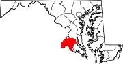
U.S. Highways Categories:- State highways in Maryland
- Roads in Charles County, Maryland


Wikimedia Foundation. 2010.