- Hallow, Worcestershire
-
Coordinates: 52°13′16″N 2°15′11″W / 52.221°N 2.253°W
Hallow 
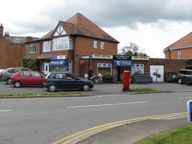
Hallow post office
 Hallow
Hallow shown within WorcestershirePopulation 1,173 (2001 census)[1] OS grid reference SO8257 Parish Hallow District Malvern Hills Shire county Worcestershire Region West Midlands Country England Sovereign state United Kingdom Post town WORCESTER Postcode district WR2 Dialling code 01905 Police West Mercia Fire Hereford and Worcester Ambulance West Midlands EU Parliament West Midlands UK Parliament West Worcestershire Website Welcome to Hallow Parish Council List of places: UK • England • Worcestershire Hallow is a village and civil parish beside the River Severn, about 2 miles (3.2 km) north-west of Worcester in Worcestershire. The village is on the A433 road that links Worcester with Holt Heath.
Contents
Toponym
In the 9th century the toponym was recorded as Halhegan, Heallingan and Halnegan.[2] In the 11th century it was recorded as Halhegan and Hallhagan, while in the 13th century it was Hallawe, Hallaye or Hallag.[2]
Manor
The earliest record of the manor of Hallow is from AD 816, during the reign of Coenwulf of Mercia, when Hallow evidently belonged to Worcester Cathedral, and by the 10th century Hallow belonged to the Benedictine priory attached to the cathedral.[2] After the Dissolution of the Monasteries around 1540 the cathedral retained Hallow, and in 1913 the manor was vested in the Ecclesiastical Commissioners.[2]
By the middle of the 11th century Worcester Priory had fishponds at Hallow and in 1256 permission was granted for a warren as well.[2] Both were still in use in 1346.[2]
The Domesday Book records that in 1086 Hallow had two mills for grinding grain:[2] presumably watermills on the River Severn. Hallow Mill was still in use in 1913.[2]
Parish church
Until 1876 Hallow was a chapelry of Grimley.[2] Hallow's original chapel of ease was demolished in 1830 and replaced by a modest Georgian chapel on a new site about 300 yards (270 m) south-east of the old one.[2]
In 1867 the second chapel was demolished and building began of the present Church of England parish church of Saint Philip and Saint James. It was designed by W.J. Hopkins and completed in 1869.[3] Hallow was made a separate parish in 1876.[2] The bell tower with its 150 feet (46 m) high broach spire were added in 1879.[3]
The church is W.J. Hopkins' most notable work.[3] The nave and clerestorey are of four bays and are flanked by north and south aisles.[3] The clerestorey is supported by flying buttresses and, like a number of Hopkins' works, has round windows.[3] The chancel and its arch are impressively high.[3] 17th and 18th century memorial tablets from the old chapel were preserved and are mounted in the new church.[2][3]
The old chapel had three bells in 1552 and five in 1740.[4] A 16th century bell from the old chapel hung in the new church until 1900, when a new peal of eight bells cast by John Taylor & Co of Loughborough was hung in the tower.[5]
Notable people
Colonel William Careless, who preserved the life of Charles II by hiding him in the Royal Oak (1651), was resident in Hallow during the 1680s.
The manufacturer and philanthropist William Morris (1877-1963), the future Viscount Nuffield, was born in Hallow and baptised at SS Philip and James.[4]
Amenities
Hallow has a public house,[6] a post office and a Church of England primary school.[7]
References
- ^ "Area selected: Malvern Hills (Non-Metropolitan District)". Neighbourhood Statistics: Full Dataset View. Office for National Statistics. http://neighbourhood.statistics.gov.uk/dissemination/viewFullDataset.do?instanceSelection=03070&productId=779&$ph=60_61&datasetInstanceId=3070&startColumn=1&numberOfColumns=4&containerAreaId=790554. Retrieved 21 July 2010.
- ^ a b c d e f g h i j k l Victoria County History, 1913, pages 367-372
- ^ a b c d e f g Pevsner, 1968, page 182
- ^ a b "A Brief History of Hallow Church". Hallow Church. The parish of St. Philip and St. James, Hallow. 2010. http://www.hallowchurch.co.uk/default.aspx?ID=1115. Retrieved 20 July 2010.
- ^ "Hallow SS Philip & James". Dove's Guide for Church Bell Ringers. http://dove.cccbr.org.uk/detail.php?searchString=Hallow&Submit=++Go++&DoveID=HALLOW. Retrieved 20 July 2010.
- ^ The Crown at Hallow
- ^ Hallow C.E. Primary School
Sources
- Pevsner, Nikolaus (1968). The Buildings of England: Worcestershire. Harmondsworth: Penguin Books.
- Victoria County History: A History of the County of Worcester: Volume 3. Archibald Constable & Co. 1913. pp. 367–372.
Categories:- Villages in Worcestershire

Wikimedia Foundation. 2010.