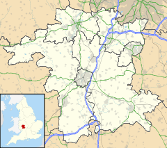
Malvern Hills (district) — Malvern Hills District Non metropolitan district Malvern Hills shown within Worcestershire … Wikipedia
Gilbert fitz Turold — (Thorold) was an Anglo Norman landowner of the eleventh century, mentioned in the Domesday Survey, with widely spread holdings in six counties [ [http://www.domesdaybook.co.uk/landownersd f.html Domesday Book Online] ] . He was an important… … Wikipedia
Nurden — This uncommon name is of Anglo Saxon origin, and has two possible interpretations; both from the same derivation, which is the Olde English pre 7th Century north , north, with denu , valley. Firstly, the surname may be topographical in origin,… … Surnames reference
Nurdin — This uncommon name is of Anglo Saxon origin, and has two possible interpretations; both from the same derivation, which is the Olde English pre 7th Century north , north, with denu , valley. Firstly, the surname may be topographical in origin,… … Surnames reference
Great Malvern — This article relates to the town centre of Malvern. For in depth treatment see Malvern, Worcestershire. Coordinates: 52°07′N 2°20′W / 52.11°N 2.33°W / … Wikipedia
Malvern Wells — Coordinates: 52°04′43″N 2°19′56″W / 52.078479°N 2.332357°W / 52.078479; 2.332357 … Wikipedia
Mamble — Coordinates: 52°20′27″N 2°27′24″W / 52.3407°N 2.4566°W / 52.3407; 2.4566 … Wikipedia
List of civil parishes in Worcestershire — Bromsgrove= Bromsgrove and Rubery are unparished.*Alvechurch *Barnt Green *Belbroughton *Bentley Pauncefoot *Beoley *Bournheath *Catshill and North Marlbrook *Clent *Cofton Hackett *Dodford with Grafton *Finstall *Frankley *Lickey and Blackwell… … Wikipedia
Martley — Coordinates: 52°14′09″N 2°21′37″W / 52.23584°N 2.36018°W / 52.23584; 2.36018 … Wikipedia
Newland, Worcestershire — Coordinates: 52°08′04″N 2°17′59″W / 52.1344°N 2.2997°W / 52.1344; 2.2997 … Wikipedia
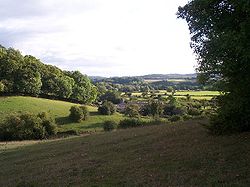
 Doddenham
