- Oldwood, Worcestershire
-
Coordinates: 52°17′52″N 2°36′04″W / 52.29779°N 2.60117°W
Oldwood 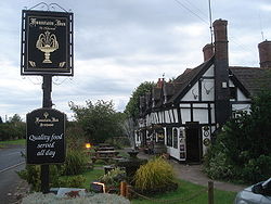
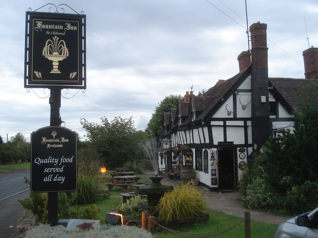
The Fountain Inn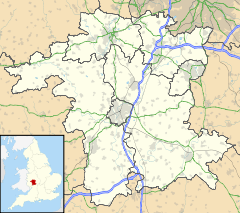
 Oldwood
Oldwood shown within WorcestershireOS grid reference SO591668 District Malvern Hills Shire county Worcestershire Region West Midlands Country England Sovereign state United Kingdom Post town TENBURY WELLS Postcode district WR15 Police West Mercia Fire Hereford and Worcester Ambulance West Midlands EU Parliament West Midlands List of places: UK • England • Worcestershire Oldwood is a hamlet in the English county of Worcestershire.
Oldwood is located on the A4112 road a mile southwest of the market town of Tenbury Wells.
External links
- Map sources for Oldwood, Worcestershire
Categories:- Hamlets in Worcestershire
- Worcestershire geography stubs

Wikimedia Foundation. 2010.