- Old Trafford, Greater Manchester
-
Coordinates: 53°27′37″N 2°17′13″W / 53.4603°N 2.287°W
Old Trafford 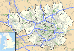
 Old Trafford
Old Trafford shown within Greater ManchesterPopulation 13,000 approx. OS grid reference SJ825955 Metropolitan borough Trafford Metropolitan county Greater Manchester Region North West Country England Sovereign state United Kingdom Post town MANCHESTER Postcode district M16 Dialling code 0161 Police Greater Manchester Fire Greater Manchester Ambulance North West EU Parliament North West England UK Parliament Stretford and Urmston List of places: UK • England • Greater Manchester Old Trafford is in Greater Manchester, England,[1] which lies south-west of Manchester. The crossroads sites of two old toll gates roughly delineate the borders of the area: Brooks's Bar to the east and Trafford Bar to the west.
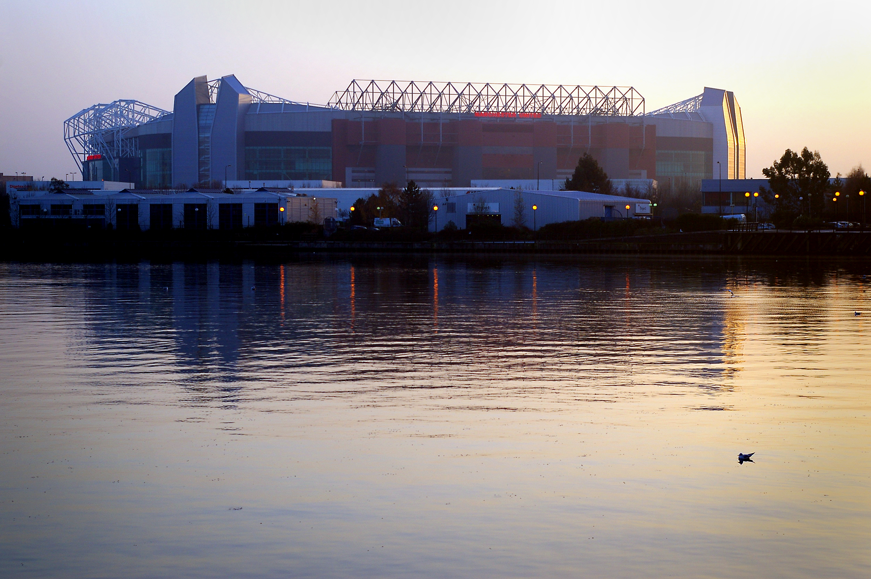
Old Trafford is the site of two major sporting venues: Old Trafford Football Stadium, home of Manchester United F.C. and Old Trafford Cricket Ground, home of Lancashire County Cricket Club.
The stadia are at either end of Warwick Road, two parts of which have been renamed Brian Statham Way (formerly Warwick Road) and Sir Matt Busby Way (formerly Warwick Road North). The interconnecting strip of road between retains the name Warwick Road, and the southern section on the other side of the Metrolink line is called Warwick Road South.
Contents
History
Old Trafford was a crossing point over the River Irwell in ancient times. The name Old Trafford possibly derives from the time when there were two Trafford Halls, Old Trafford Hall and New Trafford Hall. The old hall was situated close to what is now the White City Retail Park, and was said to have been the home of the de Trafford family since 1017, until the family moved to the new hall in what is now Trafford Park, some time between 1672 and 1720.[2] The name of the area around Old Trafford Hall may subsequently have become shortened to Old Trafford.[3] The old hall was demolished in 1939.[4]
In the 1820s, Manchester scientist John Dalton chose Old Trafford as the site for a Royal Horticultural and Botanical Gardens because of its clean, unpolluted air, and so began the area's association with sports and recreation. The popularity of the botanical gardens – which was a kind of northern Crystal Palace – led wealthy people to build large houses in the area. In 1857, and again in 1887, the gardens staged exhibitions of art treasures, the former as part of the Art Treasures Exhibition and the latter in celebration of Queen Victoria's silver jubilee. The Hallé Orchestra was formed to participate in the first of these exhibitions. The site of the botanical gardens was purchased by White City Limited in 1907, and it subsequently became an amusement park. From the 1950s to the 1970s, White City Stadium was used as a greyhound racing track and for stock car racing. This site is now White City Retail Park. The front entrance is all that has been preserved of the old botanical gardens. Nearby, on the site of what is now the Greater Manchester Police Headquarters, was Henshaw's Institute for the Blind, which originally opened as Henshaw's Blind Asylum in 1837. Next door on the same site was the Royal Institute for the Deaf, where the film Mandy was made.
Old Trafford expanded and became an urban area after the building of the Manchester Ship Canal in the 1890s, and the subsequent development of nearby Trafford Park Industrial Estate, in the early 20th century. Trafford Park provided employment for thousands of local residents. Employment was also provided on a smaller scale, notably by Duerrs Jams, Vimto, Arkady Soya Mill and Ludwig Oppenheimer Mosaics. The Royal Army Medical Corps and the Territorial Army have well-established bases in the area.
Slum clearances during the 1960s and early 1970s saw some of the old Victorian housing stock demolished. However, after the perceived failure of the deck-access concrete crescents of Hulme, Old Trafford's residents preferred renovation to demolition. As a result, there are still many Victorian terraced streets in the area.
By 1985, employment at Trafford Park had fallen to 24,500, as unemployment in the northwest soared above 30% in some inner-city areas. Nearby Manchester Docks, which had also been a major source of local employment, closed in 1982. As the revitalised Salford Quays it has become an emblematic part of the regeneration of Manchester in general.
Governance
Civic history
Old Trafford was formerly a hamlet in the township of Stretford.[5] In 1974, as a result of the Local Government Act 1972, all of Stretford became a part of the Metropolitan Borough of Trafford, in Greater Manchester. Since the realignment of Trafford's ward boundaries in 2004, Old Trafford has been divided between the Stretford area wards of Clifford and Longford, with the larger part of Old Trafford being in the Clifford ward.[6][7]
Parliamentary representation
Old Trafford is part of the parliamentary constituency of Stretford and Urmston. The current Member of Parliament is Kate Green of the Labour Party.
In 2005, Trafford Council proposed to the Boundary Commission for England that the three Stretford wards of Gorse Hill, Longford, and Clifford – which include Old Trafford – should be moved into a new Salford and The Quays constituency, along with some other wards from Salford.[8] At the subsequent public enquiry, in November 2005, Beverley Hughes opposed the change, as well as an alternative proposal to create a constituency of Salford and Old Trafford. The Boundary Commission rejected Trafford Council's proposals, noting that there was "strong opposition to the creation of a constituency that crossed the Manchester Ship Canal and ... that the Canal provided a clearly identifiable boundary which should not be breached".[9]
Geography
The area is unusual in effectively being a peninsula. Its northern boundary was the River Irwell, now canalised into the Manchester Ship Canal. To the east was a tributary of the Irwell, the Cornbrook. This was culverted as the area grew in the 19th century. In fact, Victorian Hulme and Old Trafford seemed indistinguishable, as the hidden river made its way out of sight. Similarly, the southern boundary was the Black Brook, which was culverted at about the same time as the Cornbrook. Thus Upper Chorlton Road, under which it flows, does not seem to be a natural boundary. Both sides of the road look similar, and Darley Park, on the Trafford side, could easily fit into Whalley Range. Some small anomalies due to the brook's underground route were not amended until the late 1980s. Similarly, the inter-war development of Firswood is almost indistinguishable from its Chorlton-cum-hardy neighbours. Old Trafford makes up the northern tip of Trafford and adjoins St. Georges, Hulme, Whalley Range and Moss Side – all of which are within the boundaries of the City of Manchester – and Ordsall to the northeast, which is within the boundaries of the City of Salford. At the crossroads of Brooks's Bar the boundaries between Old Trafford and Hulme, and Moss Side and Whalley Range meet. The boundary passed through the playground of Loreto College, as was famously illustrated by a photo of girls straddling the line, in the 1970's Nuffield O-Level Geography Textbook. On the western side of the area, the road named Seymour Grove has an interesting origin. In the 19th century, the people of Chorlton called it Trafford Road, and the people of Old Trafford called it Chorlton Road. Neither name was appropriate, as nearby roads already had those names. So the areas richest inhabitant, a millionaire grocer called Sir Thomas Seymour Mead, decided the road should be named after him.
Landmarks
Until the mid-20th century there were four cinemas in Old Trafford: the Imperial Picture Theatre in Chorlton Road, Brooks Bar, The Globe on Cornbrook Street, The Lyceum in City Road and the Trafford Picture House in Talbot Road. Three of the buildings have survived, although not now operated as cinemas. The Imperial opened in 1913, and for a brief period in the 1970s it became an Asian films cinema. It closed in 1979, and the building is now occupied by a timber and ironmongery business. The premises occupied by The Globe were originally part of the Manchester Carriage and Tramways Company's horse-drawn tramway depot. The cinema closed in the mid 1960s, and is now used as a warehouse. The Lyceum opened in 1915, and it also closed in the 1960s. Its building is now used for private functions. The Trafford Picture House opened in 1922, and closed in 1958. After a period when it was used as a vehicle auction room the building became derelict, and it was demolished in 1997.[10]
Present day
Today, Old Trafford has approximately 13,000 residents. Cultural diversity has been a feature of the area for over a century. Irish immigrants settled in the locality from the 1880s, coming to Manchester to work on the ship canal. Polish and east European migrants arrived during and after the Second World War. The Afro-Caribbean community arrived and settled in the 1950s and 1960s. People from the Indian sub-continent started to arrive during the 1960s but settled in more significant numbers from the 1980s onwards.
Old Trafford is among the 10% most deprived areas in England, suffering problems of unemployment, poor housing and low educational achievement. It also has levels of youth crime well above the national average.
Ayres Road and its environs are the heart of modern day Old Trafford and a walk down this road gives a real flavour of the multi-cultural nature of the neighbourhood, with its variety of grocers' shops selling food stuffs from Europe, the Caribbean and South-East Asia; its Catholic church, St. Alphonsus, frequented by a predominantly Irish congregation, and Shizhan House, the Chinese Medicine Centre, on the site of the old Vimto offices. Something of this atmosphere is evoked by Manchester poet Lemn Sissay in his poem Ayres Road.
Religion
Only 45% of the residents of Clifford ward (the ward that contains the larger part of Old Trafford) reported themselves as being Christian in the 2001 Census, compared to 76% across Trafford as a whole, and 72% across England.[11] This is reflected in the unusually high number of non Christian places of worship in the area.
Since the 1980s Old Trafford has become home to two large South Asian communities – Gujarati Indians and Pakistani Urdu speakers – almost all being Muslim. Muslims represent the largest non-Christian religious group in the area, with 28% of the population, compared to 3% in the whole of Trafford. To service this community there are four mosques in the area; the Faizan-e-Islam mosque, the *Masjid-e-Hidayah, the Masjid-e-Noor and the Masjid Imdadia.
There is also a smaller Sikh community, with its own Gurdwara, the Sangat Bhatra Sikh Temple, Upper Chorlton Road. Sikhs account for 4% of the area's population, significantly above the less than 1% average for Trafford and England. To further add to the religious mix there is also a Buddhist temple, the Fo Kang Shang Buddhist Temple, although Buddhists are recorded as making up only 0.2% of the area's population, roughly the same proportion as for Jews.
Old Trafford is in the Roman Catholic Diocese of Salford,[12] and the Church of England Diocese of Manchester.[13]
Further information: List of churches in Old TraffordEducation
Along with the rest of Trafford, Old Trafford maintains a selective education system assessed by the Eleven Plus examination. There is only one secondary school in Old Trafford; a private, female-only, Muslim secondary school [ but there are three primary schools within the area.
Further information: List of schools in TraffordHospital
The Stretford Memorial Hospital (formerly the Stretford Practitioners' Hospital) is in Seymour Grove. In its early days it was a cottage hospital used for women and children only.[14] The hospital and adjacent nurses' home were paid for by public subscription after the First World War.
Communal facilities
- Local Council Office, Library, Community Centre – Shrewsbury Street
- St. John's Centre – Ayres Road
- Old Trafford Youth Centre – Seymour Park
- Old Trafford Sports Barn – Seymour Park
- Sharon Youth Association – Chorlton Road
- St. Alphonsus Social Club – Powell Street
- Scout and Guide Association – Alphonsus Street
- Old Trafford Football Club – Lancashire and Cheshire League
Sports
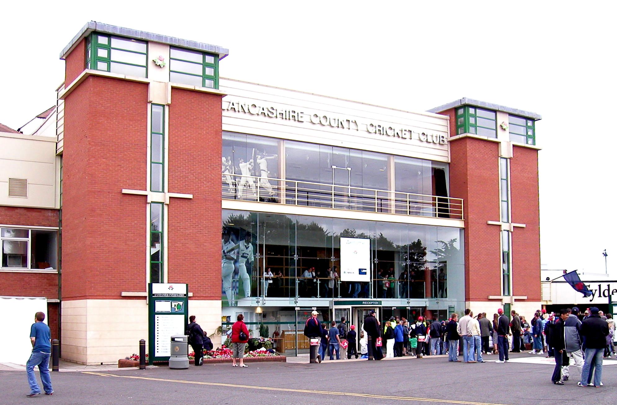
 Lancashire CCC – main entrance
Old Trafford has been the site of Manchester United Football Club's Old Trafford stadium since 1910. Lancashire County Cricket Club's ground, which is also known as Old Trafford, is close by. Before the club's formation, in 1864, it had been the home of Manchester Cricket Club, who had moved here in 1856.
The ground of the Northern Lawn Tennis Club was in Old Trafford from 1882 to 1909 (near the cricket ground): this is commemorated in the name of Tennis Street. The move to West Didsbury in 1909 was prompted by the industrialisation of Trafford Park and consequent air pollution. The half-timbered pavilion was dismantled and then re-erected at the new ground.[15]
Notable people
Famous people who were born or lived in the area include singer Ian Curtis of Joy Division and his wife, the author Deborah Curtis, artist L. S. Lowry, aviator John Alcock,[16] Dodie Smith, the author of 101 Dalmatians,[17]. Opera singer Dame Isobel Baillie lived in her large town house on Stretford Road until her death in the early 1980's., Broadcaster Terry Christian, Buzzcocks drummer John Maher, Aniff Akinola of Backyard Dog and producer of A Guy Called Gerald's "Voodoo Ray", Smiths frontman Morrissey and actress June Ritchie.
References
Notes
- ^ "Stretford Area". Trafford Council. http://www.trafford.gov.uk/content/maps/stretford/. Retrieved 2007-04-04.[dead link]
- ^ Nicholls, Trafford Park: The First Hundred Years, p. 9
- ^ Masterson and Cliff, Stretford: An Illustrated History, pp. 12–13
- ^ Masterson and Cliff, Stretford: An Illustrated History, p. 69
- ^ "Stretford". The New Lancashire Gazetteer or Topographical Dictionary 1830. Salford Hundred Ancestry, Annals and History. http://www.mancuniensis.info/StretfordFP.htm. Retrieved 2007-07-18.
- ^ "Clifford Ward Profile". Trafford Council. http://www.trafford.gov.uk/cme/live/dynamic/DocMan2Document.asp?document_id=9DA563B1-337D-43F8-B3E2-E6842C1B6CA5. Retrieved 2007-05-08.
- ^ "Longford Ward Profile". Trafford Council. http://www.trafford.gov.uk/cme/live/dynamic/DocMan2Document.asp?document_id=A919395C-7114-4A39-9FC3-A7B714E51ED0. Retrieved 2007-05-08.
- ^ "Boundary change – the facts". Sale and Altrincham Mesenger. 7 November 2005. http://archive.thisistrafford.co.uk/2005/11/7/18107.html. Retrieved 2008-08-10.
- ^ "Revised and Final Recommendations for Parliamentary Constituency Boundaries in Greater Manchester". Government News Network. http://www.gov-news.org/gov/uk/news/revised_final_recommendations_parliamentary/47788.html. Retrieved 2007-08-10.
- ^ Rendell, Cinemas of Trafford, pp. 57–60
- ^ "Clifford Neighbourhood Statistics". Statistics.gov.uk. http://www.neighbourhood.statistics.gov.uk/dissemination/LeadDatasetList.do?a=3&b=5941521&c=clifford&d=14&g=356197&i=1001x1003&m=0&enc=1&doma. Retrieved 2007-05-06.
- ^ "Catholic Diocese of Salford". http://www.salforddiocese.org.uk/. Retrieved 2007-05-07.
- ^ "The Church of England Diocese of Manchester". http://www.manchester.anglican.org/default.asp. Retrieved 2007-05-07.
- ^ The Book of Manchester and Salford; written for the British Medical Association. Manchester: George Falkner & Sons, 1929; pp. 150–51
- ^ Phythian, Graham (2010) "Looking Back", in: South Manchester Reporter; 13 May 2010, p. 22
- ^ Massey, A History of Stretford, p. 193
- ^ Scheerhout, John (12 September 2002), Honour for 'Dalmatians' Dodie, Manchester Evening News, http://www.manchestereveningnews.co.uk/news/s/19/19193_honour_for_dalmatians_dodie.html, retrieved 2010-01-14
Bibliography
- Massey, Samuel (1976). A History of Stretford. Altrincham: John Sherratt and Son Ltd. ISBN 0-85427-046-9.
- Masterson, Vicki; Cliff, Karen (2002). Stretford An Illustrated History. Derby: The Breedon Books Publishing Company. ISBN 1-85983-321-7.
- Nicholls, Robert (1996). Trafford Park: The First Hundred Years. Phillimore & Co Ltd. ISBN 1-86077-013-4.
- Rendell, Douglas (1998). Cinemas of Trafford. Jarvis Print Group Limited. ISBN 0-9512560-1-7.
- Spencer, Reuben (1897). A Survey of the History, Commerce and Manufactures of Lancashire; ... together with a biographical sketch of Reuben Spencer .... London: Biogaphical Publishing Co.. ISBN 0-9512560-1-7. (Spencer's home was at Darley Hall, Old Trafford)
External links
- "Old Trafford News". http://www.otnews.co.uk/.
- "Friends of Old Trafford". http://www.foot.org.uk.
- "Guided Walk round Trafford". http://www.industrialpowerhouse.co.uk/audiotrafford.asp.
- "Art Treasures Exhibition 1857". Manchester City Art Gallery. http://www.manchestergalleries.org/whats-on/exhibitions/index.php?itemID=25.
Areas and suburbs of Stretford Categories:- Districts of Greater Manchester
- Geography of Trafford

Wikimedia Foundation. 2010.