- Derwent Gorge and Horsleyhope Ravine
-
Derwent Gorge and
Horsleyhope RavineSite of Special Scientific Interest Country England Region North East District Derwentside
TynedaleLocation NZ052493
and
NZ063483- coordinates 54°50′0″N 1°55′3″W / 54.833333°N 1.9175°W Area 83 ha (205.1 acres) Notification 1976 Management Natural England Area of Search County Durham Interest Biological 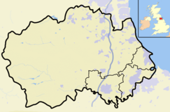
 Location of Derwent Gorge and Horsleyhope Ravine SSSI, Co Durham
Website: Map of site Derwent Gorge and Horsleyhope Ravine is a Site of Special Scientific Interest in the Derwentside district of north County Durham and the Tynedale district of south Northumberland, England. It consists of two separate areas of woodland, one in the gorge of the River Derwent and the other in the ravine of its tributary, the Horsleyhope Burn, south-east of the village of Muggleswick.
On the dry acidic soils of the upper slopes, the woodland is dominated by sessile oak, Quercus petraea. Some areas have been coppiced in the past but where the slopes are steepest, and least accessible, there appears to have been no human interference.[1]
References
- ^ "Derwent Gorge and Horsleyhope Ravine". English Nature. 1995. http://www.english-nature.org.uk/citation/citation_photo/1000964.pdf. Retrieved 20 July 2010.
Backstone Bank and Baal Hill Woods • Baldersdale Woodlands • Bishop Middleham Quarry • Bollihope, Pikestone, Eggleston and Woodland Fells • Botany Hill • Bowes Moor • Bowlees and Friar House Meadows • Brasside Pond • Brignall Banks • Burnhope Burn • Butterby Oxbow • Cassop Vale • Castle Eden Dene • Causey Bank Mires • Charity Land • Close House Mine • Cornriggs Meadows • Cotherstone Moor • Crag Gill • Crime Rigg and Sherburn Hill Quarries • Dabble Bank • Derwent Gorge and Horsleyhope Ravine • Durham Coast • Fairy Holes Cave • Far High House Meadows • Fishburn Grassland • Foster's Hush • Frog Wood Bog • God's Bridge • Grains o' th' Beck Meadows • Green Croft and Langley Moor • Greenfoot Quarry • Hannah's Meadows • Hawthorn Dene • Hawthorn Quarry • Hell Kettles • Hesledon Moor East • Hesledon Moor West • Hexhamshire Moors • Hisehope Burn Valley • Hulam Fen • Hunder Beck Juniper • Kilmond Scar • Low Redford Meadows • Lune Forest • Mere Beck Meadows • Middle Crossthwaite • Middle Side and Stonygill Meadows • Middleton Quarry • Middridge Quarry • Moorhouse and Cross Fell • Muggleswick, Stanhope and Edmundbyers Commons and Blanchland Moor • Neasham Fen • Newton Ketton Meadow • Old Moss Lead Vein • Park End Wood • Pig Hill • Pike Whin Bog • Pittington Hill • Pow Hill Bog • Quarrington Hill Grasslands • Railway Stell West • Raisby Hill Grassland • Raisby Hill Quarry • Redcar Field • Rigg Farm and Stake Hill Meadows • Rogerley Quarry • Sherburn Hill • Shipley and Great Woods • Sleightholme Beck Gorge - The Troughs • Slit Woods • Stony Cut, Cold Hesledon • Teesdale Allotments • The Bottoms • The Carrs • Thrislington Plantation • Town Kelloe Bank • Trimdon Limestone Quarry • Tuthill Quarry • Upper Teesdale • Waldridge Fell • West Newlandside Meadows • West Park Meadows • West Rigg Open Cutting • Westernhope Burn Wood • Wingate Quarry • Witton-le-Wear • Yoden Village QuarryCategories:- Sites of Special Scientific Interest in County Durham
- Sites of Special Scientific Interest in Northumberland
- Canyons and gorges of England
- United Kingdom Site of Special Scientific Interest stubs
- County Durham geography stubs

Wikimedia Foundation. 2010.