- Maranoa Region
-
Maranoa Region
Queensland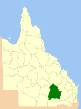
Location in QueenslandPopulation: 114,105(2009)[1] Area: 58830 km² (22,714.4 sq mi) Region: Maranoa State District: Warrego Federal Division: Maranoa 
LGAs around Maranoa Region: Murweh Central Highlands Banana Murweh Maranoa Region Western Downs Paroo Balonne Western Downs Maranoa Region is a Local Government Area in Queensland, Australia. The Local Government Area, known as Roma Region until 26 July 2009, was created in March 2008 as a result of the report of the Local Government Reform Commission released in July 2007. The new Council, located in the Western Downs/Maranoa region, contains the entire area of five previous Local Government Areas;
The report recommended that the new local government area should not be divided into wards and elect eight councillors and a mayor. The Maranoa Region covers an area of 58,830 square kilometres (22,714 sq mi), and contains an estimated resident population in 2006 of 12,648, and has an operating budget of A$44.2m.
The Region covers the towns of Injune, Mitchell, Roma, Surat and Yuleba and the villages/communities of Amby, Jackson, Muckadilla, Mungallala and Wallumbilla.
References
- ^ Australian Bureau of Statistics (30 March 2010). "Regional Population Growth, Australia, 2008–09". http://www.abs.gov.au/AUSSTATS/abs@.nsf/Latestproducts/3218.0Main%20Features62008-09?opendocument&tabname=Summary&prodno=3218.0&issue=2008-09&num=&view=. Retrieved 5 June 2010.
Towns in the Maranoa Region | Western Queensland Main Article: Local Government Areas of QueenslandLocal Government Areas of Queensland South East Brisbane · Gold Coast · Ipswich · Lockyer Valley · Logan · Moreton Bay · Redland · Scenic Rim · Somerset · Sunshine CoastWide Bay-Burnett Darling Downs Central Central Highlands · Gladstone · Isaac · Mackay · Rockhampton · WoorabindaNorth Far North Aurukun · Cairns · Cassowary Coast · Cook · Hopevale · Kowanyama · Lockhart River · Mapoon · Napranum · Northern Peninsula Area · Pormpuraaw · Tablelands · Torres · Torres Strait Islands · Weipa · Wujal Wujal · YarrabahNorth West Central West South West Coordinates: 25°47′33″S 148°35′33″E / 25.7925°S 148.5925°E
Categories:- Local Government Areas of Queensland
- Queensland geography stubs


Wikimedia Foundation. 2010.