- Marble, North Carolina
-
Marble — Unincorporated community — Location within the state of North Carolina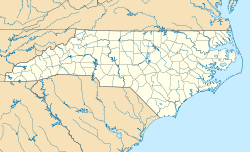
 Marble
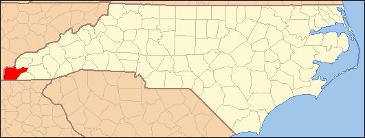
Coordinates: 35°10′30″N 83°55′30″W / 35.175°N 83.925°WCoordinates: 35°10′30″N 83°55′30″W / 35.175°N 83.925°W Country United States State North Carolina County Clay Area - Total 11.7 sq mi (30.1867 km2) - Land 11.7 sq mi (30.1867 km2) - Water 0 sq mi (0.0 km2) Elevation 1,680 ft (512 m) Population (2000) - Total 2,543 - Density 218.2/sq mi (84.2/km2) Time zone Eastern (EST) (UTC-5) - Summer (DST) EDT (UTC-4) ZIP codes 28905 Area code(s) 828 FIPS code GNIS feature ID 1020542 Marble is an unincorporated community in Cherokee County, North Carolina, United States.
Marble's elevation is 1,680 feet (512.1 m).[1] It has an area of 30.1867 square miles (78 km2).[2] Its ZIP code is 28905.[3]
Contents
History
Indigenous Peoples
Main article: Cherokee IndiansBefore settlement, Cherokee County was home to the Cherokee Indians, who was a tribe of Native Americans that made their home in Southeastern United States (principally Georgia, the Carolinas and Eastern Tennessee) They were one of the "Five Civilized Tribes" because of their assimilation of European-American cultural and technological practices. This is also the origin of the county's name.
County Formation
In 1791, Colonel David Vance and General William Lee Davidson presented a petition to the North Carolina House of Commons that said "petition of the inhabitants of that part of Burke County lying west of the Appalachian Mountains praying that a part of said county, and part of Rutherford County, be made into a separate and distinct county." Originally, the bill to create the county had the name Union, but was changed to Buncombe in honor of Col. Edward Buncombe, a Revolutionary War hero from Tyrell County, North Carolina.
The Bill was ratified on January 14, 1792. The new county included most of Western North Carolina and was so large it was commonly referred to it as the "State of Buncombe." Approximately 1,000 people lived in the county.[4]
In 1808, the western portion of Buncombe County was separated to form Haywood County. The bill, introduced by General Thomas Love became law on December 23, 1808 and was official in March 1809.[5]
In 1838, Macon County was formed from the Western side of Haywood County.[6] 11 years later, Macon formed Cherokee County.[7]
Origin of Name
Marble got its name from various marble quarries in the community. Currently, none are functioning and have filled with water.
Law Enforcement
Marble is serviced by the Andrew's Police Department located in Andrews, North Carolina, at 1101 Main Street.[8]
Crime Data
According to the 2010 Crime Rate Index,[9] Marble was rated a rape crime risk of 151 and a murder crime risk 124. Marble also scored 77 for vehicle theft and 53 for larceny. All scores are compared to a national average of 100. North Carolina average is 110.
Demographics
As of the 2000 Census,[10] there were 2543 people.
The area is predominantly white, with 94% (2,390 people) being white, 2.1% (53 people) being Hispanic or Latino, 2% (50 people) being Native American, 1% (25) being mixed race, .8% (20 people) being black, and .2% (5 people) being Asian.
Economy
Occupations
19.1% of individuals over the age of 16, are employed in management or professional industries. 19.1% are employed in the service industry, 16.9% are employed in sales or office industries, 14.9% are employed in construction, extraction and maintenance while the remaining 28.3% are employed in production and transportation.
12.3% of people are below the poverty line.[11]
Household Income
7.5% make less than $10,000 per year. 11.4% make between $10,000 and $14,999. 27.3% make between $15,000 and $24,999 per year. 14.2% make between $50,000 and $74,999 per year and 24.5% make between $35,000 and $49,999 per year. 14.2% make between $50,000 and $74,999 per year while the remaining 3.6% make over $75,000 per year.
1.7% of Marble individuals are unemployed with 3.9% living below poverty. Median household income is $28,553.[12]
Education
Schools and Colleges
Marble is in close proximity to Tri-County Community College which has campuses in Hayesville, North Carolina, Murphy, North Carolina, and Brasstown, North Carolina[13].
Public Education
The public school system (Cherokee County Schools) is run by the Cherokee County Board of Education[14]
Children in Marble will attend Marble Elementary School at 2230 Airport Road. This school covers grades Pre-k to 4th grade and was given a GreatSchools rating of 5/10.[15]
From 5th grade and on, students attend Andrews middle and Highschool located in Andrews, North Carolina, each scored 8/10 and 5/10 on GreatSchools respectively.[16][17]
Transportation
Highways
Marble sits on US 19/129/74, which runs east-west between Andrews, North Carolina, and the Murphy, North Carolina. Slow Creek Road (141) runs south toward the Murphy Medical Center in Peachtree, North Carolina.
Airport
Western Carolina Regional Airport (ICAO: KRHP, FAA LID: RHP), known locally as the Murphy Airport, Andrews Airport, or Murphy-Andrews Airport, is located approximately 4.5 miles (7.2 km)west of Marble.
Geography
Topography
Marble is located in the Southeastern United States in the southwestern portion of the North Carolina State, approximately halfway between Atlanta, Georgia and Knoxville, Tennessee.[18] The location in the Blue Ridge Mountains of Appalachia, has helped the community retain a rural character, surrounded by wildlife such as bear, deer, fox and recently reintroduced elk.[19]
According to the United States Census Bureau, Marble has a total area of 30.19 square miles (78 km2).
Climate
Marble has a humid subtropical climate, (Cfa) according to the Köppen classification, with hot, humid summers and mild, but occasionally cold winters by the standards of the southern United States.[20]
July highs average 85 °F (29 °C) or above, and lows average 55 °F (12.8 °C). Infrequently, temperatures can even exceed 100 °F (38 °C). January is the coldest month, with an average high of 48 °F (9 °C), and low of 33 °F (.6 °C).
Like the rest of the southeastern U.S., Marble receives abundant rainfall, which is relatively evenly distributed throughout the year. Average annual rainfall is 55.9 inches (1,420 mm). Blizzards are rare but possible; one nicknamed the 1993 Storm of the Century hit the entire Eastern United States in March, 1993.
Climate Data for Marble[21] Month Jan Feb Mar Apr May Jun Jul Aug Sep Oct Nov Dec Average High Fº(Cº) 47.8 (8.8) 52.2 (11.2) 61.1 (16.2) 69.9 (21.0) 77.3 (25.2) 83.3 (28.5) 85.8 (29.9) 85.6 (29.8) 80.7 (27.0) 71.8 (22.1) 61.9 (16.5) 51.4 (10.8) Average Low Fº(Cº) 24.1 (-4.4) 26.1 (-3.3) 32.9 (0.5) 39.9 (4.4) 49.1 (9.5) 56.8 (13.8) 61.4 (16.3) 60.9 (16) 54.8 (12.7) 41.6 (5.3) 34.2 (1.2) 26.8 (-2.9) Precipitation Inches(mm) 5.2 (132) 5.2 (132) 6.0 (152.4) 4.6 (116.8) 4.6 (116.8) 4.2 (106.7) 5.5 (139.7) 4.1 (121.9) 3.7 (94.0) 3.3 (83.2) 4.1 (104.1) 4.8 (121.9) Culture
Situated in the midst of the Appalachian Mountains, Marble has a rich heritage, rural character and a colorful population.
Local Festivals and Celebrations
'Possum Drop, is an annual New Year's celebration held at a local gas station called Clay's Corner, which celebrates every New Year's by dropping a live opossum in a plexiglass pyramid from the roof of the store. They also hold the annual Miss Possum Queen, have many snacks and beverages, and Bluegrass Music.[22]
The Bi-annual Celebration of Flight Airshow, located at the Andrews-Murphy Airport, is a huge presentation of aircraft, both vintage and hi-tech. There are many vendors that sell food, drink, and other festivities.
Religion
Historically, religion has been a very important part of Appalachian life. Christianity, like much of the rest of the Southern United States, is very predominant in Marble and the surrounding communities. Baptist Christian faiths are well represented here. Some local Churches are Marble Springs Baptist Church, Emanuel Baptist Church, Fair-view Church and Kingdom Hall-Jehovah's Witness.
Media
Marble and the surrounding area is served by a few local television stations, numerous local radio stations that serve several genres of music including sports, news and talk radio in addition to three local papers.
A local Television Station is W31AN (Channel 31) Based in Murphy, North Carolina.
Marble is also served by 8 local radio stations. WCVP-AM (600), WCNG-FM (102.7), and WKRK-AM (1320) are based in Murphy, North Carolina. WCVP-FM (95.9) in Robbinsville, WFSC-AM (1050), WPFJ-AM (1480), WFQS-FM (91.3), and WNCC-FM (96.7) based in Franklin, North Carolina[23][24]
The most important newspaper in Cherokee County is the Cherokee Scout which, in addition to Cherokee County, covers Clay County, North Carolina and Towns County, Georgia. Two other notable newspapers are the Clay County Progress and the Towns County Herald.
Adjacent Cities
Andrews, North Carolina Murphy, North Carolina
References
- ^ http://northcarolina.hometownlocator.com/nc/cherokee/marble.cfm
- ^ Marble at U.S. Beacon.com
- ^ Zip Code Lookup
- ^ http://buncombecounty.org/governing/aboutus/SynopsisI.aspx Buncombe County History Synopsis I
- ^ http://www.haywoodnc.net/index.php?option=com_content&view=article&id=65:history Haywood County History
- ^ http://ashevilleandbuncombecounty.blogspot.com/2010/03/brief-history-of-macon-county-north.html Asheville & Buncombe County History
- ^ http://www.main.nc.us/cherokee/cherokee.html A brief History of Cherokee County, North Carolina
- ^ Andrew's Police Department
- ^ 2010 Crime Rate Index for Marble, NC
- ^ http://factfinder.census.gov
- ^ 28905 on Zip Skinny
- ^ Economic Indicators for Marble, NC on ZipSkinny.com
- ^ TriCounty Community College Website
- ^ Cherokee County Schools
- ^ Marble Elementary School
- ^ Andrews Highschool
- ^ Andrews Middle School
- ^ Mapquest.com distance from Knoxville, TN to Atlanta, GA
- ^ www.hikewnc.com
- ^ Koppen Classification Map
- ^ Marble NC Weather Data
- ^ Clay's Corner 'Possum Drop
- ^ Radio Stations in North Carolina
- ^ Radio Stations in Georgia
External links
Municipalities and communities of Cherokee County, North Carolina County seat: Murphy Towns 
Unincorporated
communitiesCategories:- Populated places in Cherokee County, North Carolina
- Unincorporated communities in North Carolina

Wikimedia Foundation. 2010.