- Milsons Point railway station
-
 Milsons Point
North Shore Line Northern Line Station code MPT Suburb Milsons Point
KiribilliStreet(s) Alfred Street Distance from Central Station 4.44 km Altitude (above sea level) ? m Types of stopping trains Suburban all stops
Suburban limited stopsNumber of platforms 2 Number of tracks 2 Platform arrangement 1 Island Type of station Elevated Ticket barriers Yes Transfers available Bus
FerryDisabled access 
Yes Station facilities Link Milsons Point Railway Station is a station on the North Shore and Northern lines of the CityRail network in Sydney, New South Wales. Situated on the northern approaches to the Sydney Harbour Bridge, it serves the adjoining suburbs of Milsons Point and Kirribilli.
Contents
History
 The original station on the day it closed to traffic
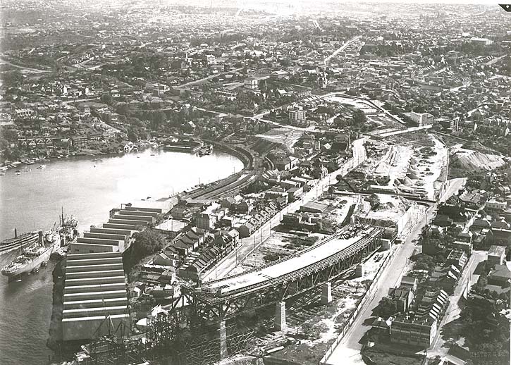
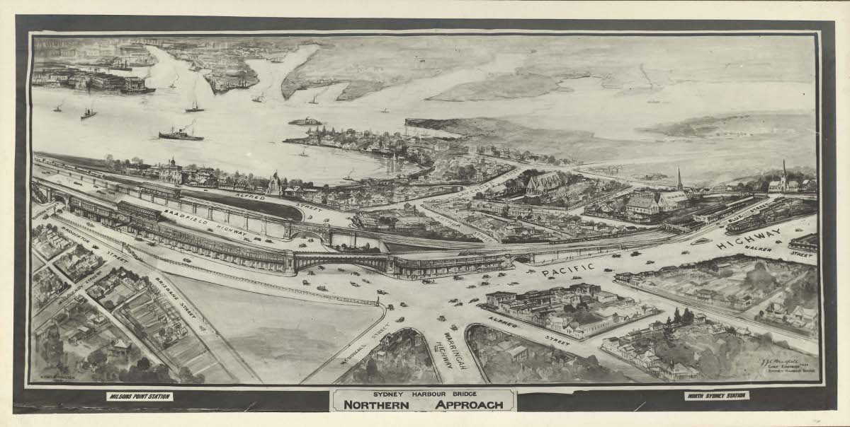
 Aerial view of construction of the northern approach to the Sydney Harbour Bridge. The original railway alignment and construction work on the realignment for extension across the bridge can both be seen.
The original Milsons Point station was not in its present location, but on the edge of Sydney Harbour approximately on the site of the present northern pylon of the Sydney Harbour Bridge and the North Sydney Olympic Pool. This location enabled passengers from the North Shore to transfer directly from steam trains to ferries to reach Circular Quay. It opened as the southern terminus of the North Shore line on 1 May 1893 .[1] when extended from its previous terminus at St Leonards (opened from Hornsby 1 January 1890).[2] The site, squeezed between the rock cliffs and the edge of Sydney Harbour was cramped, with two side platforms, one of which was built on piles partly over the water's edge, and three tracks between, including a centre road.[3] Immediately adjoining it to the east was the colonnaded Milsons Point Ferry Wharf for the ferry service to Circular Quay in central Sydney and tram terminus for the North Sydney cable tramway (opened 22 May 1886) and subsequently electrified from 11 February 1900.[4]
In 1915, to enable a start on the construction of a bridge between Milsons Point and Dawes Point, the Government instructed the Railway Commissioners to vacate the above station and a new, 4-platform, station was constructed at the site of the boundary fence between the present-day Luna Park and Lavender Bay Sidings. This station was in operation for just seven weeks, from 30 May 1915 to 18 July 1915, as the inconvenience to passengers transferring between ferries and trains was unacceptable.[5]
Due to later overcrowding, a third platform was added on 12 December 1920 by removing the centre road track and laying a new track on "inland" side of the new platform 2.[6] This station remained in use until the site was requisitioned to allow construction of the Sydney Harbour Bridge.
From 27 April 1924, a new temporary station was brought into use, approximately 300 metres back along the line on the site of the present Lavender Bay car sidings, just beyond the present Luna Park amusement park. It was linked to the street by stairs and three escalators, and to a new adjacent ferry wharf. The escalators at Milsons Point were the first installed in Australia, one of which was transferred to Town Hall Station when the temporary station closed.[7] The tram line was also relocated to terminate adjacent to the entrance to the new station in Glen Street.
The line from Hornsby to Milsons Point was electrified from 2 August 1927.[8]
Current station
 Sketch showing both pairs of platforms at Milsons Point
As part of the construction of the Sydney Harbour Bridge and relocation of the North Shore Line to extend across the bridge into the City, a new Milsons Point station was built on the northern approach to the bridge and opened on 19 March 1932. This station was in two parts: two platforms each side of the roadway. The western platforms were connected to the North Shore line whereas the Eastern pair were used for a tramway service between Wynyard in central Sydney and the northern suburbs. The tramway and the associated platforms at Milsons Point were removed in 1958 and a roadway constructed (now lanes 7 and 8 of the Harbour Bridge).
The western pair of platforms have continued in use to the present day as Milsons Point Station, and is the only "Milsons Point" known to most Sydneysiders. The line through this station has been electrified since its inception.
Platforms and services
The station is fitted with lifts, and is wheelchair accessible.
The station is served by six trains per hour each way, with additional trains during weekday peak hours.
Platform Line Stopping Pattern Notes 
North Shore Line All stations and limited stops services to Central and on to the ■Western Line or the ■Northern Line. Northern Line All stations and limited stops services to Central via the City, then on to Epping via Strathfield.
Peak hour services to Hornsby via Central and Strathfield.
North Shore Line All stations and limited stops services to North Sydney, Lindfield, Gordon, Hornsby and Berowra via Chatswood
Peak hour intercity services to Gosford and Wyong via Chatswood.Northern Line All stations and limited stops services to North Sydney, then on to Hornsby via Macquarie Park and Epping. Transport links
Sydney Buses runs a number of routes to and from Milsons Point railway station:
- E50 - weekdays (Monday to Friday) express services - to Manly - (West Promenade)
- 168 - weekdays (Monday to Friday) peak hour services - to Warringah Mall - (Pittwater Road)
- 173 - weekdays (Monday to Friday) peak hour services - to Cromer Heights - (Truman Avenue)
- 183 - weekdays (Monday to Friday) peak hour limited stops services - to Narrabeen - (Waterloo Street)
- L84 - to Mona Vale - (Barranjoey Road)
- 187 - weekdays (Monday to Friday) peak hour services - to Newport - (Coles Parade)
- L87 - weekdays (Monday to Friday) peak hour services - to Newport - (Coles Parade)
- 209 - weekdays (Monday to Friday) peak hour services - to East Lindfield - (Crana Avenue)
- 227 - to Mosman - (Military Road and Raglan Street)
- 228 - weekdays (Monday to Friday) daytime services - to Cilfton Gardens - (Morella Road)
- 229 - weekdays (Monday to Friday) off peak hour services - to Beauty Point - (Pearl Bay Avenue)
- 230 - to Mosman Wharf - (Avenue Road)
- 265 - weekdays (Monday to Friday) full time and Saturday daytime services - to Lane Cove - (Longueville Road)
- 269 -weekdays (Monday to Friday) daytime services - to McMahons Point - (Ferry Wharf)
- 286 - weekdays (Monday to Friday) peak hour daytime services - to Denistone East - (Lovell Road and Colvin Crescent)
- 287 - weekdays (Monday to Friday) peak hour services - to Ryde - (Ryde Depot)
- 290 - to Epping - (Langston Place)
- 294 - weekdays (Monday to Friday) peak hour services - to Epping - (Langston Place)
Image Gallery
-

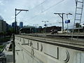
Platform 1
-

Platform 2
-

View of Sydney Harbour Bridge from the end of the island platform.
-
Looking at platforms from outside station
-
Looking south to Sydney CBD from middle of platforms
-

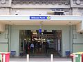
The Historic Sandstone structure and entrance to station
-

Station Concourse
-
Alternate entrance from the east side
-

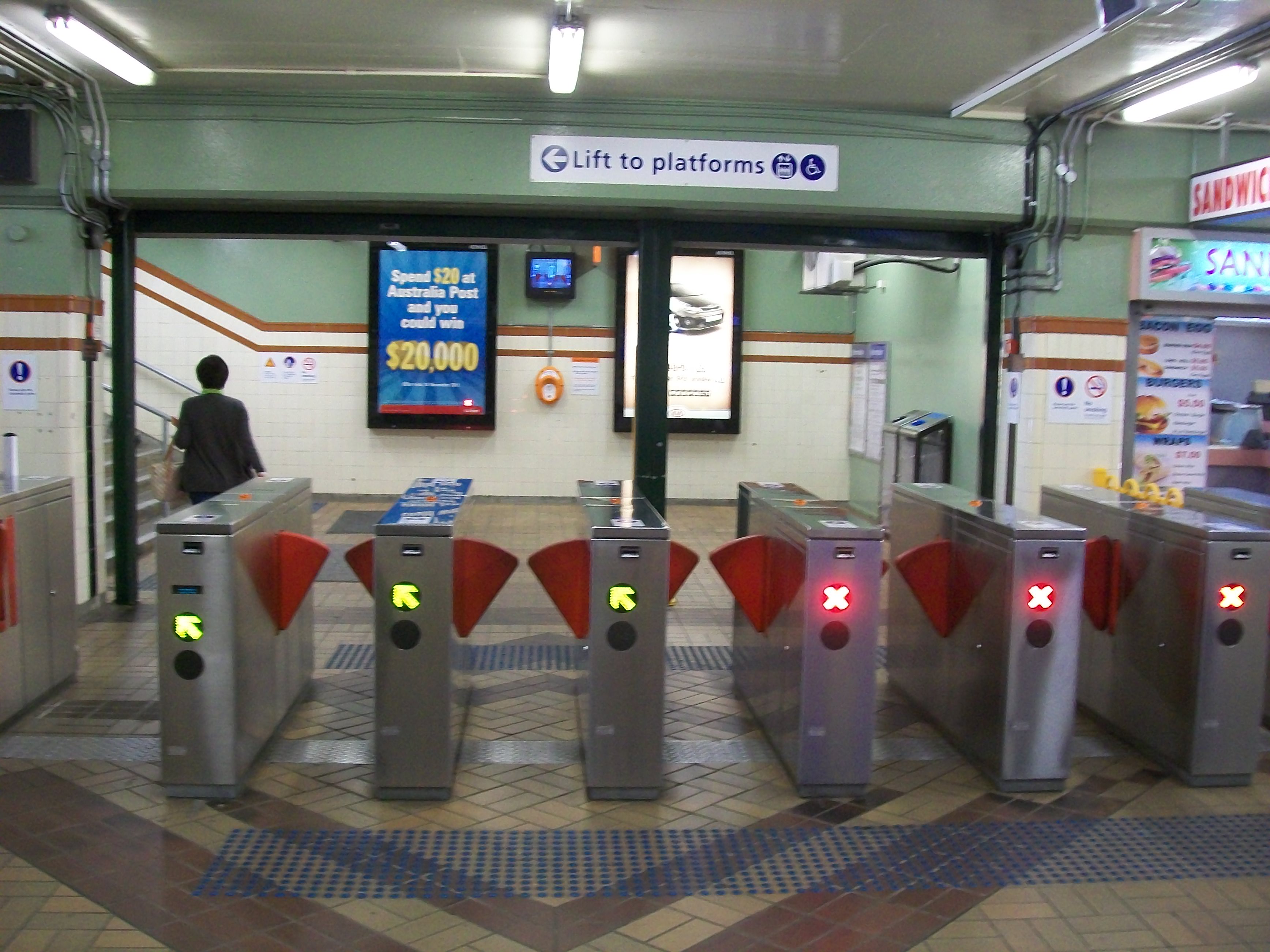
Ticket Barriers
-

Stairs leading up to platforms
-

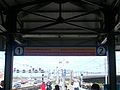
Platform Sign
-

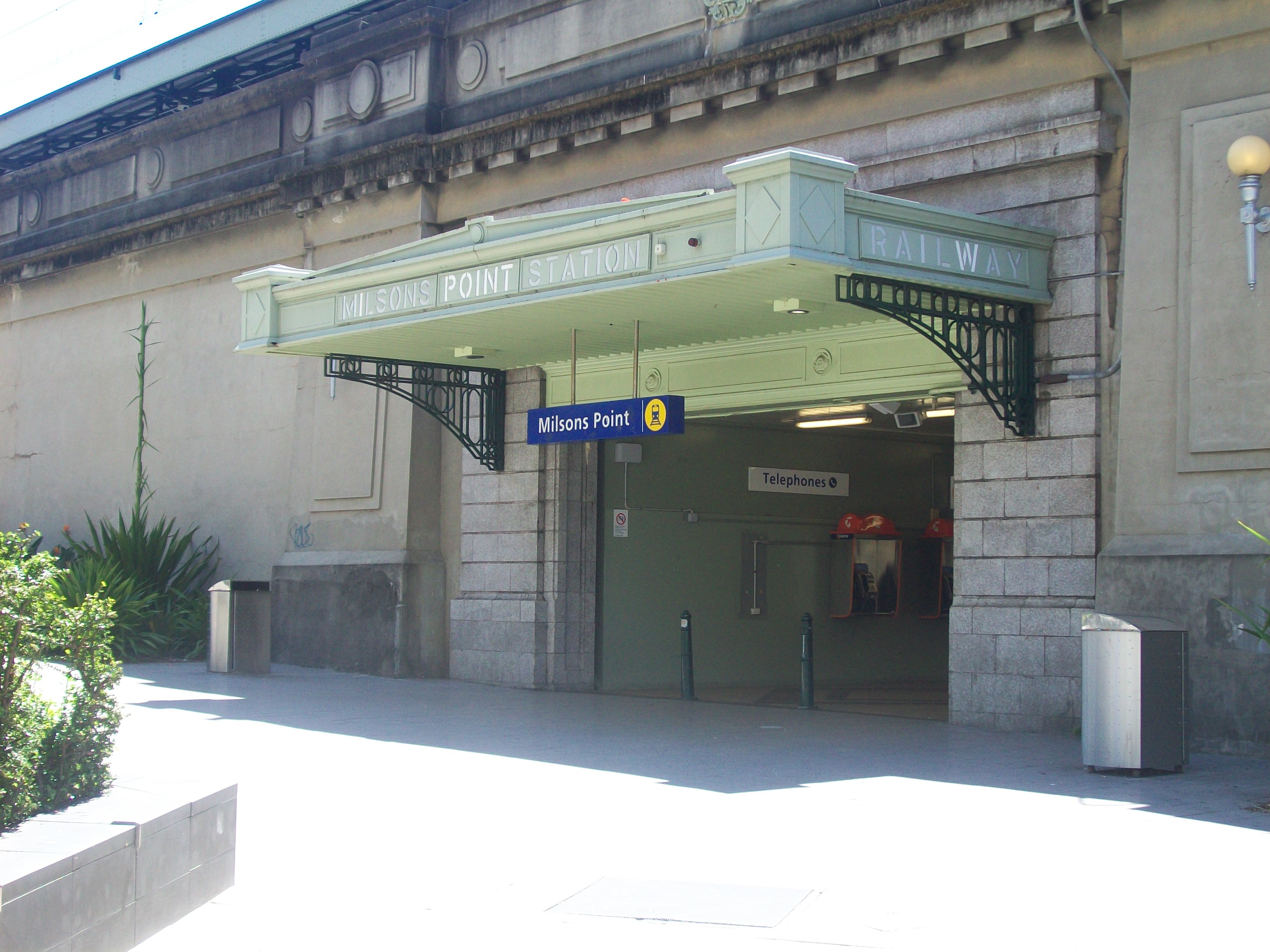
Sign outside station
-

Broughton Street entrance just prior to opening in 1932
-

Concourse in 1932
Neighbouring stations
Preceding station CityRail Following station towards Wyong or BerowraNorth Shore Line towards Centraltowards HornsbyNorthern Line via Macquarie Parktowards CentralReferences
- ^ Station Information - G to M Forsyth, J.H. State Rail Authority 1998
- ^ Station Information - N to Z Forsyth, J.H. State Rail Authority 1998
- ^ Australian Railway Historical Society Bulletin, July, 1959 p107
- ^ The North Sydney Lines Keenan, D.R. Transit Press ISBN 0 909338 05 1
- ^ The Seven Weeks Ferry Service Johnson, Geoff Australian Railway Historical Society Bulletin, May, 2001 pp178-184
- ^ Australian Railway Historical Society Bulletin, September, 1959 p135
- ^ Railway Transportation September, 1955 p112
- ^ Australian Railway Historical Society Bulletin, September, 1959 p137
Coordinates: 33°50′46″S 151°12′42″E / 33.8461°S 151.2118°E
North Shore Line - Central
- Town Hall
- Wynyard
- Milsons Point
- North Sydney
- Waverton
- Wollstonecraft
- St Leonards
- Artarmon
- Chatswood
- Roseville
- Lindfield
- Killara
- Gordon
- Pymble
- Turramurra
- Warrawee
- Wahroonga
- Waitara
- Hornsby
- Asquith
- Mount Colah
- Mount Kuring-gai
- Berowra
- Cowan
- Hawkesbury River
- Woy Woy
- Point Clare
- Gosford
- Narara
- Niagara Park
- Lisarow
- Ourimbah
- Tuggerah
- Wyong
Northern Line - Hornsby
- Normanhurst
- Thornleigh
- Pennant Hills
- Beecroft
- Cheltenham
- Epping
- Macquarie University
- Macquarie Park
- North Ryde
- Chatswood
- Artarmon
- St Leonards
- Wollstonecraft
- Waverton
- North Sydney
- Milsons Point
- Wynyard
- Town Hall
- Central
- Redfern
- Burwood
- Strathfield
- North Strathfield
- Concord West
- Rhodes
- Meadowbank
- West Ryde
- Denistone
- Eastwood
- Epping
(stations in italics are under planning or under construction)CityRail Lines Suburban - Eastern Suburbs & Illawarra
- Bankstown
- Inner West
- Airport & East Hills
- South
- Cumberland
- Western
- North Shore
- Carlingford
- Olympic Park
- Northern
Interurban and regional - South Coast
- Southern Highlands
- Blue Mountains
- Newcastle & Central Coast
- Hunter
Under construction or planning: South West Rail Link, North West Rail Link Categories:- Railway stations in Sydney
- Railway stations opened in 1893
- Railway stations opened in 1932


Wikimedia Foundation. 2010.