- Milsons Point, New South Wales
-
Milsons Point
Sydney, New South Wales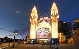
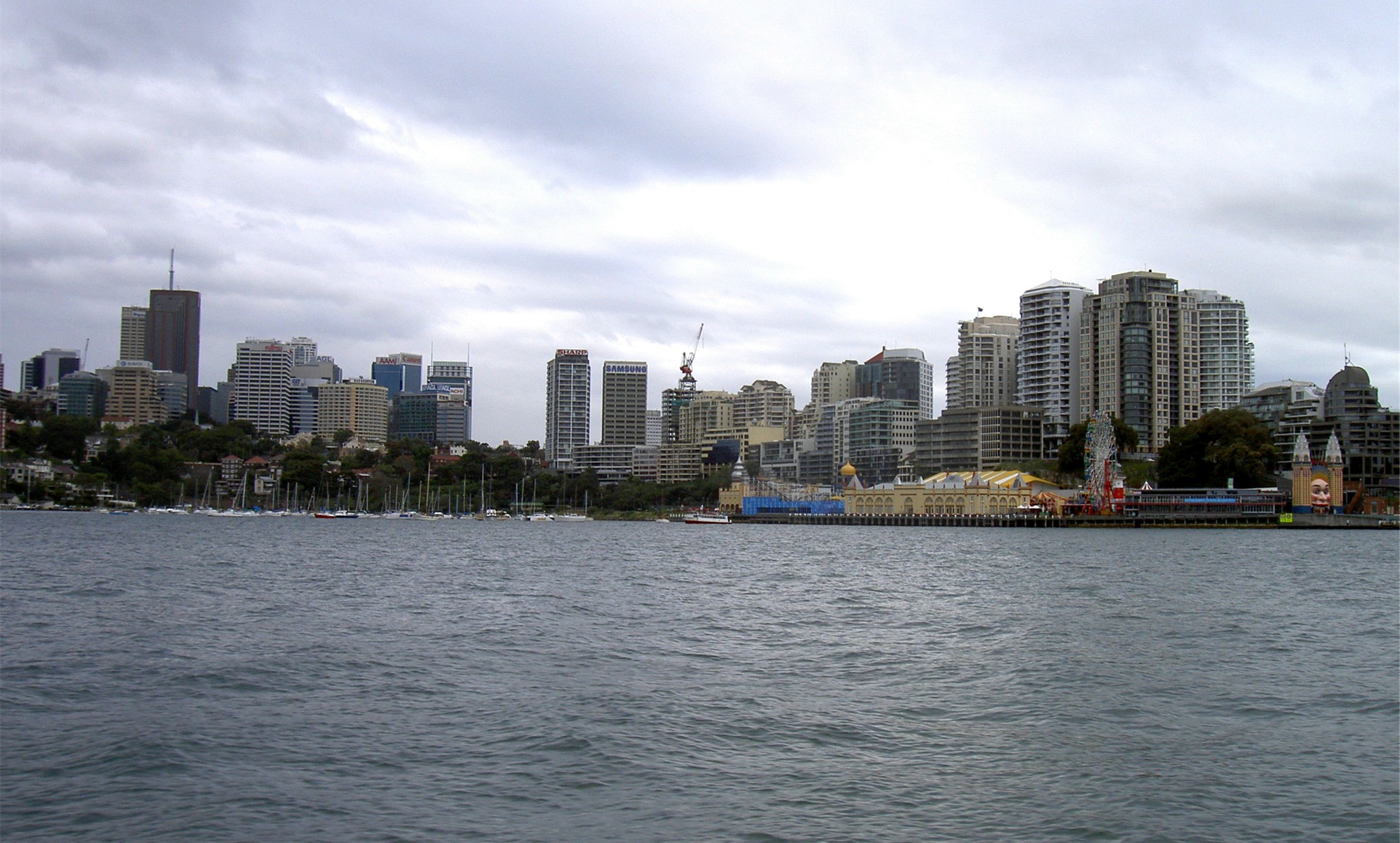
Luna Park at Milsons PointPopulation: 1,553(2006)[1] Postcode: 2061 Area: 0.2 km² (0.1 sq mi) Location: 3 km (2 mi) from CBD LGA: North Sydney Council State District: North Shore Federal Division: North Sydney Suburbs around Milsons Point: Lavender Bay North Sydney North Sydney McMahons Point Milsons Point Kirribilli Dawes Point Milsons Point is a suburb on the lower North Shore of Sydney, in the state of New South Wales, Australia. North Sydney is located 3 kilometres north of the Sydney central business district in the local government area of North Sydney Council.
Milsons Point was named after James Milson (1785-1872), one of the earliest settlers. Milsons Point is also the geographical feature that juts into Sydney Harbour from the northern side, directly opposite Sydney Cove, the spot where the first European settlement was established in 1788.
Contents
History
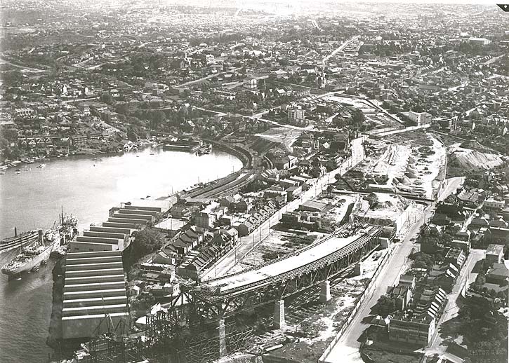
 Aerial view of Milsons Point during construction of the Sydney Harbour Bridge.
Milsons Point was named after James Milson (1785-1872), a free settler originally from Lincolnshire who settled in the then-almost uninhabited district in 1824. In that year, Governor Brisbane granted Milson a total of 350 acres (1.4 km2) on land fronting the Harbour. However, after a protracted dispute following a house fire in which all his land deeds were destroyed, Milson's holdings in the area were reduced in 1830 to 50 acres (200,000 m2) back from the Harbour. As compensation for the lost land, he was granted a holding that now encompasses the suburbs of Thornleigh and Normanhurst. Milson subsequently established a profitable business supplying ships with stone ballast, careening services, fresh water, and the produce of his farms.
Milson's eldest son, James Jnr (1814-1903) greatly expanded the family's land holdings in the lower North Shore, including the 1853 purchase of the Cremorne peninsular. The last of the family's holdings in the lower North Shore area were resumed in the early 1920s for the construction of the Harbour Bridge and associated roadways.[2]
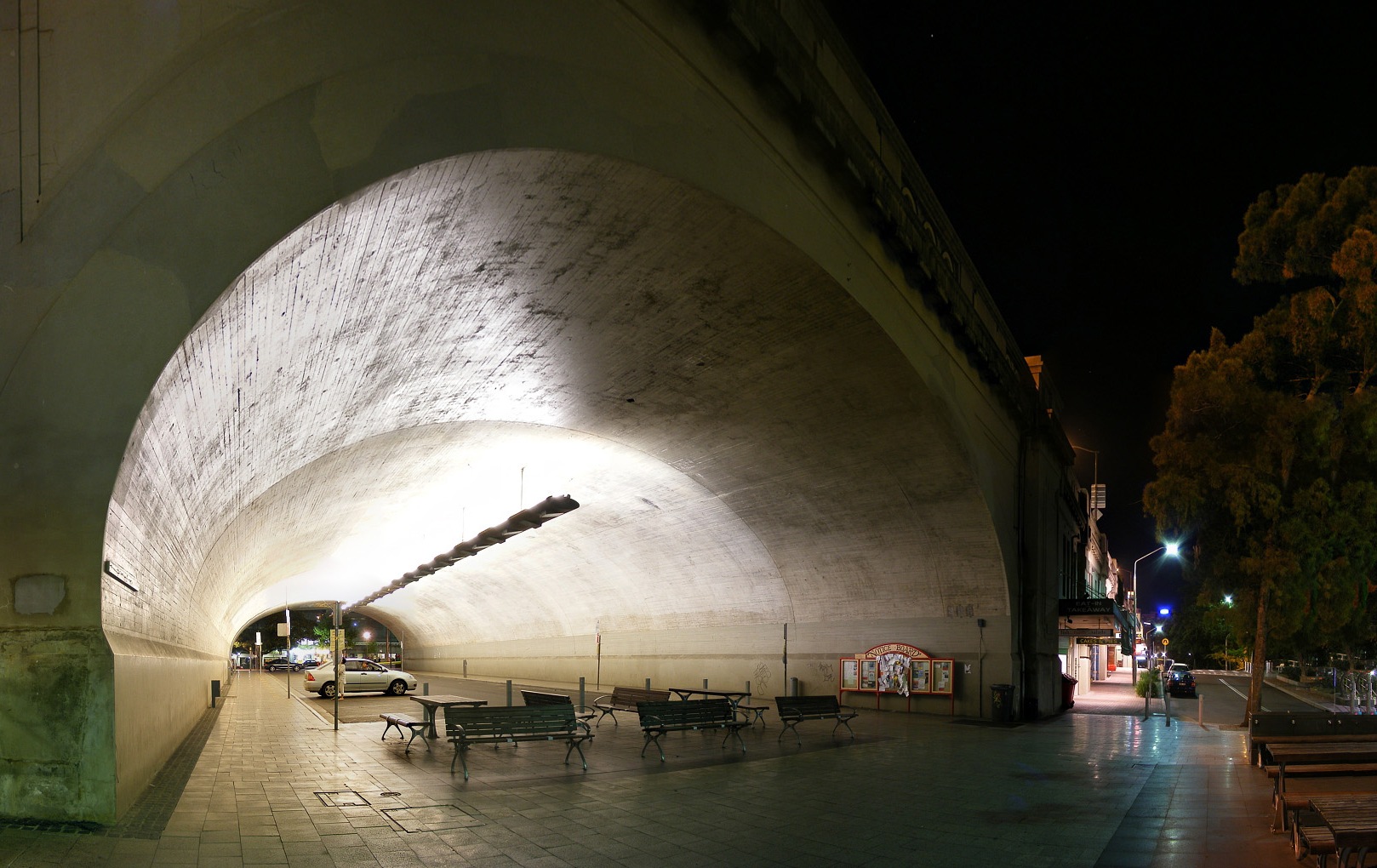
 Access stairs and underpass tunnel for the Sydney Harbour Bridge, Milsons Point
Transport
Milsons Point supports the northern end of the Sydney Harbour Bridge. Milsons Point is well connected with the CBD of Sydney by the bridge, ferries and trains. The Warringah Freeway provides a link south to the Sydney CBD and north to Chatswood.
Milsons Point railway station is on the northern approach to the Sydney Harbour Bridge. The Milsons Point ferry wharf, serviced by the Balmain, Pyrmont Bay and Rydalmere ferry lines, is located to the west of the bridge in the south-west part of the suburb. In addition to rail services, Milson's Point is serviced by buses that run to the Lower North Shore and Northern Beaches. School Buses leave from Bradfield Park to transport students to schools in North Sydney.

Commercial area
Milsons Point has a mixture of residential and commercial developments. High density developments are located close to the railway station and include a number of restaurants and shops.
Notable Residents
- Michael Stutchbury*
- Mike Gibson*
Sport and recreation
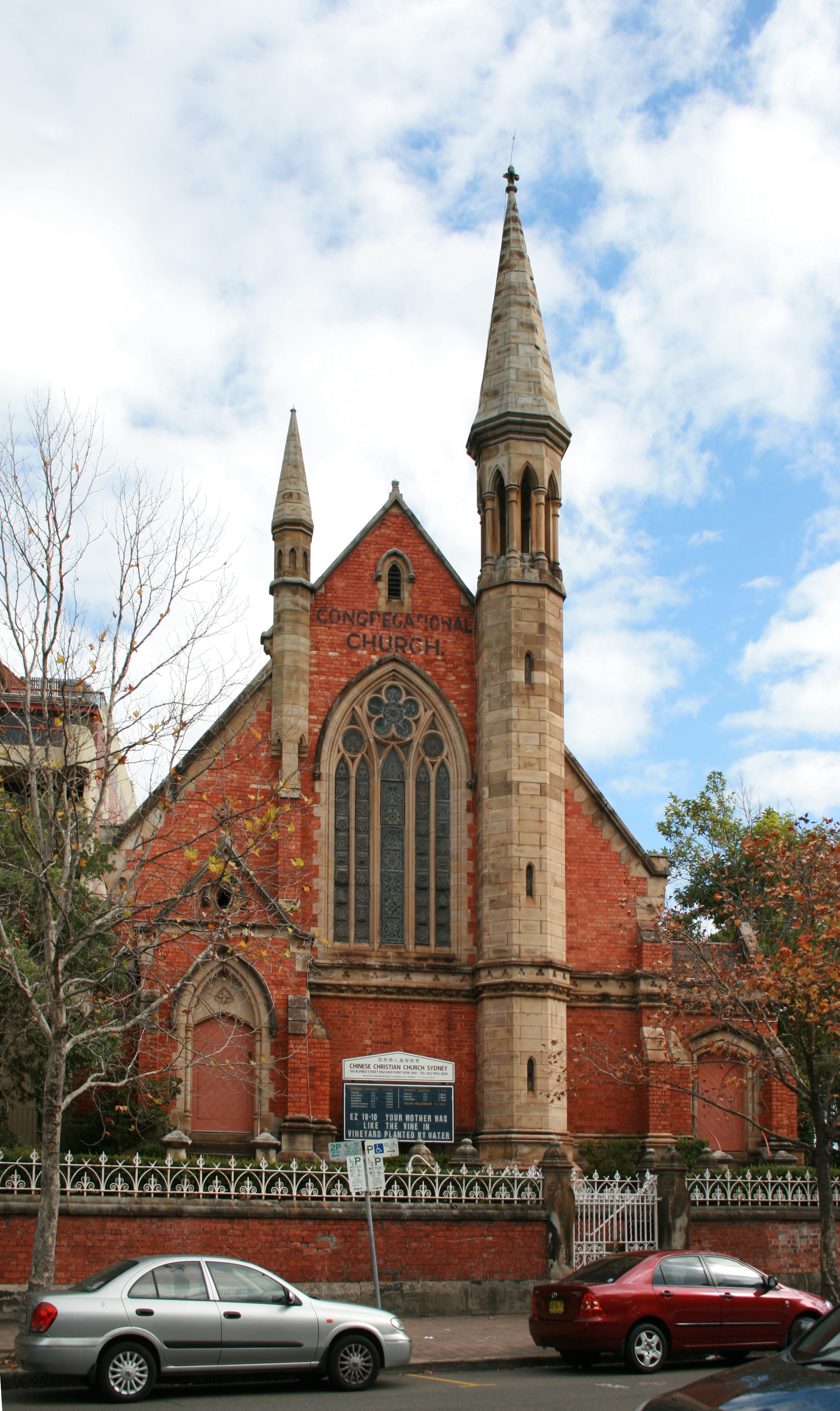
 Chinese Christian Church Sydney uses a previously Presbyterian church building in Milsons Point
Milsons Point has the entertainment centre Luna Park and the North Sydney Olympic Pool,
Schools
Schools in the area include the Catholic schools Loreto Kirribilli for girls and St Aloysius' College for boys.
References
The Earth Brought Forth - The Milsons of Milsons Point, by Scott Milson, 4SQ Books, Sydney. 2006. (ISBN 0-646-46142-7)
- ^ "2006 Census Community Profile Series : Milsons Point (State Suburb)". Australian Bureau of Statistics. Accessed 31 October 2009.
- ^ The Book of Sydney Suburbs, Compiled by Frances Pollon, Angus & Robertson Publishers, 1990, Published in Australia ISBN 0-207-14495-8, page 174
Coordinates: 33°50′52″S 151°12′43″E / 33.84765°S 151.21201°E
Suburbs of the North Sydney Local Government Area · North Shore · Sydney Cammeray · Cremorne · Cremorne Point · Crows Nest · Kirribilli · Kurraba Point · Lavender Bay · McMahons Point · Milsons Point · Neutral Bay · North Sydney · St Leonards · Waverton · WollstonecraftCategories:- Suburbs of Sydney

Wikimedia Foundation. 2010.