- National Register of Historic Places listings in Fremont County, Wyoming
-
 Location of Fremont County in Wyoming
This is a list of the National Register of Historic Places listings in Fremont County, Wyoming.
This is intended to be a complete list of the properties and districts on the National Register of Historic Places in Fremont County, Wyoming, United States. The locations of National Register properties and districts for which the latitude and longitude coordinates are included below, may be seen in a Google map.[1]
There are 30 properties and districts listed on the National Register in the county, 1 of which is a National Historic Landmark.
-
- This National Park Service list is complete through NPS recent listings posted November 10, 2011.[2]
Contents: Counties in Wyoming Albany - Big Horn - Campbell - Carbon - Converse - Crook - Fremont - Goshen - Hot Springs - Johnson - Laramie - Lincoln - Natrona - Niobrara - Park - Platte - Sheridan - Sublette - Sweetwater - Teton - Uinta - Washakie - Weston Current listings
[3] Landmark name Image Date listed Location City or town Summary 1 Atlantic City Mercantile 
April 25, 1985 Rt. 62, Box 260
42°29′15″N 108°43′47″W / 42.4875°N 108.729722°WAtlantic City 2 BMU Bridge over Wind River 
February 22, 1985 Wyoming Highway 132
43°08′36″N 108°42′29″W / 43.143333°N 108.708056°WEthete 3 Brooks Lake Lodge September 29, 1982 Lower Brooks Lake-Shoshone National Forest
43°44′47″N 110°00′23″W / 43.746389°N 110.006389°WDubois 4 Castle Gardens Petroglyph Site 
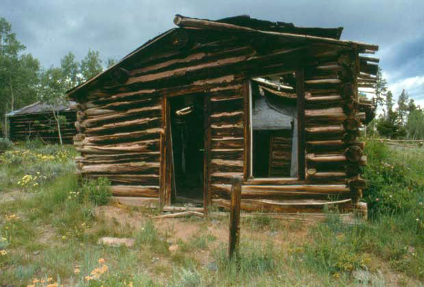
April 16, 1969 Address Restricted[4] Moneta 5 CM Ranch and Simpson Lake Cabins September 15, 1992 State Fish Hatchery Rd. south of Dubois off U.S. Route 287
43°28′08″N 109°39′03″W / 43.468889°N 109.650833°WDubois 6 Dean Decker Site March 12, 1986 Address Restricted[4] Honeycomb Buttes 7 Delfelder Schoolhouse March 29, 1978 North of Riverton off U.S. Route 26
43°05′01″N 108°21′37″W / 43.083611°N 108.360278°WRiverton 8 Diamond A Ranch August 19, 1991 Off U.S. Routes 26/287 northeast of Whiskey Mountain
43°28′43″N 109°30′09″W / 43.478611°N 109.5025°WDubois 9 ELS Bridge over Big Wind River 
February 22, 1985 County Road CN10-21
43°33′06″N 109°40′45″W / 43.551667°N 109.679167°WDubois 10 ELY Wind River Diversion Dam Bridge 
February 22, 1985 County Road CN10-24
43°13′30″N 108°57′16″W / 43.225°N 108.954444°WMorton 11 Fort Washakie Historic District 
April 16, 1969 Wind River Indian Reservation on U.S. Route 287
43°00′22″N 108°52′59″W / 43.006111°N 108.883056°WFort Washakie 12 Green Mountain Arrow Site March 12, 1986 Address Restricted[4] Stratton Rim 13 Hamilton City 
June 4, 1980 Northeast of Atlantic City
42°31′58″N 108°40′55″W / 42.532778°N 108.681944°WAtlantic City 14 Jackson Park Town Site Addition Brick Row February 27, 2003 615, 635, and 677 S. 3rd St.
42°49′39″N 108°43′58″W / 42.8275°N 108.732778°WLander 15 C. H. King Company and First National Bank of Shoshoni September 8, 1994 127 Main St.
43°14′06″N 108°06′25″W / 43.235°N 108.106944°WShoshoni 16 Lander Downtown Historic District May 5, 1987 Main St. between 2nd and 4th Sts.
42°49′59″N 108°43′55″W / 42.833056°N 108.731944°WLander 17 Quien Sabe Ranch April 18, 1991 Quien Sabe Ranch Rd., 18 mi (29 km) northeast of Shoshoni
43°23′40″N 107°59′35″W / 43.394444°N 107.993056°WShoshoni 18 Riverton Railroad Depot May 22, 1978 1st and Main Sts.
43°01′28″N 108°23′24″W / 43.024444°N 108.39°WRiverton 19 Shoshone-Episcopal Mission 
April 11, 1973 3 mi (4.8 km) southwest of Fort Washakie on Moccasin Lake Rd.
42°59′09″N 108°54′17″W / 42.985833°N 108.904722°WFort Washakie 20 South Pass 
October 15, 1966 About 10 mi (16 km) southwest of South Pass City on Wyoming Highway 28 South Pass City 21 South Pass City 
February 26, 1970 South Pass Rd.
42°28′16″N 108°48′19″W / 42.471111°N 108.805278°WSouth Pass City 22 Split Rock Prehistoric Site May 4, 1987 Address Restricted[4] Split Rock Ranch 23 St. Michael's Mission June 21, 1971 In Ethete
43°01′30″N 108°46′22″W / 43.025°N 108.772778°WEthete 24 Torrey Lake Club/Ranch Historic District August 12, 1991 Along the western shores of Lake Julia, Torrey Lake, and Ring Lake
43°27′38″N 109°33′21″W / 43.460556°N 109.555833°WDubois 25 Torrey Lake Petroglyph District October 4, 1993 Address Restricted[4] Dubois 26 Twin Pines Lodge and Cabin Camp December 10, 1993 218 W. Ramshorn
43°32′01″N 109°38′04″W / 43.533611°N 109.634444°WDubois 27 Union Pass April 16, 1969 On the Continental Divide in Teton National Forest
43°28′54″N 109°52′24″W / 43.481667°N 109.873333°WDubois 28 US Post Office and Courthouse-Lander Main 
May 19, 1987 177 N. 3rd St.
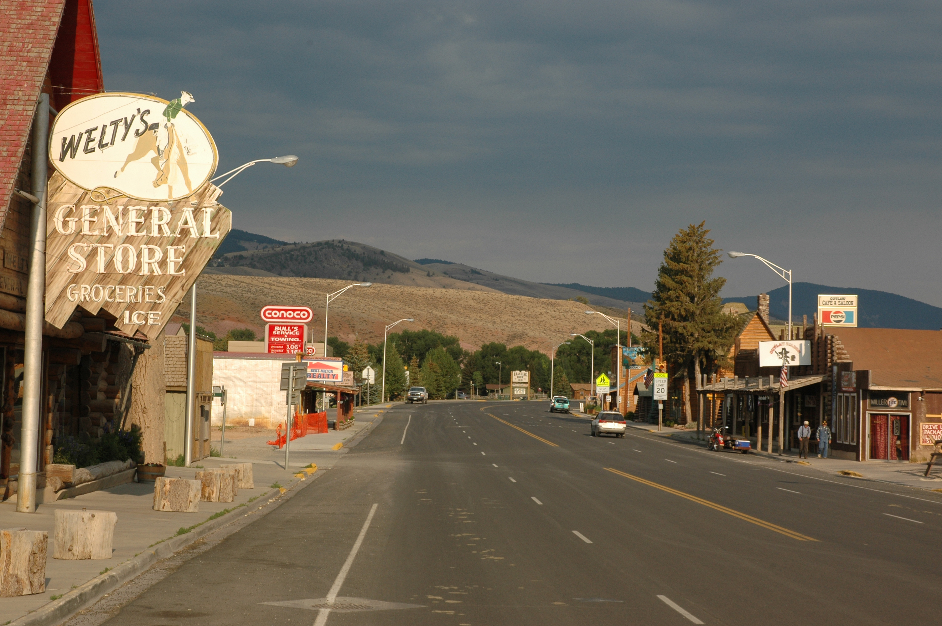
42°50′02″N 108°43′50″W / 42.833889°N 108.730556°WLander 29 Welty's General Store 
November 15, 1979 220 Ramshorn St.
43°32′01″N 109°37′59″W / 43.533611°N 109.633056°WDubois 30 Wind River Agency Blockhouse December 23, 2000 Address Restricted[4] Fort Washakie See also
- List of National Historic Landmarks in Wyoming
- National Register of Historic Places listings in Wyoming
References
- ^ The latitude and longitude information provided in this table was derived originally from the National Register Information System, which has been found to be fairly accurate for about 99% of listings. For about 1% of NRIS original coordinates, experience has shown that one or both coordinates are typos or otherwise extremely far off; some corrections may have been made. A more subtle problem causes many locations to be off by up to 150 yards, depending on location in the country: most NRIS coordinates were derived from tracing out latitude and longitudes off of USGS topographical quadrant maps created under the North American Datum of 1927, which differs from the current, highly accurate WGS84 GPS system used by Google maps. Chicago is about right, but NRIS longitudes in Washington are higher by about 4.5 seconds, and are lower by about 2.0 seconds in Maine. Latitudes differ by about 1.0 second in Florida. Some locations in this table may have been corrected to current GPS standards.
- ^ "National Register of Historic Places: Weekly List Actions". National Park Service, United States Department of the Interior. Retrieved on November 10, 2011.
- ^ Numbers represent an ordering by significant words. Various colorings, defined here, differentiate National Historic Landmark sites and National Register of Historic Places Districts from other NRHP buildings, structures, sites or objects.
- ^ a b c d e f Some listings on the NRHP are highly sensitive sites and may be subject to looting or vandalism. The NRHP lists this site as "Address Restricted."
U.S. National Register of Historic Places Topics Lists by states Alabama • Alaska • Arizona • Arkansas • California • Colorado • Connecticut • Delaware • Florida • Georgia • Hawaii • Idaho • Illinois • Indiana • Iowa • Kansas • Kentucky • Louisiana • Maine • Maryland • Massachusetts • Michigan • Minnesota • Mississippi • Missouri • Montana • Nebraska • Nevada • New Hampshire • New Jersey • New Mexico • New York • North Carolina • North Dakota • Ohio • Oklahoma • Oregon • Pennsylvania • Rhode Island • South Carolina • South Dakota • Tennessee • Texas • Utah • Vermont • Virginia • Washington • West Virginia • Wisconsin • WyomingLists by territories Lists by associated states Other Municipalities and communities of Fremont County, Wyoming Cities 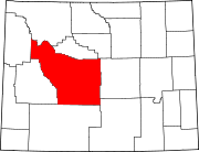
Towns CDPs Arapahoe | Atlantic City | Boulder Flats | Crowheart | Ethete | Fort Washakie | Jeffrey City | Johnstown
Unincorporated
communitiesKinnear | Kotey Place | Lysite | Miner's Delight | St. Stephens | South Pass City
Ghost town Indian reservation Categories:- National Register of Historic Places in Wyoming by county
- Fremont County, Wyoming
-


Wikimedia Foundation. 2010.