- National Register of Historic Places listings in Millard County, Utah
-
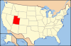
 Location of Millard County in Utah
This is a list of the National Register of Historic Places listings in Millard County, Utah.
This is intended to be a complete list of the properties and districts on the National Register of Historic Places in Millard County, Utah, United States. Latitude and longitude coordinates are provided for many National Register properties and districts; these locations may be seen together in a Google map.[1]
There are 27 properties and districts listed on the National Register in the county, including 1 National Historic Landmark.
-
- This National Park Service list is complete through NPS recent listings posted November 10, 2011.[2]
Current listings
[3] Landmark name [4] Image Date listed Location City or town Summary 1 Archeological Site No. 42Md300 
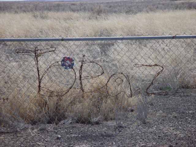
August 6, 1980 Address Restricted[5] Delta A depression near the Sevier River southwest of Delta, an archaeological site that has yielded hundreds of Paleoindian artifacts.[6] 2 Central Utah Relocation Center (Topaz) Site 
March 29, 2007 10500 W. 500 North Delta 3 Cottonwood Wash (42 MD 183) June 4, 1985 Address Restricted[5] Milford 4 Cove Fort 
October 6, 1970 2 miles east of Interstate 15 on State Route 4
38°36′06″N 112°34′49″W / 38.601667°N 112.580278°WCove Fort 5 Deseret (42 MD 55) June 4, 1985 Address Restricted[5] Deseret 6 Deseret Relief Society Hall December 13, 1995 4365 S. 4000 W.
39°17′24″N 112°39′07″W / 39.29°N 112.651944°WDeseret 7 Desert Experimental Range Station Historic District April 11, 1994 2.5 miles north of U.S. Route 21, 42 miles west of Milford
38°36′01″N 113°44′44″W / 38.600278°N 113.745556°WMilford 8 Fillmore American Legion Hall January 24, 2011 80 S. Main St.
38°48′05″N 112°26′16″W / 38.801389°N 112.437778°WFillmore 9 Fort Deseret 
October 9, 1970 2 miles south of Deseret on State Route 257
39°15′54″N 112°39′13″W / 39.265°N 112.653611°WDeseret 10 George Hotel 
June 10, 2005 10 N. Main St.
38°48′06″N 112°26′13″W / 38.801667°N 112.436944°WKanosh 11 Gunnison Massacre Site 
April 30, 1976 6 miles southwest of Hinckley on the Sevier River
39°16′46″N 112°46′40″W / 39.279444°N 112.777778°WHinckley 12 Hinckley High School Gymnasium April 1, 1985 54 N. 200 West
39°19′34″N 112°40′06″W / 39.326111°N 112.668333°WHinckley 13 Peter and Jessie Huntsman House 
January 30, 1995 155 W. Center St.
38°58′08″N 112°19′38″W / 38.968889°N 112.327222°WFillmore 14 Kanosh Tithing Office 
January 25, 1985 40 N. Main St.
38°48′08″N 112°26′11″W / 38.802222°N 112.436389°WKanosh 15 Meadow Tithing Granary January 25, 1985 50 N. 100 West
38°53′12″N 112°24′42″W / 38.886667°N 112.411667°WMeadow 16 Millard Academy February 11, 1982 55 N. 200 West
39°19′36″N 112°40′07″W / 39.326667°N 112.668611°WHinckley 17 Mountain Home Wash June 4, 1985 Address Restricted[5] Milford 18 Edward and Elizabeth Partridge House 
May 14, 1993 10 S. 200 West
38°58′07″N 112°19′44″W / 38.968611°N 112.328889°WFillmore 19 Pharo Village October 10, 1975 Address Restricted[5] Scipio 20 Peter Quarnberg House 
July 26, 1982 105 W. 100 South
39°14′36″N 112°06′20″W / 39.243333°N 112.105556°WScipio 21 Merien and Rosabelle Robins House 
September 7, 2001 110 W. 200 North
39°14′55″N 112°06′20″W / 39.248611°N 112.105556°WScipio 22 Scipio Town Hall 
December 22, 1988 55 N. State St.
39°14′45″N 112°06′12″W / 39.245833°N 112.103333°WScipio 23 Site 42 MD 284 June 4, 1985 Address Restricted[5] Fillmore 24 Thuesen-Petersen House February 1, 1983 206 W. Center St.
39°14′30″N 112°06′13″W / 39.241667°N 112.103611°WScipio 25 Topaz War Relocation Center Site 
January 2, 1974 16 miles northwest of Delta
39°24′49″N 112°46′28″W / 39.413611°N 112.774444°WDelta 26 Utah Territorial Capitol 
September 22, 1970 Center St. between Main and 100 West St.
38°58′04″N 112°19′28″W / 38.967778°N 112.324444°WFillmore 27 Van's Hall January 27, 1995 321 W. Main St.
39°21′08″N 112°34′54″W / 39.352222°N 112.581667°WDelta Former listing
[3] Landmark name Image Date listed Location City or town Summary 1 Millard High School Gymnasium 
September 3, 2009 35 N. 200 West
38°58′13″N 112°19′45″W / 38.97028°N 112.32917°WFillmore Originally listed April 1, 1985; removed September 3, 2009[7] See also
References
- ^ The latitude and longitude information provided in this table was derived originally from the National Register Information System, which has been found to be fairly accurate for about 99% of listings. For about 1% of NRIS original coordinates, experience has shown that one or both coordinates are typos or otherwise extremely far off; some corrections may have been made. A more subtle problem causes many locations to be off by up to 150 yards, depending on location in the country: most NRIS coordinates were derived from tracing out latitude and longitudes off of USGS topographical quadrant maps created under North American Datum of 1927, which differs from the current, highly accurate GPS system used by Google maps. Chicago is about right, but NRIS longitudes in Washington are higher by about 4.5 seconds, and are lower by about 2.0 seconds in Maine. Latitudes differ by about 1.0 second in Florida. Some locations in this table may have been corrected to current GPS standards.
- ^ "National Register of Historic Places: Weekly List Actions". National Park Service, United States Department of the Interior. Retrieved on November 10, 2011.
- ^ a b Numbers represent an ordering by significant words. Various colorings, defined here, differentiate National Historic Landmark sites and National Register of Historic Places Districts from other NRHP buildings, structures, sites or objects.
- ^ "National Register Information System". National Register of Historic Places. National Park Service. . http://nrhp.focus.nps.gov/natreg/docs/All_Data.html.
- ^ a b c d e f Some listings on the NRHP are highly sensitive sites and may be subject to looting or vandalism. The NRHP lists this site as "Address Restricted."
- ^ Simms, Steven R. (September 1987). Tipps, Betsy L.. ed. "42MD300, A Paleoindian/Archaic Site near Delta, Utah" (PDF). The UPAC News (Utah Professional Archeological Council) 5 (3): 4. http://www.upaconline.org/newsl/upacnews_1987sept.pdf. Retrieved February 9, 2010.
- ^ "National Register of Historic Places Listings: September 11, 2009". U.S. National Park Service. http://www.nps.gov/history/nr/listings/20090911.htm. Retrieved September 29, 2009.
External links
 Media related to National Register of Historic Places in Millard County, Utah at Wikimedia Commons
Properties on the National Register of Historic Places in Utah 
U.S. National Register of Historic Places Topics Lists by states Alabama • Alaska • Arizona • Arkansas • California • Colorado • Connecticut • Delaware • Florida • Georgia • Hawaii • Idaho • Illinois • Indiana • Iowa • Kansas • Kentucky • Louisiana • Maine • Maryland • Massachusetts • Michigan • Minnesota • Mississippi • Missouri • Montana • Nebraska • Nevada • New Hampshire • New Jersey • New Mexico • New York • North Carolina • North Dakota • Ohio • Oklahoma • Oregon • Pennsylvania • Rhode Island • South Carolina • South Dakota • Tennessee • Texas • Utah • Vermont • Virginia • Washington • West Virginia • Wisconsin • WyomingLists by territories Lists by associated states Other  Category:National Register of Historic Places •
  Portal:National Register of Historic Places
Municipalities and communities of Millard County, Utah County seat: Fillmore Cities 
Towns CDP Unincorporated
communitiesGhost towns Categories:- National Register of Historic Places in Utah by county
- Millard County, Utah
-


Wikimedia Foundation. 2010.