- Monsal Dale
-
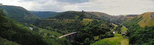 Panorama of Monsal Dale and the Headstone Viaduct
Monsal Dale is a valley in the Peak District of Derbyshire in England. In geological history this area of Derbyshire was long ago under water, and is formed from a subsequent uplift of resultant sedimentary deposits, known as the Derbyshire Dome. Overlying sandstones and shales have been eroded away, exposing the underlying limestone which forms the basis of the area today, which is consequently known as the White Peak. Monsal Dale is a Site of Special Scientific Interest (SSSI), a Special Area of Conservation (SAC) (1) and part of a Europe wide network called Natura 2000.
Contents
Headstone viaduct
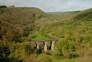 Headstone Viaduct
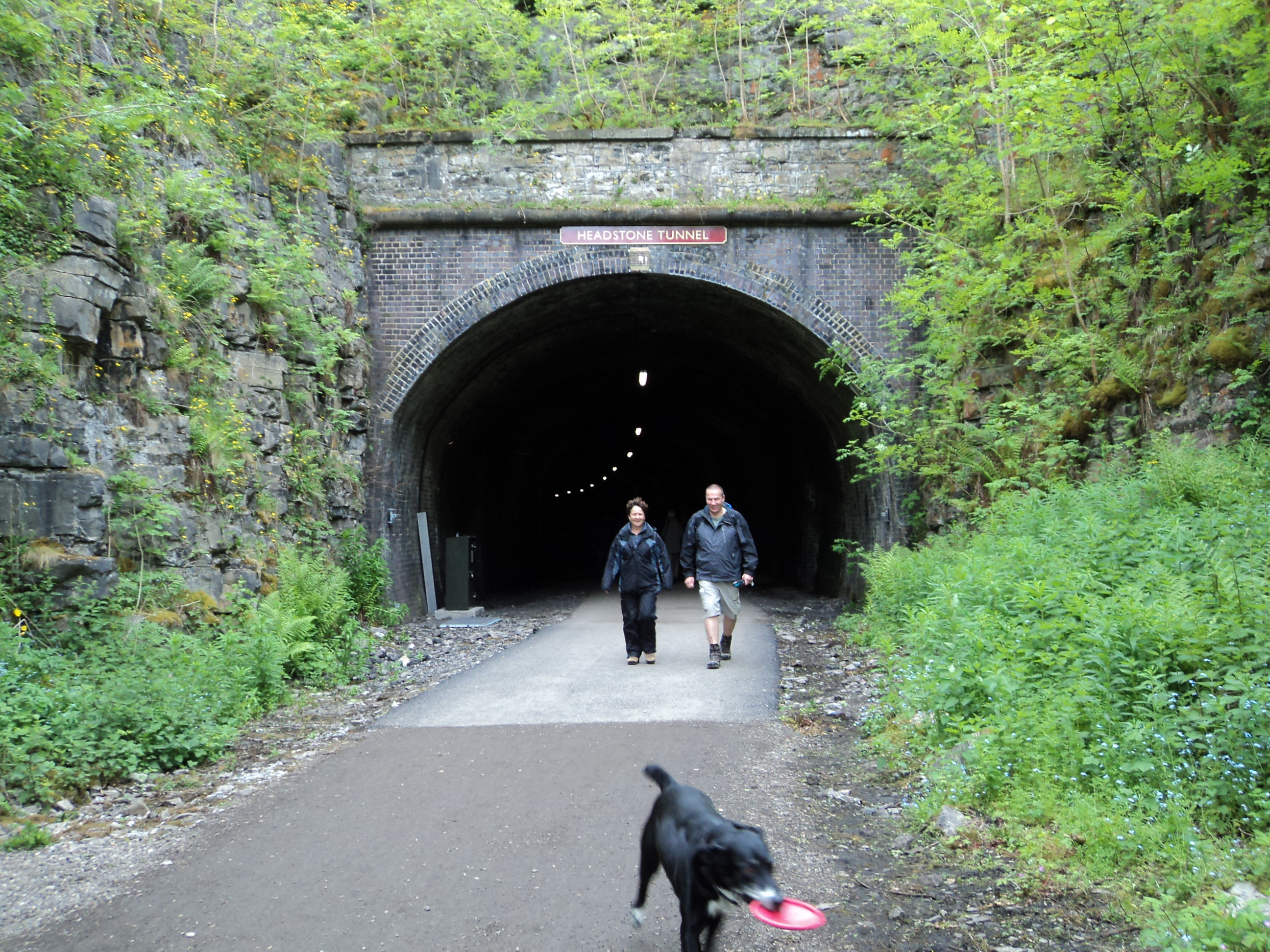
 Headstone Tunnel, at the southern end of the viaduct, was opened to the public in May 2011
The local landmark is the Headstone Viaduct, built by the Midland Railway, over the River Wye, immediately after the 533-yard (487 m) Headstone Tunnel, travelling north from Great Longstone. The viaduct, usually incorrectly called Monsal Dale Viaduct, is 300 feet (91 m) long, with five 50-foot (15 m) span arches, some forty feet high at the centre. Initially, some slippage occurred, and remedial work was carried out in 1907-8.[1]
Whilst considered elegant today, and indeed a preservation order was placed on it in 1970, when it was built in 1863 it was seen as destroying the beauty of the dale. John Ruskin, considered to be Britain's leading writer on culture, having had many works published on architecture and art, as well as political works, harshly criticized the building of the railway :
“ 'There was a rocky valley between Buxton and Bakewell, once upon a time, divine as the Vale of Tempe... You Enterprised a Railroad through the valley - you blasted its rocks away, heaped thousands of tons of shale into its lovely stream. The valley is gone, and the Gods with it; and now, every fool in Buxton can be in Bakewell in half an hour, and every fool in Bakewell at Buxton; which you think a lucrative process of exchange – you Fools everywhere'.
” Monsal Trail
The viaduct is now part of the Monsal Trail, (and a 'listed' structure). A proposal which was never came to fruition was for another viaduct for the Lancashire, Derbyshire and East Coast Railway to cross both the valley and the Midland Line, some three hundred feet high. Headstone Tunnel, at the southern end of the viaduct, was re-opened to the public in May 2011, along with nearby Cressbrook and Litton Tunnels.
- Monsal Dale railway station
Monsal Dale railway station opened in 1866 to serve the villages of Upperdale and Cressbrook, with the latter's cotton mills. The down line and platform was built on a shelf carved in the rock face, while the up was built on wooden trestles over the hillside. It closed in 1959 and nothing remains of the timber buildings.
From Monsal Dale, the line proceeded through Cressbrook (471 yards) and Litton (515 yards) tunnels to Millers Dale on its way north. Cut through solid limestone they were both complex tunnels, on a gradient of 1 in 100, and curved to allow the line to conform to the terrain.
See also
- List of bridges in the United Kingdom
- Manchester, Buxton, Matlock and Midlands Junction Railway
- Monsal Trail
References
- ^ Radford, B., (1988) Midland Though The Peak Unicorn Books
External links
- Map sources for Monsal Dale
- Ingenious.org Headstone Viaduct 1893
- "Geograph "Monsal Head overlooking the viaduct
- Monsal Head
- "Picture the Past" Monsal Dale viaduct and the River Wye
- Wier at Monsal Dale photograph
Coordinates: 53°14′41″N 1°43′54″W / 53.24472°N 1.73172°W
Categories:- Geography of Derbyshire
- Transport in Derbyshire
- Valleys of the Peak District
- Valleys of England


Wikimedia Foundation. 2010.