- Ozark National Scenic Riverways
-
Ozark National Scenic Riverways IUCN Category II (National Park)The Ozark National Scenic Riverways (red) and the nearby Eleven Point National Scenic and Wild River (green)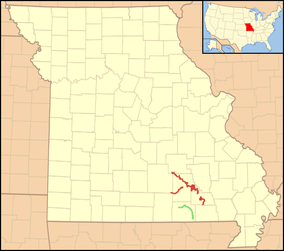
Location Shannon, Carter, Dent, and Texas Counties, Missouri Nearest city Salem, Van Buren, and Eminence Coordinates 37°11′27″N 91°16′35″W / 37.1907°N 91.2763°WCoordinates: 37°11′27″N 91°16′35″W / 37.1907°N 91.2763°W Area 80,000 acres (324 km2) Established 1964-08-27 Visitors 1,789,783 (in 2007) Governing body National Park Service Official website 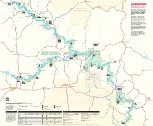 NPS map of the Riverways
The Ozark National Scenic Riverways is a national park in the Ozarks of southern Missouri in the U.S..
The park was created by an Act of Congress in 1964 to protect the Current and Jacks Fork rivers, and it was formally dedicated in 1971. The park's 80,000 acres (324 km2) are used for many forms of recreation and are home to abundant animal and plant species. Canoeing is the most popular activity, with some 1.3 million visitors coming to the area each year. Other activities include horseback riding, hunting, hiking, fishing, camping and sightseeing.
The park service touts the Current River as one of the midwest's best float streams, in part due to the contributions of some of the nation's largest springs. The headwaters of the Current River begin at the confluence of Pigeon Creek and Montauk Springs in Montauk State Park. Other notable springs along its course include Welch Spring, Cave Spring, Pulltite Spring, Round Spring, Fire Hydrant Spring, Ebb and Flow Spring, Blue Spring, Big Spring, and Gravel Spring. The park contains the United States' largest concentration of first magnitude springs, (which are defined as having average flow of more than 100 ft³/s (3 m³/s)) in dolomite rock. The only comparable spring collections are the limestone springs of North Florida near Gainesville and the igneous-based springs of Idaho's Snake River^.
The park includes many caves, including Round Spring Caverns, which offers ranger-led tours in the summer. Other notable caves include the Devils Well sink and Jam-Up Cave.
Historic sites include Alley Spring and Alley Mill, Welch Hospital and many CCC structures at Big Spring.
Facilities include campgrounds along the two rivers at Alley Spring, Round Spring, Pulltite and Big Spring. There are also a number of less developed primitive campsites, and there are group sites at Akers and Pulltite. Park rangers present campfire programs and nature hikes at the bigger campgrounds during the summer. There are also traditional craft demonstrations and free bluegrass concerts.
The park is located mostly in Shannon County with parts extending into Carter, Dent, and Texas counties. Communities surrounding the Ozark National Scenic Riverways include Eminence, Licking, Salem, Van Buren, Ellington, Bunker, and Mountain View, Missouri. Administrative offices are located in Van Buren.
Contents
History
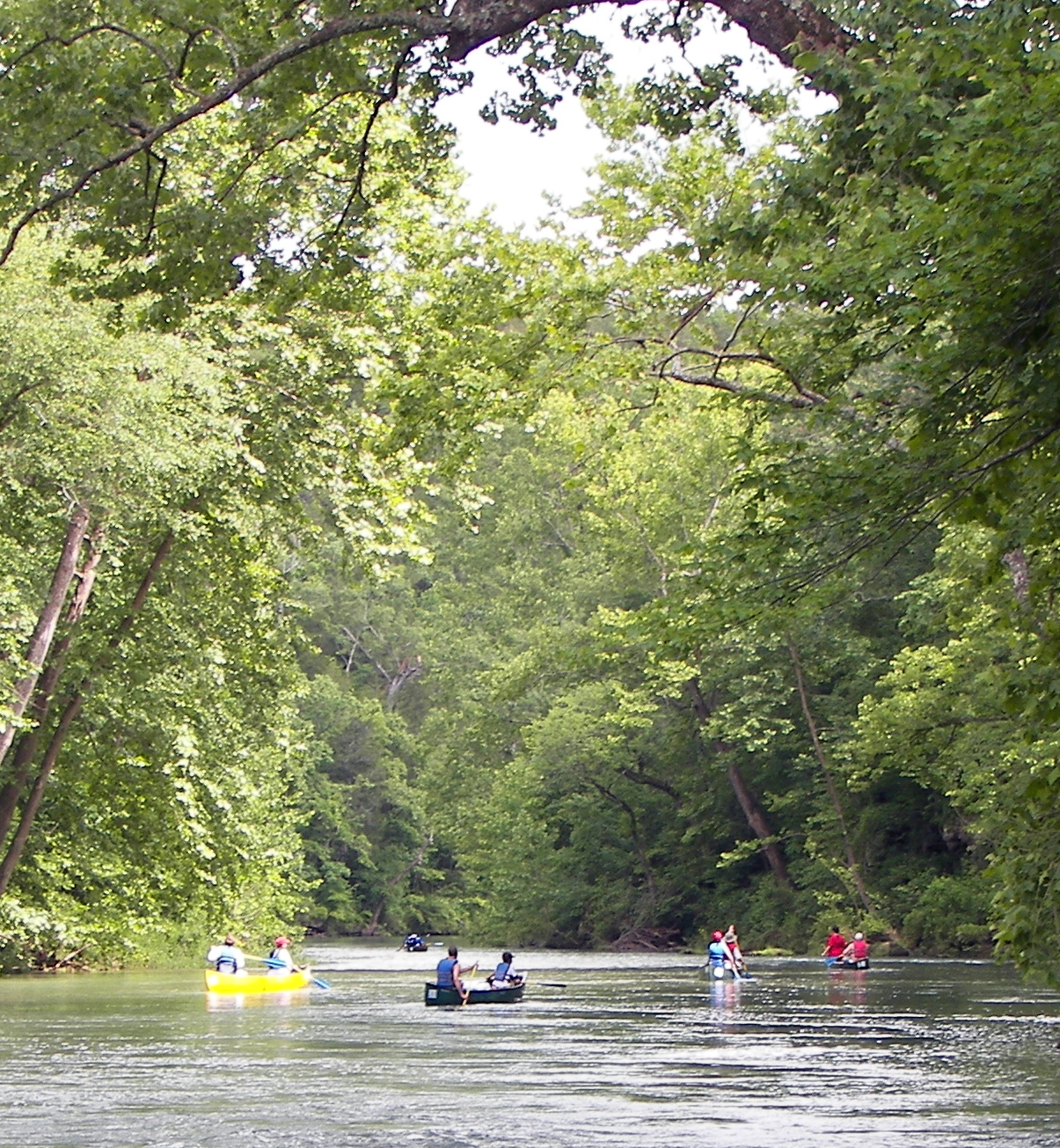
 Canoers float the Current River below Welch Spring, which contributes on average 121 cubic feet (3.5 m3) of water per second to the flow of the river.
Sarvis (2002, 2000) traces the controversy over the creation of the Ozark National Scenic Riverways (ONSR) in southeastern Missouri. Boasting clear rivers and spectacular landscape, the area saw a political contest for control of river recreational development between two federal agencies, the National Park Service (NPS) and the Forest Service. Local residents opposed NPS plans that included eminent domain acquisition of private property. Both agencies presented rival bills in Congress, and in 1964 the NPS plan was selected by Congress. In the long run the NPS has successfully accommodated and supervised OSNR recreation for two million visitors a year. By contrast, the Forest Service's nearby recreational activities have handled no more than 16,000 visitors yearly[1].
America the Beautiful Coin Series
In 2017, the park will be featured in the U.S. Mint series, the America the Beautiful Quarters.[2]
See also
- Eleven Point National Wild and Scenic River
References
- ^ Will Sarvis, "A Difficult Legacy: Creation of the Ozark National Scenic Riverways," Public Historian, Winter 2002, Vol. 24 Issue 1, pp 31-52; and, "Old Eminent Domain and New Scenic Easements: Land Acquisition for the Ozark National Scenic Riverways," Western Legal History, 13:1 (Winter / Spring 2000): 1-37.
- ^ [1] America the Beautiful Quarter Series Accessed October 14, 2010
External links
- Official National Park Service homepage for Ozark National Scenic Riverways
- For more history of the area Ozark History & Culture page.
Further reading
& O.E. Meinzer. "The Large Springs of the United States" (USGS, 1927).
- “Old Eminent Domain and New Scenic Easements: Land Acquisition for the Ozark National Scenic Riverways,” Western Legal History 13:1 (Winter / Spring 2000): 1-37.
Protected Areas of Missouri Federal National Wildlife Refuges:Big Muddy • Clarence Cannon • Great River • Middle Mississippi River • Mingo • Ozark Cavefish • Pilot Knob • Squaw Creek • Swan Lake • Two RiversNational Forests:Ozark National Scenic RiverwaysState Babler • Sam A. Baker • Bennett Spring • Big Lake • Big Oak Tree • Big Sugar Creek • Castlewood • Crowder • Cuivre River • Current River • Elephant Rocks • Finger Lakes • Graham Cave • Grand Gulf • Ha Ha Tonka • Harry S Truman • Hawn • Johnson's Shut-Ins • Jones-Confluence Point • Katy Trail • Knob Noster • Lake of the Ozarks • Lake Wappapello • Lewis and Clark • Long Branch • Mark Twain • Meramec • Montauk • Morris • Onondaga Cave • Pershing • Pomme de Terre • Prairie • Roaring River • Robertville • Rock Bridge Memorial • Route 66 • St. Francois • St. Joe • Stockton • Table Rock • Taum Sauk Mountain • Thousand Hills • Trail of Tears • Van Meter • Wakonda • Wallace • Washington • Watkins Woolen Mill • Weston BendArrow Rock • Battle of Athens • Battle of Carthage • Battle of Lexington • Thomas Hart Benton Home and Studio • Bollinger Mill • Nathan Boone Homestead • Boone's Lick • Bothwell Lodge • Clark's Hill/Norton • Confederate Memorial • Deutschheim • Dillard Mill • Gov. Daniel Dunklin's Grave • Felix Vallé House • First Missouri State Capitol • Fort Davidson • Gen. John J. Pershing Boyhood Home • Harry S Truman Birthplace • Hunter-Dawson • Iliniwek Village • Jefferson Landing • Jewell Cemetery • Locust Creek Covered Bridge • Mark Twain Birthplace • Mastodon • Missouri Mines • Missouri State Capitol • Missouri State Museum • Osage Village • Sandy Creek Covered Bridge • Sappington Cemetery • Scott Joplin House • Towosahgy • Union Covered Bridge • Watkins Woolen MillConservation areas:List of Missouri conservation areasCategories:- IUCN Category II
- The Ozarks
- Parks in Missouri
- Protected areas established in 1964
- United States National Park Service areas in Missouri
- United States National Park Service Wild and Scenic Rivers


Wikimedia Foundation. 2010.