- Dickleburgh and Rushall
-
Coordinates: 52°21′48″N 1°10′49″E / 52.363231°N 1.180344°E
Dickleburgh and Rushall 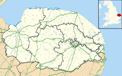
 Dickleburgh and Rushall
Dickleburgh and Rushall shown within NorfolkArea 14.90 km2 (5.75 sq mi) Population 1,356 - Density 91 /km2 (240 /sq mi) OS grid reference TM166785 Parish Dickleburgh and Rushall District South Norfolk Shire county Norfolk Region East Country England Sovereign state United Kingdom Post town DISS Postcode district IP21 Police Norfolk Fire Norfolk Ambulance East of England EU Parliament East of England List of places: UK • England • Norfolk Dickleburgh and Rushall is a parish in South Norfolk. It covers an area of 14.90 km2 (5.75 sq mi) and had a population of 1356 in 565 households as of the 2001 census.[1]
 Rushall St Mary the Virgin
The church of Rushall St Mary the Virgin is one of 124 existing round-tower churches in Norfolk.
The Parish Of Dickleburgh and Rushall
The parish comprises the two old parishes (pre-1973) Dickleburgh and Rushall.
Notes
- ^ "Dickleburgh and Rushall parish information". South Norfolk Council. 12 February 2009. http://www.south-norfolk.gov.uk/democracy/Dickleburgh_parish.asp. Retrieved 20 June 2009.
External links
- Diss Express - village's local newspaper website
- Website with photos of Rushall St Mary the Virgin, a round-tower church
Categories:- South Norfolk
- Villages in Norfolk
- Civil parishes in Norfolk
- Norfolk geography stubs
- United Kingdom church stubs


Wikimedia Foundation. 2010.