- Denton, Norfolk
-
Coordinates: 52°26′46″N 1°21′20″E / 52.446175°N 1.355438°E
Denton 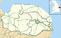
 Denton
Denton shown within NorfolkArea 10.11 km2 (3.90 sq mi) Population 352 - Density 35 /km2 (91 /sq mi) OS grid reference TM281884 - London 90 miles Parish Denton District South Norfolk Shire county Norfolk Region East Country England Sovereign state United Kingdom Post town HARLESTON Postcode district IP20 Dialling code 01986 Police Norfolk Fire Norfolk Ambulance East of England EU Parliament East of England UK Parliament South Norfolk List of places: UK • England • Norfolk
Denton is a village in the county of Norfolk, England. As of 2001, it had a population of 352 inhabitants[1] in 148 households. Denton St Mary
Located on the southern edge of the county, Denton has an area of 10.11 km2 (3.90 sq mi).[2] The nearest towns are Harleston and Bungay. To the south lies the river Waveney (the boundary with the county of Suffolk), to the west Alburgh, to the north Topcroft and Bedingham and to the east Earsham.
It is a very active community and in 2008 came first in the Under 500 population category in the annual Pride in Norfolk Community Awards. It then went on to win the East of England competition in the 2009 Calor Village of the Year Competition. For up-to-date information about the village, its residents and history - visit the Village Website listed below.
 Castle Hill, Darrow Green
The Church of Denton St Mary is one of 124 existing round-tower churches in Norfolk. Its original round tower fell probably in the 16th century, and was repaired in the most economical fashion, built of brick and square, but retaining the eastern curved part built of flint.[3]
To the north-west at Darrow Green are the surviving earthworks of Denton Castle, a small medieval motte-and-bailey castle.
References
- ^ "Office for National Statistics & Norfolk County Council, 2001". http://www.norfolk.gov.uk/consumption/groups/public/documents/general_resources/ncc017867.xls.
- ^ "Denton parish information". South Norfolk Council. 2 October 2007. http://www.south-norfolk.gov.uk/democracy/denton_parish.asp. Retrieved 20 June 2009.
- ^ The Round Tower Churches of Norfolk by Lyn Stilgoe and Dorothy Shreeve, Canterbury Press, Norwich; ISBN 1-85311-448-0
External links
For further information go to the village website
Categories:- South Norfolk
- Villages in Norfolk
- Civil parishes in Norfolk
- Norfolk geography stubs
- United Kingdom church stubs


Wikimedia Foundation. 2010.