- Melbourne city centre
Infobox Australian Place
name = Melbourne
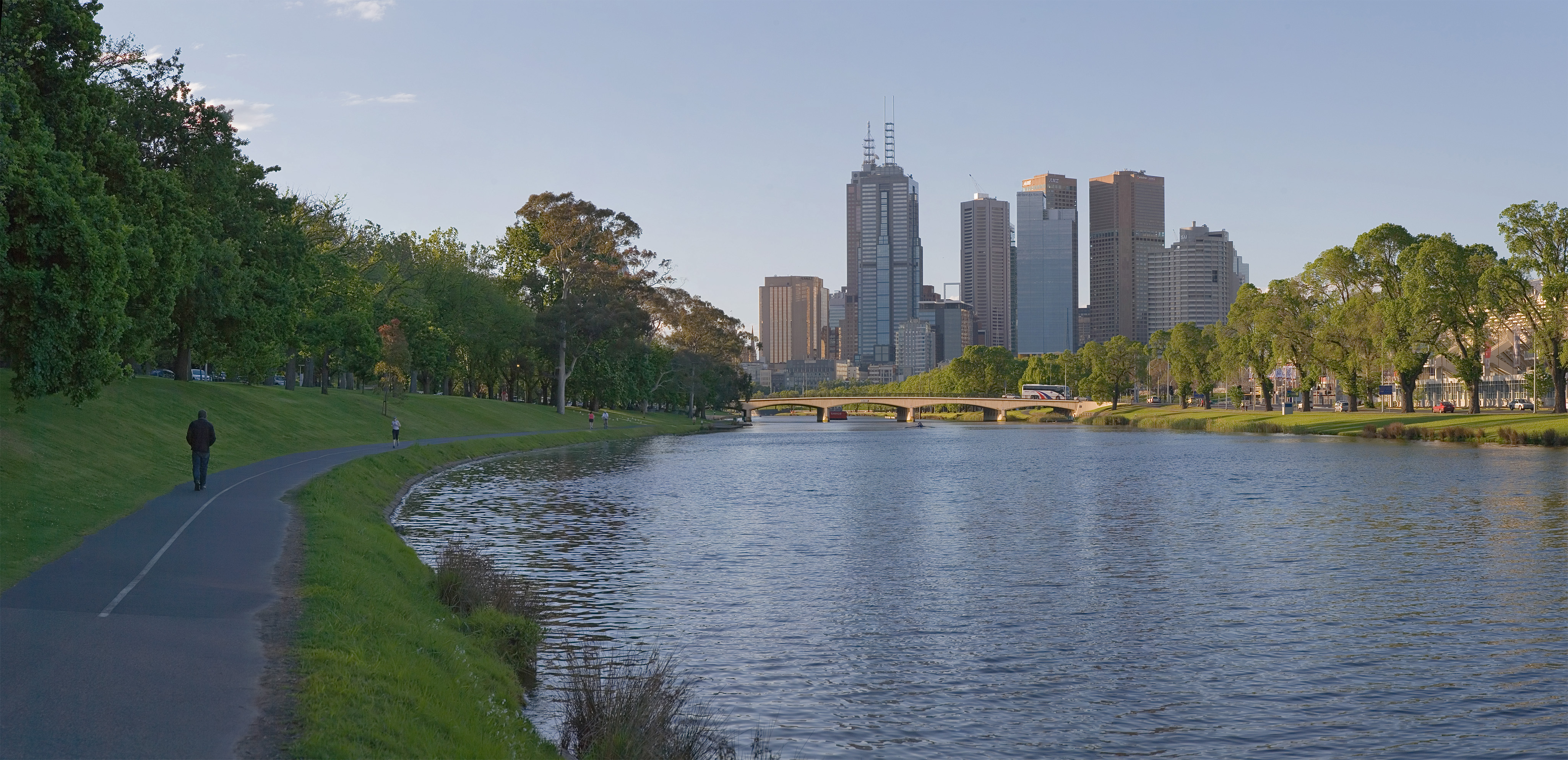
caption = Looking towards the CBD across the Yarra River from Alexandra Avenue
state = vic
type = suburb
lga = City of Melbourne
lga2 = City of Port Phillip
city = Melbourne
est = 1835
postcode = 3000, 3002, 3004
pop = 20,361 (2006) Census 2006 AUS | id = SSC21439 | name = Melbourne (State Suburb) | accessdate = 2007-09-26 | quick = on]
fedgov = Melbourne, Melbourne Ports
stategov = Melbourne, Albert Park, Prahran
propval = $340,000 [ [http://www.domain.com.au/public/suburbprofile.aspx?mode=buy&searchterm=3000 Domain.com.au Suburb Report - Melbourne] (July 08) Accessed04 July 2008 ]
near-nw = West Melbourne
near-n = North Melbourne
near-ne = Carlton
near-w = Docklands
near-e =East Melbourne
near-sw = Southbank
near-s = St Kilda
near-se = South YarraThe Melbourne city centre (referred to as "The City" or "The CBD" (Central Business District) or more recently in planning parlance, "The CAD", or Central Activities District) is a locality surrounded by metropolitan Melbourne which comprises the original settlement, the central business district, parkland and other built-up areas. It is the oldest part of Melbourne and includes many of the city's important institutions and landmarks, such as Parliament, the Supreme Court,
Federation Square ,Flinders Street Station and the Royal Botanic Gardens. The city centre is located in the local government areas of theCity of Melbourne and small parts of it are inCity of Port Phillip . At the 2006 Census, Melbourne CBD had a population of 20,361.Although the city centre is one of the most developed areas of Melbourne, demographically it is one of the less densely populated, due to its core being commercial.
Although the area is described as the "centre", it is not actually the demographic centre of Melbourne at all, due to an
urban sprawl to the south east, the demographic centre being located at Bourne St, Glen Iris. [ [http://www.theage.com.au/articles/2002/08/04/1028157880515.html Glen Iris still the heart of city's sprawl] , "The Age ,5 August 2002 ]It does however represent the financial centre of Melbourne, with the vast majority of corporate headquarters located within the locality.
History
Melbourne's central grid patterned layout, known as the
Hoddle grid , was first laid out in 1837. From the 1870s to 1920s, the central part of Melbourne was home to mostly medical professionals who had established practices along Collins Street and Spring Street [ [http://www.melbourne.vic.gov.au/info.cfm?top=53&pg=728 Collins Street] from the City of Melbourne] and before the 1960s, only a handful of permanent residents lived in the Spring Street area and St Kilda Road. The area was largely unpopular for residents and council policies did not permit development of apartment style housing in the area.St Kilda Road was annexed in the 1960s and given the postcode of Melbourne 3004 to stimulate office development along the strip and reduce pressure on overdevelopment of the Hoddle Grid. The result was the demolition of many of the street's grand mansions.
Things changed somewhat due to the Kennett government's
Postcode 3000 planning policy in the 1990s, which provided incentives for living in the central area.Although the city centre now includes St Kilda Road, it competes for office space with Southbank, Docklands and the major outer suburban centres such as Box Hill, Glen Waverley and increasingly South Yarra.
Geography
The city centre is bordered by Spencer Street to the west and extends north as far as Grattan Street which borders Carlton. The border extends along La Trobe Street, William Street, Peel Street, Grattan Street, taking in the
Queen Victoria Market , Berkeley Street, Victoria Street. To the east it is bordered by Spring Street, however the area extends east to take in parts of Wellington Parade, Brunton Avenue, Punt Road and the Yarra River. It borders South Yarra to the south east at Anderson Street, Domain Road, Domain Street, Arnold Street, Fawkner Park, Commercial Road, High Street. It also borders both St Kilda along St Kilda Road and Albert Park along Queens Road, Lakeside Drive and South Melbourne along Albert Road, Kings Way, Palmerston Cresent, Wells Place and finally Southbank along St Kilda Road and the south side of Flinders Street (Northbank) which includesFlinders Street Station and theMelbourne Aquarium .Demographics
Melbourne has one of the fastest growing residential populations in Australia. Residents of the city centre are of mixed social status. [ [http://www.melbourne.vic.gov.au/info.cfm?top=91&pg=866#social City of Melbourne - Research - Who lives in the city? ] ] On one hand, living in the centre of the city offers proximity to work and the best access to
public transport . On the other hand, there are manystrata title dstudio apartment s that have no carparks and limited space. As a result there is a mix of students and young urban professionals living in the locality of Melbourne.Culture and sport
Most professional sporting clubs represent Melbourne the city (e.g.
Melbourne Victory ,Melbourne Storm ). An exception is theMelbourne Cricket Club andMelbourne Football Club (its offshoot) both based at theMelbourne Cricket Ground which was built in Jolimont, adjacent to the city but a locality of the suburb of East Melbourne. Both were the first clubs of their respective sports and established in a time when the city's population was still very small and limited to a handful of inner suburbs. As a result, the Melbourne Cricket Club has a fairly exclusive membership, whilst the Melbourne Football Club, although bearing the name Melbourne, is associated by the supporters of other suburban clubs as representing the central suburb and perceive its supporters to represent the locality and not the entire city. [ [http://www.convictcreations.com/football/melbourne.htm Melbourne Demons - The rust bucket of Australia] from ConvictCreations.com] As a result, despite its rich tradition and early success, it is one of the least supported clubs in theVFL/AFL . The lack of identity resulted in a push for theMelbourne Hawks , which was stopped by intervention fromJoseph Gutnick and the majority of theHawthorn Football Club members. It has had intense rivalries with younger clubs from the adjacent inner suburbs such as theCollingwood Football Club and early inter-town rivalGeelong Football Club . The Melbourne Football Club has recently made efforts to shed its suburban tag and be embraced by the whole metropolitan area. [ [http://www.theage.com.au/realfooty/news/AFL/A-new-base-for-Demons/2005/03/01/1109546868430.html A new base for Demons?] from the Age] In line with this, the club recently employed strategies such as establishing "Team Melbourne", (a group of sporting teams which bear the name "Melbourne"), and a strategy for promoting the brand as representing the city inChina through club supporter Lord MajorJohn So .References
External links
* [http://localhero.biz/article/permatitle/history_of_melbourne_city,_victoria/ Local history of Melbourne CBD]
Wikimedia Foundation. 2010.