- U.S. Route 1 in New Jersey
-
This article is about the section of U.S. Route 1 in New Jersey. For the entire length of the highway, see U.S. Route 1.
U.S. Route 1
Brunswick Pike
Trenton Freeway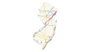
US 1 highlighted in redRoute information Maintained by NJDOT, DRJTBC, and PANYNJ Length: 66.06 mi[1] (106.31 km) Existed: 1926 – present Major junctions South end:  US 1 on Trenton–Morrisville Toll Bridge in Trenton
 Route 29 in Trenton

 Route 33 / Route 129 in Trenton

 I-295 / I-95 in Lawrence Township
 US 130 in North Brunswick Township
 Route 18 in New Brunswick
 I-287 in Edison
 G.S. Pkwy. in Woodbridge Township
 US 9 in Woodbridge Township
(Continues as U.S. Route 1/9)North end: I-95 / US 1 / US 9 on George Washington Bridge in Fort LeeHighway system United States Numbered Highways
List • Bannered • Divided • ReplacedNew Jersey State Highway Routes
Interstate and US←  I-895
I-895Route 1  →
→←  Route 173
Route 175  →
→U.S. Route 1 (US 1) is a United States highway which parallels the East Coast of the United States, running from Key West, Florida in the south to Fort Kent, Maine at the Canadian border in the north. Of the entire length of the route, 66.06 miles (106.31 km) of it runs through New Jersey. It enters the state from Pennsylvania on the Trenton–Morrisville Toll Bridge over the Delaware River in the state capital of Trenton, running through the city on the Trenton Freeway. From here, US 1 continues northeast as a surface divided highway through suburban areas continuing into Middlesex County and passing through New Brunswick and Edison. US 1 merges with US 9 in Woodbridge, and the two routes continue through northern New Jersey as US 1/9 to the George Washington Bridge over the Hudson River in Fort Lee. At this point, the road continues into New York City along with I-95.
The current alignment of US 1 between Trenton and New Brunswick was chartered as the Trenton and New Brunswick Turnpike in 1803 and struggled throughout its 100-year existence. In 1913, the Lincoln Highway across the United States was created and connected Trenton to Newark within New Jersey. The Lincoln Highway was legislated as Route 13 between Trenton and New Brunswick in 1917 and as part of Route 1 between New Brunswick and Elizabeth, later extended to Jersey City. With the creation of the U.S. Highway System in 1926, US 1 was designated to follow the Lincoln Highway between Trenton and Newark and the current alignment of US 1/9 Truck to Jersey City, where it continued to the Holland Tunnel. In 1927, the Lincoln Highway portion of US 1 became Route 27. The current alignment of US 1 between Trenton and Newark was legislated as Route 26, Route S26 and Route 25, while the current route north from Jersey City to the George Washington Bridge became Route 1 and Route 6. In subsequent years, US 1 was moved onto its current routing between Trenton and the George Washington Bridge. The state highways running concurrent with US 1 were removed in 1953, around the same time the route was moved to the Trenton Freeway within Trenton and the old alignment became US 1 Alternate, part of which is now US 1 Business. By 1969, the Trenton Freeway was extended north to Whitehead Road in Lawrence Township, and that segment became Route 174. When the Trenton Freeway was completed north to US 1, the US 1 designation was shifted to the freeway, replacing Route 174.
Contents
Route description
Mercer County
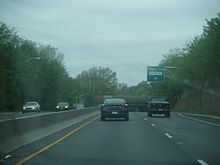 US 1 northbound on the Trenton Freeway at the Perry Street exit
U.S. Route 1 crosses the Delaware River into New Jersey on the Trenton–Morrisville Toll Bridge. Once in Trenton, US 1 is the Trenton Freeway, which is maintained by the Delaware River Joint Toll Bridge Commission. US 1 meets Route 29 at a partial diamond interchange just north of the river.[1][2] As the road heads through the downtown area with Amtrak’s Northeast Corridor running next to the route on the east side, it has a southbound exit and entrance with Warren Street that provides access to the New Jersey State House. US 1 becomes maintained by the New Jersey Department of Transportation and comes to an interchange with the northern terminus of Route 129 as well as the western terminus of Route 33 near the Trenton Transit Center. At this point, the Trenton Freeway turns onto a depressed alignment and comes to an interchange with Perry Street. The route turns northeast has an exit for Olden Avenue as it runs near urban areas.[1][2] The freeway has a northbound ramp for Mulberry Street before there is a northbound exit and southbound entrance from the median that provides access to US 1 Business and US 206.[1] Past this interchange, US 1 continues into Lawrence Township , where the surroundings become more wooded as the freeway has an exit for Whitehead Road. Along this stretch, the freeway closely parallels the Delaware & Raritan Canal.[1][2] The Trenton Freeway ends at the point US 1 Business merges back into US 1.[1]
Here, US 1 becomes a four-lane divided surface road with jughandles called the Herbert Highway that is lined with suburban businesses.[1][2] Continuing northeast, the first intersection along this road is with the eastern terminus of CR 546.[1] After this intersection, the road crosses the Delaware & Raritan Canal again prior to a modified cloverleaf interchange with I-95 and I-295. Past this point, US 1 widens to six lanes as it has an interchange providing access to the Quaker Bridge Mall to the east of the route.[1][2] A short distance later, there is a cloverleaf interchange with CR 533.[1] Upon crossing CR 533, the road enters West Windsor Township. After an interchange with Meadow Road, US 1 continues past corporate parks prior to an interchange with Alexander Road. Following this interchange, the road comes to CR 571 (also signed as CR 526) at the modified Penns Neck Circle, which US 1 runs straight through.[1][2] Past this intersection, the road passes near farmland.[2]
Middlesex County
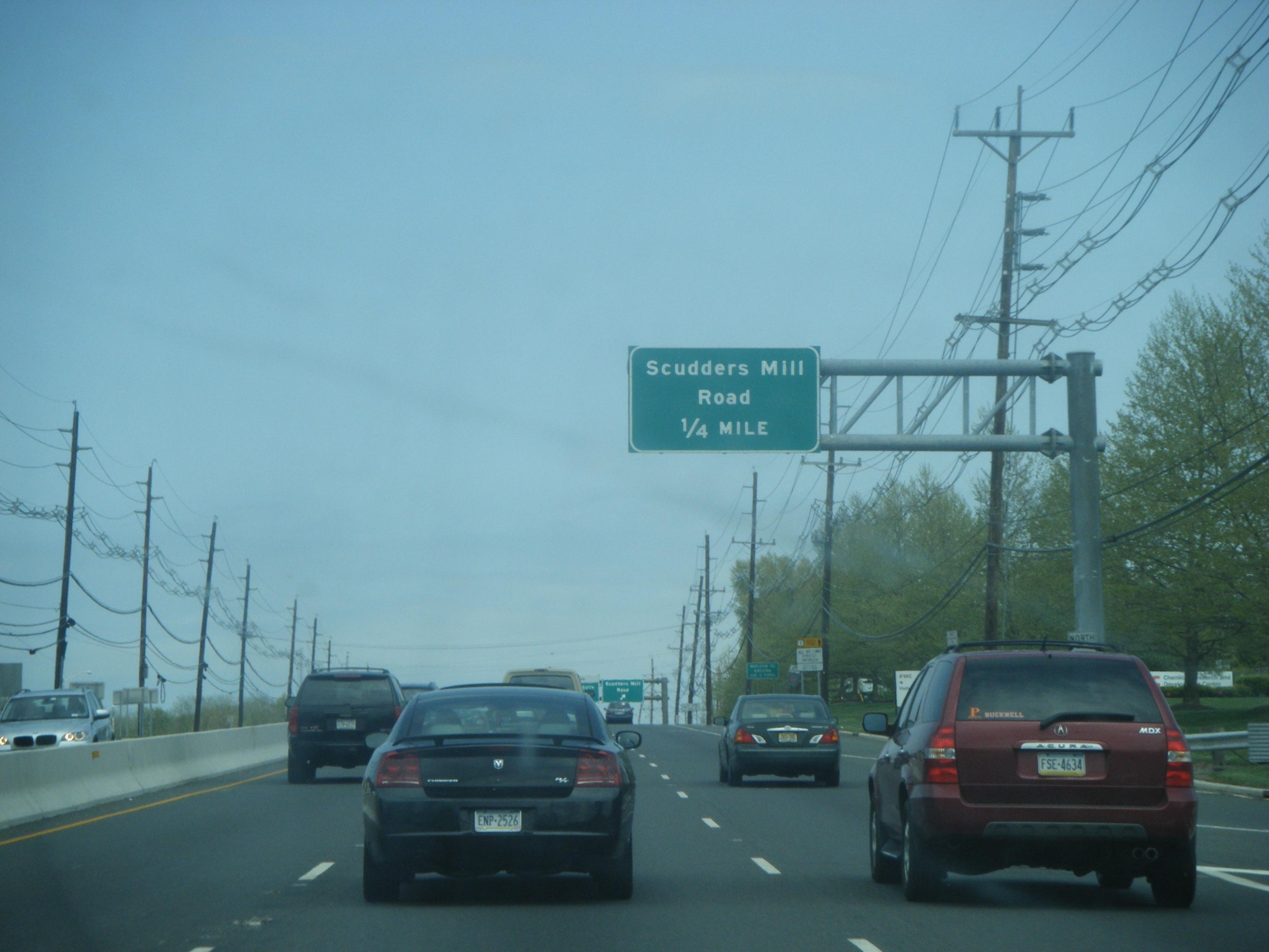
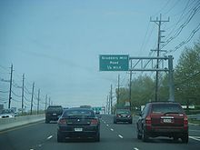 US 1 northbound approaching Scudders Mill Road in Plainsboro
Upon crossing the Millstone River, US 1 enters Plainsboro Township, where it passes more business parks and comes to an interchange with Scudders Mill Road.[1][2] Past Scudders Mill Road, the road runs to the west of the James Forrestal Campus of Princeton University before passing to the east of Forrestal Village.[2] An interchange with College Road a short distance later provides access to both places. The route continues into South Brunswick Township, where it narrows to four lanes and runs through a mix of rural areas and development.[1][2] US 1 briefly widens back to six lanes as it reaches an intersection with CR 522.[1] Past CR 522, the surroundings of the four-lane road become more forested, with a few commercial establishments.[2] The road briefly forms the border between South Brunswick Township to the northwest and North Brunswick Township to the southeast before fully entering North Brunswick Township. Here, the route widens to six lanes again and comes to an interchange with the southern terminus of Route 91, where US 1 makes a turn to the east-northeast.[1][2] Immediately after this interchange, the route passes over Amtrak’s Northeast Corridor and comes to an exit for the south end of Route 26.[1] The road reaches the northern terminus of US 130 and the southern terminus of Route 171 at an interchange.[1][2] A short distance later, US 1 has access to Milltown Road through an interchange.[1] The road passes by Rutgers University college farm before turning northeast and coming to a cloverleaf interchange with Ryders Lane. After this interchange, US 1 crosses into New Brunswick, where it has an interchange with Route 18/CR 527.[1][2]
Upon crossing the Raritan River on the Donald and Morris Goodkind Bridges, US 1 enters Edison and continues north into developed suburban areas before turning northeast and meeting CR 514 at an interchange.[1][2] A short distance later, the route crosses CR 529 at an at-grade intersection.[1] Lined with businesses, the road continues to two close interchanges with CR 531 and I-287.[1][2] Past here, US 1 comes to an interchange with CR 501 and then carries three northbound lanes and two southbound lanes. In this area, US 1 passes to the east of the Menlo Park Mall, with an interchange providing access.[1][2] The route continues northeast into Woodbridge Township, where it comes to a partial interchange with the Garden State Parkway.[1] Following this interchange, US 1 comes to the Woodbridge Center shopping mall on the east side of the road.[2] US 1 crosses CR 604 prior to merging with US 9.[1]
US 1/9 concurrency
Main article: U.S. Route 1/9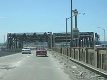
US 1 and US 9 become concurrent upon merging in Woodbridge Township and continue through developed areas, interchanging with Route 35.[1][3] Upon entering Union County, US 1/9 pass through Rahway and Linden, interchanging with I-278 in Linden.[1] The road continues into urban Elizabeth, crossing Route 439 before turning into a freeway prior to meeting Route 81 near Newark Liberty International Airport. US 1/9 continue along the west end of the airport into Newark, Essex County, reaching the Newark Airport Interchange with I-78, US 22, and Route 21. From this interchange, the road continues northeast through industrial areas to an interchange with US 1/9 Truck that provides access to the New Jersey Turnpike (I-95).[1][3] US 1/9 continue onto the Pulaski Skyway, which carries the route over the Passaic River into Hudson County, crossing over Kearny and the Hackensack River before coming into Jersey City.[1] Trucks are banned from the Pulaski Skyway and must use US 1/9 Truck to bypass it.[4]
The Pulaski Skyway ends at the Tonnele Circle with US 1/9 Truck and Route 139, and US 1/9 continue north along at-grade Tonnelle Avenue toward North Bergen, where the road intersects Route 3 and Route 495. Crossing into Bergen County, Broad Avenue carries US 1/9 through Fairview and Ridgefield before heading into Palisades Park. Here, the two routes join US 46, and the combined road heads north into Fort Lee. US 1/9/46 come to an interchange with I-95, US 9W, and Route 4, where it joins I-95 to head east to the George Washington Bridge over the Hudson River.[1] At this point, US 46 ends and I-95 and US 1/9 continue into Manhattan, New York City on the Trans-Manhattan Expressway.[3][5]
History
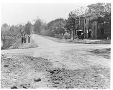 A view of the Trenton and New Brunswick Turnpike in 1904
What is now US 1 between Trenton and New Brunswick was originally chartered as the Trenton and New Brunswick Turnpike in 1803. Throughout its history, the Trenton and New Brunswick Turnpike faced stiff competition from canals such as the Delaware & Raritan Canal and railroads such as the Camden and Amboy Railroad. In the later part of the 19th century, the turnpike company folded and the Pennsylvania Railroad took over ownership of the turnpike. When the charter for the Trenton and New Brunswick Turnpike expired in 1903, it became a public road.[6] When the first numbered highways were legislated in New Jersey in 1916, the present day US 1 between New Brunswick and Elizabeth was to become a part of Route 1, a route that was to connect Trenton and Elizabeth. Between Trenton and New Brunswick, this route was to follow present-day Route 33 and US 130. In 1922, an extension of Route 1 was legislated to continue north from Elizabeth to the Holland Tunnel in Jersey City.[7] When the U.S. Highway System was established in 1926, the routing of US 1 in New Jersey was to follow the Lincoln Highway from the Lower Trenton Bridge in Trenton to Newark, which was Route 13 between Trenton and New Brunswick and Route 1 north of there. From Newark, the route followed present-day US 1/9 Truck east toward Jersey City, where it was to head to the Holland Tunnel.[8][9][10] The Lincoln Highway the first transcontinental highway in the United States created in 1913 to link New York City to San Francisco.[11] Route 13 had been legislated along the Trenton to New Brunswick portion in 1917.[12]
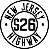 Route S26 (1927–1953)
In the 1927 New Jersey state highway renumbering, the alignment of US 1 between Trenton and Newark became Route 27, while the proposed Route 1 Extension became part of Route 25. In addition, Route 26 was designated along the former Trenton and New Brunswick Turnpike, while the current US 1 between Route 26 and US 130 became Route S26. North of current US 130, present-day US 1 to Newark also became a part of Route 25. The current US 1/9 between the Tonnele Circle and the George Washington Bridge meanwhile became parts of Route 1 and Route 6.[13][14] The Route 1 Extension, now designated Route 25, was complete in 1928 with the exception of the Pulaski Skyway. This road was considered the first superhighway in the United States.[15] After the Pulaski Skyway opened in 1932, US 1 along with US 9 was rerouted to use it.[16] By the 1930s, US 1 was routed to use Route 26, Route S26, and Route 25 between Trenton and Newark instead of Route 27.[17][18] US 1 and US 9 were routed to use the George Washington Bridge over the Hudson River instead of the Holland Tunnel by the 1940s, following Route 1 and US 46/Route 6 between the Tonnele Circle and the George Washington Bridge.[18]
The Trenton Freeway, a freeway through the city of Trenton, was first planned in 1950 to provide a bypass of Trenton and a connection to the new Trenton–Morrisville Toll Bridge. This freeway opened in December 1952 and became part of both US 1 and Route 26.[19] In the 1953 New Jersey state highway renumbering that followed a month later, all the state highways running concurrent with US 1 were removed. In addition, US 1/9 Truck was designated as a bypass of the Pulaski Skyway (replacing Route 25T) and US 1/9 Business (now Route 139) was designated on the former Route 25 between the Tonnele Circle and the Holland Tunnel. Also, after the US 1 designation was moved to the Trenton Freeway, the former route through Trenton would become US 1 Alternate.[20][21] During the development of the Interstate Highway System, New Jersey and Pennsylvania considered having I-95 cross over the Trenton–Morrisville Toll Bridge, and continue north on the existing US 1. The project was opposed due to inadequate highway standards (lack of shoulder ramps, and only two lanes in each direction). During this time, both states sought alternate routes for the proposed I-95. In 1960, New Jersey and Pennsylvania decided to designate the Scudder Falls Bridge as I-95.[22] By 1969, an extension of the Trenton Freeway from the current left-hand exit to US 1 Business/US 206 to Whitehead Road was completed and received the Route 174 designation.[23] In 1967, the New Jersey Department of Transportation recommended an extension of the Trenton Freeway from Whitehead Road to the traffic light at Bakers Basin Road and Franklin Corner Road.[24] Once the extension was completed by the 1980s, the route number was then changed from Route 174 to US 1. The former alignment of US 1 along surface streets in Trenton was renumbered to US 1 Business, while the US 1 Alternate was dropped.[25]
There had been plans to create a west–east spur of the New Jersey Turnpike called Route 92. It was to begin just north of the intersection of Ridge Road and U.S. Route 1 in South Brunswick and terminate at the mainline of the New Jersey Turnpike (I-95) at Exit 8A in Monroe Township.[26] This proposal was cancelled on December 1, 2006, after the New Jersey Turnpike Authority decided to use funds to widen the mainline turnpike instead.[27]
By the 1990s, many traffic lights along the segment of US 1 in West Windsor and Plainsboro were removed and replaced with exit ramps and overpasses. As a result, the traffic lights at Scudders Mill Road, Plainsboro Road, Alexander Road, and Meadow Road were eliminated.[28] This was followed by building ramps to replace the traffic light at US 130 and US 1 located North Brunswick Township, completed in 2003.[29] An environmental impact study has been conducted by Rutgers University’s Transportation Policy Institute and Center for Negotiation and Conflict Resolution to improve US 1 through the Penns Neck area.[30] This project would eliminate the Penns Neck Circle where US 1 meets Washington Road (CR 571) and move US 1 onto a new freeway alignment in the area. In addition, CR 571 is planned to be realigned to intersect US 1 further to the north.[31] In 2009, the segment of US 1 between I-287 in Edison and the Garden State Parkway in Woodbridge was rebuilt to include new ramps at several intersections and removed access to a couple of roads in a $53.9 million project that was intended to alleviate traffic and make this section safer.[32]
Major intersections
County Location Mile[1] Roads Notes Trenton–Morrisville Toll Bridge over Delaware River Mercer Trenton 0.10 Route 29 (John Fitch Parkway)Northbound exit, southbound entrance Warren Street - Capitol Complex Southbound exit and entrance 0.76  Route 129 to I-195 / I-295 - South Broad Street, Chambersburg
Southbound exit, northbound entrance 0.90 Route 33 east (Market Street) / South Clinton Avenue / State Street - Train Station1.34 Perry Street 2.37  CR 622 (Olden Avenue, New York Avenue)
2.72 Mulberry Street Northbound exit and entrance 2.87 

 US 1 Bus. / US 206 north – Lawrenceville
Northbound exit, southbound entrance Lawrence Township 3.75  CR 616 (Whitehead Road)
5.24
US 1 Bus. south – North TrentonSouthbound exit, northbound entrance North end of freeway section 5.98  CR 546 west (Franklin Corner Road) – Lawrenceville
6.76 I-295 south / I-95 south – Bordentown, PhiladelphiaI-295 Exit 67 7.55 Quaker Bridge Mall Interchange West Windsor Township 8.10  CR 533 (Province Line Road/Quaker Bridge Road) / Nassau Park Boulevard
Interchange 9.45 Meadow Road – Carnegie Center Interchange 10.86 Alexander Road – Princeton, Princeton Junction Interchange 11.21 
 CR 526 / CR 571 (Washington Road) – Hightstown, Princeton
Penns Neck Circle Middlesex Plainsboro Township 12.47  CR 614 east (Scudders Mill Road)
Interchange 12.93 Forrestal Road Interchange 13.70 College Road – Forrestal Center, Forrestal Village Interchange South Brunswick Township 16.47  CR 522 east (Stouts Lane)
North Brunswick Township 22.90  Route 91 north (Jersey Avenue) – New Brunswick
Interchange 23.05  Route 26 north (Livingston Avenue)
Interchange 24.64  US 130 south / Route 171 north (Georges Road) – Camden, New Brunswick
Interchange New Brunswick 27.19  Route 18 / CR 527 – East Brunswick, Old Bridge, New Brunswick
Interchange Edison Township 28.54  CR 514 – Highland Park, Raritan Center, Woodbridge
Interchange 29.06  CR 529 (Plainfield Avenue)
31.66  CR 531 (Main Street) – Metuchen, Bonhamtown
Interchange 31.96 
 I-287 to Route 440 / I-95 / NJ Turnpike – Morristown, Mahwah, Raritan Center, Perth Amboy
I-287 Exit 1 32.73  CR 501 (Amboy Avenue) – Perth Amboy, Metuchen
Interchange Woodbridge Township 34.55 G.S. Pkwy. northGSP Exit 130; access to Parkway northbound only and from Parkway southbound only 35.89 US 9 south – Shore PointsInterchange, south end of US 9 overlap U.S. Route 1/9 continues northward through New Jersey to George Washington Bridge over Hudson River 1.000 mi = 1.609 km; 1.000 km = 0.621 mi Related routes
There are two remaining bannered spurs of US 1 in the state of New Jersey:
- U.S. Route 1 Business in Trenton
- U.S. Route 1-9 Truck in Jersey City
The following state highway was also formerly designated as a bannered spur of US 1:
- Route 139 in Jersey City was formerly U.S. Route 1-9 Business.
See also
 U.S. Roads portal
 New Jersey portal
References
- ^ a b c d e f g h i j k l m n o p q r s t u v w x y z aa ab ac ad ae "US 1 straight line diagram" (PDF). New Jersey Department of Transportation. http://www.state.nj.us/transportation/refdata/sldiag/00000001__-.pdf. Retrieved November 25, 2009.
- ^ a b c d e f g h i j k l m n o p q r Google, Inc. Google Maps – overview of U.S. Route 1 in New Jersey south of U.S. Route 9 (Map). Cartography by Google, Inc. http://www.google.com/maps?f=d&source=s_d&saddr=40.2092,+-74.7677&daddr=US-1+N+to:US-1+N+to:US+1+and+US+9+woodbridge,+nj&geocode=FTCLZQIdrCKL-w%3BFSwjaAIdCACO-w%3BFTKJagIdQJyR-w%3BFVv_agIdu0-S-ynhcJiAMbTDiTEmjtQVELy4zg&hl=en&mra=ls&via=1,2&sll=40.477248,-74.294357&sspn=0.217801,0.673599&ie=UTF8&t=h&z=10. Retrieved December 6, 2009.
- ^ a b c Google, Inc. Google Maps – overview of U.S. Route 1/9 (Map). Cartography by Google, Inc. http://www.google.com/maps?f=d&source=s_d&saddr=US+1+and+US+9+woodbridge,+nj&daddr=Spring+St+to:US-1+N%2FUS-9+N+to:Trans-Manhattan+Expressway&geocode=FVv_agIdu0-S-ynhcJiAMbTDiTEmjtQVELy4zg%3BFdyRbAIdTsOT-w%3BFWeabQId4KGV-w%3BFQ1MbwIdttCX-yFnF12jFdDQpA&hl=en&mra=ls&via=1,2&sll=40.769622,-73.839798&sspn=0.21685,0.673599&ie=UTF8&t=h&z=10. Retrieved December 5, 2009.
- ^ "Traffic Regulations: Route 1 and 9, The Pulaski Skyway". New Jersey Department of Transportation. http://www.state.nj.us/transportation/refdata/traffic_orders/access/rt1_9.shtm. Retrieved August 6, 2009.
- ^ "Interstate 95 straight line diagram" (PDF). New Jersey Department of Transportation. http://www.state.nj.us/transportation/refdata/sldiag/00000095__-.pdf. Retrieved March 26, 2007.
- ^ "Trenton and New Brunswick Turnpike". Plainsboro, New Jersey: Plainsboro Historical Society Inc.. 2009. http://www.plainsborohistory.org/turnpike.htm. Retrieved November 20, 2009.[dead link]
- ^ Williams, Jimmy and Sharon. "NJ 1920s Route 1". 1920s New Jersey Highways. http://www.jimmyandsharonwilliams.com/njroads/1920s/route01.htm. Retrieved December 2, 2009.
- ^ Bureau of Public Roads (1926). United States System of Highways (Map). http://en.wikipedia.org/wiki/Image:1926us.jpg. Retrieved April 27, 2009.
- ^ Williams, Jimmy and Sharon. "1927 Tydol Trails Map - South". 1920s New Jersey Highways. http://www.jimmyandsharonwilliams.com/njroads/1920s/maps/1927tt2.jpg. Retrieved March 30, 2009.
- ^ Williams, Jimmy and Sharon. "1927 Tydol Trails Map - North". 1920s New Jersey Highways. http://www.jimmyandsharonwilliams.com/njroads/1920s/maps/1927tt1.jpg. Retrieved December 30, 2008.
- ^ Weingroff, Richard F.. "The Lincoln Highway". Federal Highway Administration. http://www.fhwa.dot.gov/infrastructure/lincoln.htm. Retrieved December 15, 2008.
- ^ Williams, Jimmy and Sharon. "NJ 1920s Route 13". 1920s New Jersey Highways. http://www.jimmyandsharonwilliams.com/njroads/1920s/route13.htm. Retrieved December 15, 2008.
- ^ State of New Jersey, Laws of 1927, Chapter 319.
- ^ Williams, Jimmy and Sharon. "1927 New Jersey Road Map". 1920s New Jersey Highways. http://www.jimmyandsharonwilliams.com/njroads/1920s/images/1927_routes.gif. Retrieved October 8, 2008.
- ^ "Jersey's Super Road to Be Opened Today" (Fee required). The New York Times. December 16, 1928. p. XX12. http://select.nytimes.com/gst/abstract.html?res=F70816F9395E1B728DDDAF0994DA415B888EF1D3.
- ^ Rand McNally (1946). Rand McNally Road Atlas (Map). p. 42. http://www.broermapsonline.org/members/NorthAmerica/UnitedStates/Midatlantic/NewYork/NewYorkCity/randmcnally_ra_1946_040.html. Retrieved August 6, 2009.
- ^ Mid-West Map Co. (1937). Map of Pennsylvania and New Jersey (Map). http://www.mapsofpa.com/roadcart/1937_1044m.jpg. Retrieved March 29, 2009.
- ^ a b Mid-West Map Co. (1941). Map of Pennsylvania and New Jersey (Map). Cartography by H.M. Gousha. http://www.mapsofpa.com/roadcart/1941_1467m.jpg. Retrieved March 29, 2009.
- ^ "Delaware Bridge at Trenton Opens". The New York Times (New York, New York): pp. 33. December 2, 1952.
- ^ 1953 renumbering, New Jersey Department of Highways, http://en.wikisource.org/wiki/1953_New_Jersey_state_highway_renumbering, retrieved July 31, 2009
- ^ "New Road Signs Ready in New Jersey". The New York Times. December 16, 1952. http://img123.imageshack.us/img123/6933/19521216newroadsignsreaiu6.jpg. Retrieved July 20, 2009.
- ^ Interstate 95. Delaware Valley Regional Planning Commission. 1979.
- ^ Chevron Oil Company (1969). Map of New Jersey (Map). Cartography by H.M. Gousha.
- ^ New Jersey Highway Facts. New Jersey Department of Transportation. 1967.
- ^ State Farm Insurance (1983). State Farm Road Atlas (Map). Cartography by Rand McNally.
- ^ Sullivan, Joseph F. (August 21, 1994). "Decision Is Near on Route 1 Link to Turnpike". The New York Times. http://www.nytimes.com/1994/08/21/nyregion/decision-is-near-on-route-1-link-to-turnpike.html?scp=5&sq=route%2092&st=cse. Retrieved December 4, 2009.
- ^ "Route 92-turnpike connection project off the table -- for now: Official says expansion of turnpike between Exits 6 and 9 is the top priority". Daily Record. December 2, 2006.
- ^ Rand McNally (1996). United States-Canada-Mexico Road Atlas (Map).
- ^ "Route 1/130/Georges Road Interchange Reconstruction". New Jersey Department of Transportation. http://www.state.nj.us/transportation/commuter/roads/route130/. Retrieved December 7, 2009.
- ^ "Route 1/Penns Neck Area". New Jersey Department of Transportation. http://www.state.nj.us/transportation/works/studies/pennsneck/. Retrieved December 7, 2009.
- ^ University, Rutgers (2009). Route 1/Penns Neck Area Final Enivornmental Impact Statement. New Jersey Department of Transportation.
- ^ "Route 1 Rehabilitation Overview". New Jersey Department of Transportation. http://www.state.nj.us/transportation/commuter/roads/route1/. Retrieved December 7, 2009.
External links
- An enlarged view of road jurisdiction at the confluence of US 1, US 206, NJ 29, NJ 33 and NJ 129 near Trenton
- An enlarged view of road jurisdiction at the confluence of the New Jersey Turnpike, I 95, NJ 3, NJ 495 and US 1 near Secaucus / North Bergen
- An enlarged view of road jurisdiction at the Fort Lee approaches to the George Washington Bridge
- New Jersey Roads: U.S. Route 1
- Steve Anderson US 1 Freeway (New Jersey)
- Speed Limits for State Roads
- Penns Neck Bypass Study
U.S. Route 1Previous state:
PennsylvaniaNew Jersey Next state:
New York Lincoln Highway
Previous state:
PennsylvaniaNew Jersey Next state:
New YorkCategories:- U.S. Highways in New Jersey
- U.S. Route 1
- Transportation in Mercer County, New Jersey
- Transportation in Middlesex County, New Jersey
- Transportation in Union County, New Jersey
- Transportation in Essex County, New Jersey
- Transportation in Hudson County, New Jersey
- Transportation in Bergen County, New Jersey
- Lincoln Highway
- Expressways in the United States


Wikimedia Foundation. 2010.