- Maryland Route 85
-
Maryland Route 85
Buckeystown Pike 
Route information Maintained by MDSHA Length: 10.80 mi[1] (17.38 km) Major junctions South end:  MD 28 in Tuscarora
 MD 80 in Buckeystown
 I-270 in Frederick
 MD 355 in Frederick
 I-70 / US 40 in Frederick
North end: East Street in Frederick Location Counties: Frederick Highway system Maryland highway system
Interstate • US • State • Minor • Former • Turnpikes←  MD 84
MD 84MD 86  →
→Maryland Route 85 (MD 85) is a state highway in the U.S. state of Maryland. Known as Buckeystown Pike, the state highway runs 10.80 miles (17.38 km) from MD 28 in Tuscarora north to the Frederick city limit north of Interstate 70 (I-70), where the highway continues north as East Street. MD 85 connects Tuscarora and Buckeystown in southern Frederick County with the county seat of Frederick. The state highway also links the suburban area between Buckeystown and Frederick with I-70 and I-270. MD 85 is the old alignment of U.S. Route 15 (US 15), which was originally constructed between Tuscarora and Frederick in the late 1910s and early 1920s. MD 85 was assigned to the highway in 1970 when US 15 was moved to a new highway heading north from its Potomac River crossing at Point of Rocks. The state highway was extended north to the city of Frederick as part of a project to overhaul MD 355's interchange with I-70 in the first decade of the 21st century.
Contents
Route description
MD 85 begins at a three-way intersection with MD 28 in Tuscarora, which is also known as Licksville. The roadway continues south as eastbound MD 28 (Dickerson Road) and westbound MD 28 (Tuscarora Road) heads west from the intersection. MD 85 heads north through farmland as a two-lane road that parallels the Monocacy River about 1 mile (1.6 km) to the east. The state highway intersects Lily Pons Road, which heads east toward the Lily Pons Water Gardens and the historic Amelung House and Glassworks, and Adamstown Road, which heads west toward Adamstown. MD 85 intersects MD 80 (Fingerboard Road) on the southern edge of Buckeystown. The state highway continues through the Buckeystown Historic District, where the highway intersects Manor Woods Road and the old alignment of MD 80, Michaels Mill Road, and crosses Rocky Fountain Run.[1][2]
MD 85 enters an industrial area as the highway enters the community of Lime Kiln, the site of the road's oblique at-grade crossing of CSX's Old Main Line Subdivision. The state highway temporarily expands to a four-lane undivided highway between the railroad crossing and its intersection with English Muffin Way, which was formerly the site of a Thomas' factory. At the north end of the industrial area, MD 85 crosses Ballenger Creek and passes the George Markell Farmstead and the historic home Arcadia. The state highway expands to a four undivided highway as it passes through a commercial area north of Executive Way. MD 85 intersects Crestwood Boulevard, which heads west into the suburb of Ballenger Creek, before the highway meets I-270 (Eisenhower Memorial Highway) at a partial cloverleaf interchange at a rakish angle.[1][2]
MD 85 continues north through a commercial area that includes the Francis Scott Key Mall. At the northern end of the commercial area at Evergreen Point, the state highway expands to a divided highway, veers east, and intersects MD 355 (Urbana Pike). MD 85 curves to the north and meets I-70 and US 40 (Baltimore National Pike) at a single-point urban interchange. The state highway intersects Walser Drive and Monocacy Boulevard before reaching its northern terminus at the end of state maintenance next to Harry T. Greager Memorial Athletic Field at the city limit of Frederick. The roadway continues north as East Street through the Frederick Historic District, where the street passes the Frederick train station on the Frederick Branch of MARC's Brunswick Line.[1][2]
History
MD 85 is the old alignment of US 15 from Tuscarora to Frederick. A portion of the highway was originally the Frederick and Buckeystown Turnpike from its junction with the Frederick and Monocacy Turnpike (which became US 240 and is now MD 355) at Evergreen Point to 1 mile (1.6 km) south of Buckeystown.[3] The old turnpike was resurfaced in macadam by 1921.[4] The remainder of modern Buckeystown Pike was paved as a 15-foot (4.6 m) wide concrete road from south of Buckeystown to around Lily Pons Road in 1918 and 1919 and south of Lily Pons Road to just north of the modern MD 28 junction by 1921.[4][5] The concrete highway was extended south through the MD 28 junction to MD 28's junction with Nolands Ferry Road by 1923.[6] Buckeystown Pike was designated US 15 in 1927. At that time, US 15 had yet to be constructed as a modern highway from Tuscarora to the bridge across the Potomac River at Point of Rocks.[7] US 15 from Tuscarora to Point of Rocks was completed in 1933.[8]
The first significant improvement to US 15 between Tuscarora and Frederick came in 1951 and 1952 when the U.S. highway was reconstructed and widened from Evergreen Point to Lime Kiln.[9][10] In 1950, construction began on the Washington National Pike freeway, which would later become I-270.[11] As part of that construction, a cloverleaf interchange was constructed between US 15 and the new freeway, which had its northern terminus at US 15 until US 40's segment of the Frederick Bypass opened in 1956.[12][13] US 15 was moved to Washington National Pike north of Buckeystown Pike after the completion of the Frederick Freeway in 1959. The portion of Buckeystown Pike between the freeway and MD 355 was designated MD 806, which is used for several segments of the old alignment of US 15 north of Frederick.[14] After US 15's present alignment north of Point of Rocks was completed in 1970, MD 85 was assigned to Buckeystown Pike south of I-270.[15] MD 85 was extended north to MD 355 at Evergreen Point in 1971, replacing MD 806.[16] The two loop ramps from MD 85 to I-270 were taken out of service to transform the interchange to its present partial cloverleaf by 1999; the loop ramps remain paved but blocked off.[17][2]
The reconstruction of I-70 Exit 54 began in 2001 to replace the tight folded diamond interchange between the Interstate and MD 355 constructed in 1956 as part of the Frederick Freeway.[18] The ramps between MD 355 and westbound I-70 were removed and temporarily replaced with ramps to and from Stadium Drive.[19] In 2005, the intersection between MD 85 and MD 355 was transformed into a perpendicular intersection from the previous angled junction. MD 85 was extended north of MD 355 as a four-lane divided highway to a pair of ramps to and from eastbound I-70; the eastbound ramps at MD 355 were removed. Related to the project was an extension of East Street south from downtown Frederick to near I-70 that was temporarily designated MD 475.[20] The overall project was completed in 2009 when a single-point urban interchange was completed between I-70 and MD 85. At the same time, MD 85 was extended north to its present terminus, the temporary ramps between Stadium Drive and westbound I-70 were removed, East Street was completed between MD 85 and downtown Frederick, and the unsigned MD 475 designation was removed from East Street.[1]
The Maryland State Highway Administration plans to expand MD 85 to a four-lane divided highway from English Muffin Way north to MD 355 as part of a three-phase project. Phase 1 includes the state highway from Crestwood Boulevard to just north of its interchange with I-270. The interchange will be reconstructed in a five-ramp configuration. I-270's bridges over MD 85, originally built in 1950, will be replaced.[21] Phase 2 will extend the four-lane divided highway south from MD 355 to just north of I-270. Phase 3 from English Muffin Way to Crestwood Boulevard includes a new bridge over Ballenger Creek.[22]
Junction list
The entire route is in Frederick County.
Location Mile
[1]Destinations Notes Tuscarora 0.00 MD 28 (Tuscarora Road/Dickerson Road) – Point of Rocks, DickersonSouthern terminus Buckeystown 4.57 MD 80 east (Fingerboard Road) – UrbanaFrederick 9.06  I-270 (Eisenhower Memorial Highway) to US 15 – Washington
I-270 Exit 31 10.18 MD 355 (Urbana Pike) – Urbana10.57 I-70 / US 40 (Baltimore National Pike) – Baltimore, HagerstownI-70 Exit 54; single-point urban interchange 10.74 Walser Drive west / Monocacy Boulevard east Walser Drive is unsigned MD 85A 10.80 East Street north Northern terminus; Frederick city limit 1.000 mi = 1.609 km; 1.000 km = 0.621 mi Auxiliary routes
- MD 85A is the designation for the 0.06-mile (0.097 km) section of Walser Drive west from MD 85's intersection with Monocacy Boulevard in Frederick.[1]
- MD 85B is the designation for the 0.21-mile (0.34 km) section of Francis Scott Key Drive running from MD 355 to MD 85. The route was designated in 2010.[23]
References
- ^ a b c d e f g "Highway Location Reference: Frederick County" (PDF). Maryland State Highway Administration. 2009. http://www.marylandroads.com/Location/2009_FREDERICK.pdf. Retrieved 2011-04-01.
- ^ a b c d Google, Inc. Google Maps – Maryland Route 85 (Map). Cartography by Google, Inc. http://maps.google.com/maps?f=d&source=s_d&saddr=MD-85+N%2FBuckeystown+Pike&daddr=S+East+St&hl=en&geocode=FZQSVwIdJPxh-w%3BFYhFWQId7uli-w&mra=ls&sll=39.33288,-77.434465&sspn=0.239528,0.617294&ie=UTF8&t=h&z=11. Retrieved 2011-04-01.
- ^ Clark, William Bullock (1899). Report on the Highways of Maryland. Baltimore: Maryland Geological Survey. p. 232. http://books.google.com/books?id=b9l9AAAAIAAJ&printsec=frontcover#v=onepage&q&f=false. Retrieved 2011-04-03.
- ^ a b Maryland Geological Survey. Map of Maryland: Showing State Road System and State Aid Roads (Map) (1921 ed.).
- ^ Report of the State Roads Commission of Maryland. 1916-1919. Baltimore: Maryland State Roads Commission. January 1920. p. 22. http://www.archive.org/details/annualreportsofs1916mary. Retrieved 2011-04-03.
- ^ Maryland Geological Survey. Map of Maryland: Showing State Road System and State Aid Roads (Map) (1923 ed.).
- ^ Maryland Geological Survey. Map of Maryland: Showing State Road System and State Aid Roads (Map) (1927 ed.).
- ^ Maryland Geological Survey. Map of Maryland Showing State Road System: State Aid Roads and Improved County Road Connections (Map) (1933 ed.).
- ^ Report of the State Roads Commission of Maryland. 1951-1952. Baltimore: Maryland State Roads Commission. 1952-12-15. p. 191. http://www.archive.org/details/reportofstateroa1951mary. Retrieved 2011-04-03.
- ^ Report of the State Roads Commission of Maryland. 1953-1954. Baltimore: Maryland State Roads Commission. 1954-11-12. p. 222. http://www.archive.org/details/reportofstateroa1953mary. Retrieved 2011-04-03.
- ^ Report of the State Roads Commission of Maryland. 1949-1950. Baltimore: Maryland State Roads Commission. 1950-12-20. p. 173. http://www.archive.org/details/reportofstateroa1949mary. Retrieved 2011-04-03.
- ^ Maryland State Roads Commission. Maryland: Official Highway Map (Map) (1955 ed.).
- ^ Report of the State Roads Commission of Maryland. 1955-1956. Baltimore: Maryland State Roads Commission. 1956-11-02. p. 202. http://www.archive.org/details/reportofstateroa1955mary. Retrieved 2011-04-03.
- ^ Maryland State Roads Commission. Maryland: Official Highway Map (Map) (1959 ed.).
- ^ Maryland State Roads Commission. Maryland: Official Highway Map (Map) (1970 ed.).
- ^ Maryland State Roads Commission. Maryland: Official Highway Map (Map) (1971 ed.).
- ^ "Highway Location Reference: Frederick County" (PDF). Maryland State Highway Administration. 1999. http://www.marylandroads.com/Location/1999_FREDERICK.pdf. Retrieved 2011-04-03.
- ^ Maryland State Roads Commission. Maryland: Official Highway Map (Map) (1956 ed.).
- ^ "Highway Location Reference: Frederick County" (PDF). Maryland State Highway Administration. 2001. http://www.marylandroads.com/Location/2001_FREDERICK.pdf. Retrieved 2011-04-03.
- ^ "Highway Location Reference: Frederick County" (PDF). Maryland State Highway Administration. 2005. http://www.marylandroads.com/Location/2005_FREDERICK.pdf. Retrieved 2011-04-03.
- ^ "NBI Structure Number: 100000100073011". National Bridge Inventory. http://nationalbridges.com/nbi_record.php?StateCode=24&struct=100000100073011. Retrieved 2011-04-03.
- ^ "Project Information: MD 0085 Buckeystown Pike South of English Muffin Way to North of Grove Road". Maryland State Highway Administration. http://apps.roads.maryland.gov/WebProjectLifeCycle/ProjectInformation.asp?projectno=FR3882110. Retrieved 2011-04-03.
- ^ "Highway Location Reference: Frederick County" (PDF). Maryland State Highway Administration. 2010. http://www.roads.maryland.gov/Location/2010_Frederick.pdf. Retrieved 2011-07-02.
External links
Roads in Frederick County, Maryland State highways 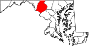
U.S. Highways Interstate Highways Categories:- State highways in Maryland
- Roads in Frederick County, Maryland


Wikimedia Foundation. 2010.