- Maryland Route 351
-
Maryland Route 351
Ballenger Creek Pike 
Route information Maintained by MDSHA and Frederick County Length: 4.24 mi[1] (6.82 km) Major junctions South end: Beginning of state maintenance near Adamstown North end: 
 MD 180 / I-70 in Frederick
Location Counties: Frederick Highway system Maryland highway system
Interstate • US • State • Minor • Former • Turnpikes←  MD 350
MD 352  →
→Maryland Route 351 (MD 351) is a state highway in the U.S. state of Maryland. Known as Ballenger Creek Pike, the state highway runs 4.24 miles (6.82 km) from the beginning of state maintenance near Adamstown north to MD 180 and Interstate 70 (I-70) in Frederick. MD 351 connects Frederick with its suburb of Ballenger Creek and the rural region around Adamstown in southern Frederick County. The state highway, which was originally MD 78, was constructed south of Ballenger Creek in the late 1920s. The highway was extended north to U.S. Route 340 (US 340) in the late 1930s. Following the construction of the US 340 freeway in Frederick in the late 1960s, MD 180 assumed all of MD 78. MD 180 was rolled back to Frederick and the highway that had formerly been MD 78 was designated MD 351 in the late 1980s. In 2002 and 2003, MD 351 was temporarily removed from the state highway system when a portion of the highway was relocated due to construction of a high school.
Contents
Route description
MD 351 begins at an arbitrary spot between Manor Woods Road and Dover Drive in the hamlet of Church Hill near Adamstown. Ballenger Creek Pike continues as a county highway that runs 6.77 miles (10.90 km) southwest along the western edge of Adamstown to MD 28 just east of that state highway's western terminus at US 15 in Point of Rocks, passing through an area of farmland that was once part of the Carrollton Manor. MD 351 heads north as a two-lane road that crosses Tuscarora Creek and passes through a mix of farmland and residential subdivisions. At Lambert Drive in the suburban community of Ballenger Creek, MD 351 becomes maintained by the Frederick County Division of Public Works. Within the 0.80-mile (1.29 km) county-maintained section, the highway passes through three curves as it crosses Ballenger Creek and passes Tuscarora High School.[1][2]
MD 351 becomes state-maintained again at Corporate Drive, which heads east opposite the entrance to Ballenger Creek Park, which contains the George Widrick House. Around Crestwood Boulevard, MD 351 gains a second lane northbound and temporarily becomes a divided highway. MD 351 reaches its northern terminus at Ballenger Center Drive at the Frederick city limits. The west leg of the intersection is a ramp to eastbound I-70 (Eisenhower Memorial Highway), which leads to southbound I-270 and eastbound US 40. Ballenger Creek Pike continues north as MD 180, which provides access to US 15, US 340, westbound US 40, and westbound I-70 before curving west as Jefferson Pike toward Jefferson.[1][2]
History
MD 351 follows what was originally the Frederick and Ballinger Creek Turnpike from Ballenger Creek north to the Frederick and Jefferson Turnpike, which was succeeded by US 340 and later MD 180.[3] A concrete road was built along the path of the turnpike from Ballenger Creek to south of Elmer Derr Road in 1926 and 1927.[4][5] The concrete road was extended south to Renn Road in 1928 and to MD 351's present southern terminus near Adamstown in 1929 and 1930.[6][7][8] The paved section of what became MD 78 was connected to US 340 by a county highway until the county highway was brought into the state system in 1938.[9][10]
MD 78's northern terminus was relocated when US 340 was reconstructed as a freeway in 1968. MD 78 and MD 180 were now co-terminus at the two highways' interchange with US 340.[11] In 1970, MD 180 was extended south along Ballenger Creek Pike to what had been MD 78's southern terminus near Adamstown, resulting in a cane-shaped route.[12] Around 1989, MD 180's eastern terminus was rolled back to Solarex Court at the southern end of its interchange with US 340 and US 15. MD 351 was assigned to Ballenger Creek Pike south of Solarex Court.[13] The original MD 351 had been assigned to Main Street in Fruitland in Wicomico County through 1955.[14] The ramp from MD 351 to eastbound I-70 was added around 1997.[15]
MD 351 was removed from the state highway system in 2002.[16][17] MD 180's eastern terminus was moved to its present location and the remainder of state-maintained Ballenger Creek Pike was transferred to Frederick County. The state highway was transferred to the county after the completion of a Maryland State Highway Administration contract to eliminate a sharp curve in the highway between Lambert Drive and Corporate Drive and construct a new bridge over Ballenger Creek.[17][18] Portions of the old road were reused on the campus of newly-constructed Tuscarora High School.[19] In 2003, much of MD 351 was brought back into the state highway system; however, the Lambert Drive – Corporate Drive section remained under Frederick County maintenance.[20][21]
Junction list
The entire route is in Frederick County.
Location Mile
[1]Destinations Notes Adamstown 0.00 Ballenger Creek Pike south – Point of Rocks Southern terminus at beginning of state maintenance 6.77 miles (10.90 km) north of MD 28 in Point of Rocks Frederick 4.24  MD 180 west (Ballenger Creek Pike) / I-70 east (Eisenhower Memorial Highway) to I-270 south / Ballenger Center Drive east – Baltimore, Washington
Northern terminus at eastern terminus of MD 180; ramp from MD 351 to eastbound I-70 1.000 mi = 1.609 km; 1.000 km = 0.621 mi References
- ^ a b c d "Highway Location Reference: Frederick County" (PDF). Maryland State Highway Administration. 2009. http://www.marylandroads.com/Location/2009_FREDERICK.pdf. Retrieved 2011-03-23.
- ^ a b Google, Inc. Google Maps – Maryland Route 351 (Map). Cartography by Google, Inc. http://maps.google.com/maps?f=d&source=s_d&saddr=MD-351+N%2FBallenger+Creek+Pike&daddr=Ballenger+Creek+Pike&geocode=FS1gWAIdGdth-w%3BFQAiWQIdJGVi-w&hl=en&mra=ls&sll=39.398563,-77.434967&sspn=0.007495,0.01929&ie=UTF8&t=h&z=13. Retrieved 2011-03-23.
- ^ Clark, William Bullock (1899). Report on the Highways of Maryland. Baltimore: Maryland Geological Survey. p. 232. http://books.google.com/books?id=b9l9AAAAIAAJ&printsec=frontcover#v=onepage&q&f=false. Retrieved 2011-03-23.
- ^ Report of the State Roads Commission of Maryland. 1924-1926. Baltimore: Maryland State Roads Commission. January 1927. p. 84. http://www.archive.org/details/annualreportsofs1924mary. Retrieved 2011-03-23.
- ^ Maryland Geological Survey. Map of Maryland: Showing State Road System and State Aid Roads (Map) (1927 ed.).
- ^ Maryland Geological Survey. Map of Maryland: Showing State Road System and State Aid Roads (Map) (1928 ed.).
- ^ Report of the State Roads Commission of Maryland. 1927-1930. Baltimore: Maryland State Roads Commission. 1930-10-01. p. 210. http://www.archive.org/details/reportofstateroa1927mary. Retrieved 2011-03-23.
- ^ Maryland Geological Survey. Map of Maryland Showing State Road System: State Aid Roads and Improved County Road Connections (Map) (1930 ed.).
- ^ Maryland State Roads Commission. Map of Maryland Showing State Road System (Map) (1938 ed.).
- ^ Maryland State Roads Commission. General Highway Map: State of Maryland (Map) (1939 ed.).
- ^ Maryland State Roads Commission. Maryland: Official Highway Map (Map) (1968 ed.).
- ^ Maryland State Roads Commission. Maryland: Official Highway Map (Map) (1970 ed.).
- ^ Maryland State Highway Administration. Maryland: Official Highway Map (Map) (1989 ed.).
- ^ Maryland State Roads Commission. Maryland: Official Highway Map (Map) (1955 ed.).
- ^ Maryland State Highway Administration. Maryland: Official Highway Map (Map) (1997 ed.).
- ^ Maryland State Highway Administration. Maryland: Official Highway Map (Map) (2002 ed.).
- ^ a b "Highway Location Reference: Frederick County" (PDF). Maryland State Highway Administration. 2002. http://www.marylandroads.com/Location/2002_FREDERICK.pdf. Retrieved 2011-03-23.
- ^ United States Geological Survey (1988-04-11). Ballenger Creek, Maryland, United States (Map). Aerial Map. http://msrmaps.com/image.aspx?T=1&S=12&Z=18&X=361&Y=5451&W=1. Retrieved 2011-03-23.
- ^ Robb, Julia (2001-06-15). "Cost for Tuscarora may reach $43M". The Frederick News–Post (Frederick, MD: Randall Family, LLC). http://www.fredericknewspost.com/sections/archives/display_detail.htm?StoryID=24091. Retrieved 2011-03-23.
- ^ Maryland State Highway Administration. Maryland: Official Highway Map (Map) (2003-2004 ed.).
- ^ "Highway Location Reference: Frederick County" (PDF). Maryland State Highway Administration. 2003. http://www.marylandroads.com/Location/2003_FREDERICK.pdf. Retrieved 2011-03-23.
External links
Roads in Frederick County, Maryland State highways 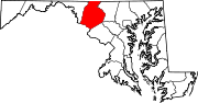
U.S. Highways Interstate Highways Categories:- State highways in Maryland
- Roads in Frederick County, Maryland


Wikimedia Foundation. 2010.