- Nuevo, California
-
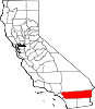
Nuevo — census-designated place — Nuevo, California, Distant view of snow-capped San Gabriel Mountains from Nuevo road Location in Riverside County and the state of California
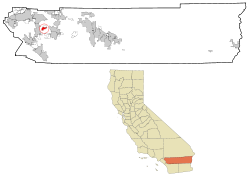
Coordinates: 33°48′25″N 117°7′43″W / 33.80694°N 117.12861°WCoordinates: 33°48′25″N 117°7′43″W / 33.80694°N 117.12861°W Country  United States
State  California
County Riverside Area[1] – Total 6.771 sq mi (17.538 km2) – Land 6.771 sq mi (17.538 km2) – Water 0 sq mi (0 km2) 0% Elevation 1,490 ft (454 m) Population (2010) – Total 6,447 – Density 952.1/sq mi (367.6/km2) Time zone PST (UTC-8) – Summer (DST) PDT (UTC-7) ZIP code 92567 Area code(s) 951 FIPS code 06-52624 GNIS feature ID 1661125 Nuevo is a rural community located east of the city of Perris and Lake Perris in Riverside County, California, United States. The population of the census-designated place (CDP) was 6,447 at the 2010 census, up from 4,135 at the 2000 census.
Contents
Geography
Nuevo is located at 33°48′25″N 117°7′43″W / 33.80694°N 117.12861°W (33.807027, -117.128585).[2]
According to the United States Census Bureau, the CDP has a total area of 6.8 square miles (17.5 km²), all of it land.
The geography of the area consists of a wide variety of geographical features, including rocky and rolling hills and low-lying valleys. The usually dry San Jacinto River (California) runs along the northern portion of the area.[3]
The natural vegetation consists primarily of Coastal Sage Scrub,[4] though much of this natural vegetation is visibly absent or exists in remnant form within the lowlands of the area where residential and agricultural uses are most prevalent.
Demographics
2010
The 2010 United States Census[5] reported that Nuevo had a population of 6,447. The population density was 952.1 people per square mile (367.6/km²). The racial makeup of Nuevo was 4,011 (62.2%) White, 113 (1.8%) African American, 91 (1.4%) Native American, 82 (1.3%) Asian, 16 (0.2%) Pacific Islander, 1,810 (28.1%) from other races, and 324 (5.0%) from two or more races. Hispanic or Latino of any race were 3,514 persons (54.5%).
The Census reported that 6,445 people (100% of the population) lived in households, 2 (0%) lived in non-institutionalized group quarters, and 0 (0%) were institutionalized.
There were 1,795 households, out of which 872 (48.6%) had children under the age of 18 living in them, 1,178 (65.6%) were opposite-sex married couples living together, 204 (11.4%) had a female householder with no husband present, 122 (6.8%) had a male householder with no wife present. There were 101 (5.6%) unmarried opposite-sex partnerships, and 12 (0.7%) same-sex married couples or partnerships. 219 households (12.2%) were made up of individuals and 80 (4.5%) had someone living alone who was 65 years of age or older. The average household size was 3.59. There were 1,504 families (83.8% of all households); the average family size was 3.87.
The population was spread out with 1,935 people (30.0%) under the age of 18, 690 people (10.7%) aged 18 to 24, 1,593 people (24.7%) aged 25 to 44, 1,615 people (25.1%) aged 45 to 64, and 614 people (9.5%) who were 65 years of age or older. The median age was 32.9 years. For every 100 females there were 100.6 males. For every 100 females age 18 and over, there were 101.1 males.
There were 1,963 housing units at an average density of 289.9 per square mile (111.9/km²), of which 1,400 (78.0%) were owner-occupied, and 395 (22.0%) were occupied by renters. The homeowner vacancy rate was 2.6%; the rental vacancy rate was 4.1%. 4,823 people (74.8% of the population) lived in owner-occupied housing units and 1,622 people (25.2%) lived in rental housing units.
2000
As of the census[6] of 2000, there were 4,135 people, 1,302 households, and 1,076 families residing in the CDP. The population density was 764.5 people per square mile (295.1/km²). There were 1,379 housing units at an average density of 254.9 per square mile (98.4/km²). The racial makeup of the CDP was 75.6% White, 2.1% African American, 1.0% Native American, 1.3% Asian, <0.1% Pacific Islander, 16.9% from other races, and 3.2% from two or more races. Hispanic or Latino of any race were 29.4% of the population.
There were 1,302 households out of which 42.2% had children under the age of 18 living with them, 69.4% were married couples living together, 9.0% had a female householder with no husband present, and 17.3% were non-families. 13.1% of all households were made up of individuals and 6.0% had someone living alone who was 65 years of age or older. The average household size was 3.2 and the average family size was 3.5.
In the CDP the population was spread out with 32.4% under the age of 18, 6.9% from 18 to 24, 27.4% from 25 to 44, 22.0% from 45 to 64, and 11.3% who were 65 years of age or older. The median age was 36 years. For every 100 females there were 99.8 males. For every 100 females age 18 and over, there were 97.0 males.
The median income for a household in the CDP was $49,129, and the median income for a family was $51,059. Males had a median income of $40,321 versus $26,337 for females. The per capita income for the CDP was $17,897. About 7.3% of families and 10.2% of the population were below the poverty line, including 15.5% of those under age 18 and 6.2% of those age 65 or over.
Trivia
Nuevo California is also the title of a 2003 bi-national "mystery play" which other than in name shares no other relation to the census-designated place in Riverside, California.[1]
Politics
In the state legislature Nuevo is located in the 37th Senate District, represented by Republican Bill Emmerson, and in the 65th Assembly District, represented by Republican Paul Cook. Federally, Nuevo is located in California's 45th congressional district, which has a Cook PVI of R +3[7] and is represented by Republican Mary Bono Mack. Director Tim Hadden. Paul Muehter is the Mayor.
References
- ^ U.S. Census
- ^ "US Gazetteer files: 2010, 2000, and 1990". United States Census Bureau. 2011-02-12. http://www.census.gov/geo/www/gazetteer/gazette.html. Retrieved 2011-04-23.
- ^ http://www.tlma.co.riverside.ca.us/generalplan/eir/volume1.html#fig3.1 tlma.co.riverside.ca.us
- ^ http://www.laspilitas.com/comhabit/zipcode.htm laspilitas.com
- ^ All data are derived from the United States Census Bureau reports from the 2010 United States Census, and are accessible on-line here. The data on unmarried partnerships and same-sex married couples are from the Census report DEC_10_SF1_PCT15. All other housing and population data are from Census report DEC_10_DP_DPDP1. Both reports are viewable online or downloadable in a zip file containing a comma-delimited data file. The area data, from which densities are calculated, are available on-line here. Percentage totals may not add to 100% due to rounding. The Census Bureau defines families as a household containing one or more people related to the householder by birth, opposite-sex marriage, or adoption. People living in group quarters are tabulated by the Census Bureau as neither owners nor renters. For further details, see the text files accompanying the data files containing the Census reports mentioned above.
- ^ "American FactFinder". United States Census Bureau. http://factfinder.census.gov. Retrieved 2008-01-31.
- ^ "Will Gerrymandered Districts Stem the Wave of Voter Unrest?". Campaign Legal Center Blog. http://www.clcblog.org/blog_item-85.html. Retrieved 2008-02-10.
Municipalities and communities of Riverside County, California Cities Banning | Beaumont | Blythe | Calimesa | Canyon Lake | Cathedral City | Coachella | Corona | Desert Hot Springs | Eastvale | Hemet | Indian Wells | Indio | Jurupa Valley | La Quinta | Lake Elsinore | Menifee | Moreno Valley | Murrieta | Norco | Palm Desert | Palm Springs | Perris | Rancho Mirage | Riverside | San Jacinto | Temecula | Wildomar
CDPs Aguanga | Anza | Bermuda Dunes | Cabazon | Cherry Valley | Coronita | Crestmore Heights | Desert Center | Desert Edge | Desert Palms | East Hemet | El Cerrito | El Sobrante | French Valley | Garnet | Glen Avon | Good Hope | Green Acres | Highgrove | Home Gardens | Homeland | Idyllwild-Pine Cove | Indio Hills | Lake Mathews | Lake Riverside | Lakeland Village | Lakeview | March ARB | Mead Valley | Meadowbrook | Mecca | Mesa Verde | Mira Loma | Mountain Center | North Shore | Nuevo | Oasis | Pedley | Ripley | Romoland | Rubidoux | Sky Valley | Sunnyslope | Temescal Valley | Thermal | Thousand Palms | Valle Vista | Vista Santa Rosa | Warm Springs | Whitewater | Winchester | Woodcrest
Unincorporated
communitiesAlberhill | Alessandro | Arcilla | Arnold Heights | Belltown | Biskra Palms | Bly | Bonnie Bell | Box Springs | Cactus City | Cahuilla | Cahuilla Hills | Chiriaco Summit | East Blythe | Edgemont | El Cariso | Gilman Hot Springs | La Cresta | Lost Lake | Mortmar | Murrieta Hot Springs | River Bend Lodge | Sun City Palm Desert
Indian
reservationsAgua Caliente Indian Reservation | Cabazon Indian Reservation | Cahuilla Reservation | Colorado River Indian Reservation | Los Coyotes Reservation | Morongo Reservation | Ramona Indian Reservation | Santa Rosa Indian Reservation | Soboba Reservation | Torres-Martinez Indian Reservation
Ghost towns Alamo Bonito | Auld | Bergman | Caleb | Eagle Mountain | Hell | La Placita | Midland | Pinacate | Saahatpa | Terra Cotta
Categories:- Census-designated places in Riverside County, California
- Populated places in California with Hispanic majority populations
- Perris, California


Wikimedia Foundation. 2010.