- Cockfield, County Durham
-
Coordinates: 54°36′47″N 1°48′22″W / 54.61292°N 1.80616°W
Cockfield 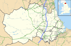
 Cockfield
Cockfield shown within County DurhamPopulation 1,545 OS grid reference NZ126242 Unitary authority County Durham Ceremonial county County Durham Region North East Country England Sovereign state United Kingdom Post town Bishop Auckland Postcode district Bishop Auckland Dialling code 01388 Police Durham Fire County Durham and Darlington Ambulance North East EU Parliament North East England UK Parliament Bishop Auckland List of places: UK • England • County Durham  Church of St Mary the Virgin
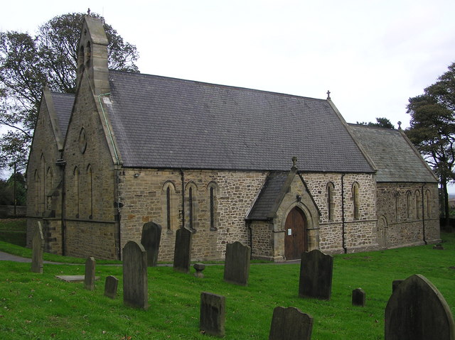
Cockfield is a village on the edge of Teesdale, County Durham, England. It is situated 8 miles to the south-west of Bishop Auckland, 15 miles north-west of Darlington and 40 miles south-east of Newcastle-upon-Tyne. Remains found on Cockfield Fell suggest there was a settlement in the area during the Iron Age. The parish church, dedicated to St Mary the Virgin, probably dates from the late 12th century.
Coal mining began in the area in the medieval period. When the South West Durham coalfield was opened in the nineteenth and twentieth centuries the population of the village grew significantly. The last Coal Mine closed in 1962.
Contents
Notable residents
One of the more illustrious families to hail from Cockfield was the Dixon family. George Dixon (1731–1785) owned coal mines and was a keen inventor, and was probably the first to use coal gas for illumination.[1] His brother Jeremiah Dixon (1733–1779), an astronomer, went to America with Charles Mason in 1763 to survey the boundaries of Maryland and Pennsylvania thereby creating the 'Mason-Dixon Line'.
Cockfield is a small village, in between Evenwood and Butterknowle
Local amenities
Public houses
There are three public houses in the village, the Queen's Head, the King's Head, and the Cockfield Working Men's Club.
Stores
There are two stores in the village of Cockfield, a Co-Operative and a newsagents.
Schools
The local primary school is Cockfield C of E Primary School.
Churches
The two churches that can be found in Cockfield are the CofE Church of Saint Mary the Virgin and the Cockfield Methodist Church.
References
- ^ "From star-gazing to canal digging". The Northern Echo. Newsquest Media Group. http://archive.thenorthernecho.co.uk/2002/8/7/125478.html. Retrieved 2010-03-11.
External links
 Media related to Cockfield, County Durham at Wikimedia CommonsCategories:
- Villages in County Durham
- County Durham geography stubs

Wikimedia Foundation. 2010.