- Clinton, Maryland
-
Clinton, Maryland — CDP — Location of Clinton, Maryland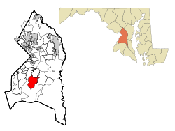
Coordinates: 38°45′49″N 76°53′44″W / 38.76361°N 76.89556°WCoordinates: 38°45′49″N 76°53′44″W / 38.76361°N 76.89556°W Country United States State Maryland County Prince George's Area - Total 11.8 sq mi (30.6 km2) - Land 11.8 sq mi (30.6 km2) - Water 0.0 sq mi (0.0 km2) Elevation 249 ft (76 m) Population (2010) - Total 35,970 - Density 2,208.6/sq mi (852.7/km2) Time zone Eastern (EST) (UTC-5) - Summer (DST) EDT (UTC-4) ZIP code 20735 Area code(s) 301 FIPS code 24-17900 GNIS feature ID 0597253 Clinton is an unincorporated area and census-designated place (CDP) in Prince George's County, Maryland, United States.[1] Clinton was formerly known as Surrattsville until after the time of the American Civil War. The population of Clinton was 26,064 at the 2000 census. However, as of 2007, there is an estimate of 35,096. The postal code for Clinton is 20735. Clinton is historically known for its role in the American Civil War concerning the Abraham Lincoln assassination. Clinton is adjacent to Camp Springs, Rosaryville, also known as Melwood, and Andrews Air Force Base.
Contents
Geography
Clinton is located at 38°45′49″N 76°53′44″W / 38.76361°N 76.89556°W (38.763711, -76.895458)[2]. According to the United States Census Bureau, the CDP has a total area of 11.8 square miles (31 km2), of which, 11.8 square miles (31 km2) of it is land and 0.08% is water.
Demographics
Historical populations Census Pop. %± 1980 16,438 — 1990 19,987 21.6% 2000 26,064 30.4% source:[3] As of the census[4] of 2000, there were 26,064 people, 8,605 households, and 6,772 families residing in the CDP. The population density was 2,208.6 people per square mile (852.8/km²). There were 8,962 housing units at an average density of 759.4 per square mile (293.2/km²). The racial makeup of the CDP was 20.56% White, 73.69% Black, 0.47% Native American, 2.47% Asian, 0.02% Pacific Islander, 0.72% from other races, and 2.08% from two or more races. Hispanic or Latino of any race were 1.90% of the population.
There were 8,605 households out of which 38.5% had children under the age of 18 living with them, 58.8% were married couples living together, 15.2% had a female householder with no husband present, and 21.3% were non-families. 17.4% of all households were made up of individuals and 5.3% had someone living alone who was 65 years of age or older. The average household size was 2.96 and the average family size was 3.32.
In the CDP the population was spread out with 27.2% under the age of 18, 6.7% from 18 to 24, 30.7% from 25 to 44, 26.4% from 45 to 64, and 9.1% who were 65 years of age or older. The median age was 37 years. For every 100 females there were 89.1 males. For every 100 females age 18 and over, there were 84.8 males.
The median income for a household in the CDP was $71,139, and the median income for a family was $75,036 (these figures had risen to $90,285 and $97,640 respectively as of a 2007 estimate[5]). Males had a median income of $41,736 versus $39,545 for females. The per capita income for the CDP was $24,949. About 2.4% of families and 3.4% of the population were below the poverty line, including 2.5% of those under age 18 and 10.2% of those age 65 or over.
History
Clinton was originally founded in the 1770s. The town, then named Surratt's Villa, was actually a simple crossroads with a few buildings. In the 1800s, it became known as Surrattsville. The main building served as the Post Office, an inn and tavern, and a polling place. This main residence was one of two properties owned by the widowed Mary Surratt; the second property was in Washington, D.C.
On 14 and 15 April 1865, John Wilkes Booth, who had two hours earlier assassinated President Abraham Lincoln, stopped by the Surrattsville tavern to pick up weapons and supplies. The U.S. Government alleged that Mrs. Surratt had gone there earlier with these supplies, and was in collusion with the conspirators, one of whom was her son, John Surratt. Because she was found guilty of complicity in the Lincoln assassination, Mary Surratt was hanged at the Capitol Prison in Washington D.C., on 7 July 1865. (Her house is now the Surratt House Museum, with a focus on the assassination.) The U.S. Post Office renamed the town Robeysville, due to the notoriety of the Surratt name.
 Surratt House 2006
In 1879, Robeysville was renamed Clinton. The local high school, however, retains the name of Surrattsville, and local historians have continually urged Clinton to regain its unique name. Major local growth began in the 1950s, spurred partly by the expansion of adjacent Andrews Air Force Base, home of the Air Force Systems Command and the President's plane "Air Force One".
Also a part of Clinton's history is the Wyoming house. Wyoming is a frame historic house located in Clinton. It consists of three separate and distinct sections: the main block built in the third quarter of the 18th century, a circa. 1800 kitchen, and a connecting two-bay section of c. 1850. The house is a well preserved example of Maryland's gambrel-roofed colonial architecture, and is more specifically noteworthy as an excellent example of southern Maryland tidewater architecture.
Wyoming is also significant historically as the ancestral home of the Marburys, a family which produced many of Maryland's political, professional, and judicial leaders through the 18th, 19th, and 20th centuries.
Clinton has mostly single-family housing, but includes a few townhouse developments and one retirement mid-rise. Southern Maryland Regional Hospital is in Clinton, as is a private airfield. Louise F. Cosca Regional Park, a public facility operated by the Maryland National Capital Parks and Planning Commission, offers camping, hiking, fishing in a lake, an excellent playground, and a nature museum with nature activities. Clinton boasts a major shopping complex as well, and has a large fringe parking lot nearby where Metro buses take passengers a few miles to the Branch Avenue station of the Washington metrorail system. There are more shopping centers yet to be built. Clinton is also home to the James O. Hall Research Center which is located on the premises of the Surratts House.
Then-presidential candidate Bill Clinton briefly visited Clinton, Maryland, as a campaign stop in 1992.
Clinton is also the hometown of Maryland State Senate President Thomas V. Mike Miller, Jr. (a few years ago he moved to Calvert County, but still has a Clinton law office); the Miller family is well-known in the area.
In 1913, B.K. Miller founded a general store at the main intersection in the town which still exists today as one of the largest liquor stores in southern Prince Georges County. It is still owned by the Miller family.
Academy Award-winning actress Marcia Gay Harden attended Surrattsville High School and graduated in 1976. She won the Oscar for Best Supporting Actress for Pollock in 2001 and was also nominated for Best Supporting Actress for her performance in Mystic River in 2003. Another member of the Surrattsville High School Class of 1976 was baritone Gordon Hawkins. Mr. Hawkins has won critical acclaim for his performances with opera companies and symphonies around the world.
Clinton is where American soap opera actress Laura Wright grew up. She graduated from Surrattsville High School in 1988.
Clinton is also where R&B Singer Tank grew up, as well as opera singer Gordon Hawkins.
NFL running back Brian Westbrook, known for playing for the Philadelphia Eagles and currently playing for the San Francisco 49ers, grew up in Clinton.
A movie titled The Photon Effect was filmed in the town and also in Baltimore.
A movie titled "Safehouse" was filmed in Clinton in 2007. Among the actors who flew out from Los Angeles to act in the film was Luke Barnett, who grew up in Clinton and graduated from Grace Brethren Christian School in 2000.
Education
Clinton, MD, schools spend $6,986 per student. By average, There are 18 pupils per teacher, 789 students per librarian, and 431 children per counselor in Clinton (zip 20735), MD schools.
Primary and secondary schools
Public schools
Prince George's County Public Schools operates public schools that serve the area.
- Clinton Grove Elementary School (9420 Temple Hills Road, Temple Hills)
- Francis T. Evans Elementary School (6720 Old Alexander Ferry Road, Clinton)
- James Ryder Randall Elementary School (5410 Kirby Road, Clinton)
- Waldon Woods Elementary School (10301 Thrift Road, Clinton)
Middle schools:
- Stephen Decatur Middle School (8200 Pinewood Drive)
High schools:
- Surrattsville High School (6101 Garden Drive)
Special schools:
- Tanglewood Regional Center (8333 Woodyard Road)
Private schools
- Grace Brethren Christian Church and School (6501 Surratts Road); this building was originally built as the first Surrattsville High School, and then became Surrattsville Junior High School before it was sold to Grace Brethren.
- St. John the Evangelist School ( 8912 Old Branch Avenue) for grades Pre-K through 8 opened in 1961.
- Independent Baptist Academy - (Piscataway Road) Grades K-4 and up.
- Clinton Christian School
References
- ^ U.S. Geological Survey Geographic Names Information System: Clinton, Maryland
- ^ "US Gazetteer files: 2010, 2000, and 1990". United States Census Bureau. 2011-02-12. http://www.census.gov/geo/www/gazetteer/gazette.html. Retrieved 2011-04-23.
- ^ "CENSUS OF POPULATION AND HOUSING (1790-2000)". U.S. Census Bureau. http://www.census.gov/prod/www/abs/decennial/index.html. Retrieved 2010-07-18.
- ^ "American FactFinder". United States Census Bureau. http://factfinder.census.gov. Retrieved 2008-01-31.
- ^ http://factfinder.census.gov/servlet/ACSSAFFFacts?_event=Search&geo_id=16000US1756640&_geoContext=01000US%7C04000US17%7C16000US1756640&_street=&_county=clinton&_cityTown=clinton&_state=04000US24&_zip=&_lang=en&_sse=on&ActiveGeoDiv=geoSelect&_useEV=&pctxt=fph&pgsl=160&_submenuId=factsheet_1&ds_name=ACS_2007_3YR_SAFF&_ci_nbr=null&qr_name=null®=null%3Anull&_keyword=&_industry=
Categories:- Populated places established in the 1770s
- Populated places in Prince George's County, Maryland
- Unincorporated communities in Maryland
- Census-designated places in Maryland
- Populated places in Maryland with African American majority populations


Wikimedia Foundation. 2010.