- Millers Falls, Massachusetts
-
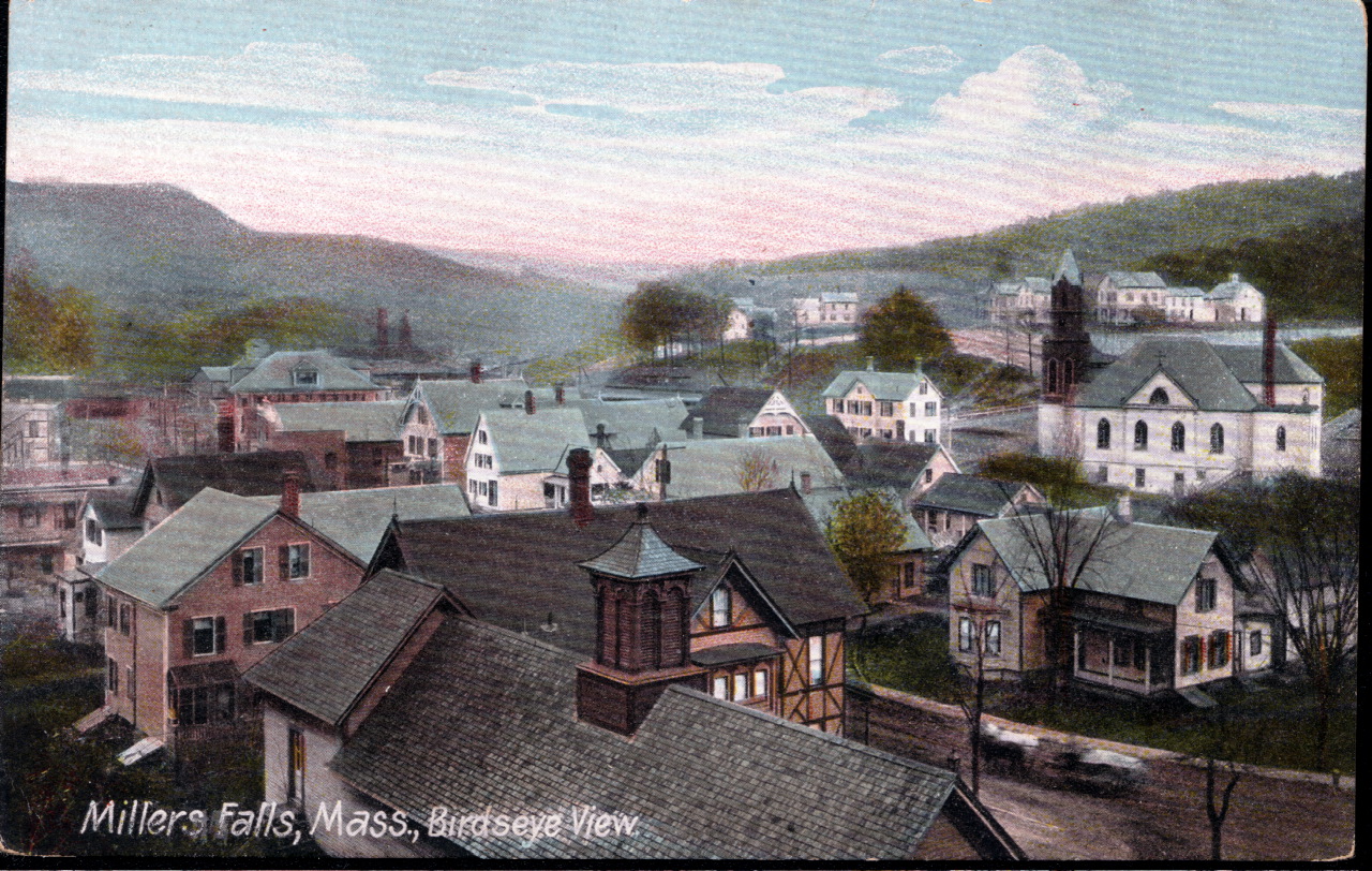
Millers Falls, Massachusetts — CDP — Bird's-eye view in 1907
Coordinates: 42°34′45″N 72°29′36″W / 42.57917°N 72.49333°WCoordinates: 42°34′45″N 72°29′36″W / 42.57917°N 72.49333°W Country United States State Massachusetts County Franklin Area – Total 0.9 sq mi (2.4 km2) – Land 0.9 sq mi (2.3 km2) – Water 0.0 sq mi (0.1 km2) Elevation 299 ft (91 m) Population (2000) – Total 1,072 – Density 1,198.1/sq mi (462.6/km2) Time zone Eastern (EST) (UTC-5) – Summer (DST) EDT (UTC-4) ZIP code 01349 Area code(s) 413 FIPS code 25-41410 GNIS feature ID 0609184 Millers Falls is a census-designated place (CDP) in the town of Montague in Franklin County, Massachusetts, United States. The population was 1,072 at the 2000 census. It is part of the Springfield, Massachusetts metropolitan statistical area.
Contents
History
Located along the Mohawk Trail, Millers Falls was first established in 1824 as an agricultural community, named Grout's Corner after first settler Martin Grout (1790–1865). In the 1860s, however, the local growth of railroads stimulated development, as the New London Northern Railroad bought the Amherst & Palmer railroad in 1864 and in 1866 extended its line to a connection with the Vermont & Massachusetts at Grout's Corner. With this new railroad juncture, the abundant water power of the falls at Grout's Corner provided a perfect place to establish mills. The village's present name derives from the Millers Falls Manufacturing Company (later the Millers Falls Company), established on the Millers River in 1868, and famed for its fine hand tools.
-

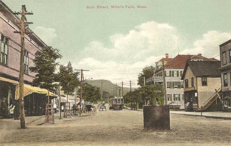
Main Street in 1910
-

Millers River in 1912
-

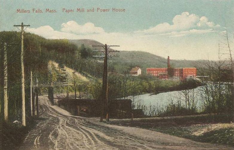
Paper mill in 1912
Geography
Millers Falls is located at 42°34′45″N 72°29′36″W / 42.57917°N 72.49333°W (42.579154, -72.493414)[1], near the border with Erving, Massachusetts.
According to the United States Census Bureau, the CDP has a total area of 2.4 km² (0.9 mi²). 2.3 km² (0.9 mi²) of it is land and 0.1 km² (0.04 mi²) of it (3.26%) is water. The village is drained by the Millers River, a tributary of the Connecticut River.
Millers Falls is crossed by Massachusetts Route 2 and Massachusetts Route 63.
Demographics
As of the census[2] of 2000, there were 1,072 people, 439 households, and 273 families residing in the CDP. The population density was 465.1/km² (1,198.1/mi²). There were 472 housing units at an average density of 204.8/km² (527.5/mi²). The racial makeup of the CDP was 96.18% White, 0.28% African American, 1.03% Native American, 0.37% Asian, 0.09% from other races, and 2.05% from two or more races. Hispanic or Latino of any race were 1.12% of the population.
There were 439 households out of which 31.0% had children under the age of 18 living with them, 43.3% were married couples living together, 11.8% had a female householder with no husband present, and 37.8% were non-families. 27.3% of all households were made up of individuals and 13.0% had someone living alone who was 65 years of age or older. The average household size was 2.44 and the average family size was 2.95.
In the CDP the population was spread out with 22.9% under the age of 18, 9.6% from 18 to 24, 34.7% from 25 to 44, 19.2% from 45 to 64, and 13.5% who were 65 years of age or older. The median age was 35 years. For every 100 females there were 100.0 males. For every 100 females age 18 and over, there were 97.6 males.
The median income for a household in the CDP was $37,337, and the median income for a family was $41,711. Males had a median income of $34,886 versus $24,375 for females. The per capita income for the CDP was $17,768. About 1.8% of families and 4.8% of the population were below the poverty line, including 4.8% of those under age 18 and 9.0% of those age 65 or over.
See also
References
- ^ "US Gazetteer files: 2010, 2000, and 1990". United States Census Bureau. 2011-02-12. http://www.census.gov/geo/www/gazetteer/gazette.html. Retrieved 2011-04-23.
- ^ "American FactFinder". United States Census Bureau. http://factfinder.census.gov. Retrieved 2008-01-31.
External links
Municipalities and communities of Franklin County, Massachusetts City 
Towns Ashfield | Bernardston | Buckland | Charlemont | Colrain | Conway | Deerfield | Erving | Gill | Hawley | Heath | Leverett | Leyden | Monroe | Montague | New Salem | Northfield | Orange | Rowe | Shelburne | Shutesbury | Sunderland | Warwick | Wendell | Whately
CDPs Millers Falls | Northfield | Orange | Shelburne Falls | South Deerfield | Turners Falls
Other
villagesLake Pleasant | Satans Kingdom | Zoar
Categories:- Montague, Massachusetts
- Census-designated places in Franklin County, Massachusetts
- Springfield, Massachusetts metropolitan area
-


Wikimedia Foundation. 2010.