- North Fambridge
-
Coordinates: 51°38′31″N 0°40′30″E / 51.642°N 0.675°E
North Fambridge 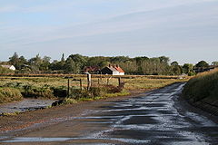
 North Fambridge
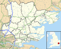
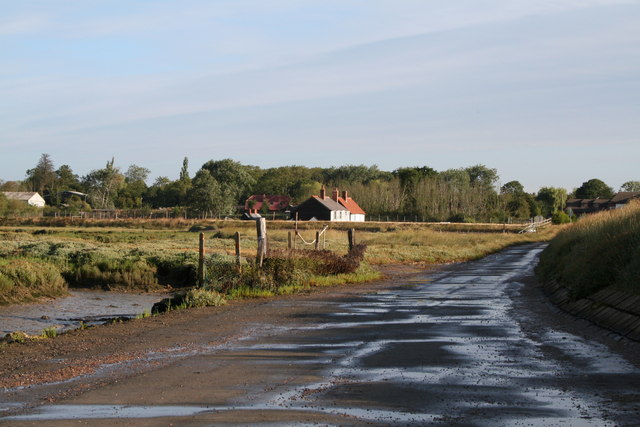
North Fambridge shown within EssexPopulation 600 + OS grid reference TQ852972 District Maldon Shire county Essex Region East Country England Sovereign state United Kingdom Post town Maldon Postcode district CM3 Dialling code 01621 Police Essex Fire Essex Ambulance East of England EU Parliament East of England UK Parliament Maldon List of places: UK • England • Essex North Fambridge is a village and civil parish on the Dengie peninsula in the English county of Essex.
North Fambridge is on the north bank of the River Crouch opposite South Fambridge and is served by North Fambridge railway station on the Crouch Valley Line. Administratively, North Fambridge forms part of the ward of Purleigh in the district of Maldon.[1]
Adjoining the village is Blue House Farm, a 605-acre (2.45 km2) Site of Special Scientific Interest and nature reserve owned by the Essex Wildlife Trust.[2]
In the Domesday Book, North Fambridge was known as 'Fanbruge'.
North Fambridge is home to the Fambridge Yacht Haven Middle Distance Triathlon. The first event took place on 24 July 2011 and was the first Half Ironman Triathlon in Essex and the wider region.[3]
Local amenities
The local public house is The Ferry Boat Inn. The North Fambridge Yacht Club is based in the village.
Holy Trinity Church has been serving the community for at least 200 years.[4]
References
- ^ "North Fambridge at Maldon District Council". http://www.maldon.gov.uk/LocalDemocracy/ParishCouncils/North+Fambridge+Parish.htm. Retrieved 2008-11-23.
- ^ "Blue House Farm at the Essex Wildlife Trust". http://www.essexwt.org.uk/sites/Blue%20House%20Farm.htm. Retrieved 2008-11-23.
- ^ "Fambridge Yacht Haven Middle Distance Triathlon". http://www.dengieevents.co.uk/#/fambridge-yacht-haven-tri/4543261097. Retrieved 2011-08-11.
- ^ "Crouch Valley Churches: Holy Trinity, North Fambridge.". http://www.crouchvalleychurches.co.uk/c_fambridge.asp. Retrieved 2011-5-7.
External links
- Local History overview
- War Memorial details
- Information and pictures of North Fambridge Village
- Local history of North Fambridge
Towns: 
Villages: Althorne • Asheldham • Bradwell Waterside • Bradwell-on-Sea • Cold Norton • Creeksea • Dengie • Great Totham • Hazeleigh • Heybridge • Langford • Latchingdon • Mayland • Maylandsea • Mundon • North Fambridge • Purleigh • Snoreham • Southminster • Steeple • Stow Maries • St. Lawrence • Tillingham • Tolleshunt D'Arcy • Wickham Bishops • Woodham Mortimer • Woodham WalterMaldon is the seat of the Maldon district
List of places in EssexCategories:- Villages in Essex
- Essex geography stubs
- Maldon (district)

Wikimedia Foundation. 2010.