- Issyk Kul Province
-
Coordinates: 42°0′N 78°0′E / 42°N 78°E
Issyk Kul Province Ысык-Көл областы
Иссык-Кульская областьProvince Country Kyrgyzstan Capital Karakol Highest point Pobeda peak - elevation 7,439 m (24,406 ft) Area 43,100 km2 (16,641 sq mi) Population 437,200 (2009) Density 10.1 / km2 (26 / sq mi) Governor Mirbek Asanakunov ISO 3166-2 KG-Y 
Issyk Kul Province (Kyrgyz: Ысык-Көл областы) is a province (oblast) of Kyrgyzstan. Its capital is Karakol. It is surrounded by Almaty Province, Kazakhstan (north), Chui Province (west), Naryn Province (southwest) and Xinjiang, China (southeast).
Contents
Geography
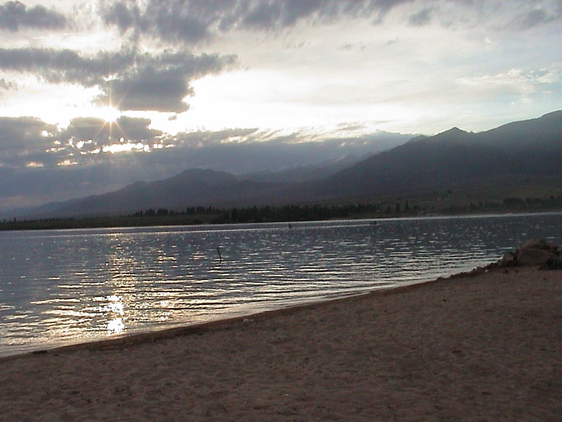
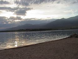 Issyk Kul at sundown
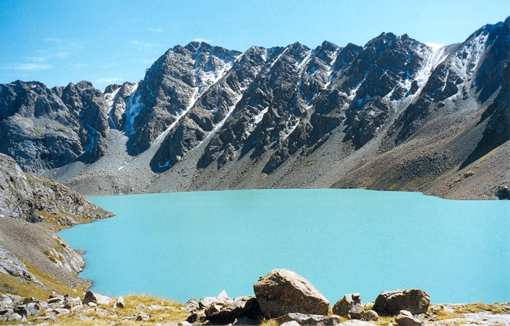
 Lake Ala-Kul in the Terskey Alatau mountains
The north is dominated by the eye-shaped Issyk Kul Lake, surrounded by the ridges of the Tian Shan mountain system: the Kyungey Ala-Too mountains to the north and the Terskey Alatau to the south (the 'sunny' and 'shady' Alatau, respectively). To the south is mountains and 'jailoos' (mountain meadows used for summer grazing). The highest peaks of the Tian Shan mountains, including Khan Tengri, are located in the easternmost part of the province.
Most of the population of the province lives around the lake, in particular in the cities of Balykchy near the lake's western end, and Karakol near its eastern end.
Basic Socio-Economic Indicators
- Population: 437,200 (assessment for 1 January 2009) including 28.7% - urban, and 71.3% - rural population[1]
- Employed population: 180,300 (2008) [2]
- Registered unemployed population: 4,902 (2008)[3]
- Export: 18.8 million US dollars (2008)[4]
- Import: 221.7 million US dollars (2008) [5]
- Direct Foreign Investments: 1,1 million US dollars (in 2008)[6]
Demographics
As of 2009, Issyk Kul Province included 3 towns, 5 urban-type settlements, and 175 villages. Its de-facto and permanent population, according to the Population and Housing Census of 2009, was 425,116 and 438,389 correspondingly.
Historical populations in Issyk Kul Province Year Pop. ±% 1970 311,992 — 1979 352,017 +12.8% 1989 409,618 +16.4% 1999 415,513 +1.4% 2009 425,116 +2.3% Note: de facto population; Source: [7] Ethnic composition
According to the 2009 Census, the ethnic composition (de jure population) of Issyk Kul Province was:[7]
Ethnic group Population Proportion of Chuy Province population Kyrgyzs 377,994 86.2% Russians 35,275 8.0% Kazakhs 6,464 1.5% Uygurs 3,897 0.9% Kalmyks 3,801 0.9% Dungans 3,124 0.7% Uzbeks 2,982 0.7% Tatars 2,098 0.5% Ukrainians 1,170 0.3% other groups 1,584 0.3% Transportation
The railroad coming from the northwest (from Bishkek) ends at Balykchy. The main highway (A365) from Bishkek passes through Balykchy and into Naryn Province on its way to the Torugart Pass into China. Highway A363 circles the lake and A362 runs east from the lake into Kazakhstan.
Tourism
 On the plateau between the north shore of Lake Issyk Kul and the Kyungei Alatau Range (near Tamchy)
The province, which resembles the Alps or Colorado, would be a major tourist destination were it not for its remoteness, underdeveloped infrastructure, and growing conflict between Kyrgyz nationalists and independence factions, which in December 2008 flared up again, killing 39 civilians. Currently, it is visited mostly by locals who use the Soviet-era establishments around the lake and the more adventurous sort of international tourist.
Trivia
There is a village by the name of Kyzyldzhildyz in this province. Its name is hard enough to pronounce for foreigners to the language that the village's mayor has offered a reward for any American that can pronounce "Kyzyldzhildyz".
Districts of Issyk Kul
Issyk Kul is divided administratively into 5 districts: [8]:
District Capital Ak-Suu District Karakol Jeti-Oguz District Kyzyl-Suu Tong District Bokonbaev Tup District Tyup Issyk Kul District Cholpon-Ata References
- ^ National Committee on Statistics (in Kyrgyz/Russian)
- ^ National Committee on Statistics (in Kyrgyz/Russian)
- ^ National Committee on Statistics (in Kyrgyz/Russian)
- ^ National Committee on Statistics (in Kyrgyz/Russian)
- ^ National Committee on Statistics (in Kyrgyz/Russian)
- ^ National Committee on Statistics (in Kyrgyz/Russian)
- ^ a b Population and Housing Census 2009. Book 3 (in tables). Provinces of Kyrgyzstan: Issyk Kul Province (Перепись населения и жилищного фонда Кыргызской Республики 2009. Книга 3 (в таблицах). Регионы Кыргызстана: Иссык-Кульская область, Bishkek: National Committee on Statistics, 2010, http://212.42.101.100:8088/nacstat/sites/default/files/%D0%98%D1%81%D1%81%D1%8B%D0%BA-%D0%9A%D1%83%D0%BB%D1%8C%D1%81%D0%BA%D0%B0%D1%8F%20%D0%BE%D0%B1%D0%BB%D0%B0%D1%81%D1%82%D1%8C.pdf
- ^ Kyrgyzstan - Джалал-Абадская область
- Laurence Mitchell, Kyrgyzstan, Bradt Travel Guides, 2008
External links
- Guide to the region from the Spektator magazine
- (English) Karakol - Djeti-Oguz region in Central Tien-Shan
(Mountaineering reports and maps. Although the site is in English, with some web browsers you may need to set "Character Encoding" to "Cyrillic" in the "View" menu of your browser in order to get better display of the main page).

Chuy Province Almaty Province,  Kazakhstan
 Issyk Kul Province

Naryn Province  Xinjiang, China
Provinces (Oblasts) of Kyrgyzstan 
 Categories:
- Issyk Kul geography stubs
- Issyk Kul Province
- Provinces of Kyrgyzstan


Wikimedia Foundation. 2010.