- 2000–01 South-West Indian Ocean cyclone season
-
2000–01 South-West Indian Ocean cyclone season 
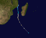
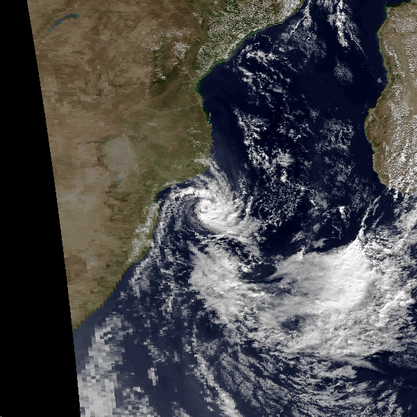
Season summary mapFirst storm formed: August 1, 2000 Last storm dissipated: June 23, 2001 Strongest storm: Charly – 925 hPa (mbar), 195 km/h (120 mph) (10-minute sustained) Total disturbances: 11 Total storms: 5 Tropical cyclones: 4 Intense cyclones: 2 Total fatalities: 2 Total damage: Unknown South-West Indian Ocean cyclone seasons
1998–99, 1999–00, 2000–01, 2001–02, 2002–03Related articles: The 2000-01 South-West Indian Ocean cyclone season was an annual event of tropical cyclone formation. It started on November 15, 2000 and ended on April 30, 2001. For Mauritius and the Seychelles, the season continued until May 15. These dates conventionally delimit the period of each year when most tropical cyclones form in the basin, which is west of 90°E and south of the Equator. Tropical cyclones in this basin are monitored by the Regional Specialised Meteorological Centre in Réunion.
Storms

Tropical Depression 01
Tropical depression (MFR) Tropical storm (SSHS) 
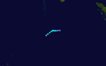
Duration August 1 – August 3 Intensity 55 km/h (35 mph) (10-min), 999 mbar (hPa) This storm existed from August 1 until August 3. It was also classified as Tropical Cyclone 01S by the Joint Typhoon Warning Center.
Tropical Depression 02
Tropical depression (MFR) Tropical storm (SSHS) 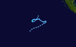
Duration November 12 – November 18 Intensity 55 km/h (35 mph) (10-min), 998 mbar (hPa) This storm existed from November 12 until November 18. It was also classified as Tropical Cyclone 02S by the Joint Typhoon Warning Center.
Intense Tropical Cyclone Ando
Intense tropical cyclone (MFR) Category 4 tropical cyclone (SSHS) 
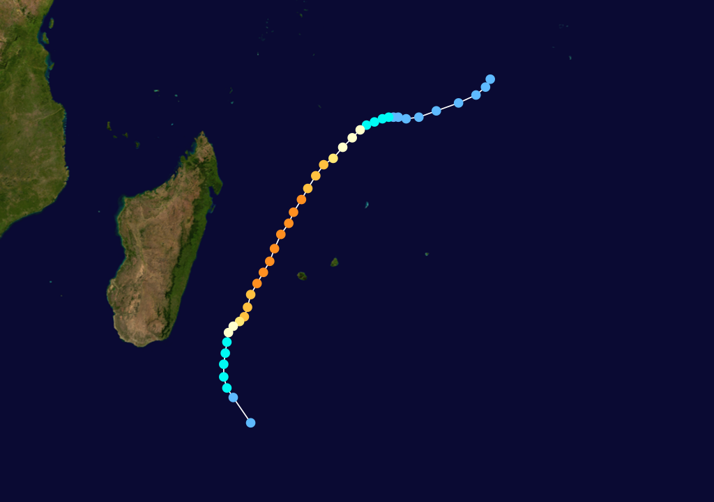
Duration December 31 – January 12 Intensity 185 km/h (115 mph) (10-min), 925 mbar (hPa) The beginnings of Ando can be traced to an area of convection within the Intertropical Convergence Zone (ITCZ) about 400 km south-west of Diego Garcia. The Joint Typhoon Warning Center rated the system's potential for development as 'fair' on December 31.[1] After 48 hours of dormancy, the disturbance gradually improved, becoming a tropical storm on January 2.[2] JTWC numbered the system 04S and initiated warnings. At the same time, the Mauritius Meteorological Service upgraded the depression to Tropical Storm Ando.
Over the next 24 hours, the system strengthened rapidly into the first tropical cyclone of the season. By this time the cyclone moved southwestward into a weakness in the subtropical ridge caused by a mid-latitude trough in the Mozambique Channel. Ando became an intense cyclone as it passed about 120 km to the south-east of Tromelin Island, where it brought high gusts to the island.[2] On January 5 Ando's intensity was steady throughout most of the day, but at 1800 UTC, JTWC and MFR estimated different mean wind speeds. Joint Typhoon Warning Center increased their 1-min estimate to 115 kts, while Météo-France lowered their 10-minute estimate to 90 kts.[1][3] However, MFR increased its estimate once again when Ando reached its maximum peak on January 6.[4]
By January 7, Ando started to weaken under the influence of north-westerly wind shear. The storm moved southward and dissipated south of Madagascar on the 13th. Though Ando never made landfall in the inhabited areas of the zone, it brought heavy rains and winds to some countries. As it approached La Reunion, the storm brought more than 1200 mm of rain and gusts up to 130 km/h. Two people died when they were carried away by flood waters.[2] As a developing storm, Ando produced some heavy rain between December 30 and January 2 over the Seychelles. Swaziland also reported that Ando drew moisture from the continent, aggravating a persistent dry spell.[5]
Tropical Cyclone Bindu
Tropical cyclone (MFR) Category 3 tropical cyclone (SSHS) 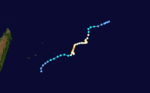
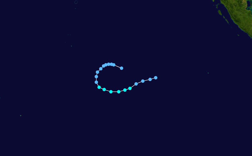
Duration January 3 – January 17 Intensity 150 km/h (90 mph) (10-min), 955 mbar (hPa) When Ando became a named tropical storm, the second system formed in the monsoon trough north of Cocos Island. A weak low moved westward, crossing longitude 90°E on January 3. After traveling three days and more than 1000 km, the system entered an area with less vertical shear.[2] The JTWC upgraded the system's development potential to 'fair' and issued two Formation Alerts before MFR upgraded the disturbance to a tropical depression on January 7.[1]
The following night, after reaching the tropical storm stage, the system was named Bindu by the TCWC in Mauritius. Bindu began tracking southward towards a weakness in the pressure field induced by a mid-level ridge. This track brought the storm closer to an upper level ridge near 15°S where conditions were favorable for development. Between the 8th and 9th, Bindu became a very small tropical cyclone: the CDO, which surrounded a 25 km diameter eye, had a diameter of about 100 km.[2] Having entered a region of weak steering flow, the cyclone became quasistationary and weakened back to a tropical storm because of energy overconsumption.[1]
During the evening of the 10th, Bindu moved west-south-west under the influence of a steering current. In response to this movement, the system reintensified until it reached its peak intensity on January 12. The cyclone maintained its strength as it moved east of Rodrigues, but started to weaken the next day due to the intrusion of dry air and shear.[1] The storm turned south and became extratropical on the 18th near latitude 30°S.[2] Bindu tracked far from any islands, and did not influence their weather.[5]
Intense Tropical Cyclone Charly
Intense tropical cyclone (MFR) Category 3 tropical cyclone (SSHS) 
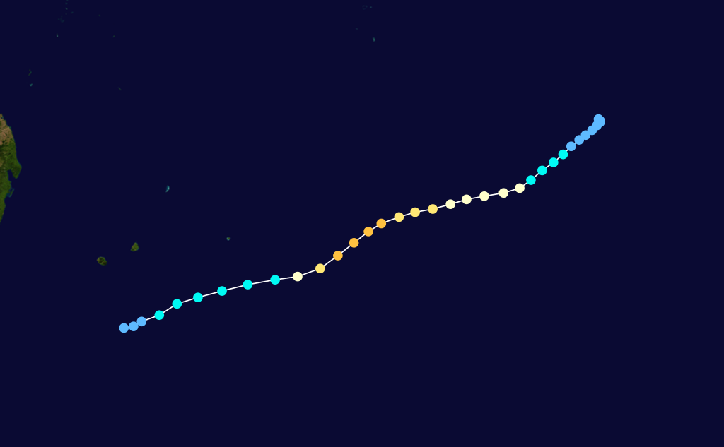
Duration January 17 – January 26 Intensity 195 km/h (120 mph) (10-min), 930 mbar (hPa) During the second week of January another disturbance developed in the South-East Indian Ocean approximately 600 km southwest of Sumatra.[2] The system was poorly-organized and development was slow until it drifted west of 90°E on January 16. Météo-France issued their first bulletin on Tropical Disturbance 05 at 1800 UTC the next day. Joint Typhoon Warning Center issued a formation alert on the 18th and numbered the system 06S. On January 19, Mauritius TCWC upgraded the depression to a tropical storm and assigned the name Charly.[1]
From then on, the storm steadily intensified to become the second intense tropical cyclone of the season. A ragged eye developed in the morning of January 20 while Charly was still a tropical storm. Intensification was more vigorous the next day when the cyclone deepened by about 35 hPa in 24 hours.[6] Charly reached its peak intensity late in the afternoon on January 22 when it was centered approximately 900 km east of Rodrigues.[1] Along with Ando, it was one of two intense cyclones to develop during the season. Different versions of the MFR best track conflict over which of the two cyclones was more intense.[2][6]
Before reaching peak intensity, Charly was tracking along a high level ridge; but when it approached latitude 20°S, the storm was on the polar side of that ridge under strong vertical shear. At the same time, the cyclone struggled with dry air and cold waters.[2] On January 29, Charly was an extratropical cyclone.[6]
Tropical Depression 06
Tropical depression (MFR) Duration January 22 – January 24 Intensity 55 km/h (35 mph) (10-min), 997 mbar (hPa) While Intense Tropical Cyclone Charly was spinning to the east of Mauritius, another system was forming off the east coast of central Madagascar. On 22 January, Météo-France issued the first bulletin on the disturbance. Later that day the system strengthened into a depression - eventually peaking at an intensity of 997 hPa.[7][8] The depression drifted erratically for a couple of days and then moved west-southwestward towards the southeastern coastal regions of the country to where it dissipated on the 24th. La Reunion estimated the storm's maximum sustained winds at 55 km/h, while the Joint Typhoon Warning Center never issued any warnings.[1]
Tropical Depression 07
Tropical depression (MFR) Duration February 1 – February 3 Intensity 55 km/h (35 mph) (10-min), 996 mbar (hPa) The only system in the region during the month of February was Tropical Depression 07. Late on 31 January, the Joint Typhoon Warning Center issued a Formation Alert, indicating a weak circulation was located about 450 nmi northeast of Rodrigues Island. Météo-France issued the first tropical disturbance bulletin at 0600 UTC 1 February, designating the system as Tropical Disturbance 07. The disturbance was upgraded to a tropical depression six hours later when its central winds were estimated at about 55 km/h.[9] The depression generally moved on a southerly course, taking it away of the tropics into less favorable waters.[10] It passed about 325 nmi east of Rodrigues before becoming extratropical on the 3rd. The storm had a large circulation, with 30 knot winds extending about 250-300 nmi southeast of the center. The JTWC issued another Formation Alert on 2 February, but did not issue any warnings on the depression. (In the Southern Hemisphere JTWC usually does not initiate warnings until winds have reached 35 kts.)[9]
Tropical Cyclone Dera
Tropical cyclone (MFR) Category 2 tropical cyclone (SSHS) 
Duration March 5 – March 12 Intensity 140 km/h (85 mph) (10-min), 960 mbar (hPa) Severe Tropical Storm Evariste
Severe tropical storm (MFR) Category 1 tropical cyclone (SSHS) 
Duration April 2 – April 8 Intensity 110 km/h (70 mph) (10-min), 976 mbar (hPa) Tropical Depression 10
Tropical depression (MFR) Tropical storm (SSHS) 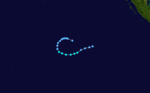
Duration April 3 – April 5 Intensity 55 km/h (35 mph) (10-min), 997 mbar (hPa) This compact system existed from April 3 until April 5. It was also classified as Tropical Cyclone 16S by the Joint Typhoon Warning Center.
Subtropical Storm 11
Subtropical storm (MFR) Category 1 tropical cyclone (SSHS) 

Duration June 20 – June 23 Intensity 95 km/h (60 mph) (10-min), 995 mbar (hPa) Storm names
A tropical disturbance is named when it reaches moderate tropical storm strength. If a tropical disturbance reaches moderate tropical storm status west of 55°E, then the Sub-regional Tropical Cyclone Advisory Centre in Madagascar assigns the appropriate name to the storm. If a tropical disturbance reaches moderate tropical storm status between 55°E and 90°E, then the Sub-regional Tropical Cyclone Advisory Centre in Mauritius assigns the appropriate name to the storm. A new annual list is used every year so no names are retired.[11]
- Ando
- Bindu
- Charly
- Dera
- Evariste
- Francois (unused)
- Gaby (unused)
- Hans (unused)
- Idriss (unused)
- Jakoba (unused)
- Kiran (unused)
- Lanto (unused)
- Mathieu (unused)
- Nancy (unused)
- Oda (unused)
- Premnath (unused)
- Quirin (unused)
- Rakoto (unused)
- Suzy (unused)
- Tovo (unused)
- Ursula (unused)
- Vimla (unused)
- Wenda (unused)
- Xino (unused)
- Yul (unused)
- Zoe (unused)
See also
- List of Southern Hemisphere tropical cyclone seasons
- Atlantic hurricane seasons: 2000, 2001
- Pacific hurricane seasons: 2000, 2001
- Pacific typhoon seasons: 2000, 2001
- North Indian Ocean cyclone seasons: 2000, 2001
References
- ^ a b c d e f g h Gary Padgett (January 2001). "Monthly Global Tropical Cyclone Summary". Australia Severe Weather. http://www.australiasevereweather.com/cyclones/2001/summ0101.htm. Retrieved 2008-08-18.
- ^ a b c d e f g h i "Annual Summary of Global Tropical Cyclone Season 2001". World Meteorological Organization. 2002. http://ftp.wmo.int/pages/prog/www/tcp/documents/doc/TD1132-TCseason2001.doc. Retrieved 2008-08-18.
- ^ Joint Typhoon Warning Center (2001). "Best Track for Cyclone 01S". http://www.usno.navy.mil/NOOC/nmfc-ph/RSS/jtwc/best_tracks/2001/2001s-bsh/bsh042001.txt. Retrieved 2008-08-20.
- ^ "Best Track Data for Cyclone Ando" (in French). Météo-France. http://www.meteo.fr/temps/domtom/La_Reunion/base_cyclone/nom_annee/ANDO_2000.html. Retrieved 2008-08-22.
- ^ a b "RA I Tropical Cyclone Committee for the South-West Indian Ocean, Fifteenth Session". World Meteorological Organization. September 2001. http://ftp.wmo.int/pages/prog/www/TCP_vO/Reports/finalrep-RAI-TCC-XV-Eng.doc. Retrieved 2008-08-18.
- ^ a b c "Best Track Data for Cyclone Charly" (in French). Météo-France. http://www.meteo.fr/temps/domtom/La_Reunion/base_cyclone/nom_annee/CHARLY_2000.html. Retrieved 2008-08-22.
- ^ Gary Padgett (January 2001). "Monthly Global Tropical Cyclone Tracks". Australia Severe Weather. http://www.australiasevereweather.com/cyclones/2001/trak0101.htm. Retrieved 2009-03-27.
- ^ "MFR Data for Tropical Depression 06" (in French). Météo-France. http://www.meteo.fr/temps/domtom/La_Reunion/trajGP20002001/data/06.html. Retrieved 2009-03-27.
- ^ a b Gary Padgett (February 2001). "Monthly Global Tropical Cyclone Summary". Australia Severe Weather. http://www.australiasevereweather.com/cyclones/2001/summ0102.htm. Retrieved 2009-03-28.
- ^ "MFR Data for Tropical Depression 07" (in French). Météo-France. http://www.meteo.fr/temps/domtom/La_Reunion/trajGP20002001/data/07.html. Retrieved 2009-03-28.
- ^ "Tropical Cyclone Operational Plan for the South Pacific and South-East Indian Ocean". World Meteorological Organization. 2003. http://ftp.wmo.int/pages/prog/www/TCP_vO/OperationPlans/TCP12-English2003.pdf. Retrieved 2008-08-15.
External links
- Joint Typhoon Warning Center (JTWC).
- Météo France (RSMC La Réunion).
- World Meteorological Organization
- WMO Annual Summary of Global Tropical Cyclone Seasons 2000
- WMO Annual Summary of Global Tropical Cyclone Seasons 2001
- RA I Tropical Cyclone Committee Final Report
- Joint Typhoon Warning Center 2001 ATCR
- 2000-01 Best Track Data from Météo France
- 2000-2001 Season Summary from Météo France
- July 2000 to June 2001 Tropical Cyclone Summaries and Operational Track Data
- Gary Padgett's Southern Hemisphere 2000-2001 Tropical Cyclone Season Review
- Report on Tropical Cyclone Ando
2000–09 South-West Indian Ocean cyclone seasons


Wikimedia Foundation. 2010.