- North Bend, Nebraska
-
North Bend, Nebraska — City — Downtown North Bend: west side of Main Street Location of North Bend, Nebraska
Coordinates: 41°27′51″N 96°46′51″W / 41.46417°N 96.78083°WCoordinates: 41°27′51″N 96°46′51″W / 41.46417°N 96.78083°W Country United States State Nebraska County Dodge Area – Total 0.8 sq mi (2.0 km2) – Land 0.8 sq mi (2.0 km2) – Water 0.0 sq mi (0.0 km2) Elevation 1,273 ft (388 m) Population (2000) – Total 1,213 – Density 1,588.1/sq mi (613.2/km2) Time zone Central (CST) (UTC-6) – Summer (DST) CDT (UTC-5) ZIP code 68649 Area code(s) 402 FIPS code 31-34720[1] GNIS feature ID 0831653[2] North Bend is a city in Dodge County, Nebraska, United States. The population was 1,213 at the 2000 census.
Contents
Geography
North Bend is located at 41°27′51″N 96°46′51″W / 41.46417°N 96.78083°W (41.464285, -96.780874)[3]. It lies on the north bank of the Platte River,[4] at the intersection of U.S. Highway 30 and Nebraska Highway 79. The main east-west line of the Union Pacific Railroad passes through the city.[5]
According to the United States Census Bureau, the city has a total area of 0.8 square miles (2.1 km2), all of it land.
History
The site of North Bend was settled in 1856 by a party of Scottish immigrants. En route from Lake Zurich, Illinois to Kansas,[6] they stopped at a bend at the northernmost point of the Platte River,[7] where they were invited to an impromptu Fourth of July celebration at a newly-founded townsite named Emerson. Finding the site congenial, and concerned about the "Border War" in Kansas,[6] they opted to remain there, founding a nearby townsite that they named Franklin.[7]
The site grew with the arrival of new parties of settlers. One such party brought a steam-powered sawmill and meal-grinder,[6] the first steam mill in Dodge County.[8] In 1858, Emerson's name was changed to Wallace, after a Philadelphia philanthropist who had offered to build a library in any town taking his name.[6]
The combined townsite arrived at its present name in 1864, when the Union Pacific Railroad bought a piece of ground for a depot on the proposed transcontinental railroad. For many years, surveys had showed the town's location as "the north bend",[4] and residents and Union Pacific officials agreed on that name for the town.[7]
The first train arrived in North Bend in 1866, and the town was platted by the railroad in 1867.[4] By 1876, the population had reached 250; there were 21 businesses, a school, and two churches. The city's first newspaper, the Independent, was founded in 1879.[6]
Growth continued steadily. In 1890, the population reached 897; a city building was constructed. By 1920, North Bend had electricity, a waterworks, and paved streets; the population was 1,087. The town continued to grow through much of the 20th century, with its population reaching a peak of 1,368 in 1980.[4]
Demographics
As of the census[1] of 2000, there were 1,213 people, 468 households, and 322 families residing in the city. The population density was 1,588.1 people per square mile (616.2/km²). There were 509 housing units at an average density of 666.4 per square mile (258.6/km²). The racial makeup of the city was 99.34% White, 0.08% African American, 0.16% Native American, 0.08% Asian, 0.16% from other races, and 0.16% from two or more races. Hispanic or Latino of any race were 0.82% of the population.
There were 468 households out of which 35.7% had children under the age of 18 living with them, 57.1% were married couples living together, 9.4% had a female householder with no husband present, and 31.0% were non-families. 28.4% of all households were made up of individuals and 19.7% had someone living alone who was 65 years of age or older. The average household size was 2.48 and the average family size was 3.04.
In the city the population was 27.0% under the age of 18, 6.4% from 18 to 24, 23.7% from 25 to 44, 21.4% from 45 to 64, and 21.4% who were 65 years of age or older. The median age was 40 years. For every 100 females there were 85.8 males. For every 100 females age 18 and over, there were 80.6 males. The median income for a household in the city was $38,879, and the median income for a family was $43,984. Males had a median income of $31,324 versus $18,352 for females. The per capita income for the city was $15,897. About 3.3% of families and 5.1% of the population were below the poverty line, including 4.7% of those under age 18 and 11.2% of those age 65 or over.
Economy
The largest industry in the North Bend area is agriculture.[5] There are nearly 100 small businesses operating in the city.[4] The largest single employers are North Bend Central Public Schools, which employs 76 people[9] and serves Morse Bluff and Ames as well as North Bend;[10] and Birchwood Manor, a nursing home with 72 employees.[9]
Media
The city's newspaper is the weekly North Bend Eagle. The paper was formed in November 1897 by the merger of the North Bend Argus and the North Bend Republican. It is the city's oldest continuously operating business.[11]
Notable resident
- Marg Helgenberger, actress on CSI and China Beach
References
- ^ a b "American FactFinder". United States Census Bureau. http://factfinder.census.gov. Retrieved 2008-01-31.
- ^ "US Board on Geographic Names". United States Geological Survey. 2007-10-25. http://geonames.usgs.gov. Retrieved 2008-01-31.
- ^ "US Gazetteer files: 2010, 2000, and 1990". United States Census Bureau. 2011-02-12. http://www.census.gov/geo/www/gazetteer/gazette.html. Retrieved 2011-04-23.
- ^ a b c d e Kay, John (1994). Nebraska Historic Buildings Survey—Reconnaisance Survey Final Report of Dodge County, Nebraska. Nebraska State Historical Society. Retrieved 2010-06-21.
- ^ a b "Welcome to North Bend". North Bend Chamber of Commerce. Retrieved 2010-06-21.
- ^ a b c d e Freeman, Kate. "North Bend—Dodge County". Nebraska...Our Towns. Retrieved 2010-06-21.
- ^ a b c "North Bend, Dodge, Nebraska". Nebraska State Historical Society. Retrieved 2010-06-21.
- ^ Perkey, Elton A (1995). Perkey's Nebraska Place Names. Nebraska State Historical Society. p. 61.
- ^ a b "North Bend, Nebraska". Nebraska Public Power District. Retrieved 2010-06-21.
- ^ "Education". North Bend Chamber of Commerce. Retrieved 2010-06-21.
- ^ "History". North Bend Eagle. Retrieved 2010-06-21.
Municipalities and communities of Dodge County, Nebraska Cities 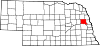
Villages Townships Unincorporated
communityAmes | Centerville
Categories:- Cities in Nebraska
- Populated places in Dodge County, Nebraska


Wikimedia Foundation. 2010.