- City of Keilor
-
This article is about a former local government area. For the suburb, see Keilor, Victoria.
City of Keilor
Victoria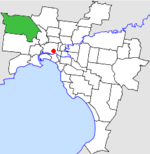
Location in MelbournePopulation: 110,500 (1992)[1] Established: 1863 Area: 99.70 km² (38.5 sq mi) Council Seat: Keilor Region: Melbourne County: Bourke LGAs around City of Keilor: Melton Bulla Broadmeadows Melton City of Keilor Essendon Melton Sunshine Sunshine  Final logo used by the City of Keilor
The City of Keilor was a Local Government Area located about 13 kilometres (8 mi) northwest of Melbourne, the state capital of Victoria, Australia. The city covered an area of 99.70 square kilometres (38.49 sq mi), and existed from 1863 until 1994.
Contents
History
Keilor was first incorporated as a district on 3 March 1863. It became a Shire on 22 December 1871, and was proclaimed a City on 29 April 1961.[2] Its boundaries were relatively stable throughout its existence.
On 15 December 1994, along with nearly all other councils in Victoria, the City of Keilor was abolished, and its area was divided by the Maribyrnong River and the freight railway—the eastern section merging with Essendon to form the City of Moonee Valley, and the western section merging with parts of Sunshine (including St Albans) to form the City of Brimbank. Melbourne Airport and a small section of Tullamarine north of Sharps Road was transferred to the City of Hume.[3]
Wards
Keilor was divided into three wards, each electing three councillors:
- Doutta Galla-Tullamarine Ward
- Maribyrnong Ward
- Niddrie Ward
Suburbs
- Airport West
- Avondale Heights
- Calder Park*
- Essendon West
- Kealba
- Keilor
- Keilor Downs
- Keilor East
- Keilor North
- Keilor Park
- Kings Park
- Melbourne Airport (shared with Shire of Bulla)
- Niddrie
- St Albans (shared with City of Sunshine)
- Sydenham
- Taylors Lakes
- Tullamarine
Population
Year Population 1954 10,681 1958 18,100* 1961 29,519 1966 43,363 1971 55,616 1976 70,587 1981 81,762 1986 93,327 1991 106,076 * Estimate in the 1958 Victorian Year Book.
References
- ^ Australian Bureau of Statistics, Victoria Office (1994). Victorian Year Book. p. 49. ISSN 0067-1223.
- ^ Victorian Municipal Directory. Brunswick: Arnall & Jackson. 1992. pp. 402–403. Accessed at State Library of Victoria, La Trobe Reading Room.
- ^ Australian Bureau of Statistics (1 August 1995). Victorian local government amalgamations 1994-1995: Changes to the Australian Standard Geographical Classification. Commonwealth of Australia. p. 7, 9. ISBN 0-642-23117-6. http://www.ausstats.abs.gov.au/ausstats/free.nsf/0/76E601D6DB55E88ACA25722500049195/$File/12570_1994-95.pdf. Retrieved 2007-12-16.
Former Local Government Areas in Melbourne, Victoria Altona · Berwick · Box Hill · Brighton · Broadmeadows · Brunswick · Bulla (S) · Camberwell · Caulfield · Chelsea · Coburg · Collingwood · Cranbourne · Croydon · Diamond Valley (S) · Doncaster & Templestowe · Dandenong · Eltham (S) · Essendon · Fitzroy · Flinders (S) · Footscray · Frankston · Hastings (S) · Hawthorn · Healesville (S) · Heidelberg · Keilor · Kew · Lillydale (S) · Malvern · Moorabbin · Mordialloc · Mornington (S) · Northcote · Nunawading · Oakleigh · Pakenham (S) · Port Melbourne · Prahran · Preston · Richmond · Ringwood · Sandringham · Sherbrooke (S) · South Melbourne · Springvale · St Kilda · Sunshine · Upper Yarra (S) · Waverley · Werribee · Williamstown
Categories:- Former Local Government Areas of Victoria (Australia)

Wikimedia Foundation. 2010.