- City of Dandenong
-
This article is about a former local government area until 1994. For the present area, see City of Greater Dandenong.
City of Dandenong
Victoria
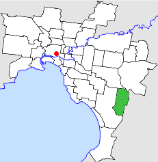
Location in MelbournePopulation: 59,000 (1992)[1] Established: 1955 Area: 36.26 km² (14.0 sq mi) Council Seat: Dandenong Region: Melbourne County: Mornington LGAs around City of Dandenong: Waverley Knox Knox Springvale City of Dandenong Berwick Springvale Springvale Cranbourne  Final logo used by the City of Dandenong
The City of Dandenong was a Local Government Area located about 35 kilometres (22 mi) southeast of Melbourne, the state capital of Victoria, Australia. The city covered an area of 36.26 square kilometres (14.00 sq mi), and existed from 1857 until 1994.
Contents
History
Dandenong was initially part of the Shire of Dandenong, which was first incorporated in 1857 as a district, becoming a shire in 1873. On 31 May 1955, the new Shire of Dandenong was separately incorporated, while the original Shire of Dandenong was renamed Springvale and Noble Park. On 14 May 1959 Dandenong was proclaimed a city.[2]
On 15 December 1994, along with nearly all other councils in Victoria, the City of Dandenong was abolished, and merged into the new City of Greater Dandenong along with nearby sections of Berwick, Springvale, Cranbourne.[3]
Council meetings were held at the Town Hall at Lonsdale Street and Walker Street, Dandenong, but most city business was consucted at the city offices in Clow Street two blocks away. Both locations are still used by the City of Greater Dandenong for their original purpose.
Wards
The City of Dandenong was subdivided into four wards, each electing three councillors:[2]
- North West Ward
- North East Ward
- Centre Ward
- South West Ward
Suburbs
- Dandenong
- Dandenong North
- Dandenong South (split with City of Cranbourne)
- Keysborough (split with City of Springvale)
- Noble Park (split with City of Springvale)
- Noble Park North (split with City of Springvale)
Population
Year Population 1955 27,748 1961 24,909 1966 31,659 1971 40,883 1976 48,444 1981 54,962 1986 56,461 1991 57,275 * Estimate in the 1958 Victorian Year Book.
References
- ^ Australian Bureau of Statistics, Victoria Office (1994). Victorian Year Book. p. 48. ISSN 0067-1223.
- ^ a b Victorian Municipal Directory. Brunswick: Arnall & Jackson. 1992. pp. 356–357, 489–490. Accessed at State Library of Victoria, La Trobe Reading Room.
- ^ Australian Bureau of Statistics (1 August 1995). Victorian local government amalgamations 1994-1995: Changes to the Australian Standard Geographical Classification. Commonwealth of Australia. p. 6. ISBN 0-642-23117-6. http://www.ausstats.abs.gov.au/ausstats/free.nsf/0/76E601D6DB55E88ACA25722500049195/$File/12570_1994-95.pdf. Retrieved 2007-12-16.
Former Local Government Areas in Melbourne, Victoria Altona · Berwick · Box Hill · Brighton · Broadmeadows · Brunswick · Bulla (S) · Camberwell · Caulfield · Chelsea · Coburg · Collingwood · Cranbourne · Croydon · Diamond Valley (S) · Doncaster & Templestowe · Dandenong · Eltham (S) · Essendon · Fitzroy · Flinders (S) · Footscray · Frankston · Hastings (S) · Hawthorn · Healesville (S) · Heidelberg · Keilor · Kew · Lillydale (S) · Malvern · Moorabbin · Mordialloc · Mornington (S) · Northcote · Nunawading · Oakleigh · Pakenham (S) · Port Melbourne · Prahran · Preston · Richmond · Ringwood · Sandringham · Sherbrooke (S) · South Melbourne · Springvale · St Kilda · Sunshine · Upper Yarra (S) · Waverley · Werribee · Williamstown
Categories:- Former Local Government Areas of Victoria (Australia)
Wikimedia Foundation. 2010.