- Cornwall, New York
-
Cornwall Town  Storm King Mountain, Cornwall's best-known landmark.
Name origin: from Cornwall, England Country USA State New York Region Hudson Valley County Orange Landmark Storm King Mountain, Moodna Viaduct River Hudson River Center Downtown traffic circle - elevation 240 ft (73 m) - coordinates 41°26′04″N 74°02′09″W / 41.43444°N 74.03583°W Highest point Southwest town line on Schunemunk Mountain - elevation 1,540 ft (469 m) - coordinates 41°23′52″N 74°06′39″W / 41.39778°N 74.11083°W Lowest point Sea level - location Hudson River Area 28.2 sq mi (73 km2) - land 26.8 sq mi (69 km2) - water 1.3 sq mi (3 km2) Population 12,307 (2000) Density 458.8 / sq mi (177 / km2) Founded 1788 Government - location Town Hall - elevation 240 ft (73 m) - coordinates 41°26′20″N 74°01′42″W / 41.43889°N 74.02833°W Town Supervisor D. Kevin Quigley (R) - Randy Clark (R)
- J. Kerry McGuinness (R)
- Mary Beth Greene-Krafft (R)
- Alexander M. Mazzocca, Sr. (R)
Timezone Eastern (EST) (UTC-5) - summer (DST) EDT (UTC-4) ZIP Code 12518 Area code 845 Exchange 534 FIPS code 36-18300 GNIS feature ID 0978869 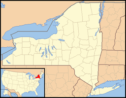
 Location of Cornwall within New York
Wikimedia Commons: Cornwall, New York Website: www.cornwallny.com Cornwall is a town in Orange County, New York, USA. It is located about 50 miles north of New York City on the western shore of the Hudson River. The estimated population in 2007 was 12,827.
Cornwall continues to increase in popularity as a bedroom community for New York City. Commuter rail service is available via the Salisbury Mills-Cornwall train station, operated by NJ Transit, and several other nearby stations on Metro North Railroad.
Cornwall has a distinct walkable downtown along Main Street, including a co-op, gift shops, taverns, restaurants, coffeehouses, yoga studios and boutiques. Government offices, churches, parks, the riverfront, and St. Luke's Cornwall Hospital, a part of the NewYork-Presbyterian Healthcare System, are situated within walking distance of downtown.
While the town is located less than an hour from the George Washington Bridge, major commuter routes like the New York State Thruway and the Palisades Parkway run nearby, but not through the heart of Cornwall. The town is a designated Tree City.
Contents
History
The region was visited by the explorer Henry Hudson in 1609. The first settler, a Scotsman, named McGregor, arrived in 1684. In 1685, the future town was part of the Governor Dongan Tract.
The Town of Cornwall was founded in 1788.
The nineteenth century
In the mid-19th century, Cornwall took on another personality – a health retreat. Until the early 20th century, city folk flocked to the Valley to experience the therapeutic powers they believed it to hold. The mountains, fresh air and evergreen forests were thought to offer the perfect conditions for good health and they were not far from the city. Cornwall on the west side of the Hudson became especially popular as a health retreat, offering numerous boarding houses and many conveniences of the day, including accessibility to the railroad and steamboats, as well as a telegraph office and large library. Nathaniel Parker Willis, one of the Knickerbocker writers, enjoyed the time he spent here so much he bought property in Cornwall, establishing a country home he called Idlewild. His many writings on the area helped make Cornwall a popular spot for health-seekers.
Shifting attitudes toward a more healthy lifestyle began to make the Hudson Valley popular for outdoor activities and exercise. Hiking, rowing, swimming, fishing, hunting and biking all contributed to the development in the area of summer camps as well as the notion of the summer vacation.
An environmental issue
In 1962, a 17-year legal battle began that launched modern-day environmental activism. Consolidated Edison proposed building a giant hydro-electric plant on the river at Storm King Mountain near Cornwall. Despite pressure from local residents, Con Ed went forward with its plan, applying to the Federal Power Commission for a license to operate such a facility. Three years later, after hearings and appeals and more hearings, the U. S. Court of Appeals set a major precedent when it sent the case back to the FPC to start the process over again. Its reasoning was based on the commission's refusal to hear much of the environmental impact testimony the first time around. For the first time in U.S. history, a court had decided that protection of natural resources was just as important as economic gain. It prompted Congress to pass the National Environmental Policy Act in 1969, which requires an environmental impact study on all major projects needing an OK from the federal government.
Past residents of note
- Djuna Barnes, author of Nightwood was born in a log cabin on Storm King Mountain in Cornwall in 1892.
- Olympic speed skater Bonnie Blair was born in Cornwall on March 18, 1964.
- Rob Cohen, motion picture director and producer, was born in Cornwall on March 12, 1949.
- William Frederick Hoppe (1887–1959), billiards champion, was a native.
- David Petraeus, four-star general, graduated from Cornwall Central High School in 1970.
- Whit Stillman (born John Whitney Stillman in Washington, D.C., on January 25, 1952), an Academy Award–nominated American writer-director, grew up in Cornwall.
- Shea Farrell, Actor and Producer noted for playing Mark Danning in the television show Hotel created by Aaron Spelling
- Nathaniel Parker Willis, was an American author and editor who is associated with notable American writers including Harriet Ann Jacobs and Edgar Allan Poe. In 1846 Willis settled on an estate bordered to the north by Moodna Creek, naming his new home Idlewild. Because of failing health he spent the remainder of his life chiefly in retirement. The site of his property has since been used for housing, with Idlewild Avenue and Idlewild Park Drive, Cornwall-on-Hudson, commemorating his choice of name.
 Much of the town can be seen from near its highest point on the northeast ridge of Schunemunk Mountain
Geography
The town is located 52 miles (84 km) north of New York City, and just 5 miles (9 km) north of the United States Military Academy at West Point, in eastern Orange County. It is shaped like an irregular pentagon pointing southwards. According to the United States Census Bureau, the town has a total area of 28.2 square miles (73 km2), of which, 26.8 square miles (69 km2) of it is land and 1.3 square miles (3.4 km2) of it (4.76%) is water.
Cornwall's terrain is quite diverse, with considerable relief. It is shaped by the valleys of Moodna and Woodbury creeks, and includes estuarine salt marshes, heavily-developed residential and commercial areas, rolling farms, and rocky, scrub-covered ridges and mountaintops. There are two major protected areas mostly within the town, Storm King State Park and the privately-managed Black Rock Forest.
 Downtown Cornwall
The most level section is in the northeast corner, east of the curve of US 9W, sloping gently to the river, where it borders on the towns of Fishkill and Philipstown in Dutchess and Putnam counties respectively, across the river. Here is located the village of Cornwall on Hudson, and the most developed section of the town proper, the area usually meant by Cornwall, just to the southwest of the village. To its west lies another residential area, Firthcliffe, named for the carpet factory once located here along the banks of Moodna Creek. Much of the town's population is concentrated in the village and this area.
In its south section, Cornwall on Hudson rises to the high area known as Deer Hill, a foothill to Storm King Mountain to its immediate south. South of Storm King the town's southeast boundary, with Highlands, leaves the river just north of Crow's Nest and runs through Storm King State Park, taking in most of Black Rock Forest. It turns more southerly, taking in the northwestern sliver of the United States Military Academy Reservation before reaching Cornwall's southernmost point, its tripoint with Highlands and the town and village of Woodbury.
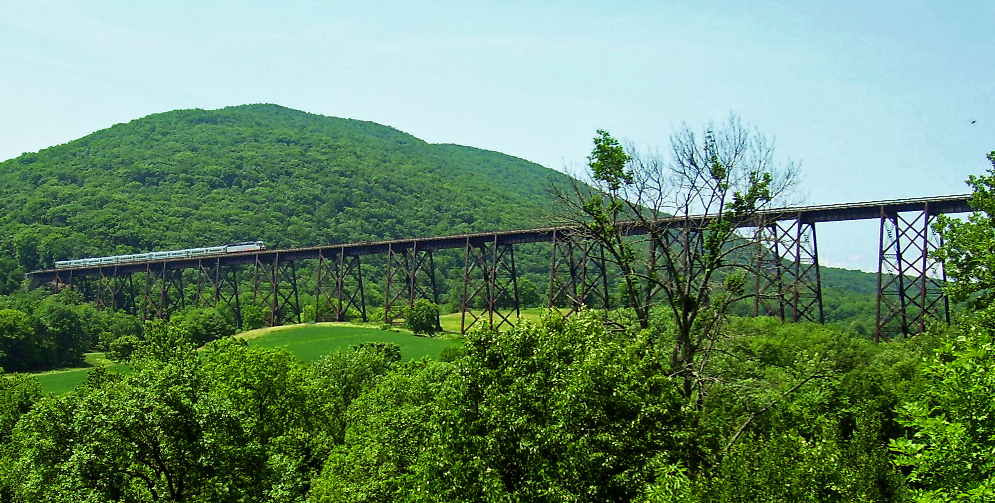
 The Moodna Viaduct
This area of town is also mountainous and rugged, with the border descending along a northwesterly line to the narrow Woodbury Creek valley, where NY 32 and the New York State Thruway enter the town. At the valley's mouth, where Woodbury Creek drains into Moodna Creek, is the small hamlet of Mountainville, with its own fire district and ZIP Code. It gets its name from Schunemunk Mountain, where the town line climbs the northern end of Schunemunk, reaching the town's highest elevation at 1,540 feet (470 m) at the tripoint with Woodbury and Blooming Grove.
Just past Schunemunk's western ridge, the town line reaches another corner and changes course to due north. This takes in the rural, rolling countryside between the mountain and Salisbury Mills, where Storm King Art Center is located and the Moodna Viaduct, the highest and longest railroad trestle east of the Mississippi River, spans the valley between Schunemunk and the Salisbury Mills-Cornwall station on the Metro-North Port Jervis Line. This trestle was shown in the 2007 film Michael Clayton and is a well known landmark. NY 94 runs through this section of town.
The town's northeast corner is another tripoint, with Blooming Grove and New Windsor, located in the middle of Beaverdam Lake. From there the New Windsor boundary runs east, trending slightly to the north, just south of the hamlet of Vails Gate back to the salt marshes where the Moodna drains into the Hudson.
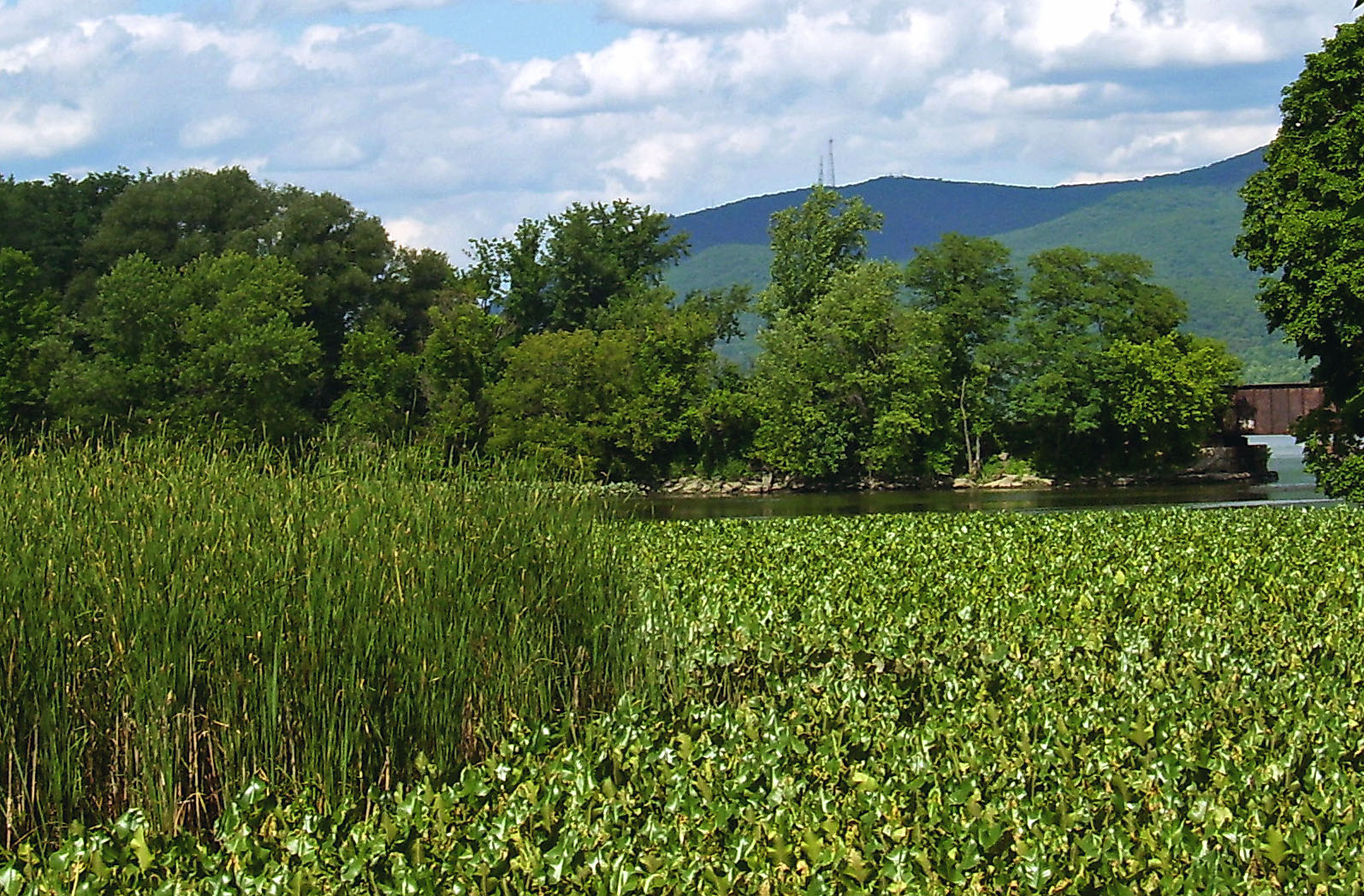
 Moodna Creek estuary
 Mountainville
Communities and locations in Cornwall
- Beaver Dam Lake – A lake partly inside the northwest corner of the town.
- Cornwall-on-Hudson is in the eastern part of the town.
- Cornwall Landing – A community east of Cornwall on Hudson, next to the Hudson River.
- Firthcliffe – A hamlet west of Cornwall on Hudson on US-9W..
- Firthcliffe Heights – A hamlet by the north town line.
- Meadowbrook – A hamlet near the town line, west of Cornwall on Hudson on NY-94.
- Mountainville – A hamlet located along NY 32 in the western part of town
- Orrs Mill – A hamlet south of Firthcliffe.
- Salisbury Mills – Part of the hamlet of Salisbury is within the west town line. The hamlet is also in the Town of Blooming Grove.
- Storm King State Park – A state park by the Hudson River.
- West Cornwall – A hamlet south of Firthecliffe, by the NY State Thruway.
- Museum of the Hudson Highlands – A park and Museum eatering preserved fishes, reptiles and amphibians as well as live animals, Indian artifacts and geological specimens indigenous to the Hudson Valley. Hiking trails, interpretive and live animal exhibits, a Tall Grass Prairie and a regional artists' gallery are also found at the museum.
- The Storm King Art Center – Located in Mountainville, near Cornwall, is an art museum and outdoor sculpture park featuring the work of 20th century American and European artists. Visitors stroll the 200 acres (0.81 km2) near Storm King Mountain to view the work.
References
External links
Municipalities and communities of Orange County, New York Cities 
Towns Blooming Grove | Chester | Cornwall | Crawford | Deerpark | Goshen | Greenville | Hamptonburgh | Highlands | Minisink | Monroe | Montgomery | Mount Hope | New Windsor | Newburgh | Tuxedo | Wallkill | Warwick | Wawayanda | Woodbury
Villages Chester | Cornwall-on-Hudson | Florida | Goshen | Greenwood Lake | Harriman | Highland Falls | Kiryas Joel | Maybrook | Monroe | Montgomery | Otisville | South Blooming Grove | Tuxedo Park | Unionville | Walden | Warwick | Washingtonville | Woodbury
CDPs Other
hamletsAmity | Arden | Bellvale | Bullville | Circleville | Howells | Little Britain | Michigan Corners | Mountain Lodge Park | Mountainville | New Hampton | Pine Island | Ridgebury | Slate Hill | Sugar Loaf | Thompson Ridge | Westbrookville
Categories:- Towns in New York
- Cornwall, New York
- Populated places on the Hudson River
- Poughkeepsie–Newburgh–Middletown metropolitan area


Wikimedia Foundation. 2010.