- Nida, Oklahoma
-
Nida — Unincorporated community — Location within the state of Oklahoma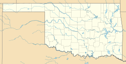
 Nida
NidaCoordinates: 34°08′35″N 96°29′56″W / 34.14306°N 96.49889°WCoordinates: 34°08′35″N 96°29′56″W / 34.14306°N 96.49889°W Country United States State Oklahoma County Johnston Time zone Central (CST) (UTC-6) – Summer (DST) CDT (UTC-5) ZIP codes FIPS code GNIS feature ID Nida is an unincorporated community in Johnston County, Oklahoma, United States, along State Highway 22. It is the nearest community to Fort Washita, a National Historic Landmark.
Municipalities and communities of Johnston County, Oklahoma City 
Towns Bromide‡ | Mannsville | Milburn | Mill Creek | Ravia | Wapanucka
Unincorporated
communitiesBee | Bromide Junction | Coleman | Connerville | Earl | Emet | Fillmore | Folsom | Nida | Pontotoc | Reagan | Russett | Troy
Footnotes ‡This populated place also has portions in an adjacent county or counties
National Register of Historic Places in Bryan County, Oklahoma Achille Bloomfield Academy Site

Bokchito Caddo Caddo Community Building
Colbert Durant Bryan County Courthouse · Durant Downtown Historic District · Robert E. Lee School · Oklahoma Presbyterian College · State Highway No. 78 Bridge at the Red River · Robert Lee Williams Public Library · J. L. Wilson Building · Carriage Point (Fisher's Station) · Roberta School Campus
Kenefic Fort McCulloch · Nail's Station
Nida Categories:- Oklahoma geography stubs
- Populated places in Johnston County, Oklahoma
- Unincorporated communities in Oklahoma


Wikimedia Foundation. 2010.