- Cross Roads, Texas
-
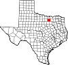
Cross Roads, Texas — Town — Location of Cross Roads in Denton County, Texas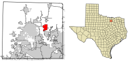
Coordinates: 33°13′55″N 97°0′7″W / 33.23194°N 97.00194°WCoordinates: 33°13′55″N 97°0′7″W / 33.23194°N 97.00194°W Country United States State Texas County Denton Area – Total 6.9 sq mi (17.8 km2) – Land 6.9 sq mi (17.8 km2) – Water 0.0 sq mi (0.0 km2) Elevation 633 ft (193 m) Population (2000) – Total 603 – Density 87.7/sq mi (33.9/km2) Time zone Central (CST) (UTC-6) – Summer (DST) CDT (UTC-5) ZIP code 76227 Area code(s) 940 FIPS code 48-17852[1] GNIS feature ID 1388194[2] Cross Roads is a town in Denton County, Texas, United States. The population was 603 at the 2000 census.
Contents
Geography
Cross Roads is located at 33°13′55″N 97°0′7″W / 33.23194°N 97.00194°W (33.231976, -97.001918)[3].
According to the United States Census Bureau, the town has a total area of 6.9 square miles (18 km2), all of it land.
Demographics
As of the census[1] of 2000, there were 603 people, 228 households, and 178 families residing in the town. The population density was 87.7 people per square mile (33.8/km²). There were 241 housing units at an average density of 35.0 per square mile (13.5/km²). The racial makeup of the town was 92.54% White, 0.66% African American, 1.16% Native American, 0.33% Asian, 4.81% from other races, and 0.50% from two or more races. Hispanic or Latino of any race were 8.29% of the population.
There were 228 households out of which 30.3% had children under the age of 18 living with them, 69.7% were married couples living together, 5.7% had a female householder with no husband present, and 21.9% were non-families. 15.4% of all households were made up of individuals and 7.9% had someone living alone who was 65 years of age or older. The average household size was 2.64 and the average family size was 2.90.
In the town the population was spread out with 21.1% under the age of 18, 6.1% from 18 to 24, 30.2% from 25 to 44, 31.2% from 45 to 64, and 11.4% who were 65 years of age or older. The median age was 42 years. For every 100 females there were 101.0 males. For every 100 females age 18 and over, there were 95.1 males.
The median income for a household in the town was $72,031, and the median income for a family was $93,510. Males had a median income of $61,827 versus $31,750 for females. The per capita income for the town was $42,664. About 2.5% of families and 3.8% of the population were below the poverty line, including 4.5% of those under age 18 and 2.5% of those age 65 or over.
Education
Cross Roads is served by Aubrey Independent School District (in parts of northern Cross Roads) and Denton Independent School District (in the rest of the city).
References
- ^ a b "American FactFinder". United States Census Bureau. http://factfinder.census.gov. Retrieved 2008-01-31.
- ^ "US Board on Geographic Names". United States Geological Survey. 2007-10-25. http://geonames.usgs.gov. Retrieved 2008-01-31.
- ^ "US Gazetteer files: 2010, 2000, and 1990". United States Census Bureau. 2011-02-12. http://www.census.gov/geo/www/gazetteer/gazette.html. Retrieved 2011-04-23.
External links
- Town of Cross Roads - Official site.
Municipalities and communities of Denton County, Texas Cities Argyle | Aubrey | Carrollton‡ | Celina‡ | Coppell‡ | Corinth | Dallas‡ | Denton | Fort Worth‡ | Frisco‡ | Grapevine‡ | Haslet‡ | Highland Village | Justin | Krugerville | Krum | Lake Dallas | Lakewood Village | Lewisville‡ | Oak Point | Pilot Point | Plano‡ | Roanoke | Sanger | Southlake‡ | The Colony
Towns Bartonville | Copper Canyon | Corral City | Cross Roads | DISH | Double Oak | Flower Mound‡ | Hackberry | Hebron‡ | Hickory Creek | Lincoln Park | Little Elm | Northlake | Ponder | Prosper‡ | Providence Village | Shady Shores | Trophy Club‡ | Westlake‡
Unincorporated
communitiesAlliance‡ | Bolivar | Lantana | Navo | Paloma Creek | Savannah
Ghost towns Alton | Elizabethtown | Mustang
Footnotes ‡This populated place also has portions in an adjacent county or counties
Categories:- Dallas – Fort Worth Metroplex
- Populated places in Denton County, Texas
- Towns in Texas


Wikimedia Foundation. 2010.