- Dayton, Virginia
-
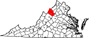
Dayton, Virginia — Town — Main Street, Dayton Location of Dayton, Virginia
Coordinates: 38°24′59″N 78°56′22″W / 38.41639°N 78.93944°WCoordinates: 38°24′59″N 78°56′22″W / 38.41639°N 78.93944°W Country United States State Virginia County Rockingham Incorporated 1879 Government – Mayor William W. "Buddy" Farris, Jr. Area – Total 0.8 sq mi (2.1 km2) – Land 0.8 sq mi (2.1 km2) – Water 0.0 sq mi (0.0 km2) Elevation 1,204 ft (367 m) Population (2009 U.S. Census estimate) – Total 1,360 – Density 1,700/sq mi (647.6/km2) Time zone Eastern (EST) (UTC-5) – Summer (DST) EDT (UTC-4) ZIP code 22821 Area code(s) 540 FIPS code 51-21648[1] GNIS feature ID 1492844[2] Website www.daytonva.us/ Dayton is a town in Rockingham County, Virginia, United States. The 2009 population estimate was 1,360.[3] It is included in the Harrisonburg, Virginia Metropolitan Statistical Area.
Contents
Geography
Dayton is located at 38°24′59″N 78°56′22″W / 38.41639°N 78.93944°W (38.416323, -78.939440)[4]. The town is approximately two miles southwest of Harrisonburg and two miles northeast of Bridgewater.
According to the United States Census Bureau, the town has a total area of 0.8 square miles (2.1 km²), all of it land.
History
The town of Dayton is one of the oldest settled communities in Rockingham County, and is the county's second oldest incorporated town, after Bridgewater. The first settler in Dayton was Daniel Harrison (c. 1702-1770), whose family settled along Cooks Creek, north of downtown. Daniel was the brother of Thomas Harrison, founder of Harrisonburg. The two-story stone house has been owned and maintained since 1977 by a private, non-profit organization, Fort Harrison, Inc.[5] The town was known as Rifeville or Rifetown[6] until 1833.[7]
Shenandoah University has its roots in Dayton, when it was known as the Shenandoah College and Conservatory of Music. The college was organized in 1875 under the leadership of Rev. A.P. Funkhouser. This was a major institution in Dayton until 1960, when it moved to Winchester. College Street was named after the school and many of the street's buildings served as part of the campus.[8]
Demographics
As of the census[1] of 2000, there were 1,344 people, 542 households, and 383 families residing in the town. The population density was 1,657.2 people per square mile (640.6/km²). There were 565 housing units at an average density of 696.6 per square mile (269.3/km²). The racial makeup of the town was 94.20% White, 0.67% African American, 0.37% Asian, 2.90% from other races, and 1.86% from two or more races. Hispanic or Latino of any race were 6.62% of the population.
There were 542 households out of which 31.5% had children under the age of 18 living with them, 57.6% were married couples living together, 7.7% had a female householder with no husband present, and 29.2% were non-families. 24.9% of all households were made up of individuals and 9.8% had someone living alone who was 65 years of age or older. The average household size was 2.48 and the average family size was 2.97.
In the town the population was spread out with 24.1% under the age of 18, 6.8% from 18 to 24, 33.6% from 25 to 44, 19.9% from 45 to 64, and 15.6% who were 65 years of age or older. The median age was 37 years. For every 100 females there were 98.2 males. For every 100 females age 18 and over, there were 96.5 males.
The median income for a household in the town was $35,958, and the median income for a family was $44,732. Males had a median income of $30,109 versus $23,906 for females. The per capita income for the town was $17,600. About 3.5% of families and 8.1% of the population were below the poverty line, including 9.7% of those under age 18 and 7.5% of those age 65 or over.
References
- ^ a b "American FactFinder". United States Census Bureau. http://factfinder.census.gov. Retrieved 2008-01-31.
- ^ "US Board on Geographic Names". United States Geological Survey. 2007-10-25. http://geonames.usgs.gov. Retrieved 2008-01-31.
- ^ http://factfinder.census.gov/servlet/SAFFPopulation?_event=ChangeGeoContext&geo_id=16000US5121648&_geoContext=&_street=&_county=dayton%2C+va&_cityTown=dayton%2C+va&_state=&_zip=&_lang=en&_sse=on&ActiveGeoDiv=&_useEV=&pctxt=fph&pgsl=010&_submenuId=population_0&ds_name=null&_ci_nbr=null&qr_name=null®=null%3Anull&_keyword=&_industry=
- ^ "US Gazetteer files: 2010, 2000, and 1990". United States Census Bureau. 2011-02-12. http://www.census.gov/geo/www/gazetteer/gazette.html. Retrieved 2011-04-23.
- ^ http://www.virginia.org/site/description.asp?attrid=33160
- ^ http://www.rootsweb.ancestry.com/~varockbr/vatown.htm#Virginiatowns
- ^ http://www.daytonva.us/history.htm
- ^ http://www.daytonva.us/history.htm
Municipalities and communities of Rockingham County, Virginia Towns Bridgewater | Broadway | Dayton | Elkton | Grottoes‡ | Mount Crawford | Timberville
CDPs Belmont Estates | Massanetta Springs | Massanutten
Unincorporated
communitiesBergton | Berrytown | Briery Branch | Clover Hill | Cootes Store | Criders | Cross Keys | Dale Enterprise | Edom | Fulks Run | Hinton | Inglewood | Keezletown | Lacey Spring | Linville | Lilly | Mauzy | Mayland | McGaheysville | Mechanicsville | Montezuma | Mount Clinton | Ottobine | Penn Laird | Pleasant Valley | Port Republic | Rawley Springs | Singers Glen | Stemphleytown | Tenth Legion | Turleytown | Yankeetown
Footnotes ‡This populated place also has portions in an adjacent county or counties
Categories:- Populated places in Rockingham County, Virginia
- Towns in Virginia
- Harrisonburg metropolitan area


Wikimedia Foundation. 2010.