- National Register of Historic Places listings in Greenbrier County, West Virginia
-
 Location of Greenbrier County in West Virginia
This is a list of the National Register of Historic Places listings in Greenbrier County, West Virginia.
This is intended to be a complete list of the properties and districts on the National Register of Historic Places in Greenbrier County, West Virginia, United States. The locations of National Register properties and districts for which the latitude and longitude coordinates are included below, may be seen in a Google map.[1]
There are 41 properties and districts listed on the National Register in the county, one of which is a National Historic Landmark.
-
- This National Park Service list is complete through NPS recent listings posted November 10, 2011.[2]
Contents: Counties in West Virginia Barbour - Berkeley - Boone - Braxton - Brooke - Cabell - Calhoun - Clay - Doddridge - Fayette - Gilmer - Grant - Greenbrier - Hampshire - Hancock - Hardy - Harrison - Jackson - Jefferson - Kanawha - Lewis - Lincoln - Logan - Marion - Marshall - Mason - McDowell - Mercer - Mineral - Mingo - Monongalia - Monroe - Morgan - Nicholas - Ohio - Pendleton - Pleasants - Pocahontas - Preston - Putnam - Raleigh - Randolph - Ritchie - Roane - Summers - Taylor - Tucker - Tyler - Upshur - Wayne - Webster - Wetzel - Wirt - Wood - Wyoming
Current listings
[3] Landmark name Image Date listed Location City or town Summary 1 Alderson Bridge 
December 4, 1991 Monroe St. across the Greenbrier River
37°43′29″N 80°38′36″W / 37.724722°N 80.643333°WAlderson 2 Alderson Historic District 
November 12, 1993 Roughly along Monroe St., Riverview Dr., Railroad Ave., and adjacent streets
37°43′29″N 80°38′32″W / 37.724722°N 80.642222°WAlderson 3 Alexander W. Arbuckle I House May 3, 1976 2 miles north of Lewisburg on Arbuckle Lane
37°51′41″N 80°25′24″W / 37.861389°N 80.423333°WLewisburg 4 Argabrite House April 16, 2009 504 Virginia St.
37°43′47″N 80°38′11″W / 37.729761°N 80.636494°WLewisburg 5 Blue Bend Forest Camp April 20, 1994 4 miles west of WV 92 on Alvon-Blue Bend-Anthony Rd., County Route 16/2
37°55′14″N 80°16′06″W / 37.920556°N 80.268333°WAlvon 6 Blue Sulphur Springs Pavilion October 29, 1992 County Route 25, 9 miles north of Alderson
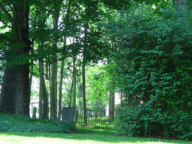
37°49′42″N 80°38′30″W / 37.828333°N 80.641667°WBlue Sulphur Springs 7 Confederate Cemetery at Lewisburg 
February 2, 1988 Maple St. and U.S. Route 60, Library Park
37°48′07″N 80°27′06″W / 37.801944°N 80.451667°WLewisburg 8 David S. Creigh House November 12, 1975 Southwest of Lewisburg off the Davis-Stuart Rd.
37°46′14″N 80°28′33″W / 37.770556°N 80.475833°WLewisburg 9 Deitz Farm April 17, 1992 Junction of County Routes 28 and 60/32
37°54′34″N 80°40′10″W / 37.909444°N 80.669444°WMeadow Bluff 10 Elmhurst June 5, 1975 U.S. Route 60 at the Greenbrier River
37°46′50″N 80°23′47″W / 37.780556°N 80.396389°WCaldwell 11 Greenbrier County Courthouse and Lewis Spring 
August 17, 1973 Corner of Court and Randolph Sts.
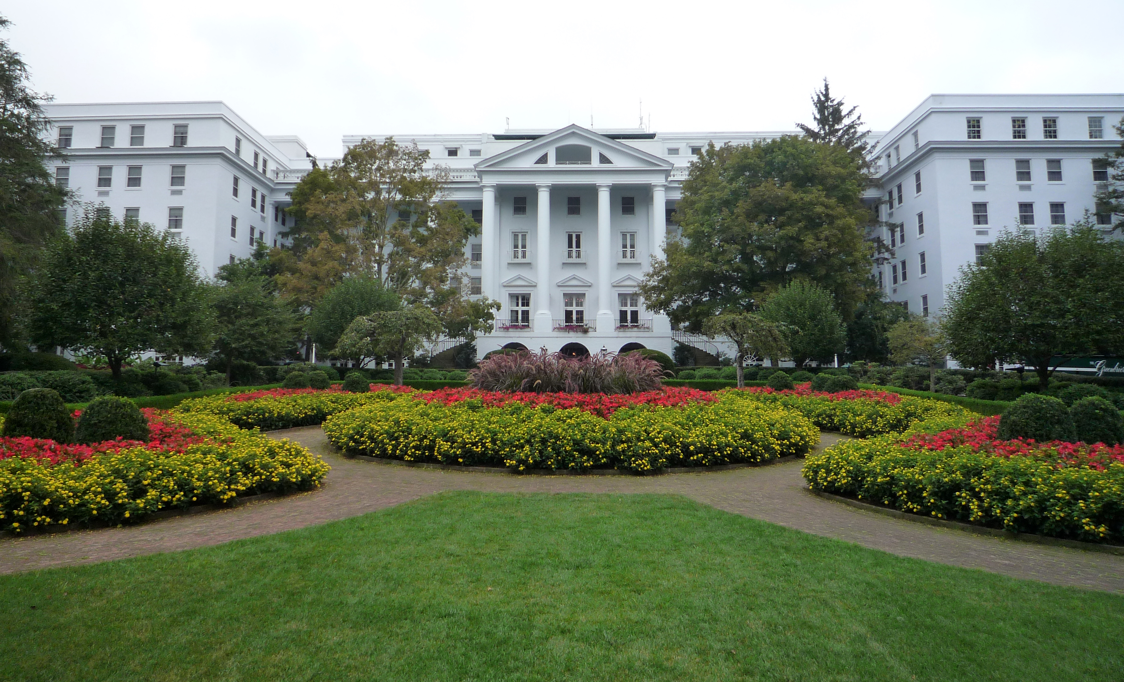
37°48′11″N 80°26′46″W / 37.803056°N 80.446111°WLewisburg 12 The Greenbrier 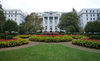
October 9, 1974 Off U.S. Route 60
37°47′41″N 80°20′09″W / 37.794722°N 80.335833°WWhite Sulphur Springs 13 Hartland June 10, 1975 2 miles west of Lewisburg on Houfnaggle Rd.
37°48′06″N 80°28′29″W / 37.801667°N 80.474722°WLewisburg 14 Herns Mill Covered Bridge 
June 4, 1981 County Route 40 near its junction with County Route 60/11
37°49′57″N 80°30′18″W / 37.8325°N 80.505°WLewisburg 15 Hokes Mill Covered Bridge 
June 4, 1981 County Route 62 at Hokes Mill crossing of Second Creek
37°41′50″N 80°31′30″W / 37.697222°N 80.525°WRonceverte 16 Homeplace January 17, 2008 U.S. Route 219 North
37°54′43″N 80°22′55″W / 37.911944°N 80.381944°WFrankford 17 Hopkins Mountain Historic District April 14, 1994 Along Forest Road 139 (Hopkins Mountain Rd), north of County Road 16/2 (Alvon-Blue Bend-Anthony Road), approximately 4 miles west of WV 92
37°57′08″N 80°15′52″W / 37.952222°N 80.264444°WAlvon 18 John Wesley Methodist Church June 5, 1974 E. Foster St.
37°47′58″N 80°26′42″W / 37.799444°N 80.445°WLewisburg 19 Lewisburg Historic District 
July 7, 1978 Irregular pattern along U.S. Routes 60 and 219
37°49′22″N 80°26′07″W / 37.822778°N 80.435278°WLewisburg 20 Maple Street Historic District April 6, 1988 107-121 Maple St.
37°48′17″N 80°27′00″W / 37.804722°N 80.45°WLewisburg 21 Meadow River Lumber Building November 13, 1997 U.S. Route 219 South at State Fair of West Virginia
37°46′39″N 80°27′45″W / 37.7775°N 80.4625°WFairlea 22 Alexander McVeigh Miller House December 15, 1978 Hemlock Ave.
37°43′53″N 80°38′05″W / 37.731389°N 80.634722°WAlderson 23 Morlunda March 25, 1977 Northwest of Lewisburg on County Route 40
37°49′54″N 80°29′28″W / 37.831667°N 80.491111°WLewisburg 24 Mountain Home November 28, 1980 Southwest of White Sulphur Springs on U.S. Route 60
37°46′24″N 80°21′10″W / 37.773333°N 80.352778°WWhite Sulphur Springs 25 Mt. Tabor Baptist Church December 12, 1976 Court and Foster Sts.
37°48′06″N 80°26′51″W / 37.801667°N 80.4475°WLewisburg 26 John A. North House October 9, 1974 100 Church St.
37°48′11″N 80°26′55″W / 37.803056°N 80.448611°WLewisburg 27 Oakhurst Links December 4, 2001 1 Montague Dr.
37°49′41″N 80°16′47″W / 37.828056°N 80.279722°WWhite Sulphur Springs 28 Old Stone Church 
February 23, 1972 Church and Foster Sts.
37°48′04″N 80°26′55″W / 37.801111°N 80.448611°WLewisburg 29 Organ Cave 
May 5, 2005 WV 63, 0.5 miles east of its junction with U.S. Route 219
37°43′12″N 80°26′09″W / 37.72°N 80.435833°WRonceverte 30 Gov. Samuel Price House June 20, 1975 224 N. Court St.
37°48′15″N 80°26′39″W / 37.804167°N 80.444167°WLewisburg 31 Renick Farm 
April 4, 1997 U.S. Route 219 near its junction with County Route 9
37°59′00″N 80°21′04″W / 37.983333°N 80.351111°WRenick 32 Ronceverte Historic District 
May 6, 2005 Roughly along Main St., Pocahontas, Monroe, and Greenbrier Avenues
37°45′00″N 80°28′03″W / 37.75°N 80.4675°WRonceverte 33 Sam Black Church 
March 5, 1999 U.S. Route 60 at its junction with County Route 60/5
37°53′55″N 80°37′50″W / 37.898611°N 80.630556°WSmoot 34 South Church Street Historic District February 2, 1988 S. Church St.
37°47′55″N 80°27′11″W / 37.798611°N 80.453056°WLewisburg 35 Stone Manse April 15, 2004 County Route 38 (Stonehouse Rd.)
37°47′52″N 80°22′45″W / 37.797778°N 80.379167°WCaldwell 36 Stuart Manor July 27, 1973 Southwest of Lewisburg off U.S. Route 219
37°45′58″N 80°29′59″W / 37.766111°N 80.499722°WLewisburg 37 Supreme Court Library Building February 23, 1972 U.S. Route 60 West and Courtney Dr.
37°48′12″N 80°26′53″W / 37.803333°N 80.448056°WLewisburg 38 Tuckwiller Tavern March 4, 1975 2 miles northwest of Lewisburg on U.S. Route 60
37°49′21″N 80°28′45″W / 37.8225°N 80.479167°WLewisburg 39 Tuscawilla December 19, 1979 South of Lewisburg off U.S. Route 219
37°47′00″N 80°27′00″W / 37.783333°N 80.45°WLewisburg 40 James Withrow House December 31, 1974 200 N. Jefferson St.
37°48′14″N 80°26′36″W / 37.803889°N 80.443333°WLewisburg 41 James Wylie House February 5, 1990 208 E. Main St.
37°47′48″N 80°17′52″W / 37.796667°N 80.297778°WWhite Sulphur Springs See also
- List of National Historic Landmarks in West Virginia
- National Register of Historic Places listings in West Virginia
References
- ^ The latitude and longitude information provided in this table was derived originally from the National Register Information System, which has been found to be fairly accurate for about 99% of listings. For about 1% of NRIS original coordinates, experience has shown that one or both coordinates are typos or otherwise extremely far off; some corrections may have been made. A more subtle problem causes many locations to be off by up to 150 yards, depending on location in the country: most NRIS coordinates were derived from tracing out latitude and longitudes off of USGS topographical quadrant maps created under North American Datum of 1927, which differs from the current, highly accurate GPS system used by Google maps. Chicago is about right, but NRIS longitudes in Washington are higher by about 4.5 seconds, and are lower by about 2.0 seconds in Maine. Latitudes differ by about 1.0 second in Florida. Some locations in this table may have been corrected to current GPS standards.
- ^ "National Register of Historic Places: Weekly List Actions". National Park Service, United States Department of the Interior. Retrieved on November 10, 2011.
- ^ Numbers represent an ordering by significant words. Various colorings, defined here, differentiate National Historic Landmark sites and National Register of Historic Places Districts from other NRHP buildings, structures, sites or objects.
U.S. National Register of Historic Places in West Virginia Lists by county Barbour • Berkeley • Boone • Braxton • Brooke • Cabell • Calhoun • Clay • Doddridge • Fayette • Gilmer • Grant • Greenbrier • Hampshire • Hancock • Hardy • Harrison • Jackson • Jefferson • Kanawha • Lewis • Lincoln • Logan • Marion • Marshall • Mason • McDowell • Mercer • Mineral • Mingo • Monongalia • Monroe • Morgan • Nicholas • Ohio • Pendleton • Pleasants • Pocahontas • Preston • Putnam • Raleigh • Randolph • Ritchie • Roane • Summers • Taylor • Tucker • Tyler • Upshur • Wayne • Webster • Wetzel • Wirt • Wood • Wyoming

Other lists Keeper of the Register • History of the National Register of Historic Places • Property types • Historic district • Contributing property Municipalities and communities of Greenbrier County, West Virginia County seat: Lewisburg Cities 
Towns Alderson‡ | Falling Spring | Quinwood | Rainelle | Rupert
CDP Other
communitiesAlta | Alvon | Anjean | Anthony | Asbury | Auto | Bellburn | Bingham | Blaker Mills | Blue Bend | Blue Sulphur Springs | Bowes | Brantville | Burdette | Caldwell | Charmco | Clearco | Clendenenville | Clintonville | Cobb | Cordova | Cornstalk | Crag | Crawley | Crichton | Dawson | Dennis | Dickson | Droop Mountain | Duo | Esty | Farmdale | Fort Donnally | Fort Spring | Frankford | Frazier | Friars Hill | Gardner | Golden | Grassy Meadows | Half Way | Henning | Hickory Grove | Hines | Hokes Mill | Hopper | Horrock | Hughart | Julia | Keister | Kessler | Kieffer | Lawn | Leonard | Leslie | Lile | Lilly Park | Loopemount | Loveridge | Mapledale | Marfrance | Maxwelton | McRoss | Meadow Bluff | Modoc | Morlunda | Neola | North Bend | North Caldwell | Nutterville | Organ Cave | Orient Hill | Oscar | Palestine | Patton‡ | Piercys Mill | Renicks Valley | Richlands | Rock Cliff | Rockland | Rorer | Sam Black Church | Shawver‡ | Shawvers Crossing | Shryock | Sims | Smoot | Snowflake | Spring Creek | Sue | Sunlight | Teaberry | Trainer | Trout | Tuckahoe | Unus | Vago | Vale | Whiteoak Grove | Wild Meadow | Williamsburg | Woodman
Ghost towns Alum Springs | Brink | Bryant | Fairview | McClung | Walker Hill | Whitcomb
Footnotes ‡This populated place also has portions in an adjacent county or counties
-


Wikimedia Foundation. 2010.