- National Register of Historic Places listings in Rocky Mountain National Park
-
This is a list of the National Register of Historic Places listings in Rocky Mountain National Park.
This is intended to be a complete list of the properties and districts on the National Register of Historic Places in Rocky Mountain National Park, Colorado, United States. The locations of National Register properties and districts for which the latitude and longitude coordinates are included below, may be seen in a Google map.[1]
There are 46 properties and districts listed on the National Register in the park, one of which is a National Historic Landmark.
-
- This National Park Service list is complete through NPS recent listings posted November 10, 2011.[2]
Current listings
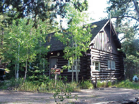
[3] Landmark name[4] Image Date listed Location City or Town Summary 1 Bear Lake Comfort Station 
January 29, 1988 Bear Lake
40°18′44″N 105°38′42″W / 40.31222°N 105.645°WEstes Park 2 Dutchtown January 29, 1988 Ditch Rd.
40°26′16″N 105°52′55″W / 40.43778°N 105.88194°WGrand Lake 3 East Inlet Trail 
February 28, 2005 Rocky Mountain National Park
39°54′37″N 105°44′30″W / 39.91028°N 105.74167°WEstes Park 4 East Longs Peak Trail-Longs Peak Trail-Keyhole Route-Shelf Trail 
July 10, 2007 West of State Highway 7
40°16′20″N 105°36′2″W / 40.27222°N 105.60056°W[5]Allenspark 5 Fall River Entrance Historic District 
January 29, 1988 Fall River Entrance
40°24′11.232″N 105°35′13.452″W / 40.40312°N 105.58707°WEstes Park 6 Fall River Pass Ranger Station 
January 29, 1988 Fall River Pass
40°26′27″N 105°45′13″W / 40.44083°N 105.75361°WEstes Park 7 Fall River Pump House and Catchment Basin 
August 30, 2006 Near the top of Fall River Road in Rocky Mountain National Park
40°26′15″N 105°44′50″W / 40.4375°N 105.74722°WEstes Park 8 Fall River Road 
July 20, 1987 Fall River Rd.
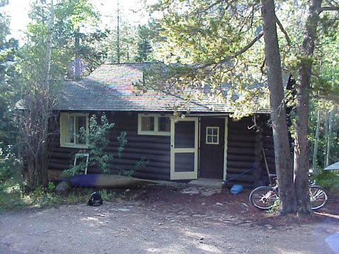
40°25′47″N 105°42′43″W / 40.42972°N 105.71194°WEstes Park 9 Fern Lake Patrol Cabin 
January 29, 1988 Fern Lake
40°20′17″N 105°40′34″W / 40.33806°N 105.67611°WEstes Park 10 Fern Lake Trail 
February 28, 2005 Rocky Mountain National Park
40°20′34″N 105°39′48″W / 40.34278°N 105.66333°WEstes Park 11 Flattop Mountain Trail 
September 27, 2007 Rocky Mountain National Park
40°18′50″N 105°40′42″W / 40.31389°N 105.67833°W[6]Estes Park 12 Gem Lake Trail 
January 29, 2008 North of Devils Gulch Rd. to Gem Lake
40°24′40″N 105°30′13″W / 40.41111°N 105.50361°W[7]Estes Park 13 Glacier Basin Campground Ranger Station 
July 20, 1987 Glacier Basin
40°19′48″N 105°35′40″W / 40.33°N 105.59444°WEstes Park 14 Grand River Ditch 
September 29, 1976 North of Grand Lake
40°25′10″N 105°52′12″W / 40.41944°N 105.87°WGrand Lake 15 Holzwarth Historic District 
December 2, 1977 North of Grand Lake on Trail Ridge Road
40°22′13″N 105°51′28″W / 40.37028°N 105.85778°WGrand Lake 16 Lake Haiyaha Trail March 5, 2008 Roughly along Bear, Nymph, and Dream Lakes, then up Chaos Canyon
40°18′17″N 105°39′44″W / 40.30472°N 105.66222°W[8]Estes Park 17 Leiffer House 
August 2, 1978 South of Estes Park off State Highway 7
40°16′34″N 105°32′42″W / 40.27611°N 105.545°WEstes Park 18 Lost Lake Trail March 5, 2008 Roughly along the North Fork of the Big Thompson River
40°29′56″N 105°33′2″W / 40.49889°N 105.55056°W[9]Estes Park 19 Lulu City Site September 14, 1977 North of Grand Lake on Trail Ridge Rd.
40°26′30″N 105°50′50″W / 40.44167°N 105.84722°WGrand Lake 20 McGraw Ranch 
September 17, 1998 McGraw Ranch Rd.
40°25′53″N 105°30′6″W / 40.43139°N 105.50167°WEstes Park 21 Milner Pass Road Camp Mess Hall and House 
July 20, 1987 Milner Pass Rd.
40°25′2″N 105°48′57″W / 40.41722°N 105.81583°WEstes Park 22 Moraine Lodge 
October 8, 1976 West of Estes Park off U.S. Route 36 on Bear Lake Rd.
40°21′31″N 105°34′59″W / 40.35861°N 105.58306°WEstes Park 23 Moraine Park Museum and Amphitheater 
June 15, 2005 Rocky Mountain National Park
40°21′31″N 105°35′2″W / 40.35861°N 105.58389°WEstes Park 24 North Inlet Trail 
March 5, 2008 Roughly along North Inlet and Hallett Creek to Flattop Mountain
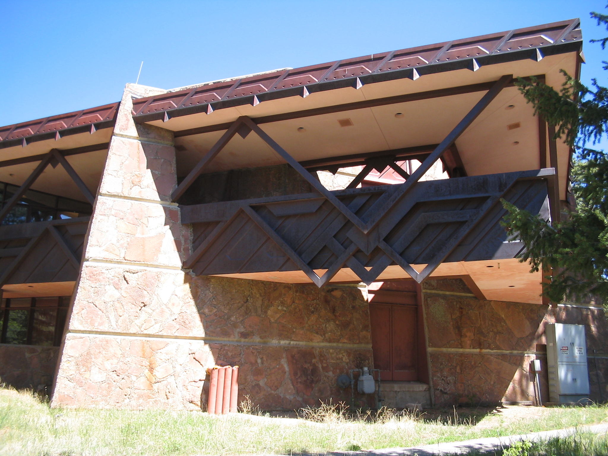
40°15′50″N 105°47′22″W / 40.26389°N 105.78944°W[10]Grand Lake Extends into Grand County 25 Rocky Mountain National Park Administration Building 
January 3, 2001 U.S. Route 36 Estes Park 26 Rocky Mountain National Park Utility Area Historic District 
March 18, 1982 Beaver Meadows Entrance Rd.
40°21′50″N 105°33′38″W / 40.36389°N 105.56056°WEstes Park 27 Shadow Mountain Lookout 
August 2, 1978 Southeast of Grand Lake in Rocky Mountain National Park
40°13′50″N 105°48′52″W / 40.23056°N 105.81444°WGrand Lake 28 Shadow Mountain Trail March 5, 2008 Eastern side of Shadow Mountain Lake
40°13′40″N 105°49′8″W / 40.22778°N 105.81889°W[11]Grand Lake 29 Snogo Snow Plow 
October 4, 2006 Rocky Mountain National Park
40°21′51″N 105°33′34″W / 40.36417°N 105.55944°WEstes Park 30 Thunder Lake Patrol Cabin 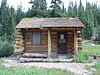
January 29, 1988 Thunder Lake
40°13′20″N 105°38′39″W / 40.22222°N 105.64417°WEstes Park In Rocky Mountain National Park 31 Thunder Lake Trail-Bluebird Lake Trail January 29, 2008 Roughly along the North St. Vrain Creek, west of Wild Basin Ranger Station Allenspark 32 Timber Creek Campground Comfort Station No. 245 
January 29, 1988 Timber Creek Campground
40°22′50″N 105°51′5″W / 40.38056°N 105.85139°WEstes Park 33 Timber Creek Campground Comfort Station No. 247 
January 29, 1988 Timber Creek Campground
40°22′42″N 105°51′5″W / 40.37833°N 105.85139°WEstes Park 34 Timber Creek Road Camp Barn 
July 30, 1987 Approximately 200 yards south of Columbine Lake Rd., 450 yards west of the Kawuneeche Visitor Center
40°22′45″N 105°50′53″W / 40.37917°N 105.84806°WEstes Park 35 Timberline Cabin January 29, 1988 Fall River Rd.
40°26′30″N 105°44′37″W / 40.44167°N 105.74361°WEstes Park 36 Tonahutu Creek Trail 
March 5, 2008 Roughly along Tonahutu Creek to Flattop Mountain
40°19′10″N 105°46′32″W / 40.31944°N 105.77556°W[12]Grand Lake Extends into Grand County 37 Trail Ridge Road 
November 14, 1984 Rocky Mountain National Park
40°21′30″N 105°45′47″W / 40.35833°N 105.76306°WEstes Park Extends into Grand County 38 Twin Sisters Lookout 
December 24, 1992 On the Twin Sisters Peaks in Rocky Mountain National Park
40°17′21″N 105°31′3″W / 40.28917°N 105.5175°WEstes Park 39 Agnes Vaille Shelter 
December 24, 1992 Northwest of Longs Peak along the East Longs Peak Trail in Rocky Mountain National Park
40°15′38″N 105°37′13″W / 40.26056°N 105.62028°WEstes Park 41 Wild Basin House 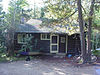
January 29, 1988 Wild Basin
40°12′29″N 105°33′56″W / 40.20806°N 105.56556°WEstes Park 42 Wild Basin Ranger Station and House 
January 29, 1988 Wild Basin
40°12′32″N 105°33′55″W / 40.20889°N 105.56528°WEstes Park 43 Beatrice Willard Alpine Tundra Research Plots October 25, 2007 U.S. Route 34 at Rock Cut and Forest Canyon
40°23′43″N 105°42′40″W / 40.39528°N 105.71111°WEstes Park 44 Willow Park Patrol Cabin 
July 20, 1987 Fall River Rd.
40°25′59″N 105°44′1″W / 40.43306°N 105.73361°WEstes Park 45 Willow Park Stable 
July 20, 1987 Fall River Pass
40°26′1″N 105°43′59″W / 40.43361°N 105.73306°WEstes Park 46 Ypsilon Lake Trail March 5, 2008 Along a ridge between Ciquita Creek and the Roaring River Estes Park See also
- National Register of Historic Places listings in Larimer County, Colorado
- National Register of Historic Places listings in Grand County, Colorado
- National Register of Historic Places listings in Boulder County, Colorado
- List of National Historic Landmarks in Colorado
- National Register of Historic Places listings in Colorado
References
- National Register of Historic Places Inventory - Nomination Form: Multiple Resource Nomination for Rocky Mountain National Park. National Park Service 1987 [1]
- Standish, Sierra. National Register of Historic Places Multiple Property Documentation Form: Rocky Mountain National Park MPS (additional documentation - trails). National Park Service September 27, 2004 [2]
- ^ The latitude and longitude information provided in this table was derived originally from the National Register Information System, which has been found to be fairly accurate for about 99% of listings. For about 1% of NRIS original coordinates, experience has shown that one or both coordinates are typos or otherwise extremely far off; some corrections may have been made. A more subtle problem causes many locations to be off by up to 150 yards, depending on location in the country: most NRIS coordinates were derived from tracing out latitude and longitudes off of USGS topographical quadrant maps created under the North American Datum of 1927, which differs from the current, highly accurate WGS84 GPS system used by Google maps. Chicago is about right, but NRIS longitudes in Washington are higher by about 4.5 seconds, and are lower by about 2.0 seconds in Maine. Latitudes differ by about 1.0 second in Florida. Some locations in this table may have been corrected to current GPS standards.
- ^ "National Register of Historic Places: Weekly List Actions". National Park Service, United States Department of the Interior. Retrieved on November 10, 2011.
- ^ Numbers represent an ordering by significant words. Various colorings, defined here, differentiate National Historic Landmark sites and National Register of Historic Places Districts from other NRHP buildings, structures, sites or objects.
- ^ "National Register Information System". National Register of Historic Places. National Park Service. 2008-04-24. http://nrhp.focus.nps.gov/natreg/docs/All_Data.html.
- ^ Coordinates are those of the East Longs Peak Trail as provided by its GNIS record; the NRIS gives no coordinates
- ^ Coordinates are derived from its GNIS record; the NRIS gives no coordinates
- ^ Coordinates are those of Gem Lake as provided by its GNIS record; the NRIS gives no coordinates
- ^ Coordinates are those of Lake Haiyaha, derived from its GNIS record; the NRIS gives no coordinates
- ^ Coordinates are derived from its GNIS record; the NRIS gives no coordinates
- ^ Coordinates are those of the Grand Lake end of the trail as provided by its GNIS record; the NRIS gives no coordinates
- ^ Coordinates are provided by its GNIS record; the NRIS gives no coordinates
- ^ Coordinates are those of the Grand Lake end of the trail as provided by its GNIS record; the NRIS gives no coordinates
National Register of Historic Places in Rocky Mountain National Park National Historic Landmarks Other historic districts Fall River Entrance Historic District | Holzwarth Historic District | McGraw Ranch | Moraine Park Museum and Amphitheater | Rocky Mountain National Park Utility Area Historic District | William Allen White Cabins | Beatrice Willard Alpine Tundra Research Plots
Other properties Bear Lake Comfort Station | Dutchtown | East Inlet Trail | East Longs Peak Trail-Longs Peak Trail-Keyhole Route-Shelf Trail | Fall River Pass Ranger Station | Fall River Pump House and Catchment Basin | Fall River Road | Fern Lake Patrol Cabin | Fern Lake Trail | | Flattop Mountain Trail Gem Lake Trail | Glacier Basin Campground Ranger Station | Grand River Ditch | Lake Haiyaha Trail | Leiffer House | Lost Lake Trail | Lulu City Site | Milner Pass Road Camp Mess Hall and House | Moraine Lodge | North Inlet Trail | Shadow Mountain Lookout | Shadow Mountain Trail | Snogo Snow Plow | Thunder Lake Patrol Cabin | Thunder Lake Trail-Bluebird Lake Trail | Timber Creek Campground Comfort Station No. 245 | Timber Creek Road Camp Barn | Timberline Cabin | Tonahutu Creek Trail | Trail Ridge Road | Twin Sisters Lookout | Agnes Vaille Shelter | Wild Basin House | Wild Basin Ranger Station | Willow Park Patrol Cabin | Willow Park Stable | Ypsilon Lake Trail
See also: National Register of Historic Places listings in Rocky Mountain National ParkU.S. National Register of Historic Places Topics Lists by states Alabama • Alaska • Arizona • Arkansas • California • Colorado • Connecticut • Delaware • Florida • Georgia • Hawaii • Idaho • Illinois • Indiana • Iowa • Kansas • Kentucky • Louisiana • Maine • Maryland • Massachusetts • Michigan • Minnesota • Mississippi • Missouri • Montana • Nebraska • Nevada • New Hampshire • New Jersey • New Mexico • New York • North Carolina • North Dakota • Ohio • Oklahoma • Oregon • Pennsylvania • Rhode Island • South Carolina • South Dakota • Tennessee • Texas • Utah • Vermont • Virginia • Washington • West Virginia • Wisconsin • WyomingLists by territories Lists by associated states Other Categories:- National Register of Historic Places lists in the National Park Service
- Buildings and structures in Rocky Mountain National Park
-


Wikimedia Foundation. 2010.