- U.S. Route 36
-
U.S. Route 36

Route information Length: 1,414 mi[1] (2,276 km) Existed: 1926[1] – present Major junctions West end:  US 34 in Rocky Mountain National Park, CO
 I-25 north of Denver, CO
 I-76 north of Denver, CO
 I-29 in Saint Joseph, MO
 I-35 in Cameron, MO
 I-55 in Springfield, IL
 I-65 in Indianapolis, IN
 I-75 in Piqua, OH
East end: 
 US 250 / SR 800 at Uhrichsville, OH
Highway system United States Numbered Highways
List • Bannered • Divided • ReplacedU.S. Route 36 is an east–west United States highway that runs for 1,414 miles (2,276 km) from Rocky Mountain National Park, Colorado to Uhrichsville, Ohio. The highway's western terminus is at Deer Ridge Junction, an intersection in Rocky Mountain National Park, Colorado, where it meets U.S. Route 34. Its eastern terminus is at U.S. Route 250 in Uhrichsville, Ohio.
Contents
Route description

Colorado
Main article: U.S. Route 36 in ColoradoIn Colorado, the highway is a freeway from Boulder to Byers, a distance of 62 miles (100 km), which includes four contiguous segments:
- the former Denver-Boulder Turnpike [1] (18 miles) from Boulder to Westminster,
- the former Colorado State Highway 382 (2 miles) from Westminster to Welby,
- the concurrency with I-270 (5 miles) from Welby to Denver, and
- the concurrency with I-70 (37 miles) from Denver to Byers.
As of 2005, the overlaps I-270 and I-70 are not signed as US-36. The former Denver-Boulder Turnpike [2] and the former Colorado State Highway 382 are so signed.
The remainder of the highway in Colorado is signed as US-36. It is a conventional roadway, mostly two lanes, but four lanes divided on 28th Street in Boulder and in a few other short stretches.
Kansas
US-36 passes through all 13 counties in Kansas which border Nebraska. The highway enters the Sunflower State from Colorado in Cheyenne County and shares a seven-mile (11 km) concurrency through the town of St. Francis with K-27, the first north–south route intersected in Kansas. K-27 splits east of St. Francis and heads south toward Goodland, and US-36 then continues through Bird City and McDonald before intersecting K-25 in Atwood, the seat of Rawlins County.
US-36 continues east through Decatur County, intersecting with US-83 in Oberlin before beginning a concurrency with K-383 in Norton County, a concurrency which runs for 12 miles (19 km) through the city of Norton, where it crosses US-283. K-383 splits in eastern Norton County and bends northeast toward Almena and the Nebraska state line, while US-36 enters Phillips County, picking up a brief concurrency with US-183 in Phillipsburg.
The highway passes through the small towns of Agra and Kensington before reaching Smith Center, the seat of Smith County, where US-281 joins US-36 for a 12-mile (19 km) concurrency. The highways split at Lebanon, and US-36 passes through largely unpopulated areas, except for the tiny town of Mankato in Jewell County.
At Belleville, the seat of Republic County, US-36 intersect US-81, a four-laned expressway which heads south toward Concordia and Salina, where the highway becomes Interstate 135 and runs south toward Wichita. After passing through Washington County, US-36 picks up brief concurrencies with US-77 in Marysville, the seat of Marshall County, and with US-75 in Fairview.
In Hiawatha, the seat of Brown County, US-36 intersects the concurrency of US-73 and US-159, before entering Doniphan County for its final trek through the state, passing through Troy, Wathena and Elwood before crossing the Missouri River and reaching Interstate 229 in St. Joseph, Missouri.
The section from Washington, Kansas to St. Joseph, Missouri is officially called the Pony Express Highway because it marks the starting section of the Pony Express. It crosses the Missouri River on the Pony Express Bridge. US-36 through Kansas is mostly a two-lane road, with a few short segments in towns, including the stretch from Wathena to the Missouri state line, being four lanes divided.
Missouri
Main article: U.S. Route 36 in MissouriSee also: Interstate 72 in MissouriUS 36 in Missouri passes through or near St. Joseph, Cameron, Chillicothe, Brookfield, Macon, Monroe City and Hannibal. It was Route 8 from 1922 to 1926.
On August 3, 2005, residents of Macon, Marion, Monroe, Shelby, and Ralls counties approved Proposition 36B, which excludes Ralls County from the Transportation Development District and allows for the construction of a 4-lane US 36 to be constructed without Ralls County's participation. This construction would serve as an extension of Interstate 72 west from Hannibal to Cameron and would make US 36 four lanes across Missouri.
All of US 36 in Missouri is named the V.F.W. Memorial Highway.[2] The section from St. Joseph to Hannibal parallels the route of the Hannibal and St. Joseph Railroad, which was the reason St. Joseph was selected for the Pony Express. The two towns were the second and third largest cities in the State of Missouri prior to the American Civil War. Prior to the establishment of the railroad in the late 1850s, the stagecoach route was called the "Hound Dog Trail."[3]
For the Missouri portion of the highway, MoDOT is working on upgrading to a four-lane divided highway across the state in 2010. Presently, it is 4 lanes between the Missouri River and just east of Macon, Missouri and from Monroe City, Missouri to the Illinois state line.
With the passage of Proposition 36B, the US 36/I-72 Corridor Transportation District was created to help fund construction to convert the remaining 38 miles (61 km) of 2-lane highway between Macon, Missouri and Monroe City, Missouri by September 30, 2010. East of the Monroe City exit, US 36 is a 4-lane highway to US 61, where I-72 takes over the alignment.
Illinois
Main article: U.S. Route 36 in IllinoisSee also: Interstate 72 in IllinoisIn the state of Illinois, U.S. 36 runs concurrent with much of Interstate 72. It enters from Missouri across the Mississippi River on the Mark Twain Memorial Bridge, and runs east, crossing Interstate 55 in Springfield. At the U.S. Route 51 bypass in Decatur, U.S. 36 leaves I-72 and runs due east through downtown Decatur. U.S. 36 then continues east to the Indiana border.
Indiana
US 36 enters Indiana near Dana in Vermillion County. It then passes through the towns of Montezuma, Rockville, Bainbridge, Danville, and Avon before entering Indianapolis. The original route through Indianapolis consisted of Rockville Rd., Washington St.. West St./Michigan Rd. (Now Dr. Martin Luther King St.) 38th St. and Pendleton Pike. However, US 36 is now concurrent with I-465 south of Indianapolis. East of The Circle City, US 36 travels northeast through Lawrence, McCordsville, Pendleton, Losantville, Modoc, and Lynn before exiting into Ohio.
Ohio
US 36 enters Ohio in Darke County near the small village of Palestine, Ohio. In Ohio it travels through Darke, Miami, Champaign, Union, Delaware, Knox and Coshocton Counties before reaching its terminus at Uhrichsville in Tuscarawas County. It conjoins with US Route 127 in Greenville for about 5 miles (8.0 km). It also conjoins with US Route 33 in Marysville for about 5 miles (8.0 km).
Major intersections
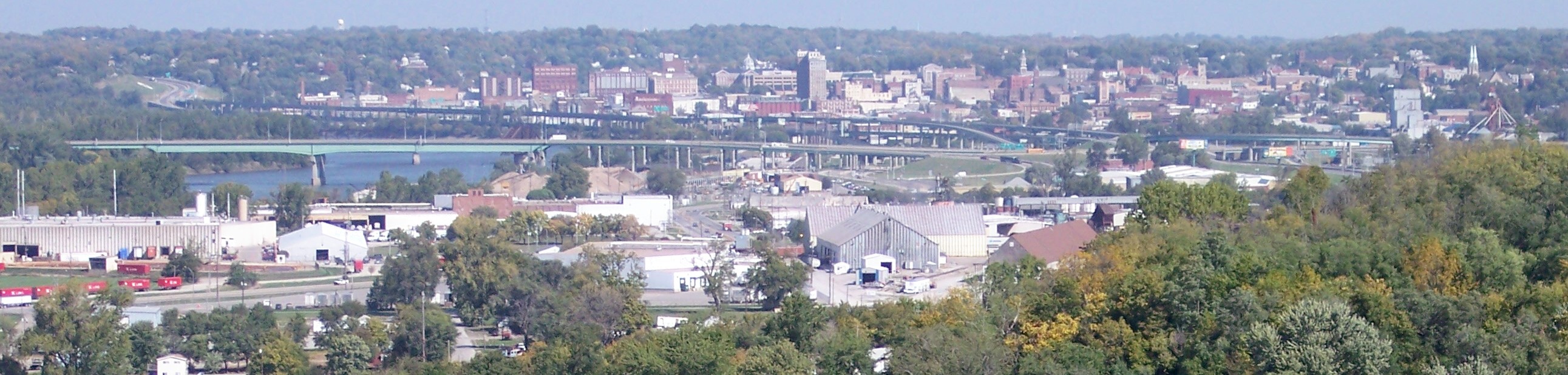
 36 crossing the Missouri River on the Pony Express Bridge in St. Joseph. I-229 parallels the river.
- I-25 at Welby, Colorado
- I-270 from Welby to Denver, Colorado - concurrency 5 miles (8.0 km)
- I-76 at Welby, Colorado
- I-70 from Denver to Byers, Colorado - concurrency 37 miles (60 km)
- I-225 in Aurora, Colorado
- US 81 in Belleville, Kansas (four-lane divided highway becomes Interstate 135 69 miles (111 km) to the south in Salina)
- I-229 in St. Joseph, Missouri
- I-29 in St. Joseph, Missouri
- I-35 in Cameron, Missouri
- I-72 from Hannibal, Missouri to Decatur, Illinois - concurrency 135 miles (217 km)
- I-172 in northwestern Pike County, Illinois, west of Hull, Illinois and east of Hannibal, Missouri
- Old U.S. 36 intersects I-72 near Winchester, Illinois
- U.S. Route 67 near Jacksonville, Illinois
- I-55 in Springfield, Illinois - concurrency 6 miles (9.7 km)
- I-57 at Tuscola, Illinois
- I-74/I-465 in Indianapolis, Indiana
- I-65 in Indianapolis, Indiana
- I-70 in Indianapolis, Indiana
- I-465 near Lawrence, Indiana
- U.S. Route 127/Ohio State Route 571 near Greenville, Ohio
- I-75 in Piqua, Ohio
- I-71 in Delaware County, Ohio west of Sunbury and east of Delaware
- I-77 at Newcomerstown, Ohio
See also
References
- ^ a b Droz, Robert V. U.S. Highways : From US 1 to (US 830). URL accessed 02:55, 4 July 2006 (UTC).
- ^ The Associated Press (2002-08-24). "A look at Missouri's named highways and bridges" (LexisNexis). http://www.lexisnexis.com/us/lnacademic/results/docview/docview.do?risb=21_T1975867486&format=GNBFI&sort=RELEVANCE&startDocNo=1&resultsUrlKey=29_T1975867493&cisb=22_T1975867492&treeMax=true&treeWidth=0&csi=304481&docNo=4.
- ^ The Hound Dog Trail: The Economy of Cameron - cameron-mo.com - Retrieved November 15, 2007
External links
 Main U.S. Routes
1 2 3 4 5 6 7 8 9 10 11 12 13 14 15 16 17 18 19 20 21 22 23 24 25 26 27 28 29 30 31 32 33 34 35 36 37 38 40 41 42 43 44 45 46 48 49 50 51 52 53 54 55 56 57 58 59 60 61 62 63 64 65 66 67 68 69 70 71 72 73 74 75 76 77 78 79 80 81 82 83 84 85 87 89 90 91 92 93 94 95 96 97 98 99 101 163 400 412 425 Lists U.S. Routes • Bannered • Divided • Bypassed Browse numbered routes ←  SH 35
SH 35CO SH 36  →
→←  I-35
I-35KS K-39  →
→← I-35MO Route 37  →
→←  IL 35
IL 35IL IL 37  →
→←  US 35
US 35IN SR 37  →Categories:
- U.S. Highway System
- U.S. Highways in Kansas
- U.S. Highways in Ohio
- U.S. Highways in Indiana
- U.S. Highways in Missouri
- U.S. Highways in Colorado
- U.S. Route 36


Wikimedia Foundation. 2010.