- National Register of Historic Places listings in Santa Rosa County, Florida
-
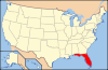
 Location of Santa Rosa County in Florida
This is a list of the National Register of Historic Places listings in Santa Rosa County, Florida.
This is intended to be a complete list of the properties and districts on the National Register of Historic Places in Santa Rosa County, Florida, United States. The locations of National Register properties and districts for which the latitude and longitude coordinates are included below, may be seen in a Google map.[1]
There are 16 properties and districts listed on the National Register in the county.
-
- This National Park Service list is complete through NPS recent listings posted November 10, 2011.[2]
Contents: Counties in Florida (non-linked contain no National Register listings) Alachua - Baker - Bay - Bradford - Brevard - Broward - Calhoun - Charlotte - Citrus - Clay - Collier - Columbia - DeSoto - Dixie - Duval - Escambia - Flagler - Franklin - Gadsden - Gilchrist - Glades - Gulf - Hamilton - Hardee - Hendry - Hernando - Highlands - Hillsborough - Holmes - Indian River - Jackson - Jefferson - Lafayette - Lake - Lee - Leon - Levy - Liberty - Madison - Manatee - Marion - Martin - Miami-Dade - Monroe - Nassau - Okaloosa - Okeechobee - Orange - Osceola - Palm Beach - Pasco - Pinellas - Polk - Putnam - Santa Rosa - Sarasota - Seminole - St. Johns - St. Lucie - Sumter - Suwannee - Taylor - Union - Volusia - Wakulla - Walton - Washington Current listings
[3] Landmark name [4] Image Date listed Location City or town Summary 1 Arcadia Sawmill and Arcadia Cotton Mill 
August 3, 1987 Address Restricted
30°36′35″N 87°05′03″W / 30.609722°N 87.084167°WMilton 2 Bagdad Village Historic District 
December 8, 1987 Roughly bounded by Main, Water, and Oak Streets, Cobb and Woodville Roads, and Cemetery, Pooley, and School Streets
30°36′01″N 87°02′04″W / 30.600278°N 87.034444°WBagdad 3 Bethune Blackwater Schooner 
August 8, 1991 Address Restricted Milton 4 Big Heart West September 28, 1998 Address Restricted Gulf Breeze Part of the Archeological Properties of the Naval Live Oaks Reservation MPS 5 Butcherpen Mound September 28, 1998 Address Restricted Gulf Breeze Part of the Archeological Properties of the Naval Live Oaks Reservation MPS 6 First American Road in Florida First American Road in FloridaSeptember 28, 1998 Gulf Islands National Seashore-Naval Live Oaks Area
30°22′09″N 87°08′21″W / 30.369167°N 87.139167°WGulf Breeze Part of the Archeological Properties of the Naval Live Oaks Reservation MPS 7 Florida State Road No. 1 
June 23, 1994 Roughly, three sections east of Milton, parallel to U.S. Route 90, between Marquis Bayou and Harold
30°37′54″N 86°59′28″W / 30.631667°N 86.991111°WMilton 8 Louisville and Nashville Depot 
October 29, 1982 206 Henry Street
30°37′14″N 87°02′02″W / 30.620556°N 87.033889°WMilton 9 Milton Historic District 
November 12, 1987 U.S. Route 90 at the Blackwater River, bounded by Berryhill, Willing, Hill, Canal, Margaret, and Susan Streets
30°37′16″N 87°02′20″W / 30.621111°N 87.038889°WMilton 10 Mt. Pilgrim African Baptist Church 
May 29, 1992 Junction of Alice and Clara Streets
30°37′11″N 87°02′26″W / 30.619722°N 87.040556°WMilton 11 Naval Live Oaks Cemetery September 28, 1998 Address Restricted Gulf Breeze Part of the Archeological Properties of the Naval Live Oaks Reservation MPS 12 Naval Live Oaks Reservation 
September 28, 1998 Gulf Islands National Seashore-Naval Live Oaks Area
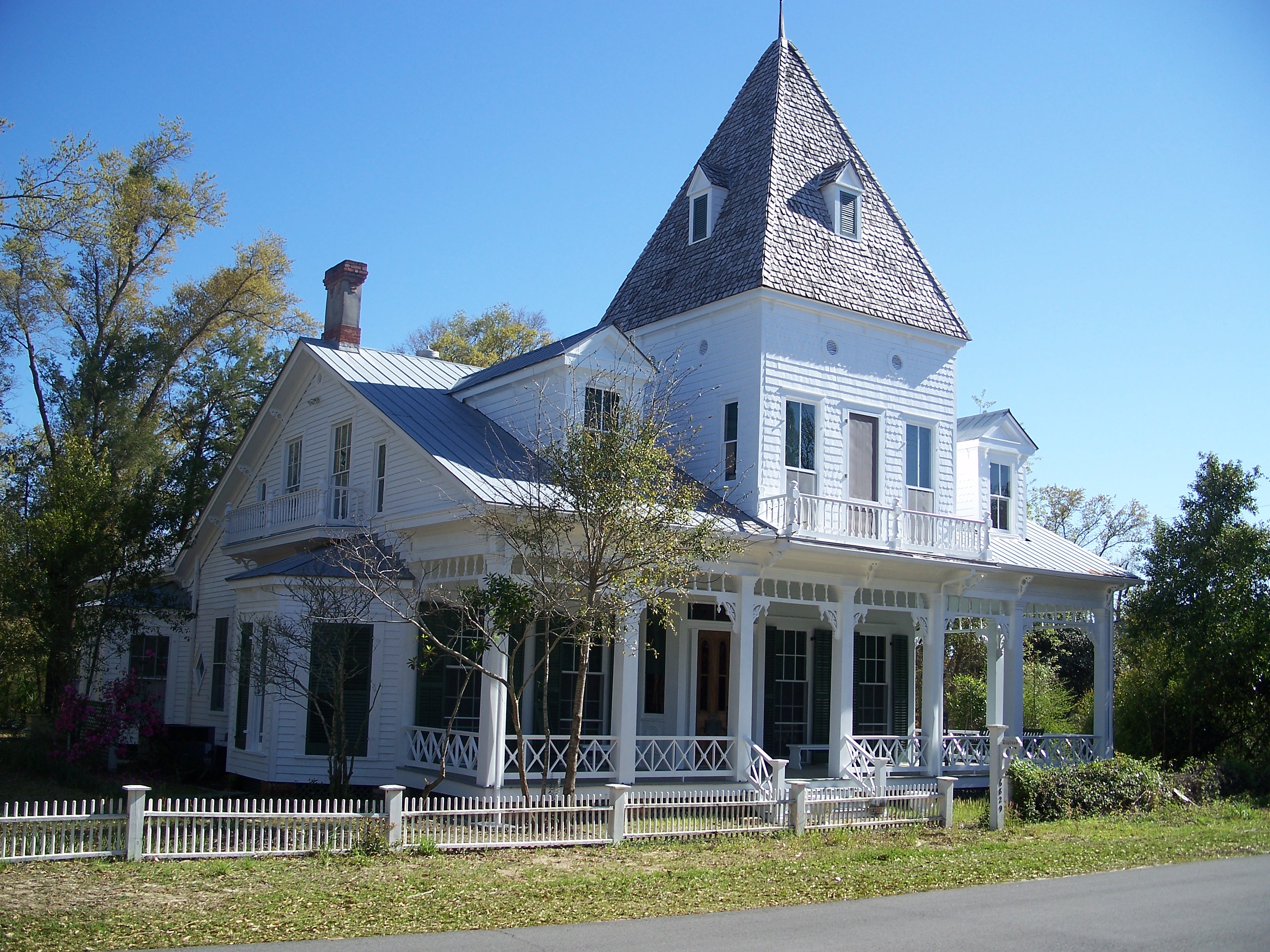
30°22′04″N 87°08′24″W / 30.367778°N 87.14°WGulf Breeze Part of the Archeological Properties of the Naval Live Oaks Reservation MPS 13 Ollinger-Cobb House 
January 11, 1983 302 Pine Street
30°37′09″N 87°02′16″W / 30.619167°N 87.037778°WMilton 14 St. Mary's Episcopal Church and Rectory 
May 6, 1982 300-301 Oak Street
30°37′16″N 87°02′10″W / 30.621111°N 87.036111°WMilton 15 Third Gulf Breeze September 28, 1998 Address Restricted Gulf Breeze Part of the Archeological Properties of the Naval Live Oaks Reservation MPS 16 Thomas Creek Archeological District November 4, 1985 Address Restricted Chumuckla See also
- List of National Historic Landmarks in Florida
- National Register of Historic Places listings in Florida
References
- ^ The latitude and longitude information provided in this table was derived originally from the National Register Information System, which has been found to be fairly accurate for about 99% of listings. For about 1% of NRIS original coordinates, experience has shown that one or both coordinates are typos or otherwise extremely far off; some corrections may have been made. A more subtle problem causes many locations to be off by up to 150 yards, depending on location in the country: most NRIS coordinates were derived from tracing out latitude and longitudes off of USGS topographical quadrant maps created under the North American Datum of 1927, which differs from the current, highly accurate WGS84 GPS system used by Google maps. Chicago is about right, but NRIS longitudes in Washington are higher by about 4.5 seconds, and are lower by about 2.0 seconds in Maine. Latitudes differ by about 1.0 second in Florida. Some locations in this table may have been corrected to current GPS standards.
- ^ "National Register of Historic Places: Weekly List Actions". National Park Service, United States Department of the Interior. Retrieved on November 10, 2011.
- ^ Numbers represent an ordering by significant words. Various colorings, defined here, differentiate National Historic Landmark sites and National Register of Historic Places Districts from other NRHP buildings, structures, sites or objects.
- ^ "National Register Information System". National Register of Historic Places. National Park Service. . http://nrhp.focus.nps.gov/natreg/docs/All_Data.html.
U.S. National Register of Historic Places in Florida Lists by county Alachua • Baker • Bay • Bradford • Brevard • Broward • Calhoun • Charlotte • Citrus • Clay • Collier • Columbia • DeSoto • Dixie • Duval • Escambia • Flagler • Franklin • Gadsden • Gilchrist • Glades • Gulf • Hamilton • Hardee • Hendry • Hernando • Highlands • Hillsborough • Holmes • Indian River • Jackson • Jefferson • Lafayette • Lake • Lee • Leon • Levy • Liberty • Madison • Manatee • Marion • Martin • Miami-Dade • Monroe • Nassau • Okaloosa • Okeechobee • Orange • Osceola • Palm Beach • Pasco • Pinellas • Polk • Putnam • Santa Rosa • Sarasota • Seminole • St. Johns • St. Lucie • Sumter • Suwannee • Taylor • Union • Volusia • Wakulla • Walton • Washington
Lists by city Other lists Municipalities and communities of Santa Rosa County, Florida Cities 
Town CDPs Unincorporated
communitiesChumuckla | Midway | Navarre | Navarre Beach | Oriole Beach
Categories:- National Register of Historic Places in Santa Rosa County, Florida
- National Register of Historic Places in Florida by county
-


Wikimedia Foundation. 2010.