National Register of Historic Places listings in St. Johns County, Florida

National Register of Historic Places listings in St. Johns County, Florida
Location of St. Johns County in Florida

This is a list of the National Register of Historic Places listings in St. Johns County, Florida.

This is intended to be a complete list of the properties and districts on the National Register of Historic Places in St. Johns County, Florida, United States. The locations of National Register properties and districts for which the latitude and longitude coordinates are included below, may be seen in a Google map.[1]

There are 42 properties and districts listed on the National Register in the county, including 6 National Historic Landmarks.

This National Park Service list is complete through NPS recent listings posted November 10, 2011.[2]


Contents: Counties in Florida   (non-linked contain no National Register listings)
Alachua - Baker - Bay - Bradford - Brevard - Broward - Calhoun - Charlotte - Citrus - Clay - Collier - Columbia - DeSoto - Dixie - Duval - Escambia - Flagler - Franklin - Gadsden - Gilchrist - Glades - Gulf - Hamilton - Hardee - Hendry - Hernando - Highlands - Hillsborough - Holmes - Indian River - Jackson - Jefferson - Lafayette - Lake - Lee - Leon - Levy - Liberty - Madison - Manatee - Marion - Martin - Miami-Dade - Monroe - Nassau - Okaloosa - Okeechobee - Orange - Osceola - Palm Beach - Pasco - Pinellas - Polk - Putnam - Santa Rosa - Sarasota - Seminole - St. Johns - St. Lucie - Sumter - Suwannee - Taylor - Union - Volusia - Wakulla - Walton - Washington


Current listings

[3] Landmark name [4] Image Date listed Location City or town Summary
1 Abbott Tract Historic District
Abbott Tract Historic District
01983-07-21July 21, 1983 Roughly bounded by Matanzas Bay and Pine, San Marco, and Shenandoah Aves.
29°54′04″N 81°18′50″W / 29.901111°N 81.313889°W / 29.901111; -81.313889 (Abbott Tract Historic District)
St. Augustine
2 Alcazar Hotel
Alcazar Hotel
01971-02-24February 24, 1971 79 King St.
29°53′30″N 81°18′51″W / 29.891667°N 81.314167°W / 29.891667; -81.314167 (Alcazar Hotel)
St. Augustine
3 Avero House
Avero House
01972-06-13June 13, 1972 39 St. George St.
29°58′44″N 81°18′48″W / 29.978889°N 81.313333°W / 29.978889; -81.313333 (Avero House)
St. Augustine
4 Bridge of Lions
Bridge of Lions
01982-11-19November 19, 1982 King St.
29°53′33″N 81°18′27″W / 29.8925°N 81.3075°W / 29.8925; -81.3075 (Bridge of Lions)
St. Augustine
5 Castillo de San Marcos National Monument Fort2.jpg 01966-10-15 October 15, 1966 1 Castillo Dr.
29°53′52″N 81°18′46″W / 29.89778°N 81.31278°W / 29.89778; -81.31278 (Castillo de San Marcos National Monument)
St. Augustine A National Monument
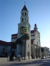
6 Cathedral of St. Augustine
Cathedral of St. Augustine
01970-04-15April 15, 1970 Cathedral St. between Charlotte and St. George Sts.
29°53′34″N 81°18′45″W / 29.892778°N 81.3125°W / 29.892778; -81.3125 (Cathedral of St. Augustine)
St. Augustine
7 Dixie Highway-Hastings, Espanola and Bunnell Road
Dixie Highway-Hastings, Espanola and Bunnell Road
02005-04-20April 20, 2005 Roughly Espanola in Flagler County to County Route 204 in St. Johns County
29°34′49″N 81°20′35″W / 29.580278°N 81.343056°W / 29.580278; -81.343056 (Dixie Highway-Hastings, Espanola and Bunnell Road)
Espanola Extends into Flagler County
8 Fish Island Site
Fish Island Site
01972-06-13June 13, 1972 Address Restricted
St. Augustine
9 Fort Matanzas National Monument Fort Matanzas across01.jpg 01966-10-15 October 15, 1966 15 miles south of St. Augustine
29°42′42″N 81°14′7″W / 29.71167°N 81.23528°W / 29.71167; -81.23528 (Fort Matanzas National Monument)
St. Augustine A National Monument
10 Fort Matanzas National Monument Headquarters and Visitor Center
Fort Matanzas National Monument Headquarters and Visitor Center
02008-12-31December 31, 2008 8635 State Road A1A, South
29°42′42″N 81°14′07″W / 29.711667°N 81.235278°W / 29.711667; -81.235278 (Fort Matanzas National Monument Headquarters and Visitor Center)
St. Augustine NRHP# 08001245, Part of the Florida's New Deal Resources MPS
11 Second Fort Mose Site
Second Fort Mose Site
01994-10-12October 12, 1994 Address Restricted
29°55′40″N 81°19′31″W / 29.927778°N 81.325278°W / 29.927778; -81.325278 (Second Fort Mose Site)
St. Augustine First free African settlement in the United States[5]
12 Fullerwood Park Residential Historic District
Fullerwood Park Residential Historic District
02010-09-24September 24, 2010 Roughly bounded by San Marcos, Macaris, Hildreth & Hospital Creek
29°54′59″N 81°19′14″W / 29.916389°N 81.320556°W / 29.916389; -81.320556 (Fullerwood Park Residential Historic District)
St. Augustine
13 Gonzalez-Alvarez House
Gonzalez-Alvarez House
01970-04-15April 15, 1970 14 St. Francis St.
29°53′17″N 81°18′36″W / 29.888056°N 81.31°W / 29.888056; -81.31 (Gonzalez-Alvarez House)
St. Augustine
14 Grace United Methodist Church
Grace United Methodist Church
01979-11-29November 29, 1979 8 Carrera St.
29°52′37″N 81°18′54″W / 29.876944°N 81.315°W / 29.876944; -81.315 (Grace United Methodist Church)
St. Augustine
15 Hastings Community Center
Hastings Community Center
02007-02-21February 21, 2007 401 N. Main St.
29°43′06″N 81°30′31″W / 29.718333°N 81.508611°W / 29.718333; -81.508611 (Hastings Community Center)
Hastings
16 Hastings High School
Hastings High School
02006-06-14June 14, 2006 6195 S. Main St.
29°42′40″N 81°30′18″W / 29.711111°N 81.505°W / 29.711111; -81.505 (Hastings High School)
Hastings
17 Hotel Ponce De Leon
Hotel Ponce De Leon
01975-05-06May 6, 1975 74 King St., bounded by King, Valencia, Sevilla, and Cordova Sts.
29°53′32″N 81°18′54″W / 29.892222°N 81.315°W / 29.892222; -81.315 (Hotel Ponce De Leon)
St. Augustine
18 Lincolnville Historic District
Lincolnville Historic District
01991-11-29November 29, 1991 Bounded by Cedar, Riberia, Cerro, and Washington Sts. and DeSoto Pl.
29°53′05″N 81°18′52″W / 29.884722°N 81.314444°W / 29.884722; -81.314444 (Lincolnville Historic District)
St. Augustine
19 Lindsley House
Lindsley House
01971-09-10September 10, 1971 214 St. George St.
29°53′30″N 81°18′48″W / 29.891667°N 81.313333°W / 29.891667; -81.313333 (Lindsley House)
St. Augustine
20 Llambias House
Llambias House
01970-04-15April 15, 1970 31 St. Francis St.
29°53′15″N 81°18′39″W / 29.8875°N 81.310833°W / 29.8875; -81.310833 (Llambias House)
St. Augustine
21 Xavier Lopez House
Xavier Lopez House
01993-07-01July 1, 1993 93½ King St.
29°53′29″N 81°18′58″W / 29.891389°N 81.316111°W / 29.891389; -81.316111 (Xavier Lopez House)
St. Augustine
22 Markland
Markland
01978-12-06December 6, 1978 102 King St.
29°53′31″N 81°19′02″W / 29.891944°N 81.317222°W / 29.891944; -81.317222 (Markland)
St. Augustine
23 Model Land Company Historic District
Model Land Company Historic District
01983-08-02August 2, 1983 Roughly bounded by Ponce de Leon Boulevard and King, Cordova, and Orange Sts.
29°53′39″N 81°19′06″W / 29.894167°N 81.318333°W / 29.894167; -81.318333 (Model Land Company Historic District)
St. Augustine
24 Nelmar Terrace Historic District
Nelmar Terrace Historic District
02011-03-28March 28, 2011 Alfred St., San Carlos Ave., San Marcos Ave., Hospital Creek
29°54′39″N 81°19′06″W / 29.910833°N 81.318333°W / 29.910833; -81.318333 (Nelmar Terrace Historic District)
St. Augustine NRHP # 11000145
25 North City Historic District
North City Historic District
02009-10-01October 1, 2009 Roughly bounded by Castillo Drive, San Marcos Avenue, Old Mission Avenue, and U.S. Route 1
29°54′07″N 81°19′05″W / 29.901944°N 81.318056°W / 29.901944; -81.318056 (North City Historic District)
St. Augustine NRHP # 09000778
26 O'Reilly House
O'Reilly House
01974-10-15October 15, 1974 131 Aviles St.
29°53′24″N 81°18′41″W / 29.89°N 81.311389°W / 29.89; -81.311389 (O'Reilly House)
St. Augustine
27 Old St. Johns County Jail
Old St. Johns County Jail
01987-08-27August 27, 1987 167 San Marco Ave.
29°54′28″N 81°19′08″W / 29.907778°N 81.318889°W / 29.907778; -81.318889 (Old St. Johns County Jail)
St. Augustine
28 Record Building
Record Building
02006-04-26April 26, 2006 154 Cordova St.
29°53′20″N 81°18′47″W / 29.888889°N 81.313056°W / 29.888889; -81.313056 (Record Building)
St. Augustine
29 Rodriguez-Avero-Sanchez House
Rodriguez-Avero-Sanchez House
01971-04-16April 16, 1971 52 St. George St.
29°53′46″N 81°18′49″W / 29.896111°N 81.313611°W / 29.896111; -81.313611 (Rodriguez-Avero-Sanchez House)
St. Augustine
30 St. Augustine Alligator Farm Historic District
St. Augustine Alligator Farm Historic District
01992-09-10September 10, 1992 999 Anastasia Boulevard
29°52′53″N 81°17′18″W / 29.881389°N 81.288333°W / 29.881389; -81.288333 (St. Augustine Alligator Farm Historic District)
St. Augustine
31 St. Augustine Civic Center
St. Augustine Civic Center
02005-04-21April 21, 2005 10 Castillo Dr.
29°53′55″N 81°18′53″W / 29.898611°N 81.314722°W / 29.898611; -81.314722 (St. Augustine Civic Center)
St. Augustine Part of the Florida's New Deal Resources MPS
32 St. Augustine Lighthouse and Keeper's Quarters
St. Augustine Lighthouse and Keeper's Quarters
01981-03-19March 19, 1981 Old Beach Rd.
29°53′08″N 81°17′20″W / 29.885556°N 81.288889°W / 29.885556; -81.288889 (St. Augustine Lighthouse and Keeper's Quarters)
St. Augustine
33 St. Augustine Town Plan Historic District
St. Augustine Town Plan Historic District
01970-04-15April 15, 1970 Roughly bounded by Grove Ave., the Matanzas River, and South and Washington Sts.
29°53′36″N 81°18′38″W / 29.893333°N 81.310556°W / 29.893333; -81.310556 (St. Augustine Town Plan Historic District)
St. Augustine
34 Sanchez Homestead
Sanchez Homestead
02001-10-12October 12, 2001 7270 Old State Road 207
29°44′16″N 81°28′43″W / 29.737778°N 81.478611°W / 29.737778; -81.478611 (Sanchez Homestead)
Elkton
35 Sanchez Powder House Site
Sanchez Powder House Site
01972-04-14April 14, 1972 Marine St.
29°52′53″N 81°18′29″W / 29.881389°N 81.308056°W / 29.881389; -81.308056 (Sanchez Powder House Site)
St. Augustine
36 Shell Bluff Landing (8SJ32)
Shell Bluff Landing (8SJ32)
01991-04-25April 25, 1991 Address Restricted
Ponte Vedra Beach
37 Solla-Carcaba Cigar Factory
Solla-Carcaba Cigar Factory
01993-05-06May 6, 1993 88 Riberia St.
29°53′27″N 81°19′08″W / 29.890833°N 81.318889°W / 29.890833; -81.318889 (Solla-Carcaba Cigar Factory)
St. Augustine
38 Spanish Coquina Quarries
Spanish Coquina Quarries
01972-02-23February 23, 1972 State Road A1A in Anastasia State Park
29°52′14″N 81°16′31″W / 29.870556°N 81.275278°W / 29.870556; -81.275278 (Spanish Coquina Quarries)
St. Augustine Beach
39 Stanbury Cottage St Aug Stanbury Cottage01.jpg 02008-10-08 October 8, 2008 232 St. George Street
29°53′26.52″N 81°18′44.46″W / 29.8907°N 81.31235°W / 29.8907; -81.31235 (Stanbury Cottage)
St. Augustine
40 Villa Zorayda
Villa Zorayda
01993-09-23September 23, 1993 83 King St.
29°53′27″N 81°18′53″W / 29.890833°N 81.314722°W / 29.890833; -81.314722 (Villa Zorayda)
St. Augustine
41 Horace Walker House
Horace Walker House
01998-01-30January 30, 1998 33 Old Mission Ave.
29°54′12″N 81°19′14″W / 29.903333°N 81.320556°W / 29.903333; -81.320556 (Horace Walker House)
St. Augustine
42 Ximenez-Fatio House
Ximenez-Fatio House
01973-07-25July 25, 1973 20 Aviles St.
29°53′29″N 81°18′45″W / 29.891389°N 81.3125°W / 29.891389; -81.3125 (Ximenez-Fatio House)
St. Augustine

See also

References

  1. ^ The latitude and longitude information provided in this table was derived originally from the National Register Information System, which has been found to be fairly accurate for about 99% of listings. For about 1% of NRIS original coordinates, experience has shown that one or both coordinates are typos or otherwise extremely far off; some corrections may have been made. A more subtle problem causes many locations to be off by up to 150 yards, depending on location in the country: most NRIS coordinates were derived from tracing out latitude and longitudes off of USGS topographical quadrant maps created under the North American Datum of 1927, which differs from the current, highly accurate WGS84 GPS system used by Google maps. Chicago is about right, but NRIS longitudes in Washington are higher by about 4.5 seconds, and are lower by about 2.0 seconds in Maine. Latitudes differ by about 1.0 second in Florida. Some locations in this table may have been corrected to current GPS standards.
  2. ^ "National Register of Historic Places: Weekly List Actions". National Park Service, United States Department of the Interior. Retrieved on November 10, 2011.
  3. ^ Numbers represent an ordering by significant words. Various colorings, defined here, differentiate National Historic Landmark sites and National Register of Historic Places Districts from other NRHP buildings, structures, sites or objects.
  4. ^ "National Register Information System". National Register of Historic Places. National Park Service. . http://nrhp.focus.nps.gov/natreg/docs/All_Data.html. 
  5. ^ Griffin, Justine (January 30, 2011). "Locals hope to keep parks". St. Augustine Record. St. Augustine, Florida. http://staugustine.com/news/local-news/2011-01-30/locals-hope-keep-parks. Retrieved January 30, 2011. 

Wikimedia Foundation. 2010.

Игры ⚽ Нужно сделать НИР?

Look at other dictionaries:

Share the article and excerpts

Direct link
Do a right-click on the link above
and select “Copy Link”