- National Register of Historic Places listings in Volusia County, Florida
-
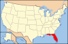
 Location of Volusia County in Florida
This is a list of the National Register of Historic Places listings in Volusia County, Florida.
This is intended to be a complete list of the properties and districts on the National Register of Historic Places in Volusia County, Florida, United States. The locations of National Register properties and districts for which the latitude and longitude coordinates are included below, may be seen in a Google map.[1]
There are 101 properties and districts listed on the National Register in the county, including 2 National Historic Landmarks. Another district was once listed but has been removed.
-
- This National Park Service list is complete through NPS recent listings posted November 10, 2011.[2]
Contents: Counties in Florida (non-linked contain no National Register listings) Alachua - Baker - Bay - Bradford - Brevard - Broward - Calhoun - Charlotte - Citrus - Clay - Collier - Columbia - DeSoto - Dixie - Duval - Escambia - Flagler - Franklin - Gadsden - Gilchrist - Glades - Gulf - Hamilton - Hardee - Hendry - Hernando - Highlands - Hillsborough - Holmes - Indian River - Jackson - Jefferson - Lafayette - Lake - Lee - Leon - Levy - Liberty - Madison - Manatee - Marion - Martin - Miami-Dade - Monroe - Nassau - Okaloosa - Okeechobee - Orange - Osceola - Palm Beach - Pasco - Pinellas - Polk - Putnam - Santa Rosa - Sarasota - Seminole - St. Johns - St. Lucie - Sumter - Suwannee - Taylor - Union - Volusia - Wakulla - Walton - Washington Current listings
[3] Landmark name [4] Image Date listed Location City or town Summary 1 The Abbey 
April 9, 1987 426 South Beach Street
29°12′17″N 81°01′01″W / 29.204722°N 81.016944°WDaytona Beach 2 Airport Clear Zone Archeological Site 
July 10, 2008 Address Restricted New Smyrna Beach Part of the Archeological Resources of the 18th-Century Smyrnea Settlement of Dr. Andrew Turnbull MPS 3 All Saint's Episcopal Church 
May 3, 1974 Corner of DeBary Avenue Northeast and Clark Street
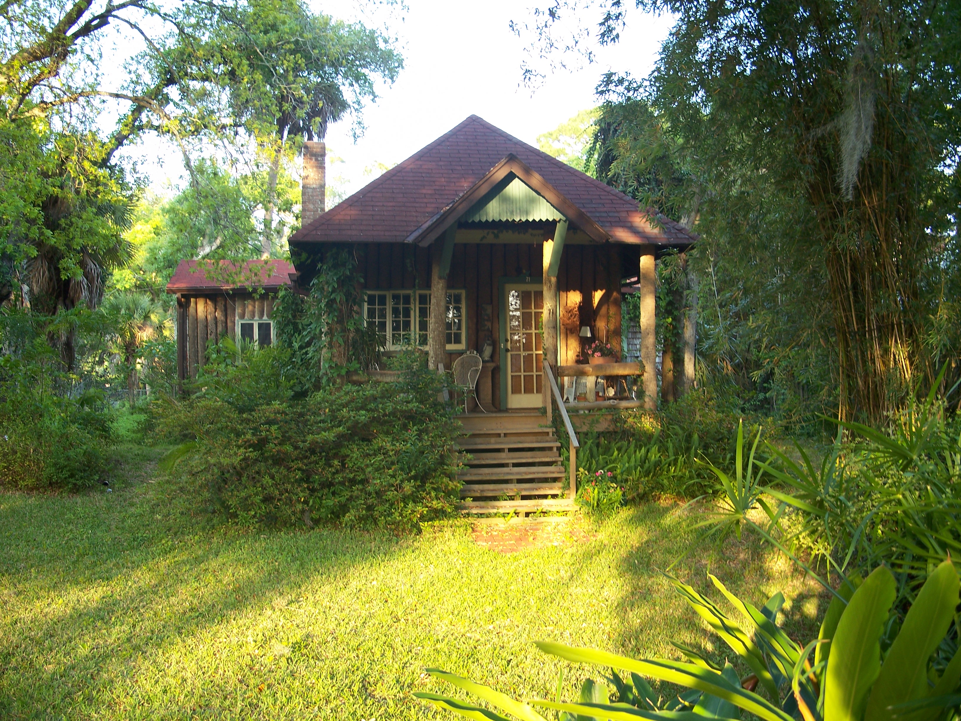
28°52′10″N 81°16′10″W / 28.869444°N 81.269444°WEnterprise 4 John Anderson Lodge 
September 6, 1989 71 Orchard Lane
29°17′26″N 81°02′50″W / 29.290556°N 81.047222°WOrmond Beach Part of the Historic Winter Residences of Ormond Beach, 1878-1925 MPS 5 Anderson-Price Memorial Library Building 
January 26, 1984 42 North Beach Street
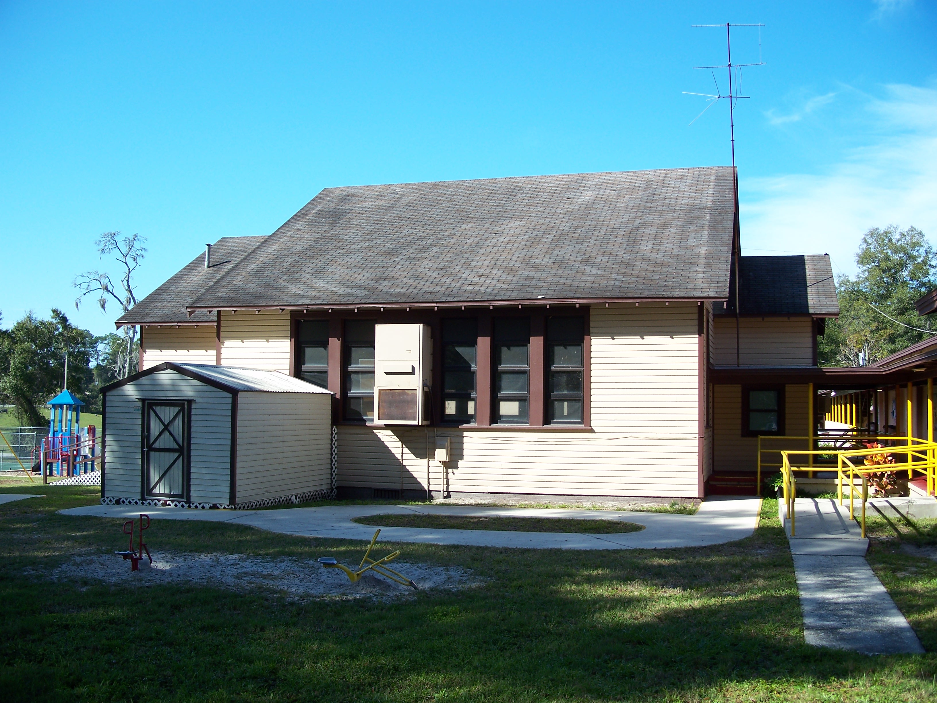
29°17′12″N 81°03′23″W / 29.286667°N 81.056389°WOrmond Beach 6 Barberville Central High School 
February 3, 1993 1776 Lightfoot Lane
29°11′00″N 81°25′23″W / 29.183333°N 81.423056°WBarberville 7 Mary McLeod Bethune Home 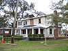
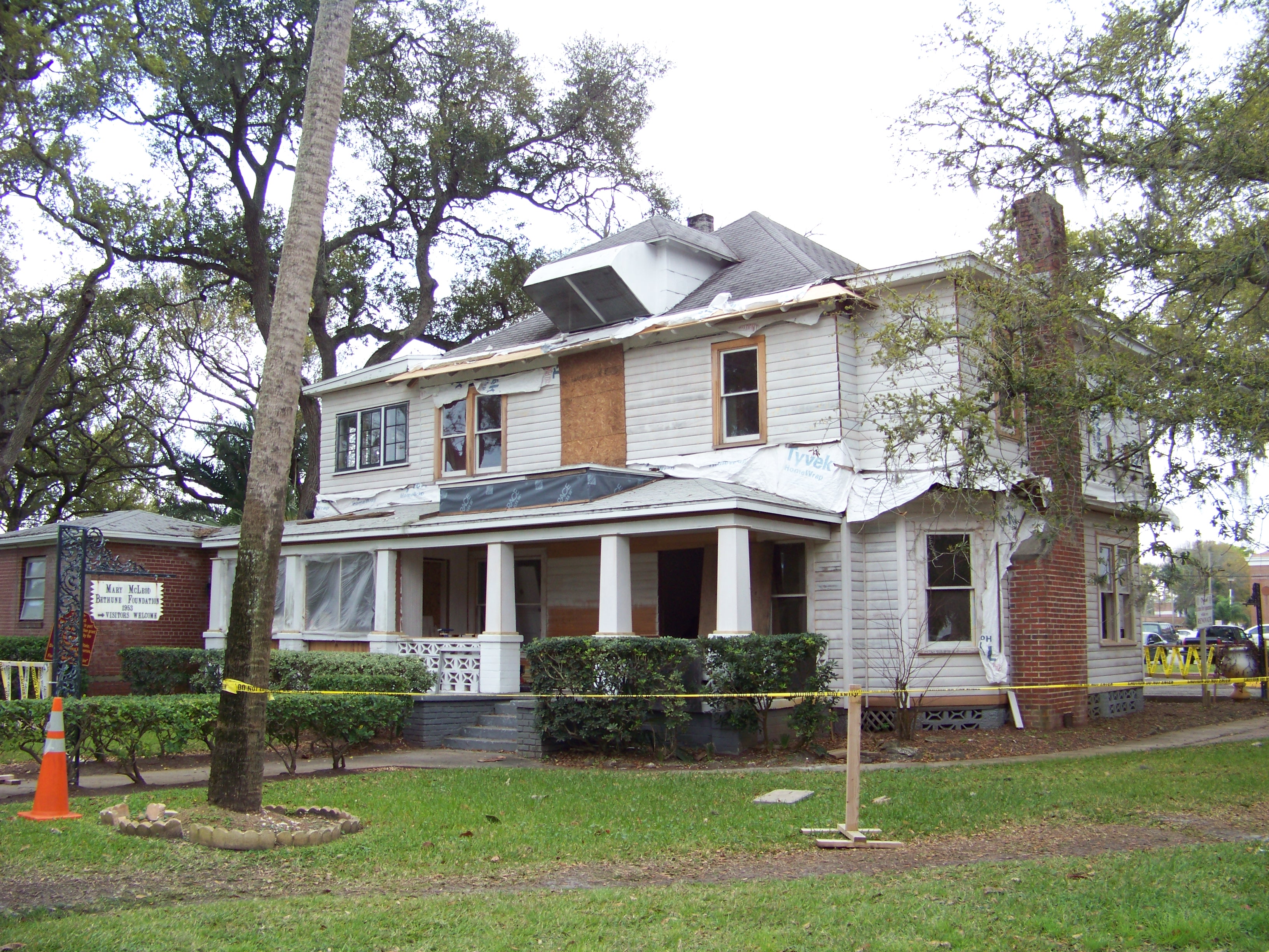
December 2, 1974 Bethune-Cookman College campus
29°12′45″N 81°01′56″W / 29.2125°N 81.032222°WDaytona Beach Home of educator and civil rights leader Mary McLeod Bethune 8 Bethune-Cookman College Historic District 
March 21, 1996 620 Dr. Mary McLeod Bethune Boulevard
29°12′43″N 81°01′55″W / 29.211944°N 81.031944°WDaytona Beach Part of the Daytona Beach MPS 9 Blanchette Archeological Site July 10, 2008 Address Restricted New Smyrna Beach Part of the Archeological Resources of the 18th-Century Smyrnea Settlement of Dr. Andrew Turnbull MPS 10 Delos A. Blodgett House 
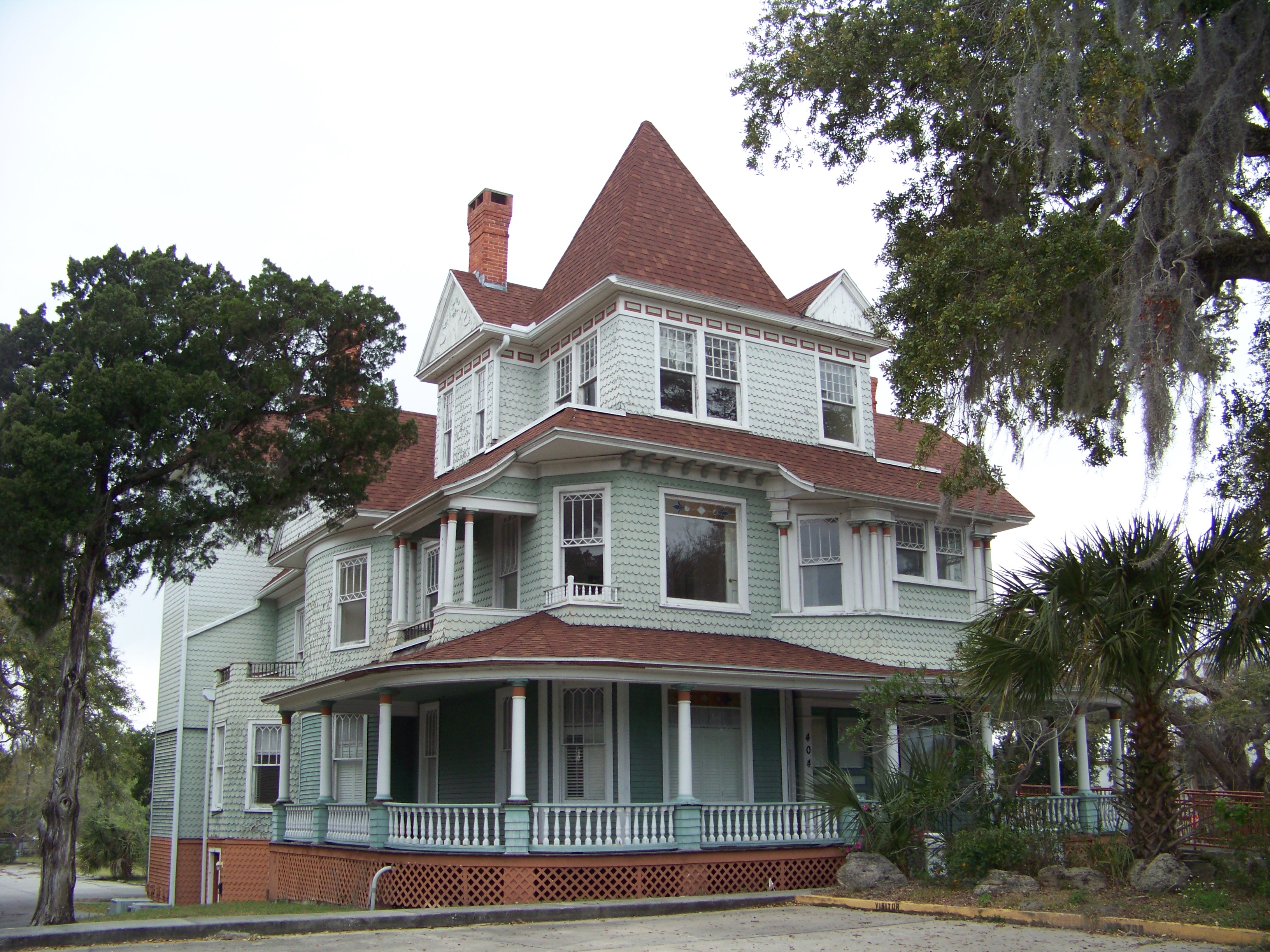
August 2, 1993 404 Ridgewood Avenue
29°12′16″N 81°01′13″W / 29.204444°N 81.020278°WDaytona Beach 11 Casements Annex 
October 6, 1988 127 Riverside Drive
29°17′07″N 81°02′45″W / 29.285278°N 81.045833°WOrmond Beach Part of the Historic Winter Residences of Ormond Beach, 1878-1925 MPS 12 The Casements 
June 30, 1972 15 East Granada Avenue
29°17′21″N 81°02′45″W / 29.289167°N 81.045833°WOrmond Beach 13 Chief Master at Arms House 
February 15, 2002 910 Biscayne Boulevard
29°03′29″N 81°17′18″W / 29.058056°N 81.288333°WDeLand Part of the Florida's Historic World War II Military Resources MPS 14 City Island 
January 7, 2000 108 East Orange Avenue
29°12′34″N 81°00′58″W / 29.209444°N 81.016111°WDaytona Beach 15 City Island Ball Park 
October 22, 1998 City Island, across from the Daytona Beach business district
29°12′34″N 81°01′00″W / 29.209444°N 81.016667°WDaytona Beach Part of the Daytona Beach MPS 16 Coronado Historic District 
February 21, 1997 Roughly bounded by Columbus, Due East, and Pine Avenues, and the Indian River
29°02′19″N 80°54′10″W / 29.038611°N 80.902778°WNew Smyrna Beach 17 Cypress Street Elementary School 
December 2, 1996 900 Cypress Street
29°12′46″N 81°02′24″W / 29.212778°N 81.04°WDaytona Beach Part of the Daytona Beach MPS 18 Daytona Beach Bandshell and Oceanfront Park Complex 
March 5, 1999 Ocean Avenue, north of the junction of Main Street and Atlantic
29°13′41″N 81°00′29″W / 29.228056°N 81.008056°WDaytona Beach Part of the Daytona Beach MPS 19 Daytona Beach Surfside Historic District 
August 1, 1996 Roughly bounded by Auditorium Boulevard, the Atlantic Ocean, U.S. Route 92, and the Halifax River
29°13′30″N 81°00′36″W / 29.225°N 81.01°WDaytona Beach Part of the Daytona Beach MPS 20 DeBary Hall 
July 24, 1972 DeBary Mansion State Park
28°52′29″N 81°17′50″W / 28.874722°N 81.297222°WDeBary 21 DeLand Hall 
January 27, 1983 Stetson University campus
29°02′06″N 81°18′12″W / 29.035°N 81.303333°WDeLand 22 DeLeon Springs Colored School 
August 1, 2003 330 East Retta Street
29°06′51″N 81°20′51″W / 29.114167°N 81.3475°WDeLeon Springs Part of the Florida's Historic Black Public Schools MPS 23 Dickinson Memorial Library and Park 
February 8, 1995 148 South Volusia Avenue
28°56′52″N 81°17′55″W / 28.947778°N 81.298611°WOrange City 24 Dix House 
September 6, 1989 178 North Beach Street
29°17′25″N 81°03′28″W / 29.290278°N 81.057778°WOrmond Beach Part of the Historic Winter Residences of Ormond Beach, 1878-1925 MPS 25 Bartholomew J. Donnelly House 
August 2, 1993 801 North Peninsula Drive
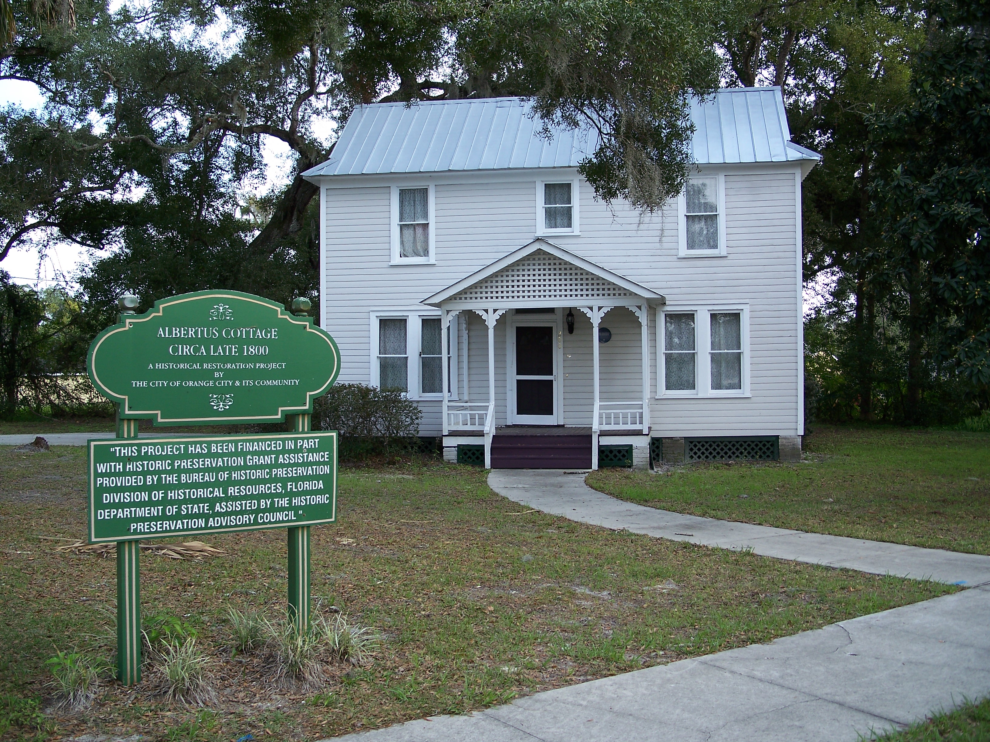
29°14′16″N 81°01′10″W / 29.237778°N 81.019444°WDaytona Beach 26 Downtown DeLand Historic District 
December 23, 1987 Roughly bounded by Florida and Rich Avenues, Woodland Boulevard, and Howry Avenue
29°01′39″N 81°18′17″W / 29.0275°N 81.304722°WDeLand 27 Dunlawton Avenue Historic District 
February 5, 1998 Roughly along Dunlawton Avenue to Lafayette Avenue, and Orange Avenue and Wellman Street
29°08′32″N 80°59′29″W / 29.142222°N 80.991389°WPort Orange Part of the Port Orange MPS 28 Dunlawton Plantation-Sugar Mill Ruins 
August 28, 1973 West of Port Orange off Nova Road
29°08′29″N 81°00′26″W / 29.141389°N 81.007222°WPort Orange 29 El Pino Parque Historic District 
April 26, 1993 1412-1604 North Halifax Drive
29°15′07″N 81°01′44″W / 29.251944°N 81.028889°WDaytona Beach 30 El Real Retiro 
November 10, 1987 636 North Riverside Drive and 647 Faulkner Street
29°02′04″N 80°55′41″W / 29.034444°N 80.928056°WNew Smyrna Beach 31 First Presbyterian Church Archeological Site July 10, 2008 509 Magnolia Street
29°1′15.6″N 80°55′12″W / 29.021°N 80.92°W[5]New Smyrna Beach Part of the Archeological Resources of the 18th-Century Smyrnea Settlement of Dr. Andrew Turnbull MPS 32 Seth French House 
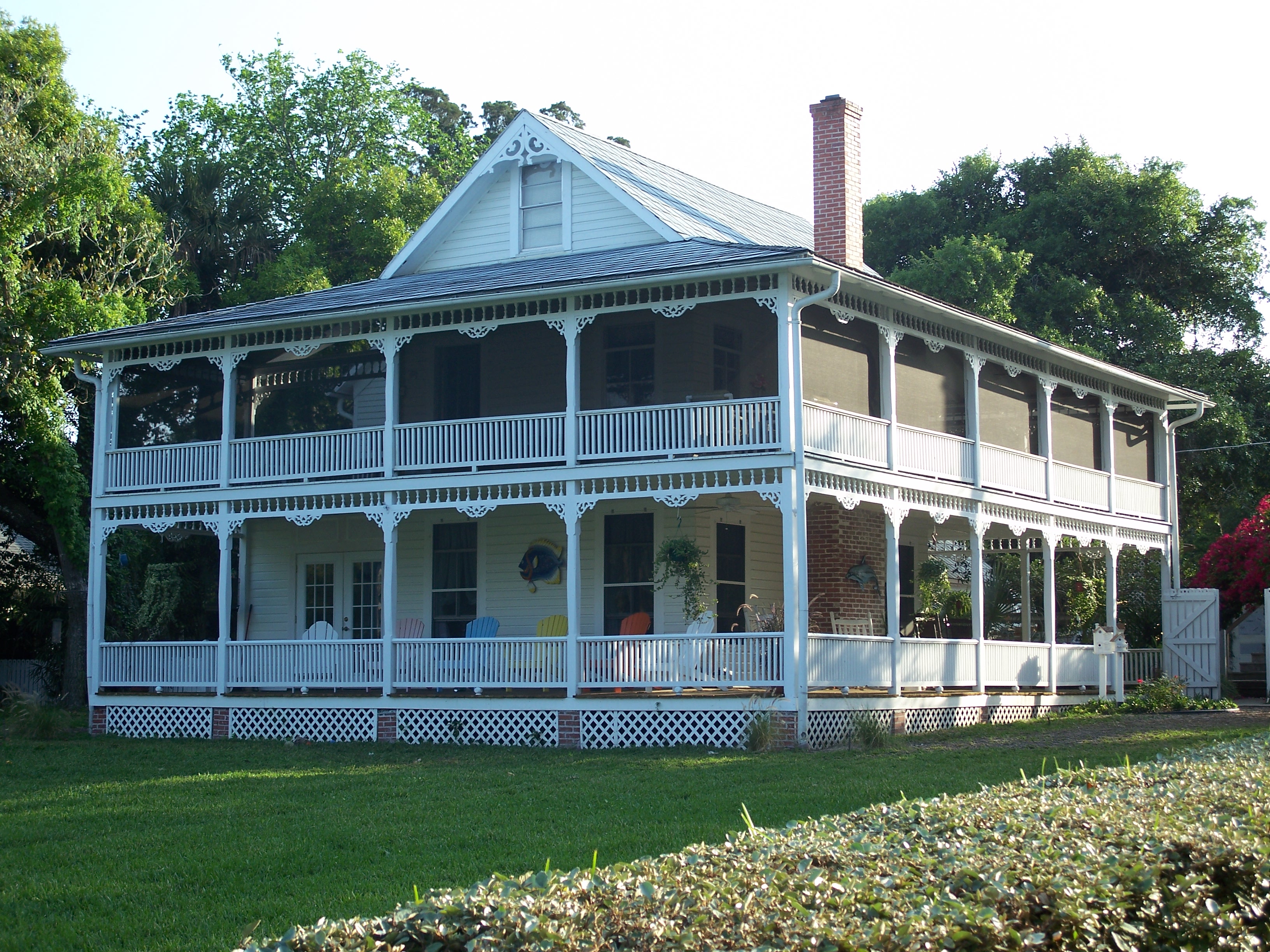
February 12, 2003 319 East French Avenue
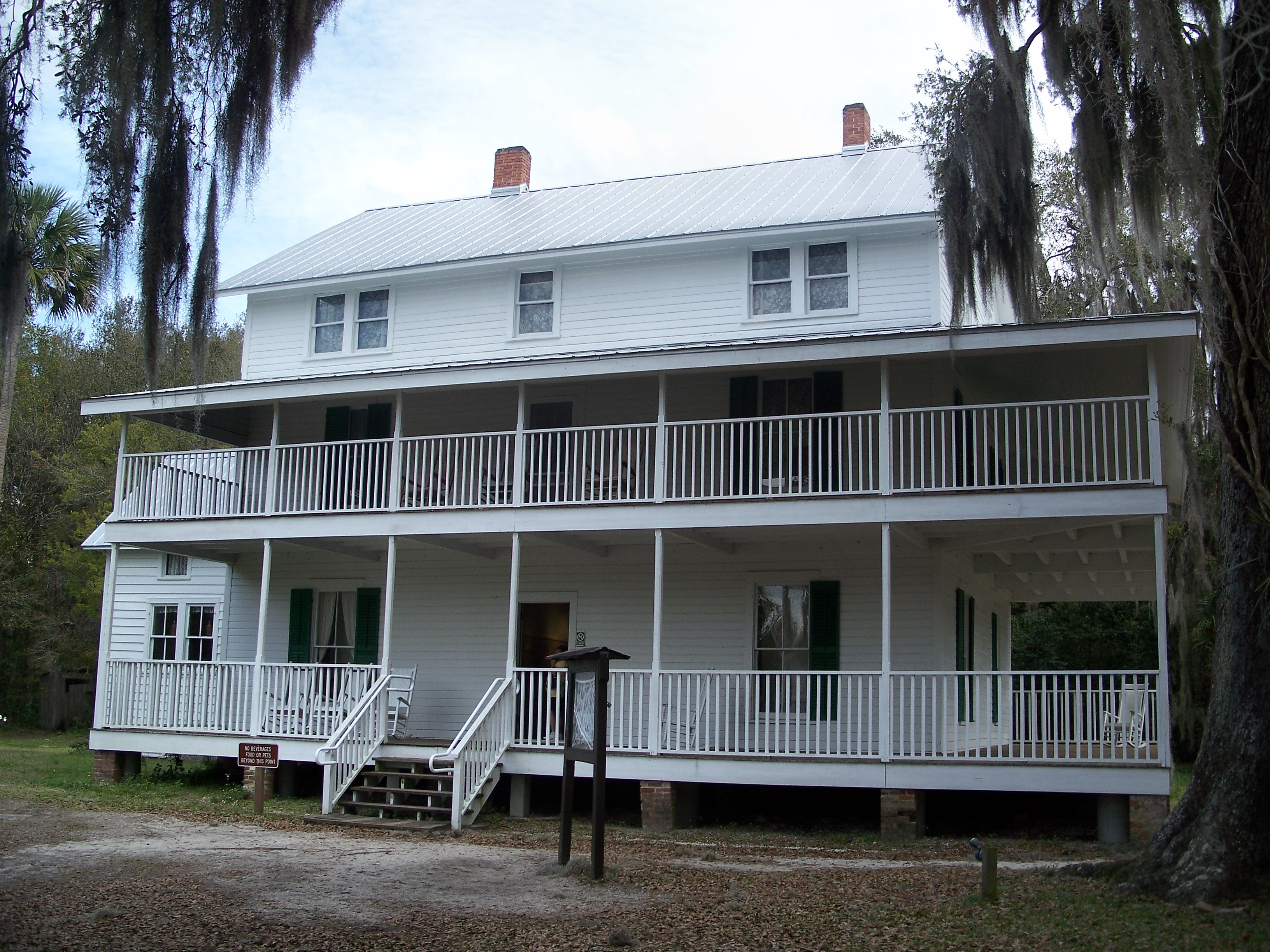
28°57′09″N 81°17′47″W / 28.9525°N 81.296389°WOrange City 33 Gamble Place Historic District 
September 29, 1993 1819 Taylor Road
29°05′22″N 81°02′44″W / 29.089444°N 81.045556°WPort Orange 34 Grace Episcopal Church and Guild Hall 
February 5, 1998 4100 Ridgewood Avenue
29°08′35″N 80°59′14″W / 29.143056°N 80.987222°WPort Orange Part of the Port Orange MPS 35 Grange Archeological Site July 10, 2008 Address Restricted New Smyrna Beach Part of the Archeological Resources of the 18th-Century Smyrnea Settlement of Dr. Andrew Turnbull MPS 36 The Hammocks 
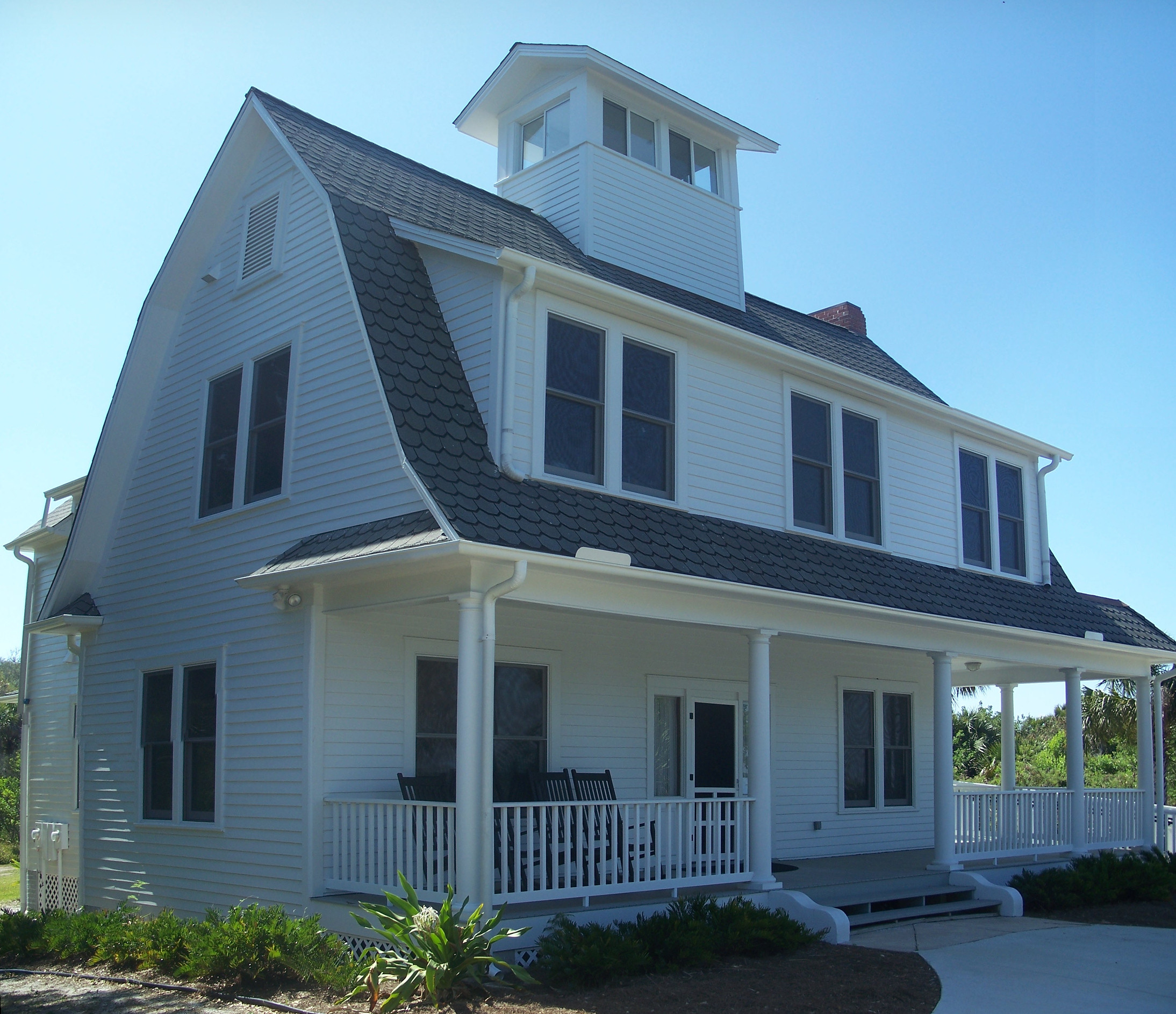
September 5, 1989 311 John Anderson Highway
29°17′51″N 81°03′06″W / 29.2975°N 81.051667°WOrmond Beach Part of the Historic Winter Residences of Ormond Beach, 1878-1925 MPS 37 Hawks Archeological Site July 10, 2008 Address Restricted Edgewater Part of the Archeological Resources of the 18th-Century Smyrnea Settlement of Dr. Andrew Turnbull MPS 38 Alexander Haynes House 
September 7, 1995 128 West Howry Avenue
29°01′33″N 81°18′18″W / 29.025833°N 81.305°WDeLand 39 Holly Hill Municipal Building 
April 8, 1993 1065 Ridgewood Avenue
29°14′43″N 81°02′25″W / 29.245278°N 81.040278°WHolly Hill 40 Janet's Archeological Site July 10, 2008 Address Restricted New Smyrna Beach Part of the Archeological Resources of the 18th-Century Smyrnea Settlement of Dr. Andrew Turnbull MPS 41 Kilkoff House 
October 8, 1997 1145 West New York Avenue
29°01′42″N 81°19′33″W / 29.028333°N 81.325833°WDeland 42 Amos Kling House 
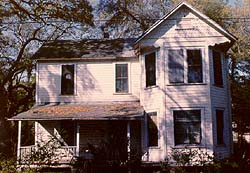
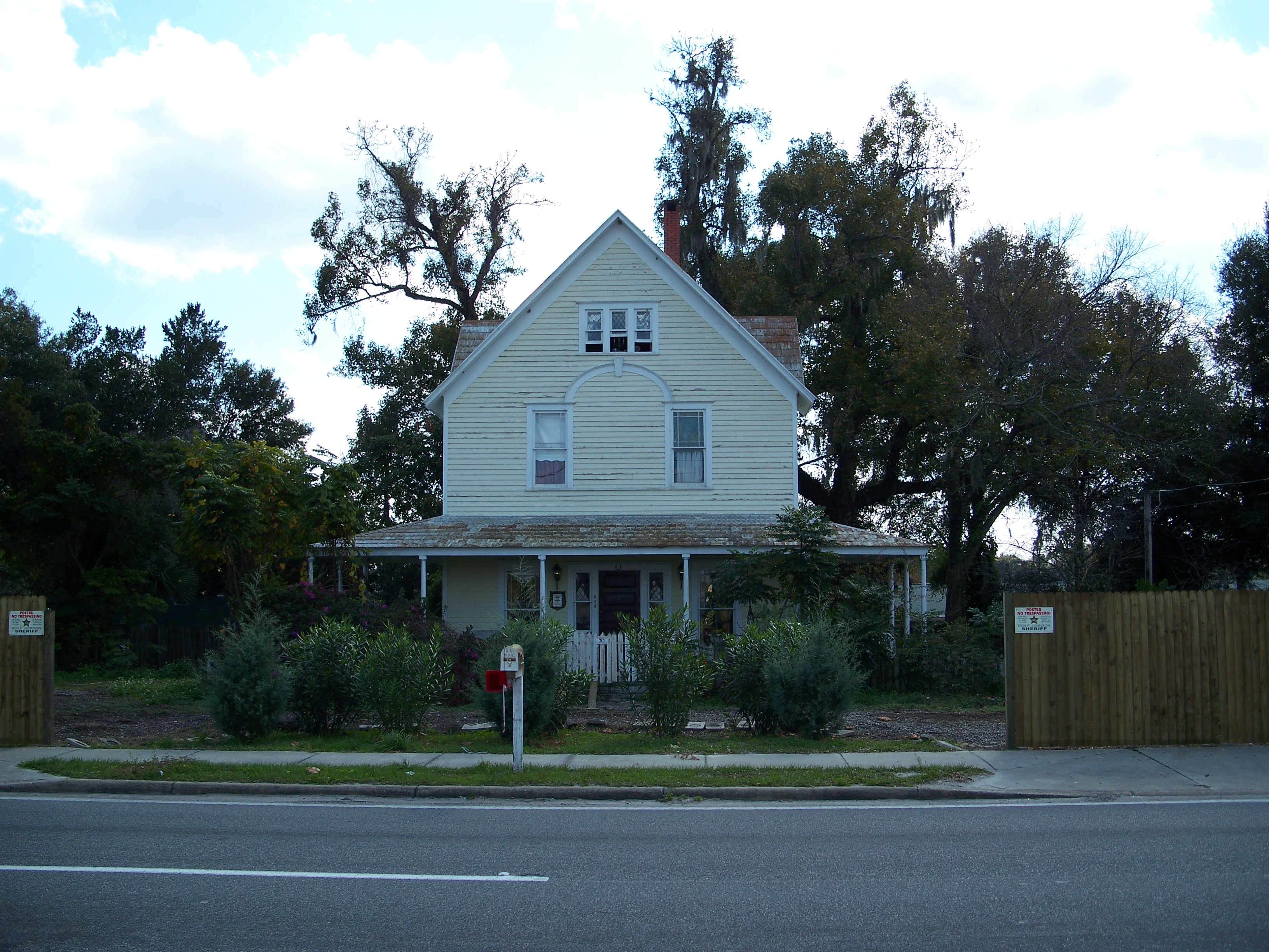
December 2, 1993 220-222 Magnolia Avenue
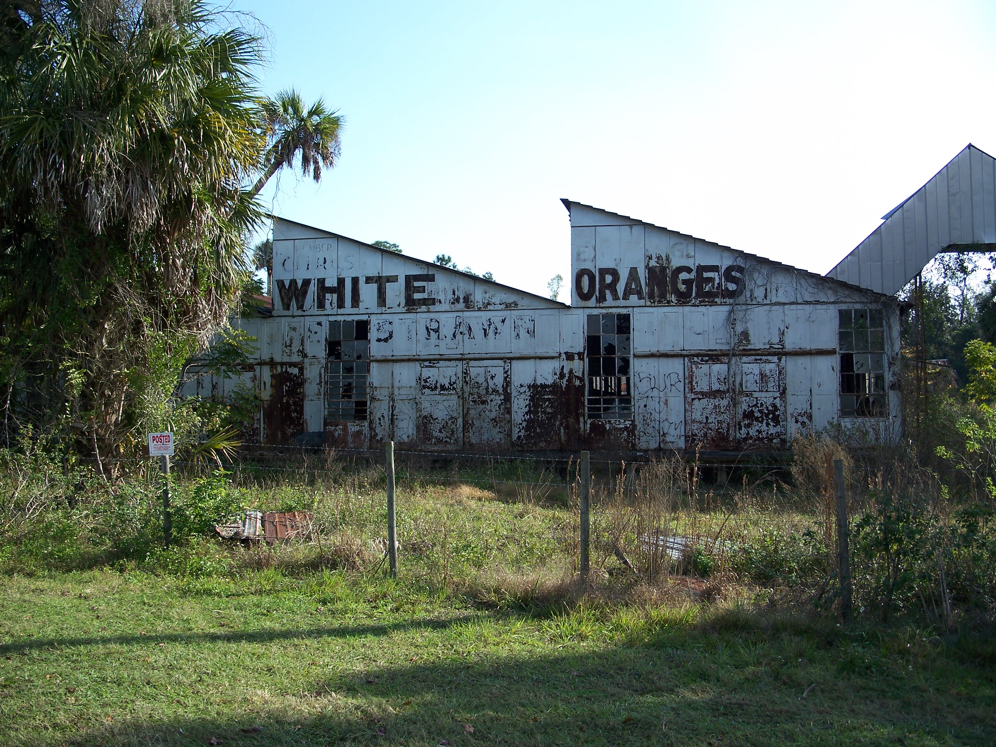
29°12′34″N 81°01′18″W / 29.209444°N 81.021667°WDaytona Beach 43 S.H. Kress and Co. Building 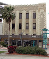
July 7, 1983 140 South Beach Street
29°12′38″N 81°01′10″W / 29.210556°N 81.019444°WDaytona Beach 44 Lake Helen Historic District 
September 16, 1993 Roughly bounded by West New York, Lakeview, Park, and Euclid Avenues
28°59′18″N 81°14′03″W / 28.988333°N 81.234167°WLake Helen Part of the Lake Helen MPS 45 Lippincott Mansion 
February 21, 1985 150 South Beach Street
29°16′51″N 81°03′15″W / 29.280833°N 81.054167°WOrmond Beach 46 Merchants Bank Building 
January 6, 1986 252 South Beach Street
29°12′30″N 81°00′29″W / 29.208333°N 81.008056°WDaytona Beach 47 Moulton-Wells House 
November 21, 2001 West of Eldora Road on the Canaveral National Seashore
28°54′32″N 80°49′16″W / 28.908889°N 80.821111°WNew Smyrna Beach 48 Mount Taylor October 8, 1997 Address Restricted DeBary 49 New Smyrna Beach Historic District 
April 26, 1990 Roughly bounded by Riverside Drive, U.S. Route 1, Ronnoc Lane, and Smith Street
29°01′30″N 80°55′27″W / 29.025°N 80.924167°WNew Smyrna Beach 50 New Smyrna Sugar Mill Ruins 
August 12, 1970 1 mile west of New Smyrna Beach
29°00′34″N 80°56′25″W / 29.009444°N 80.940278°WNew Smyrna Beach 51 Old DeLand Memorial Hospital 
November 27, 1989 Stone Street
29°02′37″N 81°19′03″W / 29.043611°N 81.3175°WDeLand 52 Old Fort Park Archeological Site 
July 10, 2008 Address Restricted
29°01′38″N 80°55′20″W / 29.027222°N 80.922222°WNew Smyrna Beach Part of the Archeological Resources of the 18th-Century Smyrnea Settlement of Dr. Andrew Turnbull MPS 53 Old Stone Wharf Archeological Site 
July 10, 2008 Address Restricted
29°01′11″N 80°55′07″W / 29.019722°N 80.918611°WNew Smyrna Beach Part of the Archeological Resources of the 18th-Century Smyrnea Settlement of Dr. Andrew Turnbull MPS 54 Nocoroco 
May 7, 1973 2 miles north of Ormond Beach
29°21′07″N 81°05′14″W / 29.351944°N 81.087222°WOrmond Beach 55 Olds Hall 
September 23, 1993 340 South Ridgewood Avenue
29°12′18″N 81°01′13″W / 29.205°N 81.020278°WDaytona Beach 56 Orange City Colored School 
August 1, 2003 200 East Blue Springs Avenue
28°56′19″N 81°17′49″W / 28.938611°N 81.296944°WOrange City Part of the Florida's Historic Black Public Schools MPS 57 Orange City Historic District 
April 6, 2004 Roughly Banana, Carpenter, French and Orange Avenues
28°56′56″N 81°17′57″W / 28.948889°N 81.299167°WOrange City Part of the Orange City, Florida MPS 58 Orange City Town Hall 
May 16, 2002 205 East Graves Avenue
28°56′56″N 81°17′52″W / 28.948889°N 81.297778°WOrange City 59 Ormond Fire House 
December 15, 2010 160 East Granada Boulevard
29°17′27″N 81°02′32″W / 29.290833°N 81.042222°WOrmond Beach 60 Ormond Hotel 
November 24, 1980 15 East Granada Boulevard
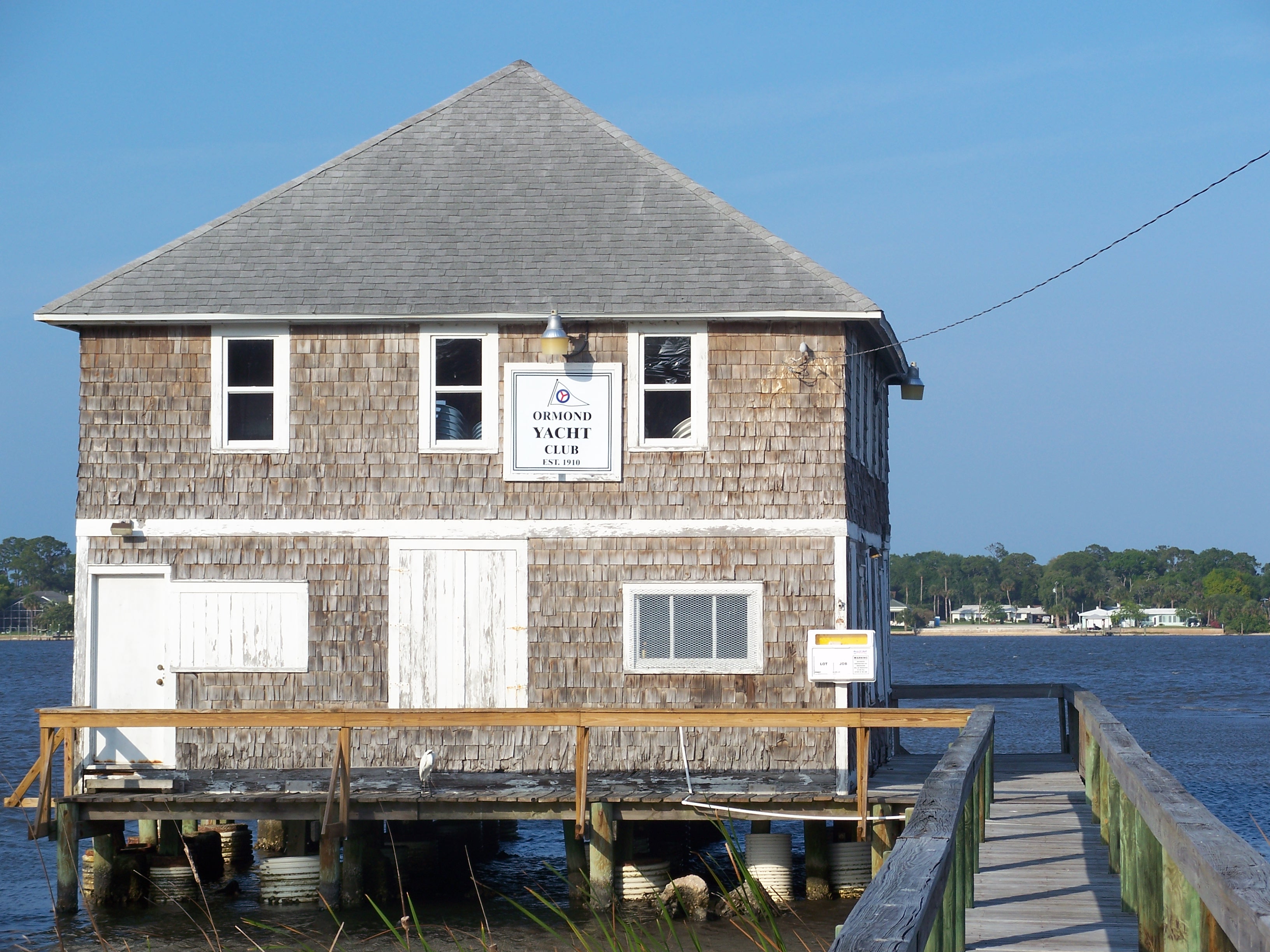
29°17′22″N 81°02′50″W / 29.289444°N 81.047222°WOrmond Beach Demolished in 1992, only hotel's cupola preserved in nearby park[6] 61 Ormond Yacht Club 
April 19, 2005 63 North Beach Street
29°17′16″N 81°03′21″W / 29.287778°N 81.055833°WOrmond Beach 62 Ponce De Leon Inlet Lightstation 
September 22, 1972 4931 South Peninsula Drive, U.S. Coast Guard Reservation
29°04′50″N 80°55′42″W / 29.080556°N 80.928333°WPonce Inlet 63 The Porches 
October 6, 1988 176 South Beach Street
29°16′52″N 81°03′14″W / 29.281111°N 81.053889°WOrmond Beach Part of the Historic Winter Residences of Ormond Beach, 1878-1925 MPS 64 Port Orange Florida East Coast Railway Freight Depot 
February 5, 1998 415C Herbert Street
29°08′37″N 80°59′36″W / 29.143611°N 80.993333°WPort Orange Part of the Port Orange MPS 65 Rogers House 
September 11, 1986 436 North Beach Street
29°13′09″N 81°00′50″W / 29.219167°N 81.013889°WDaytona Beach 66 Ross Hammock Site February 5, 1981 Address Restricted Oak Hill 67 Rowallan 
October 6, 1988 253 John Anderson Highway
29°17′36″N 81°02′59″W / 29.293333°N 81.049722°WOrmond Beach Part of the Historic Winter Residences of Ormond Beach, 1878-1925 MPS 68 St. Rita's Colored Catholic Mission 
April 13, 2007 314 Duss Street
29°01′27″N 80°55′56″W / 29.024167°N 80.932222°WNew Smyrna Beach 69 Seabreeze Historic District 
September 3, 1998 Roughly bounded by University Boulevard, the Halifax River, Auditorium Boulevard, and North Atlantic Avenue
29°13′58″N 81°02′34″W / 29.232778°N 81.042778°WDaytona Beach Part of the Daytona Beach MPS 70 Seminole Rest 
March 19, 1997 East of State Road 5 on the western shore of Mosquito Lagoon at the Canaveral National Seashore
28°52′11″N 80°50′15″W / 28.869722°N 80.8375°WOak Hill 71 Seybold Baking Company Factory 
October 30, 1997 800 Orange Avenue
29°12′09″N 81°01′55″W / 29.2025°N 81.031944°WDaytona Beach Part of the Daytona Beach MPS 72 Sleepy Hollow Archeological Site July 10, 2008 Address Restricted New Smyrna Beach Part of the Archeological Resources of the 18th-Century Smyrnea Settlement of Dr. Andrew Turnbull MPS 73 South Beach Street Historic District 
September 15, 1988 Roughly bounded by Volusia Avenue, South Beach Street, South Street, and U.S. Route 1
29°12′18″N 81°01′03″W / 29.205°N 81.0175°WDaytona Beach 74 South Peninsula Historic District 
November 19, 1998 Roughly the Daytona Beach Peninsula between the Atlantic Ocean and the Halifax River
29°12′37″N 81°00′20″W / 29.210278°N 81.005556°WDaytona Beach Part of the Daytona Beach MPS 75 South Ridgewood Elementary School South Ridgewood Elementary SchoolJuly 14, 2011 747 S. Ridgewood Ave.
29°11′55″N 81°00′56″W / 29.198611°N 81.015556°WDaytona Beach 76 Southern Cassadaga Spiritualist Camp Historic District 
March 14, 1991 Roughly bounded by Cassadaga Road and Marion, Stevens, Lake, and Chauncey Streets
28°57′52″N 81°14′14″W / 28.964444°N 81.237222°WCassadaga 77 Southwest Daytona Beach Black Heritage District 
May 23, 1997 Roughly bounded by Foote Court, South Street, Dr. Martin Luther King Boulevard, and the Florida East Coast railroad tracks
29°12′08″N 81°01′26″W / 29.202222°N 81.023889°WDaytona Beach Part of the Daytona Beach MPS 78 Spruce Creek Mound Complex 
December 3, 1990 Address Restricted Port Orange 79 Stetson University Campus Historic District 
March 14, 1991 Roughly bounded by Michigan Avenue, North Florida Avenue, West University Avenue, and a line south from North Hayden Avenue
29°02′06″N 81°18′13″W / 29.035°N 81.303611°WDeLand 80 John B. Stetson House 
November 21, 1978 1031 Camphor Lane
29°01′24″N 81°19′25″W / 29.023333°N 81.323611°WDeLand 81 Ann Stevens House 
August 18, 1993 201 East Kicklighter Road
28°58′10″N 81°14′00″W / 28.969444°N 81.233333°WLake Helen Part of the Lake Helen MPS 82 Stockton-Lindquist House 
June 22, 2004 244 East Beresford Avenue
29°00′48″N 81°17′59″W / 29.013333°N 81.299722°WDeLand 83 Strawn Historic Agricultural District 
September 13, 1993 Bounded by Broderick and Retta Streets and by Central and Dundee Avenues
29°06′56″N 81°20′56″W / 29.115556°N 81.348889°WDeLeon Springs Part of the Citrus Industry Resources of Theodore Strawn, Inc., MPS 84 Strawn Historic Citrus Packing House District 
September 13, 1993 5707 Lake Winona Road
29°08′18″N 81°21′35″W / 29.138333°N 81.359722°WDeLeon Springs Part of the Citrus Industry Resources of Theodore Strawn, Inc., MPS 85 Strawn Historic Sawmill District 
September 13, 1993 5710 Lake Winona Road
29°08′21″N 81°21′38″W / 29.139167°N 81.360556°WDeLeon Springs Part of the Citrus Industry Resources of Theodore Strawn, Inc., MPS 86 Talahloka 
September 6, 1989 19 Orchard Lane
29°17′26″N 81°02′53″W / 29.290556°N 81.048056°WOrmond Beach Part of the Historic Winter Residences of Ormond Beach, 1878-1925 MPS 87 Tarragona Tower 
May 6, 2005 Tarragona Way and International Speedway Boulevard
29°12′00″N 81°02′49″W / 29.2°N 81.046944°WDaytona Beach 88 Three Chimneys Archaeological Site 
September 16, 2010 715 West Granada Boulevard
29°16′41″N 81°04′26″W / 29.278°N 81.074°WOrmond Beach 89 Howard Thurman House February 23, 1990 614 Whitehall Street
29°11′54″N 81°01′19″W / 29.198333°N 81.021944°WDaytona Beach Home of educator and civil rights leader Howard Thurman 90 Louis P. Thursby House 
May 11, 2000 Located inside Blue Spring State Park
28°56′41″N 81°20′21″W / 28.944722°N 81.339167°WOrange City 91 Tourist Church 
October 6, 1995 501 North Wild Olive Avenue
29°13′59″N 81°00′52″W / 29.233056°N 81.014444°WDaytona Beach 92 Turnbull Canal System 
August 24, 2007 Address Restricted New Smyrna Beach Part of the Archeological Resources of the 18th-Century Smyrnea Settlement of Dr. Andrew Turnbull MPS 93 Turnbull Colonists' House Archeological Site 
July 10, 2008 1919 North Dixie Freeway
29°03′17″N 80°56′23″W / 29.054722°N 80.939722°WNew Smyrna Beach Part of the Archeological Resources of the 18th-Century Smyrnea Settlement of Dr. Andrew Turnbull MPS 94 Turnbull Colonists' House No. 2 Archeological Site July 10, 2008 Address Restricted New Smyrna Beach Part of the Archeological Resources of the 18th-Century Smyrnea Settlement of Dr. Andrew Turnbull MPS 95 Turtle Mound 
September 29, 1970 Canaveral National Seashore, south of Bethune Beach
28°55′51″N 80°49′37″W / 28.93083°N 80.82694°W[7]New Smyrna Beach 96 US Post Office 
June 30, 1988 220 North Beach Street
29°12′51″N 81°01′16″W / 29.214167°N 81.021111°WDaytona Beach 97 West DeLand Residential District 
November 20, 1992 Roughly bounded by University, Florida, New York and Orange Avenues
29°01′57″N 81°18′37″W / 29.0325°N 81.310278°WDeLand 98 White-Fox House Archeological Site July 10, 2008 Address Restricted New Smyrna Beach Part of the Archeological Resources of the 18th-Century Smyrnea Settlement of Dr. Andrew Turnbull MPS 99 White Hall 
July 15, 1992 640 Dr. Mary McLeod Bethune Boulevard
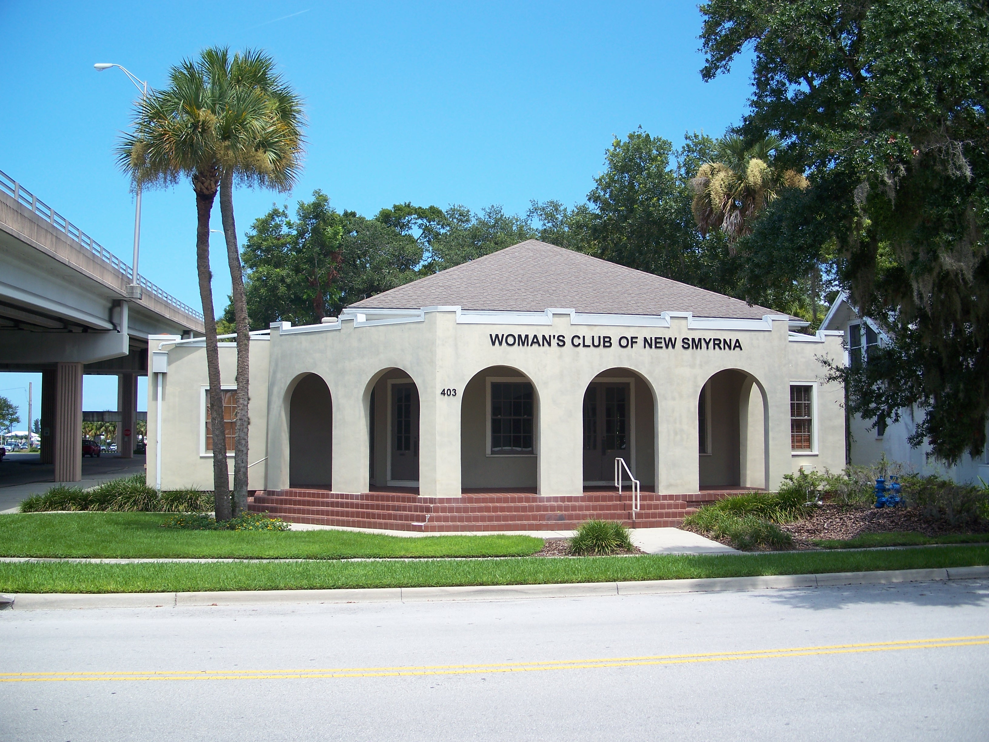
29°12′43″N 81°01′57″W / 29.211944°N 81.0325°WDaytona Beach 100 Woman's Club of New Smyrna 
May 11, 1989 403 Magnolia Street
29°01′20″N 80°55′16″W / 29.022222°N 80.921111°WNew Smyrna Beach 101 S. Cornelia Young Memorial Library 
June 25, 1992 302 Vermont Avenue
29°13′10″N 81°00′36″W / 29.219444°N 81.01°WDaytona Beach Former listing
[3] Landmark name Image Date listed Location City or town Summary 1 Halifax Drive Historic District 
February 5, 1998 Roughly along Halifax Drive from Dunlawton to Herbert Street
29°8′37″N 80°59′11″W / 29.14361°N 80.98639°WPort Orange Part of the Port Orange MPS; removed January 29, 2009 See also
- List of National Historic Landmarks in Florida
- National Register of Historic Places listings in Florida
References
- ^ The latitude and longitude information provided in this table was derived originally from the National Register Information System, which has been found to be fairly accurate for about 99% of listings. For about 1% of NRIS original coordinates, experience has shown that one or both coordinates are typos or otherwise extremely far off; some corrections may have been made. A more subtle problem causes many locations to be off by up to 150 yards, depending on location in the country: most NRIS coordinates were derived from tracing out latitude and longitudes off of USGS topographical quadrant maps created under the North American Datum of 1927, which differs from the current, highly accurate WGS84 GPS system used by Google maps. Chicago is about right, but NRIS longitudes in Washington are higher by about 4.5 seconds, and are lower by about 2.0 seconds in Maine. Latitudes differ by about 1.0 second in Florida. Some locations in this table may have been corrected to current GPS standards.
- ^ "National Register of Historic Places: Weekly List Actions". National Park Service, United States Department of the Interior. Retrieved on November 10, 2011.
- ^ a b Numbers represent an ordering by significant words. Various colorings, defined here, differentiate National Historic Landmark sites and National Register of Historic Places Districts from other NRHP buildings, structures, sites or objects.
- ^ "National Register Information System". National Register of Historic Places. National Park Service. . http://nrhp.focus.nps.gov/natreg/docs/All_Data.html.
- ^ Location derived from the location of First Presbyterian Church from this Central Florida Presbytery webpage; the NRIS lists the site as "Address Restricted"
- ^ Ormond Beach: The pace slows at the 'Birthplace of Speed'
- ^ Location derived from its GNIS feature record; the NRIS lists the site as "Address Restricted"
U.S. National Register of Historic Places in Florida Lists by county Alachua • Baker • Bay • Bradford • Brevard • Broward • Calhoun • Charlotte • Citrus • Clay • Collier • Columbia • DeSoto • Dixie • Duval • Escambia • Flagler • Franklin • Gadsden • Gilchrist • Glades • Gulf • Hamilton • Hardee • Hendry • Hernando • Highlands • Hillsborough • Holmes • Indian River • Jackson • Jefferson • Lafayette • Lake • Lee • Leon • Levy • Liberty • Madison • Manatee • Marion • Martin • Miami-Dade • Monroe • Nassau • Okaloosa • Okeechobee • Orange • Osceola • Palm Beach • Pasco • Pinellas • Polk • Putnam • Santa Rosa • Sarasota • Seminole • St. Johns • St. Lucie • Sumter • Suwannee • Taylor • Union • Volusia • Wakulla • Walton • Washington
Lists by city Other lists Municipalities and communities of Volusia County, Florida Cities Daytona Beach | Daytona Beach Shores | DeBary | DeLand | Deltona | Edgewater | Flagler Beach‡ | Holly Hill | Lake Helen | New Smyrna Beach | Oak Hill | Orange City | Ormond Beach | Port Orange | South Daytona

Towns CDPs Unincorporated
communitiesAlamana | Allandale | Barberville | Bethune Beach | Boden | Cassadaga | Cow Creek | Creighton | Eldora | Emporia | Enterprise | Farmton | Fort Florida | Lemon Bluff | Maytown | Osteen | Pennichaw | Senyah | Seville | Volusia | Wilbur-By-The-Sea
Footnotes ‡This populated place also has portions in an adjacent county or counties
Categories:- National Register of Historic Places in Volusia County, Florida
- National Register of Historic Places in Florida by county
-


Wikimedia Foundation. 2010.