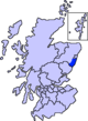
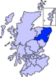
- Maryculter
-
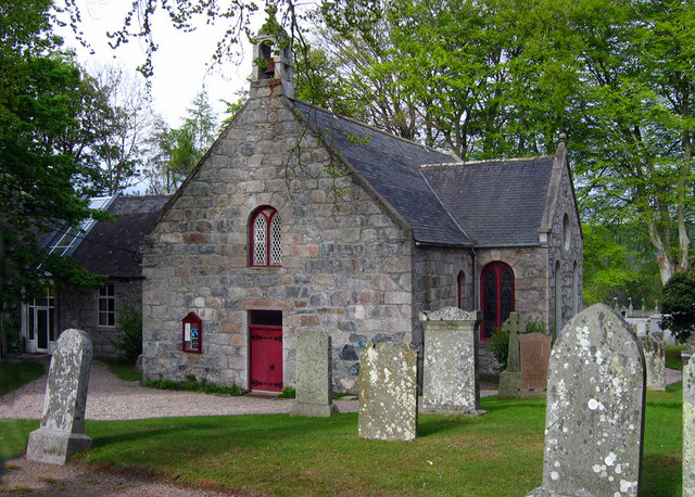
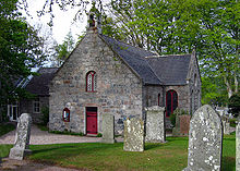 Kirkton of Maryculter Church
Maryculter (
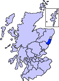
 listen (help·info)) or Kirkton of Maryculter is a village in the Lower Deeside area of Aberdeenshire, Scotland. The River Dee separates it from the town of Peterculter, and the B979 road runs through Maryculter. There are two hotels: The Old Mill Inn, a former coaching inn that dates back 200 years, and Maryculter House Hotel. At the edge of the village of Maryculter is a public forest land, known as the Oldman Wood, through which flows the Crynoch Burn. Also the children's theme park, StoryBook Glen, which also consists of a shop and restaurant is located near the old church which is still in use today as a Church of Scotland. Other notable vicinity buildings are the Lairhillock Inn and Muchalls Castle.
Contents
Ancient history
Prehistoric habitation in the Maryculter area is known through archaeological sites such as Balbridie situated somewhat west of Maryculter. Roman legions marched from Raedykes to Normandykes, marching slightly west of Maryculter, as they sought higher ground evading the bogs of Red Moss and other low-lying mosses associated with the Burn of Muchalls. That march used the Elsick Mounth, one of the ancient trackways crossing the Grampian Mountains,[1] lying west of Netherley.
References
- John A. Henderson (1892) Annals of Lower Deeside: Being a Topographical, Proprietary, Ecclesiastical, and Antiquarian History of Durris, Drumoak, and Culter, D. Wyllie and Son, 271 pages
- C. Michael Hogan, Elsick Mounth, Megalithic Portal, ed A. Burnham
Line notes
External links
Maryculter is the home of the more wealthy residents of Aberdeen. Maryculter also has an animal sanctuary Blaikiewell Animal Sanctuary
Settlements and places of interest in Kincardine and Mearns, Aberdeenshire Primary settlements Auchenblae · Drumoak · Fettercairn · Gourdon · Inverbervie · Johnshaven · Laurencekirk · Newtonhill · Portlethen · St Cyrus · Stonehaven
Other settlements Arbuthnott · Banchory-Devenick · Bridge of Muchalls · Cammachmore · Catterline · Cookney · Downies · Drumlithie · Findon · Fordoun · Glenbervie · Kinneff · Kirkton of Durris · Maryculter · Marykirk · Muchalls · Netherley · Portlethen Village
Places of interest Causey Mounth · Crawton · Drum Castle · Dunnottar Castle · Fetteresso Castle · Fowlsheugh Nature Reserve (Craiglethy) · Monboddo House · Muchalls Castle · Normandykes · Portlethen Moss · Raedykes · Stonehaven Open Air Pool · Stonehaven Tolbooth
Areas and primary settlements in Aberdeenshire
(see also: Aberdeen City)in Banff and Buchan Aberchirder · Banff · Fraserburgh · Gardenstown · Inverallochy and Cairnbulg · Macduff · Portsoy · Rosehearty · Sandhaven · Whitehills
in Buchan Boddam · Crimond · Cruden Bay · Fetterangus · Hatton · Longside · Maud · Mintlaw · New Deer · New Pitsligo · Peterhead · St Combs · St Fergus · Strichen · Stuartfield
in Formartine Balmedie · Cuminestown · Ellon · Fyvie · Newburgh · Oldmeldrum · Pitmedden · Potterton · Rothienorman · Tarves · Turriff
in Garioch in Kincardine and Mearns Drumoak · Fettercairn · Gourdon · Inverbervie · Johnshaven · Laurencekirk · Newtonhill · Portlethen · St Cyrus · Stonehaven
in Marr Categories:- Aberdeenshire geography stubs
- Villages in Aberdeenshire

Wikimedia Foundation. 2010.