Nairn Falls Provincial Park

Nairn Falls Provincial Park
BC parks.png
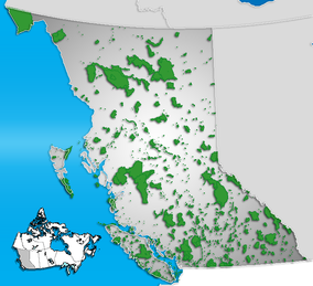
Location of Nairn Falls Provincial Park in British Columbia
Location British Columbia, Canada
Nearest city Pemberton
Area 170 hectare
Governing body BC Parks
Nairn Falls
Location Pemberton
Type Tiered
Total height 130 feet (40 m)
Total width 30 feet (9.1 m)
Watercourse Green River

Nairn Falls Provincial Park is a provincial park in British Columbia, Canada located on the Green River adjacent to British Columbia Highway 99 and the Canadian National Railway line just south of Pemberton and less than twenty minutes north of the resort town of Whistler. The 170 hectare park was established in 1966, shortly after the highway's opening, to protect and enhance visitor access to Nairn Falls, a double waterfall connected by a small canyon which throttles the flow of the Green River just before its accession to the lowlands of the Pemberton Valley and its confluence with the Lillooet River just above that river's estuary into Lillooet Lake.

Facilities

The park's campground, located in forest land near the falls, has 94 vehicle-accessible sites and is open from May to October.

References

External links


Wikimedia Foundation. 2010.

Игры ⚽ Поможем решить контрольную работу

Look at other dictionaries:

  • Murrin Provincial Park — IUCN Category II (National Park) Browning Lake, summer 2010 Locatio …   Wikipedia

  • Mount Seymour Provincial Park — Mount Seymour Provincial Park. September, 2005 East slopes, looking north toward Mt. Elsay …   Wikipedia

  • Davis Lake Provincial Park — is a provincial park in British Columbia, Canada. It is located east of the southern end of Stave Lake,[1][2] northeast of Mission, British Columbia. The park s area is c. 185 acres (0.75 km2). There are campgrounds and beaches at the south… …   Wikipedia

  • Mount Elphinstone Provincial Park — is a provincial park in British Columbia, Canada, located around the mountain of the same name on the west side of Howe Sound, just north of the town of Gibsons and just above the community of Roberts Creek. Created in 2000 the park is… …   Wikipedia

  • Duffey Lake Provincial Park — is a provincial park in British Columbia, Canada, located at the lake of the same name, which lies along BC Highway 99 just east of the summit of Cayoosh Pass. The lake s inflow and outflow are Cayoosh Creek. References …   Wikipedia

  • Mehatl Creek Provincial Park — is a provincial park in British Columbia, Canada, located in the central Lillooet Ranges to the west of Boston Bar. References BC Parks webpage Mehatl Creek Park . BC Geographical Names. http://apps.gov.bc.ca/pub/bcgnws/names/51426.html …   Wikipedia

  • Provincial Parks in British Columbia — Karte der Provincial Parks in British Columbia Die kanadische Provinz British Columbia unterhält 620 Provincial Parks (Stand: November 2010). Damit besitzt die Provinz nach den kanadischen Nationalparks das größte Parksystem des Landes. Über 13,5 …   Deutsch Wikipedia

  • Cypress Provincial Park — IUCN Category II (National Park) …   Wikipedia

  • Clendinning Provincial Park — is a provincial park in British Columbia, Canada.[1] It surrounds the drainage of Clendinning Creek, which is a tributary of the Elaho River. Its name is shared by the Clendinning Range, of which Mount Clendinning is the highest summit (there is… …   Wikipedia

  • List of British Columbia Provincial Parks — The following is a list of all British Columbia land currently managed by [http://www.env.gov.bc.ca/bcparks BC Parks] . Any parks that are closed are not currently listed.There were a number of provincial parks, protected areas and ecological… …   Wikipedia

Share the article and excerpts

Direct link
Do a right-click on the link above
and select “Copy Link”