- Coromandel Peninsula
-
This article is about the Coromandel Peninsula in New Zealand. For the similarly named region in India, see Coromandel Coast.
 Location of Coromandel Peninsula
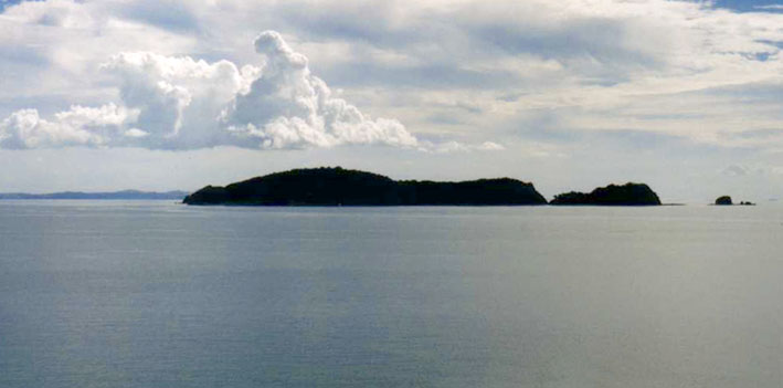
 Motukawao Islands and Hauraki Gulf from near Colville
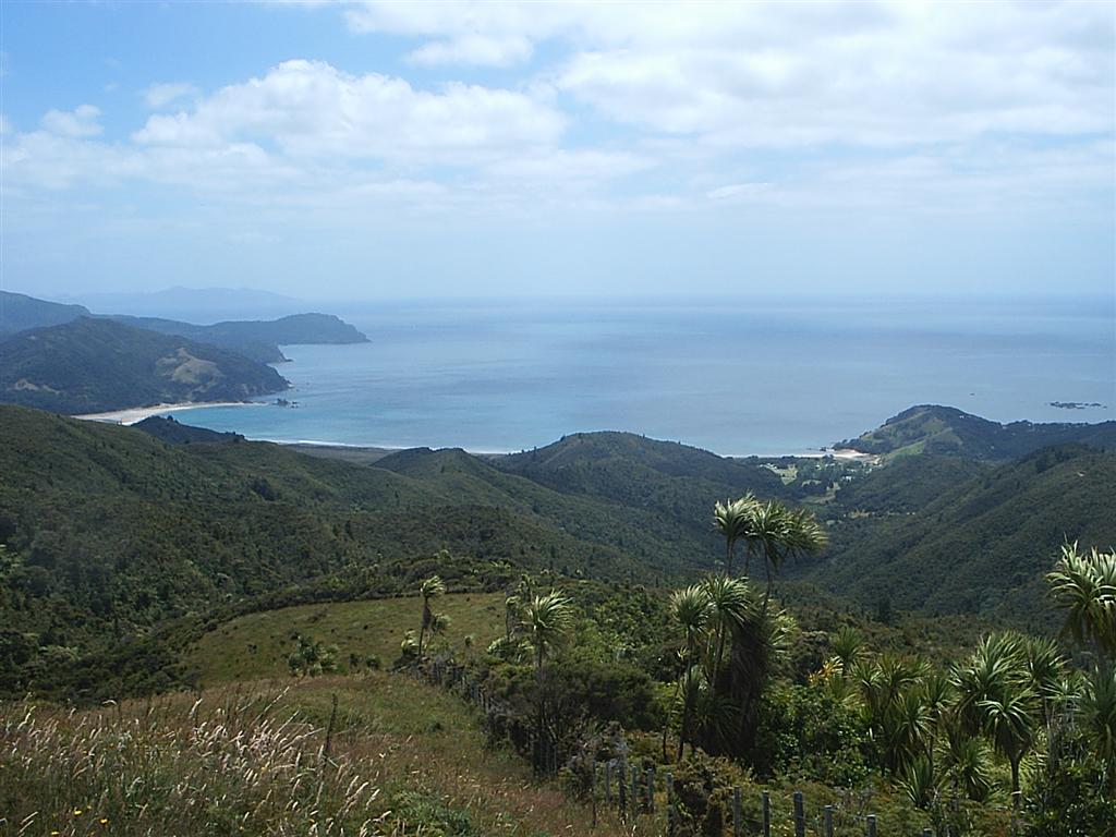
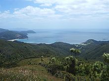 Waikawau Bay on Coromandel Peninsula
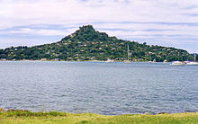 Tairua, Coromandel Peninsula
 View over Mercury Bay from the Tairua-Whitianga Road on Coromandel Peninsula
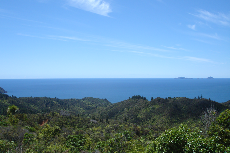
 Rain forest reserve, interior of Coromandel Peninsula
The Coromandel Peninsula lies in the North Island of New Zealand. It is part of the Waikato Region and Thames-Coromandel District and extends 85 kilometres north from the western end of the Bay of Plenty, forming a natural barrier to protect the Hauraki Gulf and the Firth of Thames in the west from the Pacific Ocean to the east. At its broadest point, it is 40 kilometres wide. Almost the entire population lies on the narrow strips along the Hauraki Gulf and Bay of Plenty coasts. The country's biggest city, Auckland, lies on the far shore of the Hauraki Gulf, 55 kilometres to the west. The peninsula is clearly visible from the city in fine weather.
Contents
Origin of the name
The Coromandel Peninsula was named for HMS Coromandel, a ship of the British Royal Navy, which stopped at Coromandel Harbour in 1820 to purchase kauri spars and was itself named for India's Coromandel Coast.
Geography
The peninsula is steep and hilly, and is largely covered in subtropical rain forest. The Coromandel Range forms a spine for the peninsula rising to nearly 900 metres, and the large island of Great Barrier, which lies beyond the northern tip, can be thought of as an extension of the range. Great Barrier is separated from Cape Colville on the peninsula's northern coast by the Colville Channel.
Although the peninsula is close to large centres of population such as Auckland to the west and Tauranga to the southeast, its rugged nature means that much of it is relatively isolated, and the interior and northern tip are both largely undeveloped and sparsely inhabited. A forest park covers much of the peninsula's interior.
Numerous small islands and island groups lie offshore, such as the Motukawao Islands to the northwest, the Alderman Islands and Slipper Island to the southeast, and the Mercury Islands to the northeast.
The peninsula shows considerable signs of previous volcanism. It comprises the eroded remnants of the Coromandel Volcanic Zone, which was highly active during the Miocene and Pliocene periods. Volcanic activity has since primarily shifted southeast to the Taupo Volcanic Zone, although Mayor Island was recently active some 25 km to the east. The peninsula is also fairly close to the Auckland Volcanic Field, which exhibits a gentler style of volcanism. Geothermal activity is still present on the Peninsula, with hot springs in several places, notably at Hot Water Beach, in the central east coast between Whitianga and Tairua.
People
Owing to the nature of the land, much of the Coromandel's population is concentrated in a small number of towns and communities along the southeastern and southwestern coasts.
Only five towns on the peninsula have populations of over 1000 (Coromandel, Whitianga, Thames, Tairua, and Whangamata), and of these only Thames has a population of over 5000. Several small towns dot the coast of the Firth of Thames in the southwest. Other small towns on the peninsula include Matarangi, Whangapoua, Whiritoa, Hikuai, Tairua, Pauanui and Colville. The population of several of these centres is highly seasonal, with many Aucklanders having holiday homes in the Coromandel.[Note 1] During the Christmas and New Year holiday period, activity in the area is significantly increased by families and travellers from around the North Island, particularly in Whangamata, Whitianga, Matarangi, Tairua and Pauanui.
The peninsula is a popular place to live for those who have chosen an alternative lifestyle, especially for those who have elected not to live in Auckland. The 1970s saw thousands of hippies relocate from large cities around New Zealand to the Coromandel in search of an environmentally friendly lifestyle associated with the counterculture back-to-the-land movement. In recent times, increasing numbers of affluent Aucklanders are also moving to the Coromandel.[citation needed]
The population density decreases with both distance from the coast and distance north. Of the main population centres, only Coromandel, Colville, Matarangi and Whitianga are in the north of the peninsula, and much of the interior is virtually uninhabited.
The twin towns of Waihi and Waihi Beach, to the southeast of the peninsula, are often considered to be in the Coromandel although they do not strictly lie on the peninsula itself, as they lie just to the north of the Karangahake Gorge, the pass which marks the southern end of the Coromandel Range.
Industries and attractions
The area was formerly known largely for its hardrock gold mining and kauri industries, but is now a mecca for tourism, especially ecotourism. A forest park occupies much of the centre of the peninsula, and the coasts are dotted with fine beaches and stunning views. The Moehau Ranges even have an elusive monster, The Hairy Moehau, which is quite a popular attraction with tourists.
Evidence of the region's geothermal origins can be found in hot springs, notably at Hot Water Beach on the peninsula's east coast. The town of Whangamata is a popular holiday retreat, and Whitianga on Mercury Bay is renowned for its yachting. The peninsula's waters are also a popular destination for scuba divers.
There are many historical mines in the Coromandel area, especially for gold mining. Waihi, in the south of Coromandel Peninsula, still has an active gold mine, as of the late 2000s, though most other mining in the area ceased about the 1980s.[1] In late 2009, New Zealand's Energy and Resources Minister Gerry Brownlee (National) noted that there was a possibility of new mining in conservation areas, even though he had previously declared that a stocktake of mineral resources in protected areas did not indicate a desire to mine there.[1]
Transportation
The towns are connected by State Highways 25 and 25A which form a circuit around the peninsula. At the base of the peninsula, the towns of Paeroa and Waihi are connected by means of a road through the Karangahake Gorge which separates the Coromandel Range from the Kaimai Range. Not all of the roads within the peninsula are sealed with tarmacadam, notably the 309 Road which connects Coromandel Town and Whitianga. Some hire car companies have contracts that specifically exclude driving on these roads.
Fishkill
A small but unexplained fish kill of snapper occurred near the Coromandel Peninsula on 4 January 2010.[2] There has been speculation that the fish "were starving because of weather conditions", but the Ministry of Fisheries is conducting its own investigation.[2][3] The Ministry advised that it was not safe to eat the dead fish.[2][3]
 Opito Bay, Coromandel Peninsula.
Notes
- ^ Normal New Zealand usage tends to refer to places informally as being "in the Coromandel" rather than "on the Coromandel Peninsula".
References
- ^ a b "Conservation land could be mined – Govt". The New Zealand Herald. 27 November 2009. http://www.nzherald.co.nz/nz/news/article.cfm?c_id=1&objectid=10612000. Retrieved 23 February 2011.
- ^ a b c Tapaleao, Vaimoana (5 January 2011). "Hundreds of snapper dead on beaches - National - NZ Herald News". The New Zealand Herald. http://www.nzherald.co.nz/nz/news/article.cfm?c_id=1&objectid=10697906. Retrieved 5 January 2011.
- ^ a b Kidd, Rob (5 January 2011). "Hundreds of dead snapper washed up on New Zealand beach". The Sydney Morning Herald. http://www.smh.com.au/environment/hundreds-of-dead-snapper-washed-up-on-new-zealand-beach-20110105-19fdr.html. Retrieved 5 January 2011.
External links
- Coromandel Information
- Coromandel Roadtrip Information
- Thames Information
- Coromandel Peninsula website
- Images from the Coromandel Peninsula
Coordinates: 36°50′S 175°35′E / 36.833°S 175.583°E
Regions of New Zealand North Island Northland · Auckland¹ · Waikato · Bay of Plenty · Gisborne¹ · Hawke's Bay · Taranaki · Manawatu-Wanganui · Wellington
South Island ¹ Unitary authorities. Categories:- Thames-Coromandel District
- Peninsulas of New Zealand
- Volcanoes of New Zealand
- Fish kill


Wikimedia Foundation. 2010.