- Nelson, New Zealand
-
Nelson City
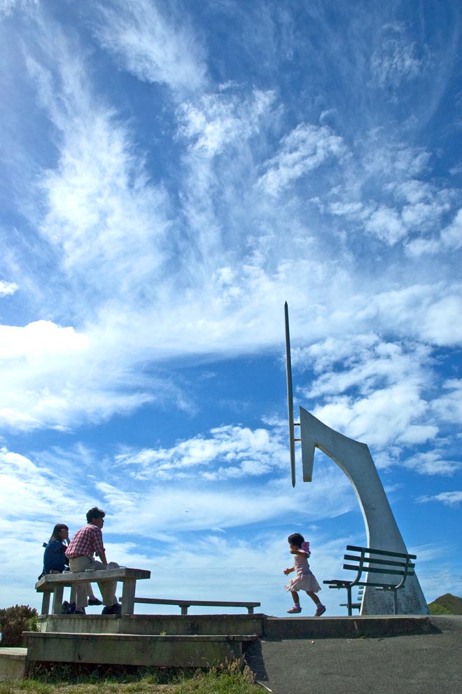
Whakatū— Unitary authority — A view of Nelson from the "Centre of New Zealand"

FlagNickname(s): Top of the South Motto: Palmam qui meruit ferat 
 Nelson City
Coordinates: 41°17′S 173°17′E / 41.283°S 173.283°ECoordinates: 41°17′S 173°17′E / 41.283°S 173.283°E Country  New Zealand
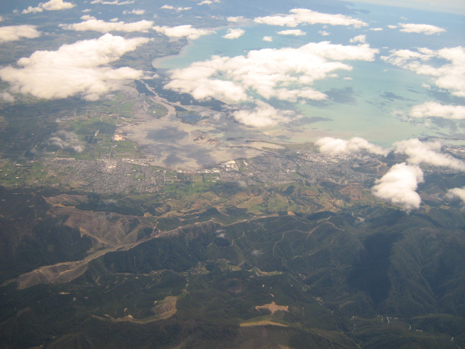
Unitary authority Nelson City Settled by Europeans 1841 Electorates Nelson Government - Mayor Aldo Miccio - Deputy Mayor Area from Rai Saddle to Stoke - Territorial 445 km2 (171.8 sq mi) Population (June 2010 estimate)[1] - Territorial 45,500 - Density 102.2/km2 (264.8/sq mi) - Urban 59,800 Demonym Nelsonian Time zone NZST (UTC+12) - Summer (DST) NZDT (UTC+13) Postcode 7010, 7011, 7020 Area code(s) 03 Website nelsoncitycouncil.co.nz  Southern suburbs of Nelson (right) and the nearby town of Richmond (left) seen from the air.
Nelson is a city on the eastern shores of Tasman Bay, and is the economic and cultural centre of the Nelson-Tasman region. Established in 1841, it is the second oldest settled city in New Zealand and the oldest in the South Island.
Nelson received its name in honour of the Admiral Horatio Nelson who defeated both the French and Spanish fleets at the Battle of Trafalgar in 1805. Many of the roads and public areas around the city are named after people and ships associated with that battle and Trafalgar Street is the main shopping axis of the city. Inhabitants of Nelson are referred to as Nelsonians.
Together with the town of Richmond, the Nelson Urban Area has a population of around 60,000 ranking it as New Zealand’s 9th most populous city and the geographical centre of New Zealand.
Nelson is well known for its arts and crafts, and each year hosts popular events such as the Nelson Arts Festival. The annual Wearable Art Awards began near Nelson and a museum, World of Wearable Art, is now housed close to Nelson Airport showcasing winning designs.
Nelson's Māori name, Whakatū,[2] means 'build', 'raise', or 'establish'. Nelson is one of the few New Zealand cities to have its own flag.
Contents
History
Early settlement
Settlement of Nelson began about 700 years ago by Māori.[3] There is evidence the earliest settlements in New Zealand are around the Nelson-Marlborough regions. The earliest recorded iwi in the Nelson district are the Ngāti Kuia, Ngāti Tumatakokiri, Ngāti Apa and Rangitane tribes.
Raids from northern tribes in the 1820s, led by Te Rauparaha and his Ngāti Toa, soon decimated the local population and quickly displaced them.
New Zealand Company

The New Zealand Company in London planned the settlement of Nelson. They intended to buy cheaply from the Māori some 200,000 acres (810 km2) which they planned to divide into one thousand lots and sell (at a considerable profit) to intending settlers. The Company earmarked future profits to finance the free passage of artisans and labourers and their families, and for the construction of public works. However by September 1841 only about one third of the lots had sold. Despite this the Colony pushed ahead.
Three ships sailed from London under the command of Captain Arthur Wakefield. Arriving in New Zealand, they discovered that the new Governor of the colony, William Hobson would not give them a free hand to secure vast areas of land from the Māori or indeed to decide where to site the colony. However, after some delay, Hobson allowed the Company to investigate the Tasman Bay area at the north end of the South Island. The Company selected the site now occupied by Nelson City because it had the best harbour in the area. But it had a major drawback: it lacked suitable arable land; Nelson City stands right on the edge of a mountain range while the nearby Waimea Plains amount to only about 60,000 acres (240 km2), less than one third of the area required by the Company plans.
The Company secured a vague and undetermined area from the Māori for £800 that included Nelson, Waimea, Motueka, Riwaka and Whakapuaka. This allowed the settlement to begin, but the lack of definition would prove the source of much future conflict. The three colony ships sailed into Nelson Haven during the first week of November 1841. When the four first immigrant ships arrived three months later they found the town already laid out with streets, some wooden houses, tents and rough sheds. These ships were the Fifeshire, the Mary-Ann, the Lord Auckland and the Lloyds. Within 18 months the Company had sent out 18 ships with 1052 men, 872 women and 1384 children. However, fewer than ninety of the settlers had the capital to start as landowners.
Notably, the early settlement of Nelson province included a proportion of German immigrants, who arrived on the ship Sankt Pauli and formed the nucleus of the villages of Sarau (Upper Moutere) and Neudorf. These were mostly Lutheran Protestants with a small number of Bavarian Catholics.
After a brief initial period of prosperity, the lack of land and of capital caught up with the settlement and it entered a prolonged period of relative depression. Organised immigration ceased until the 1850s and the labourers had to accept a cut in their wages by a third. By the end of 1843 artisans and labourers began leaving Nelson and by 1846 some twenty five percent of the immigrants had moved away.
The pressure to find more arable land became intense. To the south-east of Nelson lay the wide and fertile plains of the Wairau Valley. The New Zealand Company tried to claim that they had purchased the land. The Māori owners stated adamantly that the Wairau Valley had not formed part of the original land sale and made it clear they would resist any attempts by the settlers to occupy the area. The Nelson settlers led by Arthur Wakefield and Henry Thompson attempted to do just that. This resulted in the Wairau Affray, where 22 settlers died. The subsequent Government enquiry exonerated the Māori and found that the Nelson settlers had no legitimate claim to any land outside Tasman Bay.
City
Nelson township was managed by the Nelson Provincial Council through a Board of Works constituted by the Provincial Government under the Nelson Improvement Act 1856 until 1874. It was proclaimed a Bishop's See and city under letters patent by Queen Victoria on 27 September 1858,[4] the second New Zealand city proclained in this manner after Christchurch. Edmund Hobhouse[5] was the first Bishop. The Municipal Corporations Act 1876 stated that Nelson was constituted a city on 30 March 1874.
Nelson Province
From 1853 until 1876, when provincial governments were abolished, Nelson was the capital of Nelson Province. The provincial anniversary date for Nelson Province is 1 February and a public holiday is celebrated on the nearest Monday.[6]
Geography
The Nelson Tasman or "Top of the South" region is administered as two unitary authorities by Nelson City Council and the (much larger in geographical area) adjoining Tasman District Council, headquartered in Richmond 15 kilometres to the south west. It is between Marlborough, another unitary authority, to the east, and the West Coast Regional Council to the west.
For some while, there has been talk about amalgamating the two authorities in order to streamline and render more financially economical the existing co-operation between the two councils,[7][8][9] exemplified by similar action in the creation of Nelson Tasman Tourism,a jointly owned tourism promotion organisation.[10]
Nelson has beaches and a sheltered harbour. The harbour entrance is protected by a Boulder Bank, a natural, 13 km bank of rocks transported south from Mackay Bluff via longshore drift. The bank creates a perfect natural harbour which enticed the first settlers although the entrance was narrow. The wreck of the Fifeshire on Arrow Rock (now called Fifeshire Rock in memory of this disaster) in 1842 proved the difficulty of the passage.[11] A cut was later made in the bank in 1906 which allowed larger vessels access to the port.
The creation of Rocks Road around the waterfront area after the Tahunanui slump[12] in 1892 increased the effects of the tide on Nelson city's beach, Tahunanui, and removed sediment. This meant the popular beach and adjoining car park was being eroded (plus the sand dunes) so a project to replace these sands was put in place[13] and has so far proved a success, with the sand rising a considerable amount and the dunes continuing to grow.
Suburbs
Annesbrook, Atawhai, The Brook, The Glen, Inner Glen, Hira, Monaco, Richmond, Stoke, Tahunanui, The Wood
National parks
Nelson is surrounded by mountains on three sides with Tasman Bay on the other and the region is the gateway to Abel Tasman National Park, Kahurangi National Park, Lakes Rotoiti and Rotoroa in the Nelson Lakes National Park. It is a centre for both ecotourism and adventure tourism and has a high reputation among caving enthusiasts due to several prominent cave systems around Takaka Hill and Mounts Owen and Arthur, which hold the largest and deepest explored caverns in the southern hemisphere.
Climate
Many people[who?] believe Nelson has one of the best climates of all major New Zealand centres, with an annual average total of over 2400 hours of sunshine.[14]
Climate data for Nelson Month Jan Feb Mar Apr May Jun Jul Aug Sep Oct Nov Dec Year Average high °C (°F) 22.4
(72.3)22.4
(72.3)20.8
(69.4)18.1
(64.6)15.2
(59.4)12.9
(55.2)12.4
(54.3)13.1
(55.6)14.9
(58.8)16.8
(62.2)18.7
(65.7)20.5
(68.9)17.4 Average low °C (°F) 13
(55)12.9
(55.2)11.4
(52.5)8.2
(46.8)4.9
(40.8)2.4
(36.3)1.6
(34.9)3.1
(37.6)5.4
(41.7)7.9
(46.2)9.8
(49.6)11.8
(53.2)7.8 Precipitation mm (inches) 72
(2.83)57
(2.24)78
(3.07)86
(3.39)77
(3.03)85
(3.35)86
(3.39)90
(3.54)73
(2.87)92
(3.62)82
(3.23)75
(2.95)970
(38.19)Source: NIWA Climate Data[15] Geographical centre of New Zealand
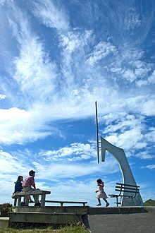 The marker at the "Centre of New Zealand".
The geographical "centre of New Zealand" allegedly lies in Nelson;[16] on a hilltop near the centre of the city. This is the point "zero, zero" from which the first trigonometrical surveys were started in the 1870s by John Spence Browning, the Chief Surveyor for Nelson. From this 360 degree viewpoint, the zero, zero points in neighbouring geodetic survey regions (including Wellington in the North Island) could be triangulated and a better survey of the whole of New Zealand constructed. In 1962, the gravitational centre (including Stewart Island and some smaller islands in addition to the North and South Island, but excluding the Chathams) of New Zealand lay in a patch of unremarkable dense scrub in a forest in Spooners Range near Tapawera, 35 kilometres south-west of Nelson: 41°30′S 172°50′E / 41.5°S 172.833°E.[17]
Demographics
 A map showing population density in the Tasman and Nelson Regions at the 2006 census.
Nelson's total population rose from 41,568 in 2001 to 42,888 in 2006, while Tasman district's rose from 41,352 to 44,625, to exceed that of Nelson for the first time. Today people see Tasman as part of the Nelson City region, which brings the city to a total of 87,516 people.[18]
Figures released on 23 April 2007 by Statistics New Zealand showed that 3,774 people born in the United Kingdom and Ireland lived in the Nelson City Council area and made up 9.1% of its population [5] - the highest proportion of residents from the United Kingdom and Ireland in New Zealand - with another 9.5% born overseas. Although Statistics New Zealand no longer keeps statistics for numbers of residents born in Germany, the Embassy of the Federal Republic of Germany in Wellington has stated that a greater proportion German speakers live in the Nelson and Bays area than anywhere else in New Zealand. There was a 23.7% rise in the number of Asians living in Nelson and a 35.4% rise in Tasman district.
Economy
The Nelson economy is based on the ‘big four’ industries; seafood, horticulture, tourism and forestry. Port Nelson is the biggest fishing port in Australasia. There are also a range of growth industries, including art and craft, aviation, engineering technology, and information technology.
The sub-national GDP of the Tasman and Nelson regions was estimated at US$2.343 billion in 2003, 2% of New Zealand's national GDP.[19]
Nelson is home to various business agencies that serve the city and its surrounds,[20] including Nelson Tasman Tourism (NTT),[21] which aims to promote the region and help advertisers reach visitors from New Zealand and overseas,[22] and the Nelson Regional Economic Development Agency (EDA), which works to "coordinate, promote, facilitate, investigate, develop, implement, support and fund initiatives relating to economic development [and] employment growth ... within the Nelson region ..."[23][24]
Government
Local
Further information: Mayor of Nelson, New ZealandThe Nelson City Council (NCC) governs the Nelson City territorial authority. It is made up of an elected mayor, a deputy mayor/councillor, and 11 additional councillors. They are elected under the First Past the Post system in triennial elections, with the most recent election held on 9 October 2010, and the next due on 12 October 2013.
As of 9 October 2010, the current council members are:-
Mayor Aldo Miccio Deputy Mayor Ali Boswijk Councillors Ian Barker
Gail Collingwood
Ruth Copeland
Eric Davy
Kate Fulton
Paul Matheson
Jeff Rackley
Pete Rainey
Rachel Reese
Derek Shaw
Mike WardNational
Nelson is covered by one general electorate: Nelson and one Maori electorate: Te Tai Tonga.
As of the 2008 general election, Nelson is held by Nick Smith of the National Party. The Maori electorate Te Tai Tonga, which covers the entire South Island and part of Wellington in the North Island, is currently held by the Maori Party and represented by Rahui Katene.
Education
Main article: List of schools in Nelson, New ZealandSecondary schools
- Garin College
- Nayland College
- Nelson College
- Nelson College for Girls
- Waimea College
Tertiary institutions
Nelson hosts two Tertiary Education Institutions, the main one being Nelson Marlborough Institute of Technology. The institute has two main campuses, one in Nelson and the other in Blenheim, in the neighbouring Marlborough region. The Institute has been providing tertiary education in the Nelson-Marlborough region for the last 100 years.[25] Nelson also has a University of Canterbury College of Education campus which currently has an intake two out of every three years for the Primary sector.
Media
The major daily newspaper is the Nelson Mail, which is part of the Fairfax Group.
The city is served by all major national radio and television stations, with terrestrial television (both analogue and Freeview) and FM radio. Local radio stations include Classic Hits FM (formerly Radio Nelson), More FM (formerly Fifeshire FM), ZM and community station Fresh FM. The city has one local television station, Mainland Television.
Transport
The Nelson urban area is served by State Highway 6, which runs in a north to southwest direction. The highway travels through the city and nearby town of Richmond, continuing southwest across the plains of the Wairoa and Motueka Rivers.
Nelson is only one of two major urban areas in New Zealand without a rail connection - the other being Queenstown. The Nelson Section was an isolated, 3 ft 6 in (1,067 mm) gauge, government-owned railway line between Nelson and Glenhope. It operated for 79 years between 1876 and 1955. The only sign of rail activity in Nelson today is a short heritage operation run by the Nelson Railway Society from Founders Historical Park using their own line between Wakefield Quay Station and Grove Station. The society has proposed future extensions of their line, possibly into or near the city centre. There have been several proposals to connect Nelson to the South Island rail network, but none have come to fruition.
Nelson has four bus routes within its urban area, forming loops into the city's suburbs from a hub at Wakatu Square. There is also a separate service to Richmond which is outside Nelson's official boundaries but which is often considered part of the Nelson urban area. Both InterCity Coachlines and Nakedbus.com provide daily services into Nelson from around the South Island.
Nelson Airport is located southwest of the city, at Annesbrook. The airport operates a single terminal and 1,347-metre (4,420 ft) runway, and is the fourth-busiest airport in New Zealand. Approximately 1.2 million people use the airport terminal annually and the airport averages 90 aircraft movements every day, with a plane taking off or landing every 4.5 minutes during scheduled hours. It is primarily used for domestic flights, with regular flights to and from Auckland, Christchurch and Wellington. Nelson Airport is home to Air Nelson, which operates and maintains New Zealand’s largest domestic airline fleet and was also the headquarters of Origin Pacific Airways until their collapse in 2006. Sounds Air offers flights from Nelson to Wellington. In 2006, the airport received restricted international airport status to facilitate small private jets.
Panoramas
 A panorama of Nelson City from the Centre of New Zealand monument
Culture and the arts
As the major regional centre, the city offers many lodgings, restaurants, and unique speciality shopping such as at the Jens Hansen Goldsmiths where "The One Ring" in The Lord of the Rings film trilogy was designed.[26]
- Nelson has a vibrant local music and arts scene and is known nationwide for its culturally idiosyncratic craftsmen and women. These include Potters, Glass Blowers (such as Flamedaisy Glass Design and Höglund Art Glass Studio & Gallery), Fibre Spectrum Handweavers & Fibre Artists' Studio[27] and dozens of Wood carvers using native New Zealand Southern beech and exotic macrocarpa.
- Nelson is a popular visitor destination and year-round attracts both New Zealanders and international tourists.[28]
- The Nelson Saturday Market is a popular weekly market where you can buy direct from local artists.[29]
- Art organizations include the Suter Gallery[30] and Nelson Arts Festival.[31]
- The Victory Village community received the 2010 New Zealander of the Year award for Community of the Year.[32]
The first rugby union match in New Zealand took place at the Botanic Reserve in Nelson on 14 May 1870, between the Nelson Suburbs and Nelson College, and an informative commemorative plaque was renovated at the western edge of the grassed area by Nelson City Council in 2006.
Festivals
Music lovers may attend the biennial Nelson School of Music Winter Music Festival, the Adam New Zealand Festival of Chamber Music[33] and the annual Nelson Jazz Festival.
The Taste Nelson festival at Founders Heritage Park highlights this region's gastronomy, the Festival of Opportunities features alternative health and lifestyle possibilities,[34][35] while the Suter International Film Festival screens 20 non-Hollywood films in late May to June every year.
The Nelson Kite Festival takes advantage of the reliable sea breezes that blow inland from Tasman Bay across Neale Park each afternoon with kite lovers arriving from around New Zealand and from overseas.
Architecture
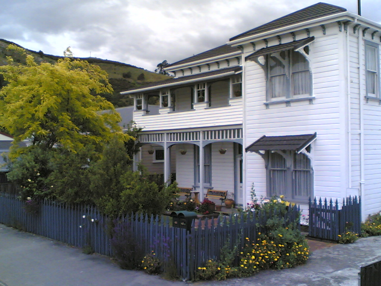
Unlike many towns and cities in New Zealand, Nelson has retained many Victorian buildings in its historic centre. The South Street area has been designated as having heritage value.[36]
Surviving historic buildings
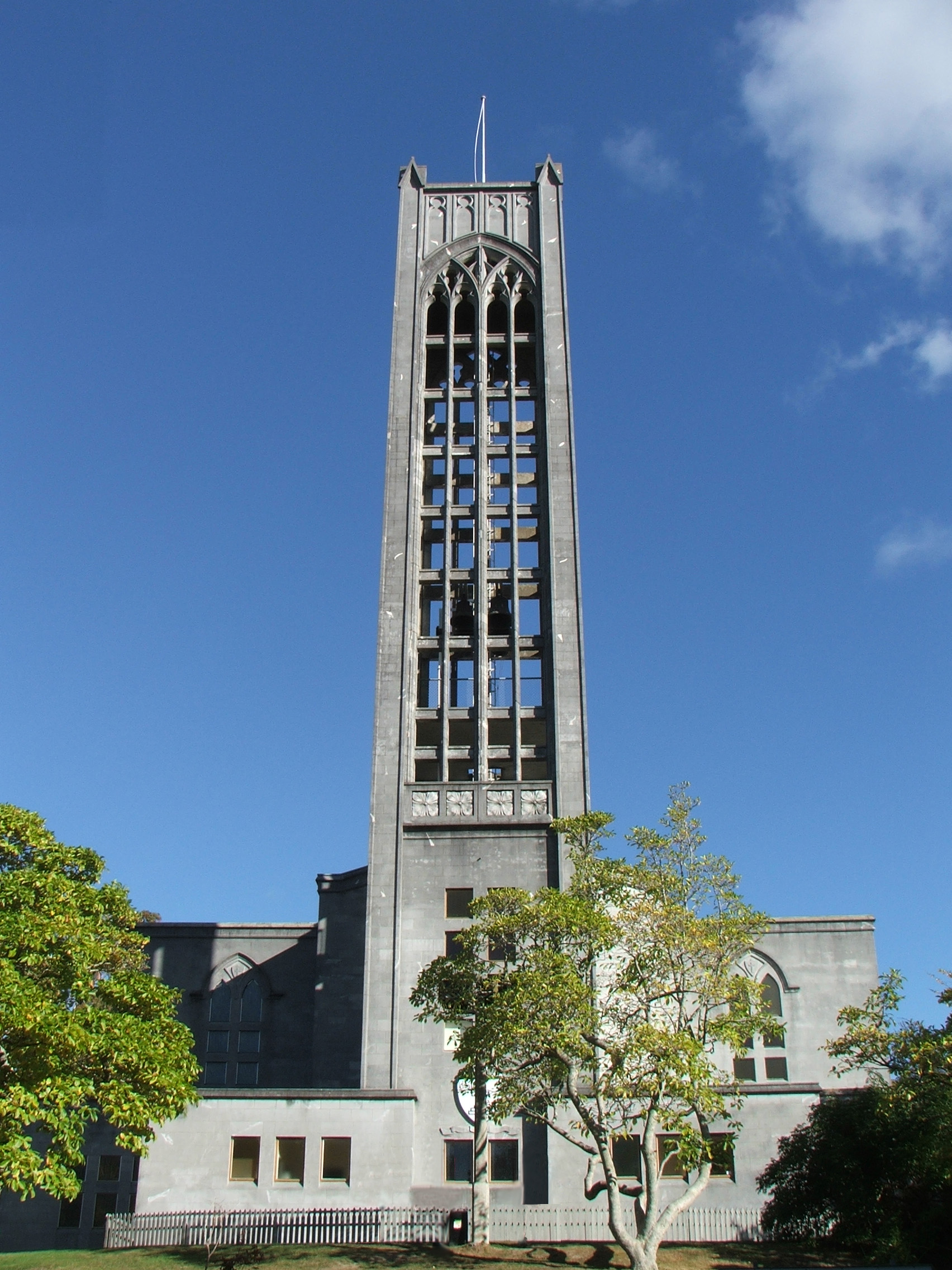
- Nelson Cathedral
- Amber House
- Broadgreen House
- Cabragh House
- Chez Eelco
- Founders Park Windmill
- Isel House
- Melrose House
- Nelson Central School Renwick House
- Te Puna Wai Lodge
- Victorian Rose Pub
- Redwood College (Founders Park)
Museums
The Nelson region houses several museums,.
- The Nelson Provincial Museum houses a collection of locally significant artifacts.
- The World of Wearable Art houses a collection of collectable cars and a collections of works from the Wearable Art Awards.
Parks and zoo
Nelson has a large number and variety of public parks and reserves maintained at public expense by Nelson City Council.[37] Major reserves include Grampians Reserve, close to the suburb of Braemar, and the botanical Reserve in the east of nelson, close to The Wood.
Natureland Zoological Park is a small zoological facility close to Tahunanui Beach. The facility is popular with children, where they can closely approach wallabies, monkeys, meerkats, llamas and alpacas, Kune Kune pigs, otters, and peacocks. There are also turtles, tropical fish and a walk through aviary.[38] Although the zoo nearly closed in 2008, the Orana Wildlife Trust took over its running instead.[39]. It looked like a bright future ahead for Natureland and its staff but since the repeated earthquakes in Christchurch in 2011 and the damage to Orana Park, Orana Wildlife Trust are uncertain of the future of Natureland]
Sport
Major teams
- Tasman Rugby Union – Air New Zealand Cup rugby union team
- Nelson Giants – National Basketball League team
Major venues
- Saxton Oval
- The Trafalgar Centre
- Trafalgar Park
Sister cities
 Miyazu, Japan
 City of Huangshi, People's Republic of China
 Eureka, California, United States of America
References and notes
- ^ "Subnational population estimates at 30 June 2010 (boundaries at 1 November 2010)". Statistics New Zealand. 26 October 2010. http://www.stats.govt.nz/~/media/Statistics/Methods%20and%20Services/Tables/Subnational%20population%20estimates/subpopest2001-10.ashx. Retrieved 7 March 2011.
- ^ "NZ government Māori Language Commission". http://www.tetaurawhiri.govt.nz/english/resources_e/list_placenames.shtm. Retrieved 25 August 2007.[dead link]
- ^ Lowe, David J. (2008). "Polynesian settlement of New Zealand and the impacts of volcanism on early Maori society: an update". University of Waikato. http://researchcommons.waikato.ac.nz/bitstream/10289/2690/1/Lowe%202008%20Polynesian%20settlement%20guidebook.pdf. Retrieved 29 April 2010.
- ^ http://www.nelsoncitycouncil.co.nz/civic-symbols
- ^ http://www.theprow.org.nz/nelson-s-landmark-cathedral/
- ^ Department of Labour - NZ public holiday dates 2006–2009
- ^ [1]
- ^ [2]
- ^ [3]
- ^ [4]
- ^ Nelson - the early years
- ^ Paul C Denton, Mike R Johnston, Soils & Foundations Ltd, Nelson (12 May 2002). "Housing Development on a Large, Active Landslide: The Tahunanui Slump Story, Nelson, New Zealand". Geo-Logic Ltd. http://geo-logic.co.nz/publications/tahunanuislump.aspx.
- ^ http://www.tahunanui.co.nz/beach-erosionTahunanui Beach Erosion Project
- ^ "Mean Monthly Sunshine". NIWA. http://www.niwascience.co.nz/edu/resources/climate/sunshine/. Retrieved 2007-11-02.
- ^ "Climate Data". NIWA. http://www.niwascience.co.nz/edu/resources/climate/. Retrieved 2 November 2007.
- ^ "The earliest version of this article first appeared in NZ Science Teacher 71 21-23 1992". http://www.rutherford.org.nz/hrbank.htm. Retrieved 27 August 2007.
- ^ "Nelson City Council website: gravitational centre". Archived from the original on 28 September 2007. http://web.archive.org/web/20070928043049/http://www.nelsoncitycouncil.co.nz/aboutnelson/heritage/centre-of-NZ.htm. Retrieved 27 August 2007.
- ^ By the Numbers
- ^ "Regional Gross Domestic Product". Statistics New Zealand. 2007. http://www.stats.govt.nz/reports/analytical-reports/regional-gross-domestic-product.aspx. Retrieved 18 February 2010.
- ^ "Business". Tasman. Tasman District Council. 2011. http://www.tasman.govt.nz/tasman/business/. Retrieved 6 March 2011.
- ^ "Nelson NZ". Nelson Tasman Tourism. NTT. 2011. http://www.nelsonnz.com/. Retrieved 6 March 2011.
- ^ "Advertise with us". Nelson Tasman Tourism. NTT. 2011. http://www.nelsonnz.com/advertise.with.us. Retrieved 6 March 2011.
- ^ "Nelson Regional Economic Development Agency". Business: EDA. Tasman District Council. 2011. http://www.tasman.govt.nz/tasman/business/nelson-regional-economic-development-agency-eda/. Retrieved 6 March 2011.
- ^ "home page". EDA. Nelson Regional Economic Development Agency. 2011. http://www.eda.co.nz/. Retrieved 6 March 2011.
- ^ http://www.theprow.org.nz/development-of-tertiary-education
- ^ Are you lord of the rings obsessed? Own the Movie Ring by Jens Hansen
- ^ "Fibre Spectrum". http://fibrespectrum.co.nz/.
- ^ Nelson Tasman Tourism - Visitor Information
- ^ The Nelson Market
- ^ "The Suter Gallery home page". http://www.thesuter.org.nz/. Retrieved 25 August 2007.
- ^ "Nelson Arts Festival". Archived from the original on 8 August 2007. http://web.archive.org/web/20070808193711/http://www.nelsoncitycouncil.co.nz/artsfestival/. Retrieved 25 August 2007.
- ^ Victory Village awarded 2010 New Zealand Community of the Year
- ^ http://www.music.org.nz/index.php
- ^ "Opening minds and eyes". The Nelson Mail. 20 February 2008. Archived from the original on 2009-01-23. http://www.webcitation.org/5e20fxGMH.
- ^ "Festival of Opportunities web site". http://www.festivalofopportunities.co.nz.
- ^ http://www.nelsoncitycouncil.co.nz/south-street/
- ^ Nelson City Council - Reserves and Parks
- ^ Natureland Zoo, Nelson, New Zealand
- ^ [http://www.natureland.co.nz/0000,000,07.html
External links
- Nelson travel guide from Wikitravel
- Historic images of Nelson from the collection of the Museum of New Zealand Te Papa Tongarewa
- Nelson City Council
- Nelson Business Directory
- Nelson Tasman Tourism
- Nelson history stories and resources
- Victory Village community in Nelson
Regions of New Zealand North Island Northland · Auckland¹ · Waikato · Bay of Plenty · Gisborne¹ · Hawke's Bay · Taranaki · Manawatu-Wanganui · Wellington
South Island ¹ Unitary authorities. Categories:- Nelson, New Zealand
- Port cities in New Zealand
- South Island
- Wine regions of New Zealand


Wikimedia Foundation. 2010.