- Ashburton, New Zealand
-
Ashburton
Hakatere (Māori)— Metropolitan Area — Aerial view of Ashburton, looking west. The Ashburton River or Hakatere is visible at left.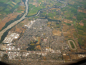
Nickname(s): Ashvegas Ashburton
 Ashburton
Coordinates: 43°54′20″S 171°44′44″E / 43.90556°S 171.74556°ECoordinates: 43°54′20″S 171°44′44″E / 43.90556°S 171.74556°E Country  New Zealand
Region Canterbury Territorial authority Ashburton District Electorates Rangitata
Te Tai Tonga (Maori electorate)[1]Government[2] – Mayor Angus McKay Area – Territorial 6,187.40 km2 (2,389 sq mi) Population ( June 2010 estimate)[3] – Territorial 29,400 – Density 4.8/km2 (12.3/sq mi) – Urban 17,700 – Demonym Ashburtonian Time zone NZST (UTC+12) – Summer (DST) NZDT (UTC+13) Area code(s) 03 Website http://www.ashburtondc.govt.nz/ Ashburton (Māori: Hakatere) is a town and district in the Canterbury Region on the east coast of the South Island of New Zealand. It is the third-largest centre in Canterbury, after Christchurch and Timaru. The area around Ashburton is frequently referred to as Mid Canterbury, which is also the name of the district's representative sports teams. Ashburton is regarded as a satellite town of Christchurch [4].
Contents
Naming
Ashburton was named by the surveyor Captain Joseph Thomas of the New Zealand Land Association, after Francis Baring, 3rd Baron Ashburton, who was a member of the Canterbury Association. The town is laid out around two central squares either side of the railway line and main highway, Baring Square East and Baring Square West.
A common nickname for Ashburton is 'Ashvegas', an ironic allusion to Las Vegas.
Location
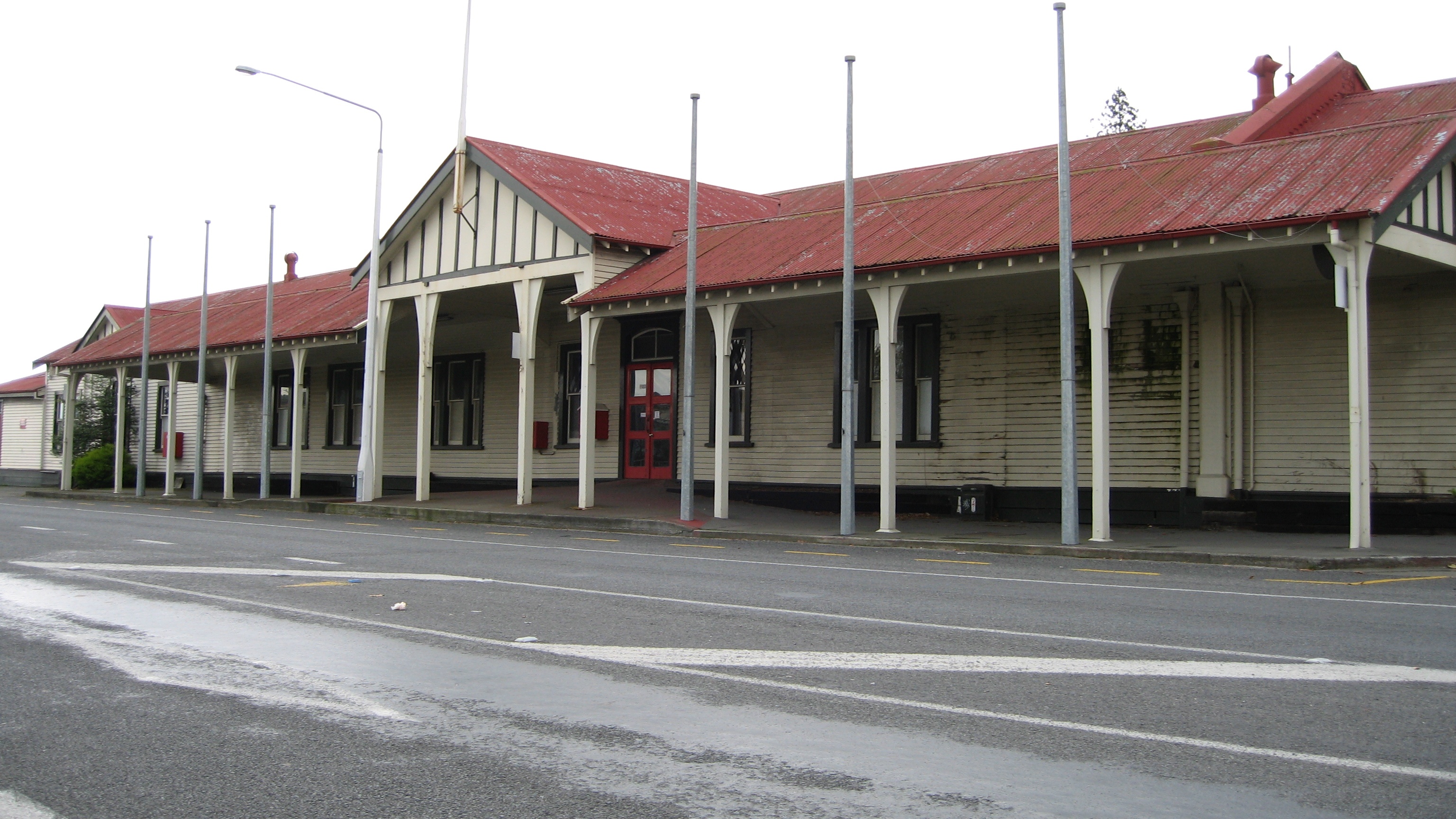
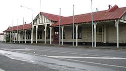 Ashburton's historic train station is currently in danger of demolition
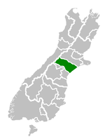 Ashburton Territorial Authority
Ashburton is on State Highway 1 86 km south of Christchurch. The Main South Line railway line runs through the centre of town, but passenger trains ceased on 10 February 2002. The town is the centre of a rich agricultural and pastoral farming district, part of the Canterbury Plains. It has one large suburb, Tinwald, south of the town and the Ashburton River. Tinwald was the junction for the now-closed Mount Somers Branch railway line.
The Ashburton District extends from the Pacific Ocean to the Southern Alps, and from the Rangitata River to the Rakaia River, including the towns of Methven, Mount Somers, and Rakaia.
Climate
On the whole, Ashburton shares a similar climate to Christchurch i.e a dry temperate climate (Cfb). However, since it lies further inland at a higher altitude to Christchurch, Ashburton experiences a greater range of temperatures. During summer Ashburton can exceed 30°C, whilst winter can see regular frosts and annual snowfall. Ashburton's heaviest snowfall was 60 cm on 12 June 2006.
Climate data for Ashburton Month Jan Feb Mar Apr May Jun Jul Aug Sep Oct Nov Dec Year Average high °C (°F) 23.7
(74.7)23.0
(73.4)21.0
(69.8)17.9
(64.2)13.9
(57.0)11.2
(52.2)10.7
(51.3)12.3
(54.1)15.2
(59.4)18.0
(64.4)19.9
(67.8)22.0
(71.6)17.4 Average low °C (°F) 11.1
(52.0)10.8
(51.4)9.5
(49.1)6.4
(43.5)3.4
(38.1)0.9
(33.6)0.5
(32.9)1.8
(35.2)3.8
(38.8)6.0
(42.8)7.9
(46.2)9.9
(49.8)6.0 Precipitation mm (inches) 58.5
(2.303)53.6
(2.11)62.5
(2.461)65.5
(2.579)61.6
(2.425)51.1
(2.012)62.7
(2.469)66.1
(2.602)43.7
(1.72)56.6
(2.228)57.8
(2.276)56.2
(2.213)696.2
(27.409)Source: NIWA Science climate data[5] Economy
Ashburton lies in the middle of the fertile alluvial Canterbury Plains which permits agricultural activity such as dairying provided irrigation is used.
Much of Ashburton's industry is oriented towards servicing the surrounding farmland, but it is also home to several unusual businesses: Designline[1], New Zealand's only bus manufacturer; Ashford Handicrafts[2], the world's largest producer of spinning wheels; Bruce McIlroy's [3] Rolls-Royce and Bentley motor car restoration business and Peter Lynn Kites [4] who produce and design and export giant inflatable display kites and power kites for kite surfing.
Ashburton has a daily newspaper, the Ashburton Guardian; AshburtonOnline, a Mid Canterbury district website; a weekly free community newspaper, The Courier and a radio station, Port FM-local. The town also has local versions of Newstalk ZB and Classic Hits ZEFM that broadcast on the frequencies previously used by local station 3ZE.
There is a small airport, Ashburton Aerodrome, serving the town.
Schooling
Main article: List of schools in the Canterbury Region#Ashburton DistrictThere are many primary schools in and around Ashburton, such as Netherby, Allenton, Hampstead, St. Joseph's, Borough inc. Longbeach, Mayfield, Wakanui, Hinds, Lowcliff, Lagmhor and Tinwald schools. There are also Ashburton Intermediate School and Ashburton College.
Recreation
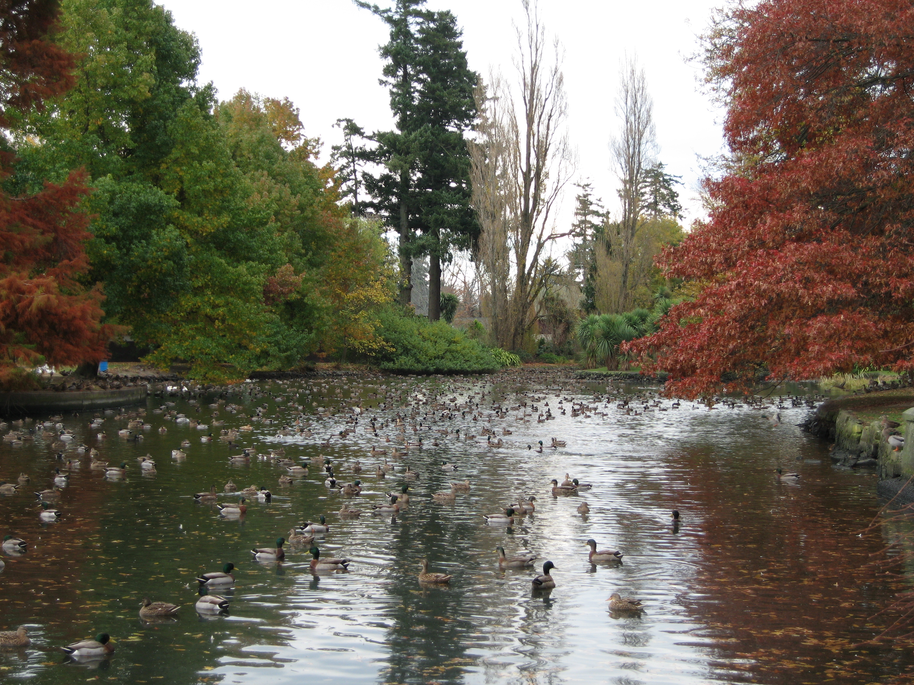
 Ashburton Domain
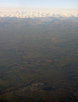 Aerial view of Ashburton, with the Southern Alps in the background
Opportunities within the town itself are limited to the kind of activities that could be expected for a town of its size, such as a movie theatre and swimming pool. There are also two local golf courses. There is a walking track for some distance, coastwards along the northern side of the river from SH1. This was overgrown for many years, but has now been restored and is in excellent condition.
Slightly further afield, the number of leisure opportunities rises dramatically. The beaches adjacent to Ashburton are steep and shingly with a strong undertow, making them unsafe to swim, but suitable nonetheless for surf-casting. In part to rectify the limitations imposed by the lack of recreational waterways, Lake Hood was constructed just south-east of Tinwald. It provides rowing, swimming, and water-skiing opportunities. The Ashburton, Rakaia, and Rangitata Rivers offer good fishing, the Rakaia in particular is renowned worldwide for its salmon fishing. Upper reaches of the Rangitata are frequently kayaked and rafted, reaching Grades 3-4. The Rakaia is known for jet-boating. The Ashburton Lakes (Lake Heron, Lake Camp, Lake Clearwater, and a number of smaller lakes) are around an hour and a half inland, and offer water sport and fishing opportunities[specify]. On the road to these lake are Mount Somers and the Mount Somers walkway.
Mount Hutt is a prominent South Island ski field an hour inland, just past Methven.
Prominent residents
Prominent residents have included the former Prime Minister of New Zealand, Jenny Shipley, international operatic tenor Simon O'Neill, Olympic silver medal cyclist Hayden Roulston and New Zealand television and radio personality Simon Barnett.
Notes
- ^ http://www.elections.org.nz/mapping/
- ^ "Mayor Bede O'Malley". Ashburton District Council. http://www.ashburtondc.govt.nz/council/Council_Members/Mayor.htm. Retrieved 2009-10-30.
- ^ "Subnational population estimates at 30 June 2010 (boundaries at 1 November 2010)". Statistics New Zealand. 26 October 2010. http://www.stats.govt.nz/~/media/Statistics/Methods%20and%20Services/Tables/Subnational%20population%20estimates/subpopest2001-10.ashx. Retrieved 7 March 2011.
- ^ Editorial comment June 15 2011 - Ashburton Guardian
- ^ "Niwa Science climate data". http://www.climate-charts.com/Locations/n/NZ9376600H319710.php.
References
- Reed, A. W. (2002). The Reed Dictionary of New Zealand Place Names. Auckland: Reed Books. ISBN 0-7900-0761-4.
External links
- Regent Cinema
- Ashburton District Council
- AshburtonOnline
- The Ashburton Guardian
- Enterprise Ashburton Economic Development Agency
- Mid Canterbury Landscape Photography
- Ashburton Street Map
Towns of the Ashburton District, Canterbury, New Zealand Major Towns Other Towns Chertsey • Ealing • Fairton • Hinds • Lake Clearwater • Lake Hood • Mayfield • Mount Somers • WinslowLocalities Acton • Alford Forest • Anama • Ashburton Gorge • Ashton • Barhill • Buccleuch • Bushside • Cairnbrae • Carew • Cavendish • Coldstream • Dorie • Dromore • Eiffelton • Elgin • Erewhon • Flemington • Greenstreet • Hackthorne • Hakatere (Gorge • River mouth) • Hatfield • Highbank • Huntingdon • Kyle • Lagmhor • Lauriston • Lismore • Longbeach • Lowcliffe • Lyndhurst • Lynnford • Marawiti • Maronan • Mitcham • Montalto • Mount Hutt • Mount Possession • Newland • Overdale • Pendarves • Punawai • Rokeby • Ruapuna • Seafield • Sherwood • Somerton • Springburn • Staveley • Urrall • Valetta • Wakanui • Waterton • Westerfield • Wheatstone • Willowby • Winchmore • Windermere
 New Zealand topics
History 
Geography Time zones · Environment · National Parks · Marine reserves · Islands · Lakes · Rivers · Caves · Cities · Towns · BiodiversityGovernance Politics Economy Society Culture Māori culture · Māori language · NZ English · Art · Cinema · Kiwi (people) · Literature · Music · Sport · Public holidaysMain cities Categories:- Ashburton District
- Populated places in New Zealand


Wikimedia Foundation. 2010.