- Northend, Buckinghamshire
-
Coordinates: 51°37′35″N 0°56′22″W / 51.6265°N 0.9395°W
Northend 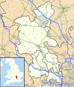
 Northend
Northend shown within BuckinghamshireOS grid reference SU735925 Parish Turville Watlington District Wycombe South Oxfordshire Shire county Buckinghamshire Oxfordshire Region South East Country England Sovereign state United Kingdom Post town HENLEY-ON-THAMES Postcode district RG9 Police Thames Valley Fire Buckinghamshire Ambulance South Central EU Parliament South East England UK Parliament Henley Wycombe List of places: UK • England • Buckinghamshire Northend is a village that straddles the border of the two English counties of Buckinghamshire and Oxfordshire. The eastern half is in the civil parish of Turville in Buckinghamshire, while the western half is across the border into Oxfordshire, in the Watlington parish.
Wycombe District Buckinghamshire • County Council elections • District Council elections
Aylesbury Constituency • Beaconsfield Constituency • Buckingham Constituency • Wycombe ConstituencyTowns
(Component Areas
and Hamlets)High Wycombe (Cressex, Micklefield, Sands, Terriers, Totteridge, Wycombe Marsh) • Marlow (Forty Green) • Princes Risborough (Alscot, Askett, Cadsden, Flowers Bottom, Loosley Row, Lower North Dean, Monks Risborough, North Dean, Redland End, Speen, Upper North Dean, Whiteleaf)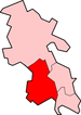
Other Civil Parishes
(Component Villages
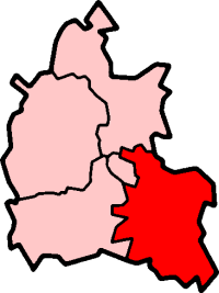
and Hamlets)Bledlow-cum-Saunderton (Bledlow, Bledlow Ridge, Crownfield, Forty Green, Holly Green, Pitch Green, Rout's Green, Saunderton, Saunderton Lee, Skittle Green) • Bradenham (Bradenham, Walters Ash) • Chepping Wycombe (Flackwell Heath, Loudwater, Tylers Green) • Downley • Ellesborough (Butlers Cross, Chalkshire, Coombe, Dunsmore, Ellesborough, Nash Lee, North Lee, Terrick) • Fawley (Fawley, Fawley Bottom) • Great and Little Hampden (Great Hampden, Green Hailey, Hampden Row, Little Hampden) • Great and Little Kimble (Great Kimble, Kimble Wick, Little Kimble, Marsh, Smoky Row) • Great Marlow (Bovingdon Green, Burroughs Grove, Chisbridge Cross, Danesfield, Marlow Common) • Hambleden (Colstrope, Fingest, Frieth, Hambleden, Mill End, Parmoor, Pheasant's Hill, Skirmett) • Hazlemere • Hedsor (Hedsor, Widmoor) • Hughenden (Cryers Hill, Four Ashes, Great Kingshill, Hughenden Valley, Hunt's Hill, Naphill, Naphill Common, Widmer End) • Ibstone • Lacey Green (Lacey Green, Parslow's Hillock, Wardrobes) • Lane End (Cadmore, Ditchfield, Lane End, Moor Common, Moor End) • Little Marlow (Coldmoorholme, Fern, Handy Cross, Little Marlow, Sheepridge, Well End, Winchbottom) • Longwick-cum-Ilmer (Horsenden, Ilmer, Little Meadle, Longwick, Meadle, Owlswick) • Marlow Bottom • Medmenham (Bockmer End, Lower Woodend, Medmenham, Rockwell End) • Piddington and Wheeler End (Piddington, Wheeler End) • Radnage (Bennett End, Radnage, The City, Waterend) • Stokenchurch (Beacon's Bottom, Bolter End, Horsleys Green, Stokenchurch, Studley Green, Water End) • Turville (Northend, Southend, Turville, Turville Heath) • West Wycombe (Booker, West Wycombe) • Wooburn and Bourne End (Berghers Hill, Bourne End, Cores End, Hawks Hill, Widmoor, Wooburn, Wooburn Green, Wooburn Moor)Former Districts
and BoroughsFormer
ConstituenciesList of Parliamentary constituencies in Buckinghamshire • List of places in Buckinghamshire • List of civil parishes in Buckinghamshire Categories:- Villages in Oxfordshire
- Villages in Buckinghamshire


Wikimedia Foundation. 2010.